|
Uphill (other)
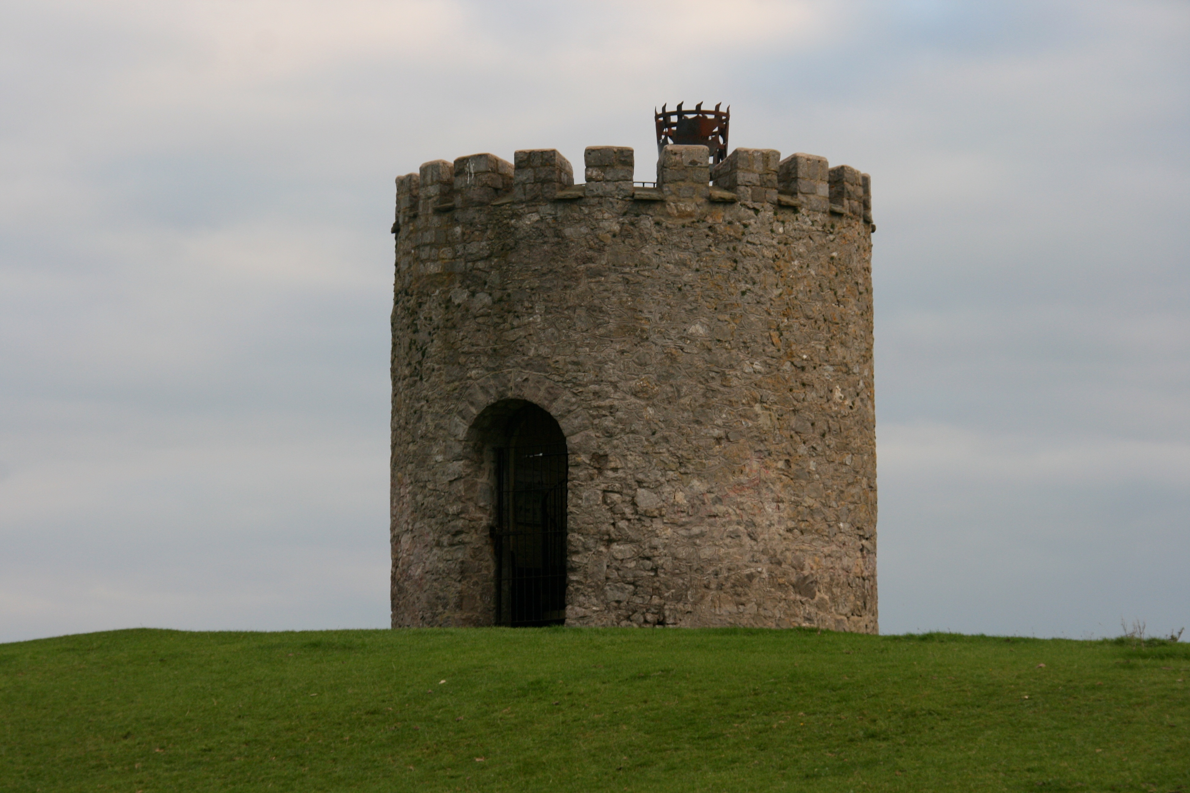
Uphill is a village and former civil parish, now in the parish of Weston-super-Mare, in the North Somerset district, in the ceremonial county of Somerset, England, at the southern edge of the town, on the Bristol Channel coast. History Bone and stone tools found in caves at Uphill provide evidence of human activity in the Upper Palaeolithic period, and a radiocarbon date of around 28,000 Before Present, which came from a bone point, was the first scientifically derived direct date from the entire British Isles for an artefact of that period (the Aurignacian). The River Axe enters the Bristol Channel at Uphill where it is sheltered by Brean Down and it is possible that there was a port at Uphill in Roman times but no archaeological evidence has been found for this.Crockford-Hawley (2004) surmises that while ''archaeological evidence has yet to prove portexisted, most local people are quite happy to rely on long-established hearsay!'' Leach (2001) does not claim that there was ... [...More Info...] [...Related Items...] OR: [Wikipedia] [Google] [Baidu] |
Weston-super-Mare
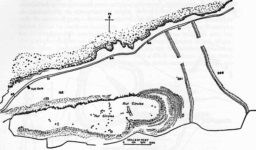
Weston-super-Mare, also known simply as Weston, is a seaside town in North Somerset, England. It lies by the Bristol Channel south-west of Bristol between Worlebury Hill and Bleadon Hill. It includes the suburbs of Mead Vale, Milton, Oldmixon, West Wick, Worlebury, Uphill and Worle. Its population at the 2011 census was 76,143. Since 1983, Weston has been twinned with Hildesheim in Germany. The local area has been occupied since the Iron Age. It was still a small village until the 19th century when it developed as a seaside resort. A railway station and two piers were built. In the second half of the 20th century it was connected to the M5 motorway but the number of people holidaying in the town declined and some local industries closed, although the number of day visitors has risen. Attractions include The Helicopter Museum, Weston Museum, and the Grand Pier. Cultural venues include The Playhouse, the Winter Gardens and the Blakehay Theatre. The Bristol Channel has a l ... [...More Info...] [...Related Items...] OR: [Wikipedia] [Google] [Baidu] |
Hannah More
Hannah More (2 February 1745 – 7 September 1833) was an English religious writer, philanthropist, poet and playwright in the circle of Johnson, Reynolds and Garrick, who wrote on moral and religious subjects. Born in Bristol, she taught at a school her father founded there and began writing plays. She became involved in the London literary elite and a leading Bluestocking member. Her later plays and poetry became more evangelical. She joined a group opposing the slave trade. In the 1790s she wrote Cheap Repository Tracts on moral, religious and political topics, to distribute to the literate poor (as a retort to Thomas Paine's Rights of Man). Meanwhile, she broadened her links with schools she and her sister Martha had founded in rural Somerset. These curbed their teaching of the poor, allowing limited reading but no writing. More was noted for her political conservatism, being described as an anti-feminist, a "counter-revolutionary", or a conservative feminist. Early life B ... [...More Info...] [...Related Items...] OR: [Wikipedia] [Google] [Baidu] |
Weston Bay
Weston Bay is an inlet of the Bristol Channel in North Somerset, England. It lies between Brean Down, which is now owned by the National Trust, is rich in wildlife, history and archaeology, and has been designated a Site of Special Scientific Interest to the south, and Worlebury Hill to the north. Quarrying took place at various places on Worlebury Hill from the late 18th century until the town quarry was abandoned in 1953. Weston Woods, which cover a large part of the hill top, were awarded a Planting Places Award in a scheme run by Sustainability South West to celebrate "brilliant examples of urban greenspaces" on 6 March 2008. Much of the bay forms the seafront for Weston-super-Mare. Two piers stick out into the bay. The grade II* listed Birnbeck Pier was designed by Eugenius Birch and opened in 1867. The early 20th century Grand Pier, is supported by 600 iron piles, and is long. It has been damaged by fire on two occasions, once in 1930 and again in 2008. Owing to the larg ... [...More Info...] [...Related Items...] OR: [Wikipedia] [Google] [Baidu] |
River Axe (Bristol Channel)
The River Axe is a river in South West England. The river is formed by water entering swallets in the limestone and rises from the ground at Wookey Hole Caves in the Mendip Hills in Somerset, and runs through a V-shaped valley. The geology of the area is limestone and the water reaches Wookey Hole in a series of underground channels that have eroded through the soluble limestone. The river mouth is in Weston Bay on the Bristol Channel. The river was navigable from the middle ages until 1915, during early centuries of which seeing some European trade. Geography The River Axe is formed by the water entering the cave systems and flows through the third and first chambers, from which it flows to the resurgence, through two sumps and long, where it leaves the cave and enters the open air. It is the second largest resurgence on Mendip, with an estimated catchment area of , and an average discharge of per second. Some of the water is allogenic in origin i.e. drained off ... [...More Info...] [...Related Items...] OR: [Wikipedia] [Google] [Baidu] |
Old English Language
Old English (, ), or Anglo-Saxon, is the earliest recorded form of the English language, spoken in England and southern and eastern Scotland in the early Middle Ages. It was brought to Great Britain by Anglo-Saxon settlers in the mid-5th century, and the first Old English literary works date from the mid-7th century. After the Norman conquest of 1066, English was replaced, for a time, by Anglo-Norman (a relative of French) as the language of the upper classes. This is regarded as marking the end of the Old English era, since during this period the English language was heavily influenced by Anglo-Norman, developing into a phase known now as Middle English in England and Early Scots in Scotland. Old English developed from a set of Anglo-Frisian or Ingvaeonic dialects originally spoken by Germanic tribes traditionally known as the Angles, Saxons and Jutes. As the Germanic settlers became dominant in England, their language replaced the languages of Roman Britain: Common Br ... [...More Info...] [...Related Items...] OR: [Wikipedia] [Google] [Baidu] |
Domesday Book
Domesday Book () – the Middle English spelling of "Doomsday Book" – is a manuscript record of the "Great Survey" of much of England and parts of Wales completed in 1086 by order of King William I, known as William the Conqueror. The manuscript was originally known by the Latin name ''Liber de Wintonia'', meaning "Book of Winchester", where it was originally kept in the royal treasury. The '' Anglo-Saxon Chronicle'' states that in 1085 the king sent his agents to survey every shire in England, to list his holdings and dues owed to him. Written in Medieval Latin, it was highly abbreviated and included some vernacular native terms without Latin equivalents. The survey's main purpose was to record the annual value of every piece of landed property to its lord, and the resources in land, manpower, and livestock from which the value derived. The name "Domesday Book" came into use in the 12th century. Richard FitzNeal wrote in the ''Dialogus de Scaccario'' ( 1179) that the book ... [...More Info...] [...Related Items...] OR: [Wikipedia] [Google] [Baidu] |
A Vision Of Britain Through Time
The Great Britain Historical GIS (or GBHGIS) is a spatially enabled database that documents and visualises the changing human geography of the British Isles, although is primarily focussed on the subdivisions of the United Kingdom mainly over the 200 years since the first census in 1801. The project is currently based at the University of Portsmouth, and is the provider of the website ''A Vision of Britain through Time''. NB: A "GIS" is a geographic information system, which combines map information with statistical data to produce a visual picture of the iterations or popularity of a particular set of statistics, overlaid on a map of the geographic area of interest. Original GB Historical GIS (1994–99) The first version of the GB Historical GIS was developed at Queen Mary, University of London between 1994 and 1999, although it was originally conceived simply as a mapping extension to the existing Labour Markets Database (LMDB). The system included digital boundaries for r ... [...More Info...] [...Related Items...] OR: [Wikipedia] [Google] [Baidu] |
Hundred (county Subdivision)
A hundred is an administrative division that is geographically part of a larger region. It was formerly used in England, Wales, some parts of the United States, Denmark, Southern Schleswig, Sweden, Finland, Norway, the Bishopric of Ösel–Wiek, Curonia, the Ukrainian state of the Cossack Hetmanate and in Cumberland County, New South Wales, Cumberland County in the British Colony of New South Wales. It is still used in other places, including in Australia (in South Australia and the Northern Territory). Other terms for the hundred in English and other languages include ''#wapentake, wapentake'', ''herred'' (Danish and Bokmål, Bokmål Norwegian), ''herad'' (Nynorsk, Nynorsk Norwegian), ''hérað'' (Icelandic), ''härad'' or ''hundare'' (Swedish), ''Harde'' (German), ''hiird'' (North Frisian language, North Frisian), ''satakunta'' or ''kihlakunta'' (Finnish), ''kihelkond'' (Estonian), ''kiligunda'' (Livonian), ''cantref'' (Welsh) and ''sotnia'' (Slavic). In Ireland, a similar subdi ... [...More Info...] [...Related Items...] OR: [Wikipedia] [Google] [Baidu] |
Winterstoke
The Hundred of Winterstoke is one of the 40 historical Hundreds in the ceremonial county of Somerset, England, dating from before the Norman conquest during the Anglo-Saxon era although exact dates are unknown. Each hundred had a 'fyrd', which acted as the local defence force and a court which was responsible for the maintenance of the frankpledge system. They also formed a unit for the collection of taxes. The role of the hundred court was described in the Dooms (laws) of King Edgar. The name of the hundred was normally that of its meeting-place. It consisted of the ancient parishes of: Axbridge, Badgworth, Banwell, Blagdon, Bleadon, Cheddar, Christon, Churchill, Compton Bishop, Congresbury, East Harptree, Hutton, Kenn, Kewstoke, Locking, Loxton, Puxton, Rodney Stoke, Rowberrow, Shipham, Uphill, Weston-super-Mare, Wick St Lawrence, Winscombe, Worle, Yatton. It also included the extra parochial area of Charterhouse-on-Mendip, covering in total approximately . The hundred ... [...More Info...] [...Related Items...] OR: [Wikipedia] [Google] [Baidu] |
Disused Railway Stations (Bristol To Exeter Line)
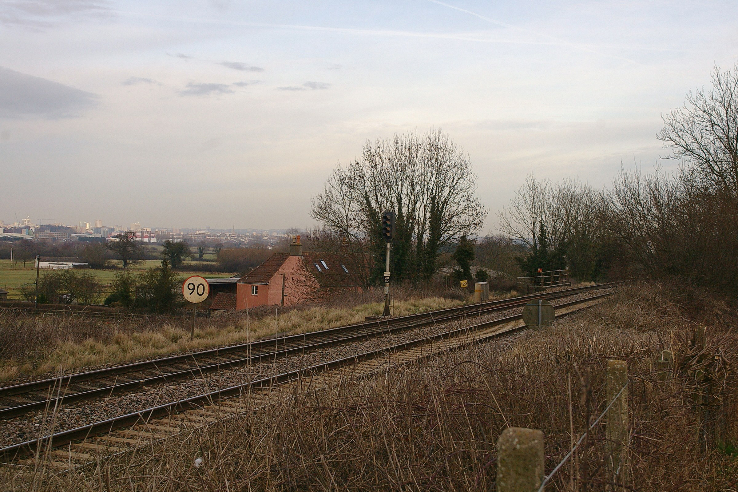
There are 22 disused railway stations in the between and , 12 of which have structures that can still be seen from passing trains. Most were closed in the 1960s but four of them, especially around , were replaced by stations on new sites. 13 stations remain open on the line today, but there have been proposals to reopen stations at Cullompton and Wellington. Background The route was opened by the Bristol and Exeter Railway in stages between 1841 and 1844. In 1876 this company was amalgamated with the Great Western Railway which, in turn, was nationalised into British Railways in 1948. It is now owned by Network Rail. Apart from the temporary station at Beam Bridge which was only used for a year, the earliest closures were in the Weston-super-Mare area in order to provide new facilities for the traffic to that town, which was much greater than predicted when the line was planned. The majority of the remaining closures followed Dr Beeching's '' Reshaping of British Railwa ... [...More Info...] [...Related Items...] OR: [Wikipedia] [Google] [Baidu] |
Isambard Kingdom Brunel
Isambard Kingdom Brunel (; 9 April 1806 – 15 September 1859) was a British civil engineer who is considered "one of the most ingenious and prolific figures in engineering history," "one of the 19th-century engineering giants," and "one of the greatest figures of the Industrial Revolution, hochanged the face of the English landscape with his groundbreaking designs and ingenious constructions." Brunel built dockyards, the Great Western Railway (GWR), a series of steamships including the first propeller-driven transatlantic steamship, and numerous important bridges and tunnels. His designs revolutionised public transport and modern engineering. Though Brunel's projects were not always successful, they often contained innovative solutions to long-standing engineering problems. During his career, Brunel achieved many engineering firsts, including assisting in the building of the first tunnel under a navigable river (the River Thames) and the development of the , the first ... [...More Info...] [...Related Items...] OR: [Wikipedia] [Google] [Baidu] |


.jpg)

