|
Winterstoke
The Hundred of Winterstoke is one of the 40 historical Hundreds in the ceremonial county of Somerset, England, dating from before the Norman conquest during the Anglo-Saxon era although exact dates are unknown. Each hundred had a 'fyrd', which acted as the local defence force and a court which was responsible for the maintenance of the frankpledge system. They also formed a unit for the collection of taxes. The role of the hundred court was described in the Dooms (laws) of King Edgar. The name of the hundred was normally that of its meeting-place. It consisted of the ancient parishes of: Axbridge, Badgworth, Banwell, Blagdon, Bleadon, Cheddar, Christon, Churchill, Compton Bishop, Congresbury, East Harptree, Hutton, Kenn, Kewstoke, Locking, Loxton, Puxton, Rodney Stoke, Rowberrow, Shipham, Uphill, Weston-super-Mare, Wick St Lawrence, Winscombe, Worle, Yatton. It also included the extra parochial area of Charterhouse-on-Mendip, covering in total approximately . The hundred ... [...More Info...] [...Related Items...] OR: [Wikipedia] [Google] [Baidu] |
Blagdon
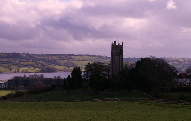
Blagdon is a village and civil parish in the ceremonial county of Somerset, within the unitary authority of North Somerset, in England. It is located in the Mendip Hills, a recognised Area of Outstanding Natural Beauty. According to the 2011 census it has a population of 1,116. The village is about east of Weston-super-Mare on the A368 between Churchill and Compton Martin. History The village was called ''Blachedon'' in the 1086 Domesday Book and the name comes from the Old English ''bloec'' and ''dun'' meaning 'the black or bleak down'. Romans There was a Roman presence in Blagdon from about 49 AD until the end of the Roman occupation of Britain. Several Roman coins and fragments of Roman pottery have been found in the village. There were lead and silver workings in Charterhouse, about a mile and a half uphill to the south, so it is likely that the wealthier supervisors had their houses away from the toxic smoke in the village. Wade and Wade in their 1929 book ''Somers ... [...More Info...] [...Related Items...] OR: [Wikipedia] [Google] [Baidu] |
Weston-super-Mare
Weston-super-Mare, also known simply as Weston, is a seaside town in North Somerset, England. It lies by the Bristol Channel south-west of Bristol between Worlebury Hill and Bleadon Hill. It includes the suburbs of Mead Vale, Milton, Oldmixon, West Wick, Worlebury, Uphill and Worle. Its population at the 2011 census was 76,143. Since 1983, Weston has been twinned with Hildesheim in Germany. The local area has been occupied since the Iron Age. It was still a small village until the 19th century when it developed as a seaside resort. A railway station and two piers were built. In the second half of the 20th century it was connected to the M5 motorway but the number of people holidaying in the town declined and some local industries closed, although the number of day visitors has risen. Attractions include The Helicopter Museum, Weston Museum, and the Grand Pier. Cultural venues include The Playhouse, the Winter Gardens and the Blakehay Theatre. The Bristol Channel has a l ... [...More Info...] [...Related Items...] OR: [Wikipedia] [Google] [Baidu] |
Badgworth
Badgworth is a village and civil parish in the Sedgemoor district of Somerset, England, south west of Axbridge. According to the 2011 census it had a population of 525. The village is home to an equestrian centre known as the Badgworth Arena. History The ancient village was named ''W. Bagewerre'' in 1086. The modern parish includes the villages of Biddisham where the Church of St John The Baptist dates from the 13th century but was rebuilt in the 15th century, and Tarnock the name of which is believed to be Brythonic in origin. Late Iron Age and Romano-British pottery was found at a kiln site in the village in the 1830s. It consisted primarily of jars with bead rims and bowls with flanged or rolled rims. The parish of Badgeworth was part of the Winterstoke Hundred, while Biddisham was part of the Bempstone hundred. A map of ''Winterstoake'' Hundred from the year 1645 shows the village name as ''Baddesworh''; on the map, the hundred contains the parish although a later han ... [...More Info...] [...Related Items...] OR: [Wikipedia] [Google] [Baidu] |
Axbridge
Axbridge is a small town in Somerset, England, in the Sedgemoor district on the River Axe, near the southern edge of the Mendip Hills. The town's population according to the 2011 census was 2,057. History ''Axanbrycg'' is suggested as the source of the name, meaning a bridge over the River Axe, in the early 9th century. Early inhabitants of the area almost certainly include the Romans (who are known to have mined lead on the top of the Mendips) and earlier still, prehistoric man, who lived in the local caves, and whose flint tools have been found on the slopes of the local hills. The history of Axbridge can be traced back to the reign of King Alfred when it was part of the Saxons' defence system for Wessex against the Vikings. In the Burghal Hidage, a list of ''burhs'' compiled in 910, it was listed as ''Axanbrycg''. A listing of Axbridge appears in the Domesday survey of 1086 as ', meaning 'axe bridge' from the Old English ' and '. It was part of the royal manor of Chedda ... [...More Info...] [...Related Items...] OR: [Wikipedia] [Google] [Baidu] |
Bleadon
Bleadon is a village and civil parish in Somerset, England. It is about south of Weston-super-Mare and, according to the 2011 census, has a population of 1,079. History Bleadon was listed in the Domesday Book of 1086 as ''Bledone'', meaning 'coloured or variegated hill', from Old English ''bleo'' 'coloured' and ''dun''. The parish was part of the Winterstoke Hundred. Just to the north of the village is Bleadon Hill, a 13.52 hectare geological Site of Special Scientific Interest. There is evidence of agricultural use of the land in the medieval period and probably from at least the Bronze Age. The village cross and well are listed buildings. Bleadon lies on the River Axe and had been a small port, sometimes known as Lympsham Wharf, for many years, with the arrival of the railway in 1841 making this the furthest navigable point. It was last used, by the ketch ''Democrat'', in 1942. An Act of 1915 authorised the drainage of the river and installation of a flood gate at Bleado ... [...More Info...] [...Related Items...] OR: [Wikipedia] [Google] [Baidu] |
Congresbury
Congresbury is a village and civil parish on the northwestern slopes of the Mendip Hills in North Somerset, England, which in 2011 had a population of 3,497. It lies on the A370 between Junction 21 of the M5 and Bristol Airport, south of Bristol city centre, and east of Weston-super-Mare. The Congresbury Yeo river flows through the village. The parish includes the hamlet of Brinsea. The nearest railway station is Yatton, with trains provided by Great Western Railway, but Congresbury once had its own railway station on the Cheddar Valley Line from Yatton to Wells. It was also the starting point for the Wrington Vale Light Railway, which went to nearby Wrington and Blagdon. History Congresbury is named after St Congar, who is said to have performed three miracles in the area. The second part of the name is thought to come from ''burh'' meaning fortified place. The remains of an Iron Age hill fort at Cadbury Hill have been discovered, as well as a Roman villa, temple and ... [...More Info...] [...Related Items...] OR: [Wikipedia] [Google] [Baidu] |
Banwell
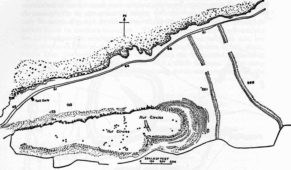
Banwell is a village and civil parish on the River Banwell in the North Somerset district of Somerset, England. Its population was 2,919 according to the 2011 census. History Banwell Camp, east of the village, is a univallate hillfort which has yielded flint implements from the Palaeolithic, Neolithic and Bronze Age. It was also occupied in the Iron Age. In the late 1950s it was excavated by J.W. Hunt of the Banwell Society of Archaeology. It is surrounded by a high bank and ditch. The remains of a Romano-British villa were discovered in 1968. It included a courtyard, wall and bath house close to the River Banwell. Artefacts from the site suggest it fell into disuse in the 4th century. Earthworks from farm buildings, south of Gout House Farm, occupied from the 11th to 14th centuries where archaeological remains suggest the site was first occupied in the Romano-British period. The raised area which was occupied by the Bower House was surrounded by a water filled ditch, part o ... [...More Info...] [...Related Items...] OR: [Wikipedia] [Google] [Baidu] |
Puxton
Puxton is a village and civil parish, north west of Axbridge in the unitary authority of North Somerset within the ceremonial county of Somerset, England. The civil parish includes the isolated hamlets of East Hewish and West Hewish. History The parish was part of the Winterstoke Hundred. Puxton was part of the manor of Banwell held by the Bishop of Bath and Wells until the reign of Henry VI when it passed to the St Loe or De Sancto Laudo family who held it for over 100 years. Puxton Park, a family attraction with small animals, a falconry centre and farm shop, opened in 2007. The park gained some notability when it was revealed that they will not allow any single people to visit under the assumption that they are all paedophiles. Governance The parish council has responsibility for local issues, including setting an annual precept (local rate) to cover the council's operating costs and producing annual accounts for public scrutiny. The parish council evaluates local ... [...More Info...] [...Related Items...] OR: [Wikipedia] [Google] [Baidu] |
Yatton
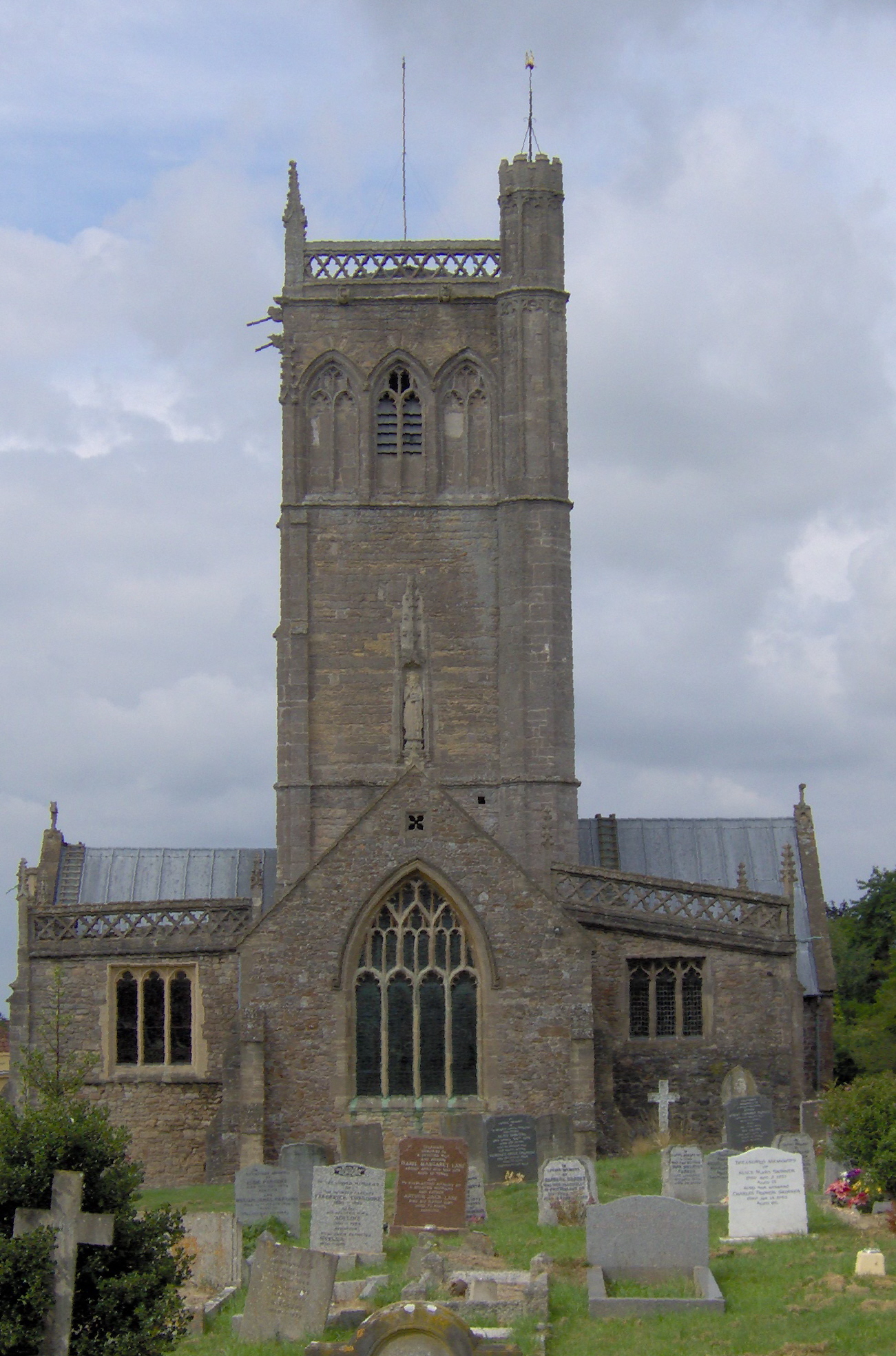
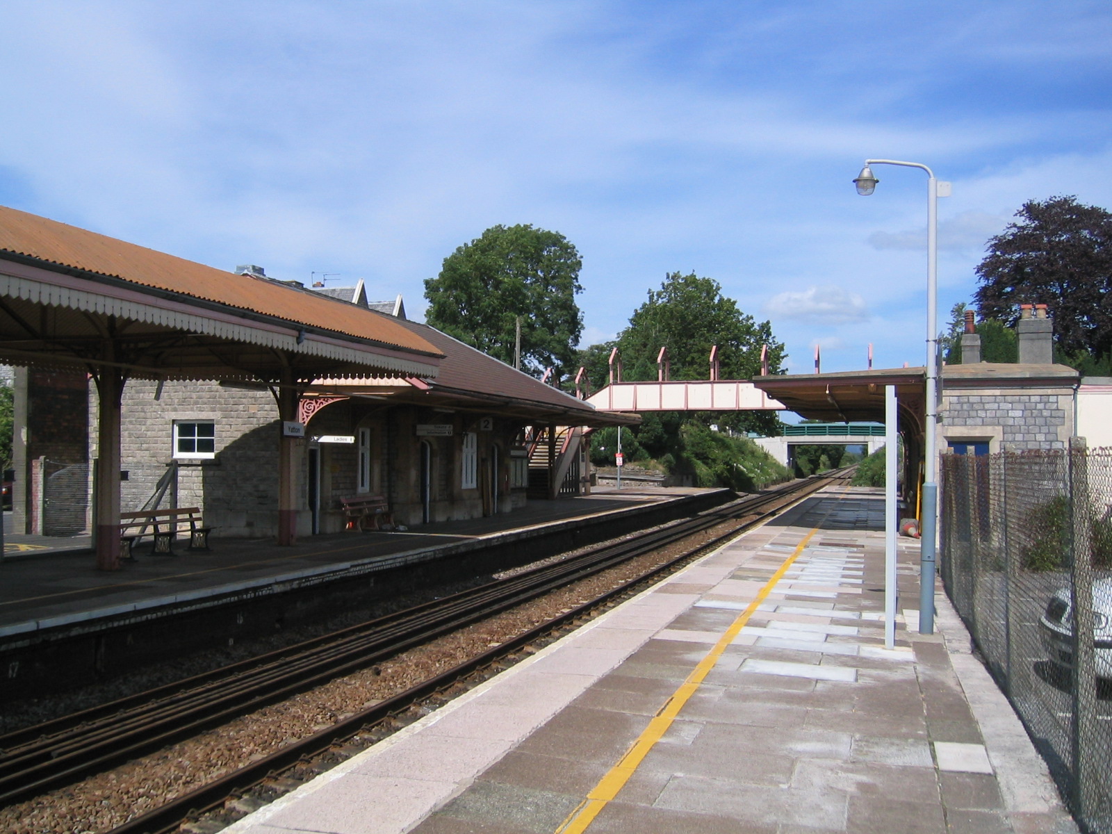
Yatton is a village and civil parish within the unitary authority of North Somerset, which falls within the ceremonial county of Somerset, England. It is located south-west of Bristol. Its population in 2011 was 7,552. The parish includes Claverham, a small village which was originally a farming hamlet. The origins of the village and its name are unclear; however, there is evidence of Iron Age hill fort and a Roman villa in the area. The arrival of the railway in the 19th century and more recent road building have led to expansion of the village with Yatton now acting as a home to many commuters, while also supporting manufacturing industry and commerce. The village is located on the North Somerset Levels, where the low-lying land, a mixture of peat, estuarine alluvium and low hills of sand and gravel, is crossed by a myriad of watercourses, providing a habitat for several scarce species. St Mary's Church dates from the 14th century and there are a range of other places of w ... [...More Info...] [...Related Items...] OR: [Wikipedia] [Google] [Baidu] |
Worle
Worle ( ) is a large village in North Somerset which is joined to the seaside town of Weston-super-Mare on its western edge. It, however, maintains a very separate identity, and may now be bigger than its more famous neighbour. Worle pre-dates Weston and was mentioned in the Domesday Book of 1086. In the book, it is said that Worle was owned by Walter of Douai, and consisted of and valued at 6.5 hides. "Walter of Douai holds of the King, Worle. Edgar held it in the time of King Edward, and gelded for six hides and a half." The parish church of St Martin's sits on the side of Worlebury Hill and overlooks the village. History The name was possibly formed from the Old English ''Wor + leah'' meaning 'wood or clearing frequented by grouse', or perhaps 'moor meadow'. The parish was part of the Winterstoke Hundred. Worle has grown dramatically in the last 40 years. That initial development in the 1970s and 1980s included a large number of houses, a Sainsburys supermarket, a secondar ... [...More Info...] [...Related Items...] OR: [Wikipedia] [Google] [Baidu] |
Winscombe
Winscombe is a large village in the North Somerset unitary district of Somerset, South West England, close to the settlements of Axbridge and Cheddar, on the western edge of the Mendip Hills, southeast of Weston-super-Mare and southwest of Bristol. The Parish of Winscombe and Sandford, centred on the Parish Church of Church of St James the Great, includes the villages/hamlets of Barton, Hale, Oakridge, Nye, Sidcot and Woodborough. Winscombe has a few shops and businesses focused in the centre of the village, along Woodborough Road and Sandford Road. There is a doctor's surgery in the village, a vet and two dentists. West of the village is the Max Bog biological Site of Special Scientific Interest. History It has been suggested that the name means a valley belonging to a Saxon named Wine. The parish was part of the Winterstoke Hundred. Winscombe was the subject of a historical and archaeological study led by Professor Mick Aston, published in the ''Proceedings of the Somer ... [...More Info...] [...Related Items...] OR: [Wikipedia] [Google] [Baidu] |
Wick St Lawrence
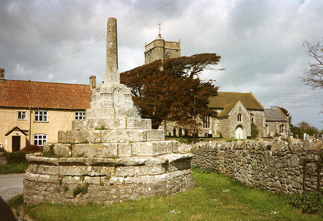
Wick St. Lawrence is a civil parish and village in Somerset, England. It falls within the unitary authority of North Somerset. The population of the parish, which includes Bourton, Icelton and Ebdon, in the 2011 census was 1,331. History The parish of Wick St Lawrence was part of the Winterstoke Hundred, while Bourton was in Portbury Hundred. The 15th century village cross stands on an area of grass opposite the parish church, raised up on five ascending octagonal stone platforms. The crosshead was destroyed during the time of the English Civil Wars. It is a Grade II* listed building and Scheduled Ancient Monument. The Ebdon Bow Bridge which carries the road from the village to nearby Worle over the River Banwell was built in the late 18th or early 19th century. In the hamlet of Ebdon there is a pub (The Ebdon), Ebdon Hair and Beauty and a playing field. There is a caravan park in Ebdon Farm. Governance North Somerset's area covers part of the ceremonial county of Some ... [...More Info...] [...Related Items...] OR: [Wikipedia] [Google] [Baidu] |


.jpg)
