|
Ugley Green
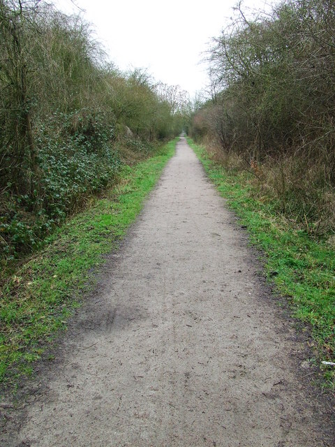
Ugley Green is a small village in the non-metropolitan district, district of Uttlesford in Essex, England. It is approximately north-east from Bishops Stortford, and just to the west of the M11 motorway. The village is within the civil parish of Ugley, a smaller settlement to the north. The village contains two Grade II listed building, listed 19th-century houses, and a post-medieval house. The village hall was built in 1920. Occupations in 1933 included four farmers, a carpenter, a stationer & sub-postmaster, a blacksmith, a gravel merchant, a beer retailer, a shopkeeper, a steward to Wades Hall, and the Landlord#Licensed victualler, licensee of the White Hart public house. Wades Hall is the remaining wing of a larger house dating to the 16th century, Grade II listed, and approximately northwest from the village. See also * Clavering hundred * The Hundred Parishes * ''Rude Britain'' References [...More Info...] [...Related Items...] OR: [Wikipedia] [Google] [Baidu] |
Ugley
Ugley is a small village and civil parish in the non-metropolitan district of Uttlesford in Essex, England. It is about north from Stansted Mountfitchet, and situated between Saffron Walden and Bishop's Stortford. Within the parish is the village of Ugley Green, to the south. Ugley was first recorded in 1041 as "Uggele". It appears in the ''Domesday Book'' as "Ugghelea". The name probably means "woodland clearing of a man named Ugga." Within Ugley there are several buildings of the 16th and 17th centuries. The Grade II* listed church, St Peter's, has a 13th-century nave and a Tudor brick tower. Orford House is a Grade II* listed building built by Edward Russell, 1st Earl of Orford, c.1700. The village's name has been noted on lists of unusual place names. Cycling There is a cycling time trial course which starts close to Ugley. The village is home to several bungalows or "huts" owned by long-established cycling clubs based in Essex and Greater London.Rouler.cc, https:/ ... [...More Info...] [...Related Items...] OR: [Wikipedia] [Google] [Baidu] |
Uttlesford
Uttlesford is a local government district in Essex, England. Its council is based in the market town of Saffron Walden. At the 2011 Census, the population of the district was 79,443. Other notable settlements include Great Dunmow, Elmdon, Stebbing, Stansted Mountfitchet, Thaxted, Debden, Little Chesterford and Felstead among other settlements. History Its name is derived from its location within the ancient Hundred (county subdivision), hundred of Uttlesford,Open Domesday: Hundred of Uttlesford. Accessed 6 January 2022. usually spelled ''Vdelesford'' Open Domesday: Saffron Walden. Accessed 6 January 2022. or ''Wdelesford'' [...More Info...] [...Related Items...] OR: [Wikipedia] [Google] [Baidu] |
Essex
Essex () is a county in the East of England. One of the home counties, it borders Suffolk and Cambridgeshire to the north, the North Sea to the east, Hertfordshire to the west, Kent across the estuary of the River Thames to the south, and Greater London to the south and south-west. There are three cities in Essex: Southend, Colchester and Chelmsford, in order of population. For the purposes of government statistics, Essex is placed in the East of England region. There are four definitions of the extent of Essex, the widest being the ancient county. Next, the largest is the former postal county, followed by the ceremonial county, with the smallest being the administrative county—the area administered by the County Council, which excludes the two unitary authorities of Thurrock and Southend-on-Sea. The ceremonial county occupies the eastern part of what was, during the Early Middle Ages, the Anglo-Saxon Kingdom of Essex. As well as rural areas and urban areas, it forms ... [...More Info...] [...Related Items...] OR: [Wikipedia] [Google] [Baidu] |
Saffron Walden (UK Parliament Constituency)
Saffron Walden is a Constituencies of the Parliament of the United Kingdom, constituency in Essex represented in the House of Commons of the United Kingdom, House of Commons of the Parliament of the United Kingdom, UK Parliament since 2017 United Kingdom general election, 2017 by Kemi Badenoch, a Conservative Party (UK), Conservative. History Saffron Walden was one of eight single-member divisions of Essex (later classified as county constituencies) created by the Redistribution of Seats Act 1885, replacing the three two member divisions of East, South and West Essex. The boundaries were redrawn under the Representation of the People Act 1918, then remaining virtually unchanged until changes brought in for the 2010 general election by the Fifth Periodic Review of Westminster constituencies. This has been a Conservative Party (UK), Conservative safe seat based on election results since 1922, in which period the majorities have occasionally been Marginal seat, marginal. However ... [...More Info...] [...Related Items...] OR: [Wikipedia] [Google] [Baidu] |
Non-metropolitan District
Non-metropolitan districts, or colloquially "shire districts", are a type of local government district in England. As created, they are sub-divisions of non-metropolitan counties (colloquially ''shire counties'') in a two-tier arrangement. Non-metropolitan districts with borough status are known as boroughs, able to appoint a mayor and refer to itself as a borough council. Non-metropolitan districts Non-metropolitan districts are subdivisions of English non-metropolitan counties which have a two-tier structure of local government. Most non-metropolitan counties have a county council and several districts, each with a borough or district council. In these cases local government functions are divided between county and district councils, to the level where they can be practised most efficiently: *Borough/district councils are responsible for local planning and building control, local roads, council housing, environmental health, markets and fairs, refuse collection and recyclin ... [...More Info...] [...Related Items...] OR: [Wikipedia] [Google] [Baidu] |
Bishops Stortford
Bishop's Stortford is a historic market town in Hertfordshire, England, just west of the M11 motorway on the county boundary with Essex, north-east of central London, and by rail from Liverpool Street station. Stortford had an estimated population of 41,088 in 2020. The district of East Hertfordshire, where the town is located, has been ranked as the best place to live in the United Kingdom, UK by the Halifax Quality of Life annual survey in 2020. The town is commonly known as “Stortford” by locals. History Etymology The origins of the town's name are uncertain. One possibility is that the Saxons, Saxon settlement derives its name from 'Steorta's ford' or 'tail ford', in the sense of a 'tail', or tongue, of land. The town became known as Bishop's Stortford due to the acquisition in 1060 by the Bishop of London. The River Stort is named after the town, and not the town after the river. When cartographers visited the town in the 16th century, they reasoned that the tow ... [...More Info...] [...Related Items...] OR: [Wikipedia] [Google] [Baidu] |
M11 Motorway
The M11 is a motorway that runs north from the North Circular Road (A406) in South Woodford to the A14, northwest of Cambridge, England. Originally proposed as a trunk road as early as 1915, various plans were considered throughout the 1960s, with final construction being undertaken between 1975 and 1980. The motorway was opened in stages, with the first stage between junctions 7 and 8 opening in June 1975, and the completed motorway becoming fully operational in February 1980. Running from Woodford to Girton, the motorway provides direct access to Harlow, Cambridge and since 2002, greatly improved access to London Stansted Airport. Route The M11 starts in South Woodford in northeast London, just north of Redbridge Roundabout, crosses the North Circular (A406) at junction 4, it then heads NNE, passing east of Loughton and Theydon Bois as well as Epping Forest, meeting the M25 motorway at junction 6, and then veering approximately north, passing to the east of Harlow. The M1 ... [...More Info...] [...Related Items...] OR: [Wikipedia] [Google] [Baidu] |
Civil Parish
In England, a civil parish is a type of administrative parish used for local government. It is a territorial designation which is the lowest tier of local government below districts and counties, or their combined form, the unitary authority. Civil parishes can trace their origin to the ancient system of ecclesiastical parishes, which historically played a role in both secular and religious administration. Civil and religious parishes were formally differentiated in the 19th century and are now entirely separate. Civil parishes in their modern form came into being through the Local Government Act 1894, which established elected parish councils to take on the secular functions of the parish vestry. A civil parish can range in size from a sparsely populated rural area with fewer than a hundred inhabitants, to a large town with a population in the tens of thousands. This scope is similar to that of municipalities in Continental Europe, such as the communes of France. However, ... [...More Info...] [...Related Items...] OR: [Wikipedia] [Google] [Baidu] |
Ugley Green, Chapman And Andre Map, 1777
Ugley is a small village and civil parish in the non-metropolitan district of Uttlesford in Essex, England. It is about north from Stansted Mountfitchet, and situated between Saffron Walden and Bishop's Stortford. Within the parish is the village of Ugley Green, to the south. Ugley was first recorded in 1041 as "Uggele". It appears in the ''Domesday Book'' as "Ugghelea". The name probably means "woodland clearing of a man named Ugga." Within Ugley there are several buildings of the 16th and 17th centuries. The Grade II* listed church, St Peter's, has a 13th-century nave and a Tudor brick tower. Orford House is a Grade II* listed building built by Edward Russell, 1st Earl of Orford, c.1700. The village's name has been noted on lists of unusual place names. Cycling There is a cycling time trial course which starts close to Ugley. The village is home to several bungalows or "huts" owned by long-established cycling clubs based in Essex and Greater London.Rouler.cc, https:/ ... [...More Info...] [...Related Items...] OR: [Wikipedia] [Google] [Baidu] |
Listed Building
In the United Kingdom, a listed building or listed structure is one that has been placed on one of the four statutory lists maintained by Historic England in England, Historic Environment Scotland in Scotland, in Wales, and the Northern Ireland Environment Agency in Northern Ireland. The term has also been used in the Republic of Ireland, where buildings are protected under the Planning and Development Act 2000. The statutory term in Ireland is " protected structure". A listed building may not be demolished, extended, or altered without special permission from the local planning authority, which typically consults the relevant central government agency, particularly for significant alterations to the more notable listed buildings. In England and Wales, a national amenity society must be notified of any work to a listed building which involves any element of demolition. Exemption from secular listed building control is provided for some buildings in current use for worship, ... [...More Info...] [...Related Items...] OR: [Wikipedia] [Google] [Baidu] |
Landlord
A landlord is the owner of a house, apartment, condominium, land, or real estate which is rented or leased to an individual or business, who is called a tenant (also a ''lessee'' or ''renter''). When a juristic person is in this position, the term landlord is used. Other terms include lessor and owner. The term landlady may be used for the female owners. The manager of a pub in the United Kingdom, strictly speaking a licensed victualler, is referred to as the landlord/landlady. In political economy it refers to the owner of natural resources alone (e.g., land, not buildings) from which an economic rent is the income received. History The concept of a landlord may be traced back to the feudal system of manoralism (seignorialism), where a landed estate is owned by a Lord of the Manor (mesne lords), usually members of the lower nobility which came to form the rank of knights in the high medieval period, holding their fief via subinfeudation, but in some cases the land may also ... [...More Info...] [...Related Items...] OR: [Wikipedia] [Google] [Baidu] |
Kelly's Directory
Kelly's Directory (or more formally, the Kelly's, Post Office and Harrod & Co Directory) was a trade directory in England that listed all businesses and tradespeople in a particular city or town, as well as a general directory of postal addresses of local gentry, landowners, charities, and other facilities. In effect, it was a Victorian version of today's Yellow Pages. Many reference libraries still keep their copies of these directories, which are now an important source for historical research. Origins The eponymous originator of the directory was Frederic Festus Kelly. In 1835 or 1836 he became chief inspector of letter-carriers for the inland or general post office, and took over publication of the Post Office London Directory, whose copyright was in private hands despite its semi-official association with the post office, and which Kelly had to purchase from the widow of his predecessor. He founded Kelly & Co. and he and various family members gradually expanded the company ... [...More Info...] [...Related Items...] OR: [Wikipedia] [Google] [Baidu] |


