|
US 33 (WV)
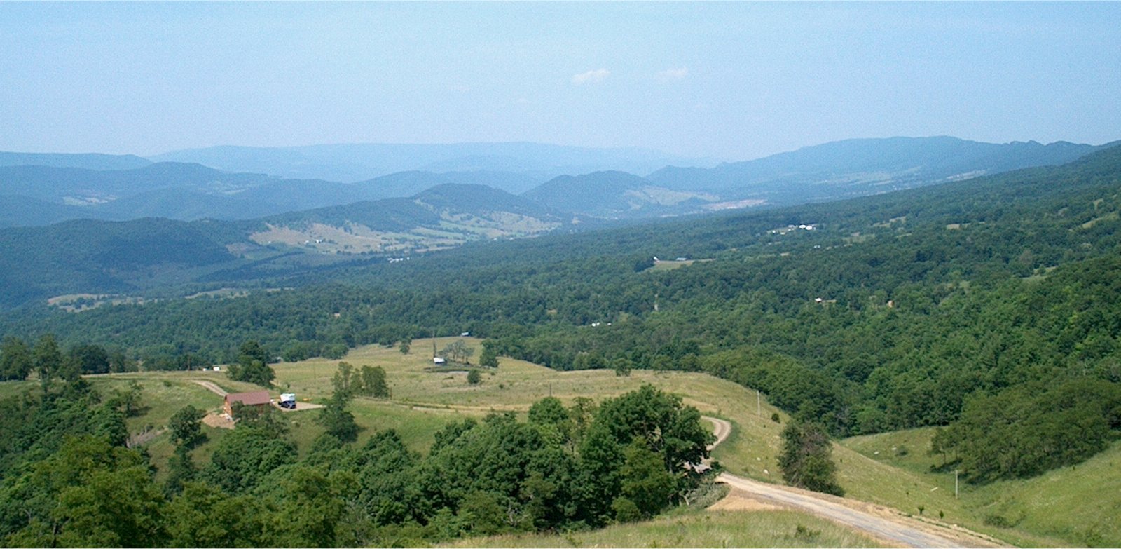
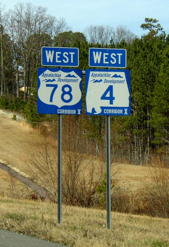
U.S. Route 33 (US 33) in the U.S. state of West Virginia extends from the Ohio River at Ravenswood to the Virginia state line atop Shenandoah Mountain west of Harrisonburg, Virginia. Route description Shortly after entering West Virginia and crossing the Ohio River, US 33 turns south, then east in Ravenswood. It then joins SR 2's freeway, turning northeast, then east again to Silverton. The two routes then split, and US 33 joins Interstate 77 to Ripley. The route then turns east from I-77, joining US 119 at Spencer, then passing through extremely rural areas of Roane, Calhoun, Gilmer, and Lewis counties. US 33 Intersects Interstate 79 at Weston, West Virginia. From Interstate 79 east, US 33 is a four-lane highway, part of Corridor H of the Appalachian Development Highway System. The four-lane segment continues on through rural areas of Upshur, and Randolph counties, to just a couple miles past Elkins. At Harding, US 250 joins US 33 for several miles afte ... [...More Info...] [...Related Items...] OR: [Wikipedia] [Google] [Baidu] |
Ohio
Ohio () is a state in the Midwestern region of the United States. Of the fifty U.S. states, it is the 34th-largest by area, and with a population of nearly 11.8 million, is the seventh-most populous and tenth-most densely populated. The state's capital and largest city is Columbus, with the Columbus metro area, Greater Cincinnati, and Greater Cleveland being the largest metropolitan areas. Ohio is bordered by Lake Erie to the north, Pennsylvania to the east, West Virginia to the southeast, Kentucky to the southwest, Indiana to the west, and Michigan to the northwest. Ohio is historically known as the "Buckeye State" after its Ohio buckeye trees, and Ohioans are also known as "Buckeyes". Its state flag is the only non-rectangular flag of all the U.S. states. Ohio takes its name from the Ohio River, which in turn originated from the Seneca word ''ohiːyo'', meaning "good river", "great river", or "large creek". The state arose from the lands west of the Appalachian Mountai ... [...More Info...] [...Related Items...] OR: [Wikipedia] [Google] [Baidu] |
Pendleton County, West Virginia
Pendleton County is a county located in the U.S. state of West Virginia. As of the 2020 census, the population was 6,143, making it the second-least populous county in West Virginia. Its county seat is Franklin. The county was created by the Virginia General Assembly in 1788 from parts of Augusta, Hardy, and Rockingham Counties and was named for Edmund Pendleton (1721–1803), a distinguished Virginia statesman and jurist. Pendleton County was strongly pro-Confederate during the American Civil War; however, there were pockets of Unionists who supported the state government in Wheeling. Spruce Knob, located in Pendleton County, is the highest point in the state and in the Alleghenies, its elevation being 4,863 feet. Parts of the Monongahela and George Washington National Forests are also located in Pendleton. History By the 1740s, the three main valleys of what became Pendleton County had been visited and named by white hunters and prospectors. One of the hunters, a single ... [...More Info...] [...Related Items...] OR: [Wikipedia] [Google] [Baidu] |
Monongahela National Forest
The Monongahela National Forest is a national forest located in the Allegheny Mountains of eastern West Virginia, USA. It protects over of federally managed land within a proclamation boundary that includes much of the Potomac Highlands Region and portions of 10 counties. The Monongahela National Forest includes some major landform features such as the Allegheny Front and the western portion of the Ridge-and-valley Appalachians. Within the forest boundaries lie some of the highest mountain peaks in the state, including the highest, Spruce Knob (4,863 ft). Spruce Knob is also the highest point in the Allegheny Mountains. Approximately 75 tree species are found in the forest. Almost all of the trees are a second growth forest, grown back after the land was heavily cutover around the start of the 20th century. Species for which the forest is important include red spruce (''Picea rubens''), balsam fir (''Abies balsamea''), and mountain ash (''Sorbus americana''). The Monong ... [...More Info...] [...Related Items...] OR: [Wikipedia] [Google] [Baidu] |
Bowden, West Virginia
Bowden is a census-designated place (CDP) in Randolph County, West Virginia, United States. Bowden is located on U.S. Route 33, east of Elkins. Bowden has a post office A post office is a public facility and a retailer that provides mail services, such as accepting letters and parcels, providing post office boxes, and selling postage stamps, packaging, and stationery. Post offices may offer additional serv ... with ZIP code 26254. According to the 2010 Census, there were nine people residing at this location. References [...More Info...] [...Related Items...] OR: [Wikipedia] [Google] [Baidu] |
Canfield, Randolph County, West Virginia
Canfield is an unincorporated community in Randolph County, West Virginia, United States. Canfield is located along U.S. Route 33 and West Virginia Route 55 West Virginia Route 55 is an east–west state highway in West Virginia. The western terminus of the route is at U.S. Route 19 in Muddlety. The eastern terminus is at the Virginia state line six miles (10 km) east of Wardensville, wher ..., east-southeast of Elkins. References Unincorporated communities in Randolph County, West Virginia Unincorporated communities in West Virginia {{RandolphCountyWV-geo-stub ... [...More Info...] [...Related Items...] OR: [Wikipedia] [Google] [Baidu] |
Appalachian Development Highway System
The Appalachian Development Highway System (ADHS) is a series of highway corridors in the Appalachia region of the eastern United States. The routes are designed as local and regional routes for improving economic development in the historically isolated region. It was established as part of the Appalachian Regional Development Act of 1965, and has been repeatedly supplemented by various federal and state legislative and regulatory actions. The system consists of a mixture of state, U.S., and Interstate routes. The routes are formally designated as "corridors" and assigned a letter. Signage of these corridors varies from place to place, but where signed are often done so with a distinctive blue-colored sign. A 2019 study found that the construction of the ADHS led to economic net gains of $54 billion (approximately 0.4 percent of national income) and boosted incomes in the Appalachian region by reducing the costs of trade. History In 1964, the President's Appalachian Re ... [...More Info...] [...Related Items...] OR: [Wikipedia] [Google] [Baidu] |
Interstate 77
Interstate 77 (I-77) is a north–south Interstate Highway in the eastern United States. It traverses diverse terrain, from the mountainous state of West Virginia to the rolling farmlands of North Carolina and Ohio. It largely supplants the old US Route 21 (US 21) between Cleveland, Ohio, and Columbia, South Carolina, as an important north–south corridor through the middle Appalachians. The southern terminus of I-77 is in Cayce, South Carolina, in Lexington County at the junction with I-26. The northern terminus is in Cleveland at the junction with I-90. Other major cities that I-77 connects to include Charlotte, North Carolina; Charleston, West Virginia; and Akron, Ohio. The East River Mountain Tunnel, connecting Virginia and West Virginia, is one of only two instances in the United States where a mountain road tunnel crosses a state line. The other is the Cumberland Gap Tunnel, connecting Tennessee and Kentucky. I-77 is a snowbird route to the Southern United ... [...More Info...] [...Related Items...] OR: [Wikipedia] [Google] [Baidu] |
The Cliffs Of Seneca
''The'' () is a grammatical article in English, denoting persons or things that are already or about to be mentioned, under discussion, implied or otherwise presumed familiar to listeners, readers, or speakers. It is the definite article in English. ''The'' is the most frequently used word in the English language; studies and analyses of texts have found it to account for seven percent of all printed English-language words. It is derived from gendered articles in Old English which combined in Middle English and now has a single form used with nouns of any gender. The word can be used with both singular and plural nouns, and with a noun that starts with any letter. This is different from many other languages, which have different forms of the definite article for different genders or numbers. Pronunciation In most dialects, "the" is pronounced as (with the voiced dental fricative followed by a schwa) when followed by a consonant sound, and as (homophone of the archaic pron ... [...More Info...] [...Related Items...] OR: [Wikipedia] [Google] [Baidu] |
Ravenswood Bridge
The William S. Ritchie Jr. Bridge, more commonly known as the Ravenswood Bridge, is a two-lane cantilever bridge in the United States, connecting Ravenswood, West Virginia and rural Meigs County, Ohio, across the Ohio River. It has a total length of with a main span of . The bridge was completed in 1981. The bridge replaced a ferry that had crossed the river between Ravenswood at Walnut Street and rural Lebanon Township since at least 1908. When the bridge opened in 1981, on the Ohio side of the river, the bridge and its approach route carried the Ohio State Route 824 (SR 824). The crossing originally led to a winding two-lane SR 338. On the West Virginia side, the bridge carried West Virginia Route 338. In 2003, the SR 824 and WV 338 designations were removed when the US 33 relocation in Meigs County was completed and the US 33 designation was moved onto the bridge. See also *List of crossings of the Ohio River This is a complete list of current bridges and other cr ... [...More Info...] [...Related Items...] OR: [Wikipedia] [Google] [Baidu] |
Harrisonburg, Virginia
Harrisonburg is an independent city in the Shenandoah Valley region of the Commonwealth of Virginia in the United States. It is also the county seat of the surrounding Rockingham County, although the two are separate jurisdictions. At the 2020 census, the population was 51,814. The Bureau of Economic Analysis combines the city of Harrisonburg with Rockingham County for statistical purposes into the Harrisonburg, Virginia Metropolitan Statistical Area, which had an estimated population of 126,562 in 2011. Harrisonburg is home to James Madison University (JMU), a public research university with an enrollment of over 20,000 students, and Eastern Mennonite University (EMU), a private, Mennonite-affiliated liberal arts university. Although the city has no historical association with President James Madison, JMU was nonetheless named in his honor as Madison College in 1938 and renamed as James Madison University in 1977. EMU largely owes its existence to the sizable Mennonite pop ... [...More Info...] [...Related Items...] OR: [Wikipedia] [Google] [Baidu] |


.png)

