|
USS Ray (SS-271)
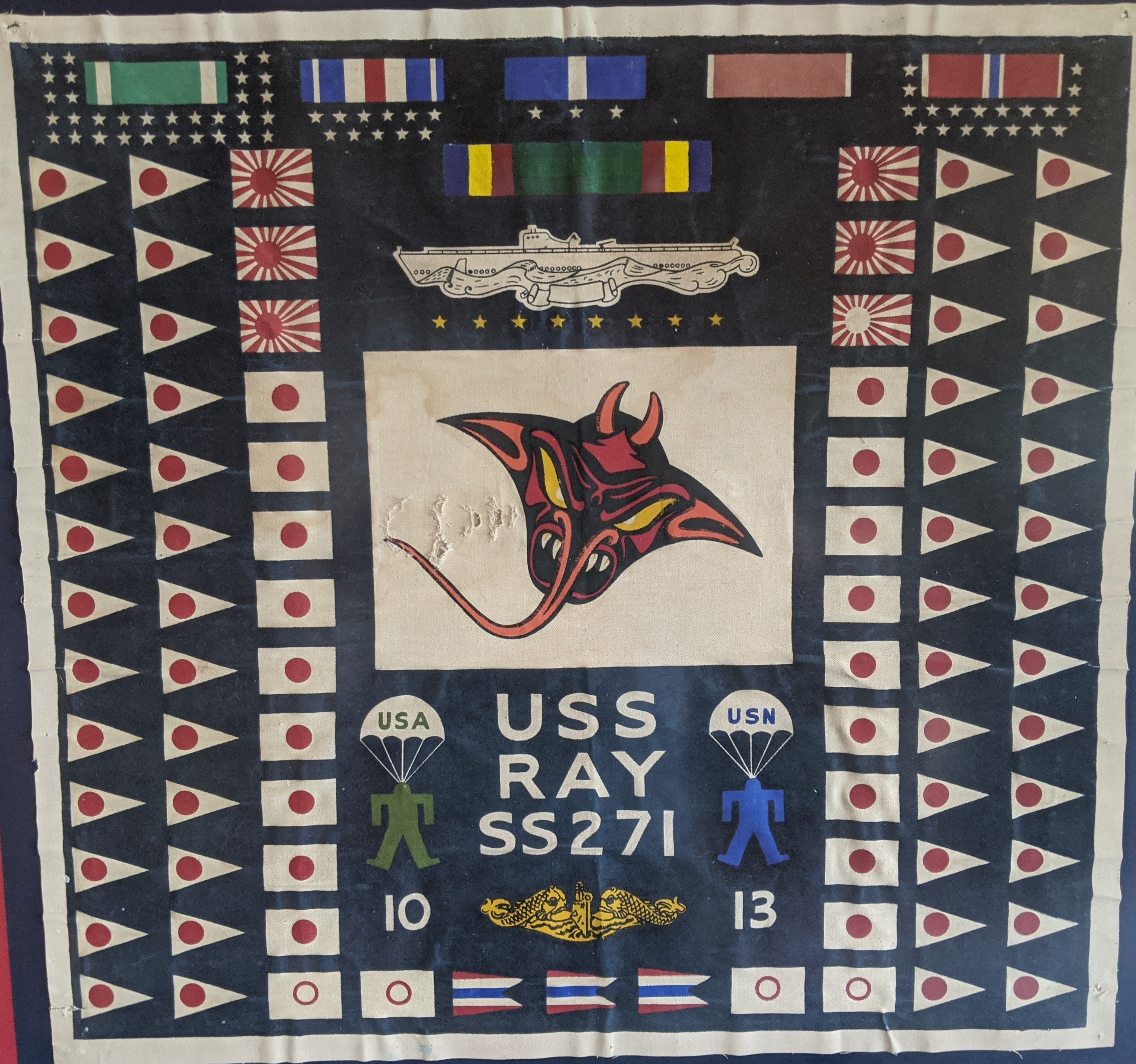
USS ''Ray'' (SS/SSR-271), a , was the first ship of the United States Navy to be named for the ray, a fish characterized by a flat body, large pectoral fins, and a whiplike tail. Construction and commissioning A fleet submarine, ''Ray'' was laid down on 20 July 1942; launched on 28 February 1943 by the Manitowoc Shipbuilding Company at Manitowoc, Wisconsin, sponsored by Mrs. S. C. Loomis; and commissioned on 27 July 1943. Service history After training in Lake Michigan until 15 August 1943, ''Ray'' arrived at Coco Solo, Panama Canal Zone, via New Orleans, Louisiana, on 31 August 1943 for intensive training. Departing Panama on 5 October, she reached Brisbane, Australia, on 30 October 1943. World War II First war patrol, November–December 1943 Departing Milne Bay, New Guinea, on 13 November for her first war patrol, ''Ray'' searched the area north of the Bismarck Archipelago. On the New Hanover- Truk shipping lane, she made radar contact with a three-ship convo ... [...More Info...] [...Related Items...] OR: [Wikipedia] [Google] [Baidu] |
Coco Solo
Coco Solo was a United States Navy submarine base and naval air station, active from 1918 to the 1960s. History The submarine base at Coco Solo was established May 6, 1918. The site corresponds with modern-day Cativá in Panama. It was on the Atlantic Ocean (northwest) side of the Panama Canal Zone, near Colón, Panama. Five C-class submarines were based there during 1914–1919. United States Senator John McCain was born in 1936 at a small Navy hospital, at Coco Solo Naval Air Station. The larger Coco Solo Hospital was constructed in the summer of 1941. The area containing it was transferred from the civil part of the Panama Canal Zone to the naval part when Franklin Roosevelt signed Executive Order 8981 on December 17, 1941. On December 7, 1941, three V-Class submarines (''Barracuda'', ''Bass'' and ''Bonita'') were stationed at Coco Solo. During World War II, Coco Solo also served as a Naval Air Facility, housing a squadron of USAAF P-38 Lightning aircraft. By the ... [...More Info...] [...Related Items...] OR: [Wikipedia] [Google] [Baidu] |
Gunboat
A gunboat is a naval watercraft designed for the express purpose of carrying one or more guns to bombard coastal targets, as opposed to those military craft designed for naval warfare, or for ferrying troops or supplies. History Pre-steam era In the age of sail, a gunboat was usually a small undecked vessel carrying a single smoothbore cannon in the bow, or just two or three such cannons. A gunboat could carry one or two masts or be oar-powered only, but the single-masted version of about length was most typical. Some types of gunboats carried two cannons, or else mounted a number of swivel guns on the railings. The small gunboat had advantages: if it only carried a single cannon, the boat could manoeuvre in shallow or restricted areas – such as rivers or lakes – where larger ships could sail only with difficulty. The gun that such boats carried could be quite heavy; a 32-pounder for instance. As such boats were cheap and quick to build, naval forces favoured swarm ... [...More Info...] [...Related Items...] OR: [Wikipedia] [Google] [Baidu] |
Convoy
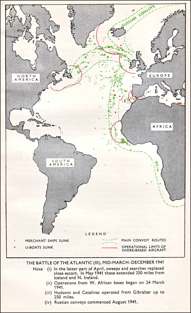
A convoy is a group of vehicles, typically motor vehicles or ships, traveling together for mutual support and protection. Often, a convoy is organized with armed defensive support and can help maintain cohesion within a unit. It may also be used in a non-military sense, for example when driving through remote areas. Naval convoys Age of Sail Naval convoys have been in use for centuries, with examples of merchant ships traveling under naval protection dating to the 12th century. The use of organized naval convoys dates from when ships began to be separated into specialist classes and national navies were established. By the French Revolutionary Wars of the late 18th century, effective naval convoy tactics had been developed to ward off pirates and privateers. Some convoys contained several hundred merchant ships. The most enduring system of convoys were the Spanish treasure fleets, that sailed from the 1520s until 1790. When merchant ships sailed independently, a privateer cou ... [...More Info...] [...Related Items...] OR: [Wikipedia] [Google] [Baidu] |
Chuuk Lagoon
Chuuk Lagoon, previously Truk Atoll, is an atoll in the central Pacific. It lies about northeast of New Guinea, and is part of Chuuk State within the Federated States of Micronesia (FSM). A protective reef, around, encloses a natural harbour , with an area of . It has a land area of , with a population of 36,158 people and a maximal elevation of . Weno city on Moen Island functions as the atoll's capital and also as the state capital and is the largest city in the FSM with its 13,700 people. Chuuk Lagoon was the Empire of Japan's main naval base in the Pacific War, South Pacific theatre during World War II. It was the site of a major U.S. attack during Operation Hailstone in February 1944, and Operation Inmate, a small assault conducted by British and Canadian forces during June 1945. Name Chuuk means ''mountain'' in the Chuukese language. The lagoon was known mainly as Truk (a mispronunciation of Ruk), until 1990. Other names included Hogoleu, Torres, Ugulat, and Lugu ... [...More Info...] [...Related Items...] OR: [Wikipedia] [Google] [Baidu] |
New Hanover Island
New Hanover Island, (german: Neuhannover), also called Lavongai, is a large volcanic island in the New Ireland Province of Papua New Guinea. This region is part of the Bismarck Archipelago and lies at . Measuring some , it had a population of 5,000 in 1960, which increased to approximately 17,160 by 2000. In the interior the Tirpitz Range reaches a height of 2,800 feet. Culture Friedrich Ratzel in ''The History of Mankind''Ratzel, Friedrich. The History of Mankind. (London: MacMillan, 1896). URLwww.inquirewithin.biz/history/american_pacific/oceania/melanesian-ornament.htm accessed 21 October 2009. reported in 1896, when discussing Melanesian ornament, that there were luxurious feather ornament displays in New Hanover, showing much taste in the combination of forms and colours with vegetable fibres and beads on sticks. An example was a delicately formed face in feather-mosaic forming the head of a hairpin. See also * Johnson cult (so called) *List of volcanoes in Papua New Guine ... [...More Info...] [...Related Items...] OR: [Wikipedia] [Google] [Baidu] |
Bismarck Archipelago
The Bismarck Archipelago (, ) is a group of islands off the northeastern coast of New Guinea in the western Pacific Ocean and is part of the Islands Region of Papua New Guinea. Its area is about 50,000 square km. History The first inhabitants of the archipelago arrived around 30–40,000 years ago. They may have traveled from New Guinea, by boat across the Bismarck Sea or via a temporary land bridge, created by an uplift in the Earth's Crust (geology), crust. Later arrivals included the Lapita people. The first European to visit these islands was Dutch explorer Willem Schouten in 1616. The islands remained unsettled by western Europeans until they were annexed as part of the German protectorate of German New Guinea in 1884. The area was named in honour of the Chancellor of Germany (German Reich), Chancellor Otto von Bismarck. On 1888 Ritter Island eruption and tsunami, 13 March 1888, a volcano erupted on Ritter Island causing a megatsunami. Almost the entire volcano fell into t ... [...More Info...] [...Related Items...] OR: [Wikipedia] [Google] [Baidu] |
New Guinea
New Guinea (; Hiri Motu Hiri Motu, also known as Police Motu, Pidgin Motu, or just Hiri, is a language of Papua New Guinea, which is spoken in surrounding areas of Port Moresby (Capital of Papua New Guinea). It is a simplified version of Motu, from the Austronesian l ...: ''Niu Gini''; id, Papua, or , historically ) is the List of islands by area, world's second-largest island with an area of . Located in Oceania in the southwestern Pacific Ocean, the island is separated from Mainland Australia, Australia by the wide Torres Strait, though both landmasses lie on the same continental shelf. Numerous smaller islands are located to the west and east. The eastern half of the island is the major land mass of the independent state of Papua New Guinea. The western half, known as Western New Guinea, forms a part of Indonesia and is organized as the provinces of Papua (province), Papua, Central Papua, Highland Papua, South Papua, Southwest Papua, and West Papua (province), West ... [...More Info...] [...Related Items...] OR: [Wikipedia] [Google] [Baidu] |
Milne Bay
Milne Bay is a large bay in Milne Bay Province, south-eastern Papua New Guinea. More than long and over wide, Milne Bay is a sheltered deep-water harbor accessible via Ward Hunt Strait. It is surrounded by the heavily wooded Stirling Range to the north and south, and on the northern shore, a narrow coastal strip, soggy with sago and mangrove swamps. The bay is named after Sir Alexander Milne. History * Surveyed by Luis Vaez de Torres in July 1606. * Surveyed by Captain Owen Stanley, R.N. F.R.S. in 1850. World War II During World War II, the area was the site of the Battle of Milne Bay in 1942 and by late 1943 it became the major support base, Naval Base Milne Bay, for the New Guinea campaign through the development of Finschhafen as an advanced base after that area was secured in the Huon Peninsula campaign. By January 1944 about 140 vessels were in harbor due to congestion at the facilities. Congestion was relieved by opening of a port at Finschhafen and extensive improveme ... [...More Info...] [...Related Items...] OR: [Wikipedia] [Google] [Baidu] |
Australia
Australia, officially the Commonwealth of Australia, is a Sovereign state, sovereign country comprising the mainland of the Australia (continent), Australian continent, the island of Tasmania, and numerous List of islands of Australia, smaller islands. With an area of , Australia is the largest country by area in Oceania and the world's List of countries and dependencies by area, sixth-largest country. Australia is the oldest, flattest, and driest inhabited continent, with the least fertile soils. It is a Megadiverse countries, megadiverse country, and its size gives it a wide variety of landscapes and climates, with Deserts of Australia, deserts in the centre, tropical Forests of Australia, rainforests in the north-east, and List of mountains in Australia, mountain ranges in the south-east. The ancestors of Aboriginal Australians began arriving from south east Asia approximately Early human migrations#Nearby Oceania, 65,000 years ago, during the Last Glacial Period, last i ... [...More Info...] [...Related Items...] OR: [Wikipedia] [Google] [Baidu] |
Brisbane
Brisbane ( ) is the capital and most populous city of the states and territories of Australia, Australian state of Queensland, and the list of cities in Australia by population, third-most populous city in Australia and Oceania, with a population of approximately 2.6 million. Brisbane lies at the centre of the South East Queensland metropolitan region, which encompasses a population of around 3.8 million. The Brisbane central business district is situated within a peninsula of the Brisbane River about from its mouth at Moreton Bay, a bay of the Coral Sea. Brisbane is located in the hilly floodplain of the Brisbane River Valley between Moreton Bay and the Taylor Range, Taylor and D'Aguilar Range, D'Aguilar mountain ranges. It sprawls across several local government in Australia, local government areas, most centrally the City of Brisbane, Australia's most populous local government area. The demonym of Brisbane is ''Brisbanite''. The Traditional Owners of the Brisbane a ... [...More Info...] [...Related Items...] OR: [Wikipedia] [Google] [Baidu] |
Panama
Panama ( , ; es, link=no, Panamá ), officially the Republic of Panama ( es, República de Panamá), is a transcontinental country spanning the southern part of North America and the northern part of South America. It is bordered by Costa Rica to the west, Colombia to the southeast, the Caribbean Sea to the north, and the Pacific Ocean to the south. Its capital and largest city is Panama City, whose metropolitan area is home to nearly half the country's million people. Panama was inhabited by indigenous tribes before Spanish colonists arrived in the 16th century. It broke away from Spain in 1821 and joined the Republic of Gran Colombia, a union of Nueva Granada, Ecuador, and Venezuela. After Gran Colombia dissolved in 1831, Panama and Nueva Granada eventually became the Republic of Colombia. With the backing of the United States, Panama seceded from Colombia in 1903, allowing the construction of the Panama Canal to be completed by the United States Army Corps of En ... [...More Info...] [...Related Items...] OR: [Wikipedia] [Google] [Baidu] |


