|
USNS Lynch (T-AGOR-7)
USNS ''Lynch'' (T-AGOR-7) was a ''Robert D. Conrad''-class oceanographic research ship that served the United States Navy from 1965 to 1994. During that period the ship was one of the ships under the technical direction of the Naval Oceanographic Office (NAVOCEANO) operating as an Auxiliary General Oceanographic Research (AGOR) program "pool" ship for support of Navy laboratories on each coast as well as NAVOCEANO projects. ''Lynch'' was assigned to support laboratories on the East Coast. Construction ''Lynch'', an oceanographic research ship and the second naval vessel with the name, was laid down 7 September 1962 by Marietta Manufacturing Co., Point Pleasant, West Virginia; launched 17 March 1964; sponsored by Mrs. Walter M. Windsor as proxy for Miss Withers Millard, great great granddaughter of Captain William Francis Lynch. The ship was towed to New Orleans on 4 April 1965 for completion and trials. ''Lynch was delivered to the Military Sea Transportation Service (MS ... [...More Info...] [...Related Items...] OR: [Wikipedia] [Google] [Baidu] |
William Francis Lynch
Captain William Francis Lynch (1 April 1801 – 17 October 1865) was a naval officer who served first in the United States Navy and later in the Confederate States Navy. Personal life William F. Lynch was born in Virginia. On 2 June 1828, one month after his promotion to lieutenant, Lynch was married in New Haven, Connecticut, to Virginia Shaw, the youngest daughter of a senior navy officer and sister-in-law of another. They had two children, but separated in the 1840s and divorced in 1850s. Early Navy service He was appointed a midshipman 26 January 1819, and first saw service with the USS ''Congress'' and next with the schooner USS ''Shark'' under Lieutenant Matthew C. Perry. Subsequent service included duty with Commodore David Porter's "Mosquito Squadron" in the West Indies and in the Mediterranean. Middle East operations Lynch had his first command, the ''Poinsett'', from 3 March to 30 December 1839. The ship sailed on behalf of the United States Naval Hydrograph ... [...More Info...] [...Related Items...] OR: [Wikipedia] [Google] [Baidu] |
Oceanographic
Oceanography (), also known as oceanology and ocean science, is the scientific study of the oceans. It is an Earth science, which covers a wide range of topics, including ecosystem dynamics; ocean currents, waves, and geophysical fluid dynamics; plate tectonics and the geology of the sea floor; and fluxes of various chemical substances and physical properties within the ocean and across its boundaries. These diverse topics reflect multiple disciplines that oceanographers utilize to glean further knowledge of the world ocean, including astronomy, biology, chemistry, climatology, geography, geology, hydrology, meteorology and physics. Paleoceanography studies the history of the oceans in the geologic past. An oceanographer is a person who studies many matters concerned with oceans, including marine geology, physics, chemistry and biology. History Early history Humans first acquired knowledge of the waves and currents of the seas and oceans in pre-historic times. Observations on ... [...More Info...] [...Related Items...] OR: [Wikipedia] [Google] [Baidu] |
Research Vessels Of The United States Navy
Research is " creative and systematic work undertaken to increase the stock of knowledge". It involves the collection, organization and analysis of evidence to increase understanding of a topic, characterized by a particular attentiveness to controlling sources of bias and error. These activities are characterized by accounting and controlling for biases. A research project may be an expansion on past work in the field. To test the validity of instruments, procedures, or experiments, research may replicate elements of prior projects or the project as a whole. The primary purposes of basic research (as opposed to applied research) are documentation, discovery, interpretation, and the research and development (R&D) of methods and systems for the advancement of human knowledge. Approaches to research depend on epistemologies, which vary considerably both within and between humanities and sciences. There are several forms of research: scientific, humanities, artistic, econom ... [...More Info...] [...Related Items...] OR: [Wikipedia] [Google] [Baidu] |
RV Polarstern
RV ''Polarstern'' (meaning pole star) is a German research icebreaker of the Alfred Wegener Institute for Polar and Marine Research (AWI) in Bremerhaven, Germany. ''Polarstern'' was built by Howaldtswerke-Deutsche Werft in Kiel and Nobiskrug in Rendsburg, was commissioned in 1982, and is mainly used for research in the Arctic and Antarctica. The ship has a length of 118 metres (387 feet) and is a double-hulled icebreaker. She is operational at temperatures as low as . ''Polarstern'' can break through ice thick at a speed of . Thicker ice of up to can be broken by ramming. History On 7 September 1991, ''Polarstern'', assisted by the Swedish arctic icebreaker , reached the North Pole as the first conventional powered vessels. Both scientific parties and crew took oceanographic and geological samples and had a common tug of war and a football game on an ice floe. In 2001, ''Polarstern'' together with reached the pole again. She returned for a third time on 22 August 2011. This ti ... [...More Info...] [...Related Items...] OR: [Wikipedia] [Google] [Baidu] |
Spitzbergen
Svalbard ( , ), also known as Spitsbergen, or Spitzbergen, is a Norwegian archipelago in the Arctic Ocean. North of mainland Europe, it is about midway between the northern coast of Norway and the North Pole. The islands of the group range from 74° to 81° north latitude, and from 10° to 35° east longitude. The largest island is Spitsbergen, followed by Nordaustlandet and . The largest settlement is Longyearbyen. The islands were first used as a base by the whalers who sailed far north in the 17th and 18th centuries, after which they were abandoned. Coal mining started at the beginning of the 20th century, and several permanent communities were established. The Svalbard Treaty of 1920 recognizes Norwegian sovereignty, and the 1925 Svalbard Act made Svalbard a full part of the Kingdom of Norway. They also established Svalbard as a free economic zone and a demilitarized zone. The Norwegian Store Norske and the Russian remain the only mining companies in place. Res ... [...More Info...] [...Related Items...] OR: [Wikipedia] [Google] [Baidu] |
Greenland
Greenland ( kl, Kalaallit Nunaat, ; da, Grønland, ) is an island country in North America that is part of the Kingdom of Denmark. It is located between the Arctic and Atlantic oceans, east of the Canadian Arctic Archipelago. Greenland is the world's largest island. It is one of three constituent countries that form the Kingdom of Denmark, along with Denmark and the Faroe Islands; the citizens of these countries are all citizens of Denmark and the European Union. Greenland's capital is Nuuk. Though a part of the continent of North America, Greenland has been politically and culturally associated with Europe (specifically Norway and Denmark, the colonial powers) for more than a millennium, beginning in 986.The Fate of Greenland's Vikings , by Dale Mackenzie Brown, ''Archaeological Institute of America'', ... [...More Info...] [...Related Items...] OR: [Wikipedia] [Google] [Baidu] |
Fram Strait
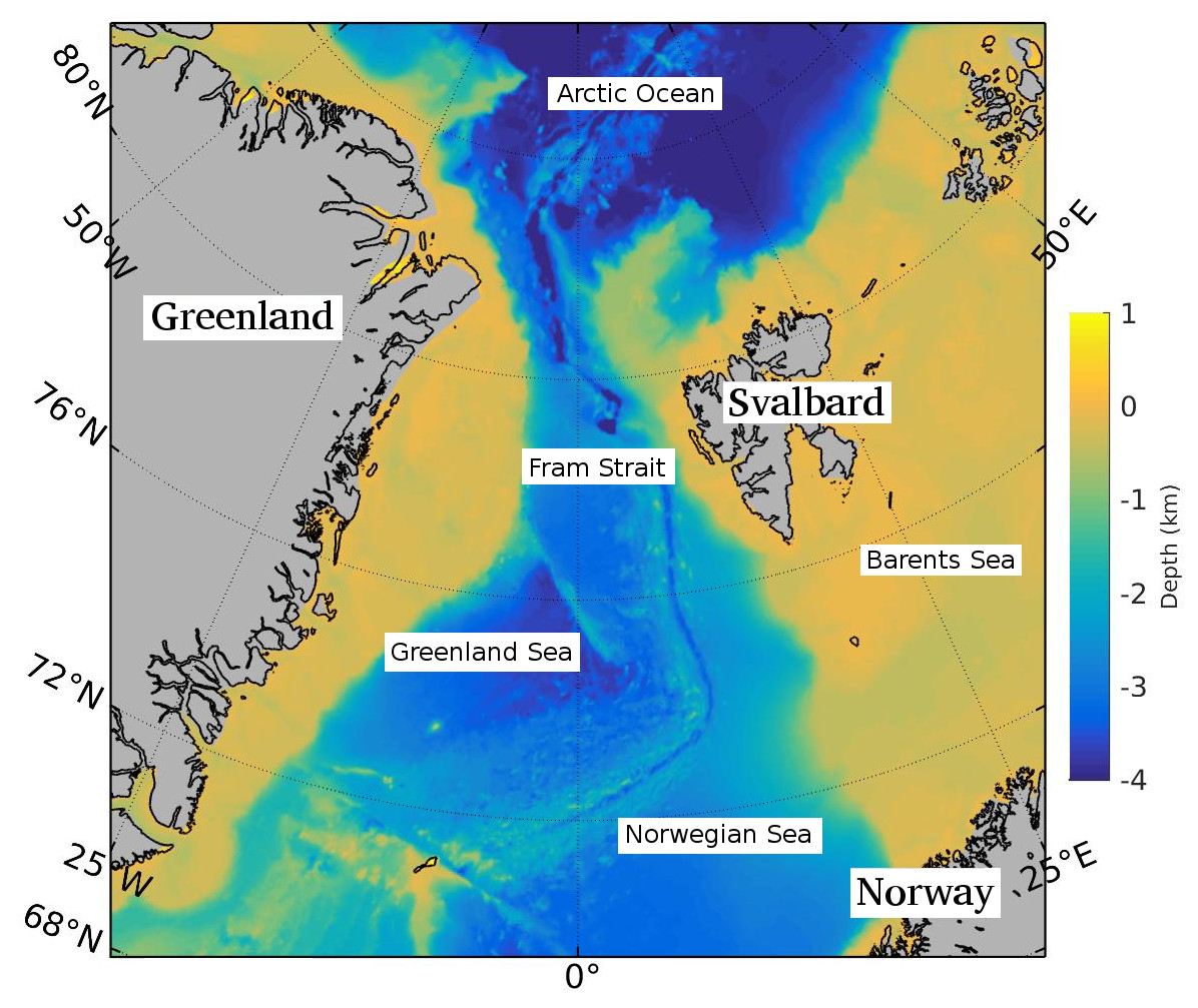
The Fram Strait is the passage between Greenland and Svalbard, located roughly between 77°N and 81°N latitudes and centered on the prime meridian. The Greenland and Norwegian Seas lie south of Fram Strait, while the Nansen Basin of the Arctic Ocean lies to the north. Fram Strait is noted for being the only deep connection between the Arctic Ocean and the World Oceans. The dominant oceanographic features of the region are the West Spitsbergen Current on the east side of the strait and the East Greenland Current on the west. Description Fram Strait is the northernmost ocean area having ice-free conditions throughout the year. The width of the strait is about 450 km, but because of the wide continental shelves of Greenland and Spitsbergen, the deep portion of Fram Strait is only about 300 km wide. The ocean over the Greenland continental shelf is often covered with ice. Within Fram Strait, the sill connecting the Arctic and Fram Strait is 2545 m deep. The Knipo ... [...More Info...] [...Related Items...] OR: [Wikipedia] [Google] [Baidu] |
CTD (instrument)
''For information about the CTD-rosette equipment package as a whole, see: Rosette sampler'' A CTD or sonde is an oceanography instrument used to measure the electrical conductivity, temperature, and pressure of seawater (the D stands for "depth," which is closely related to pressure). Conductivity is used to determine salinity. The CTD may be incorporated into an array of Niskin bottles referred to as a carousel or rosette. The sampling bottles close at predefined depths, triggered either manually or by a computer, and the water samples may subsequently be analyzed further for biological and chemical parameters. The CTD may also be used for the calibration of sensors. Measured properties The instrument is a cluster of sensors which measure conductivity, temperature, and pressure. Sensors commonly scan at a rate of 24 Hz. Depth measurements are derived from measurement of hydrostatic pressure, and salinity is measured from electrical conductivity. Sensors are arranged ... [...More Info...] [...Related Items...] OR: [Wikipedia] [Google] [Baidu] |
Cape Hatteras
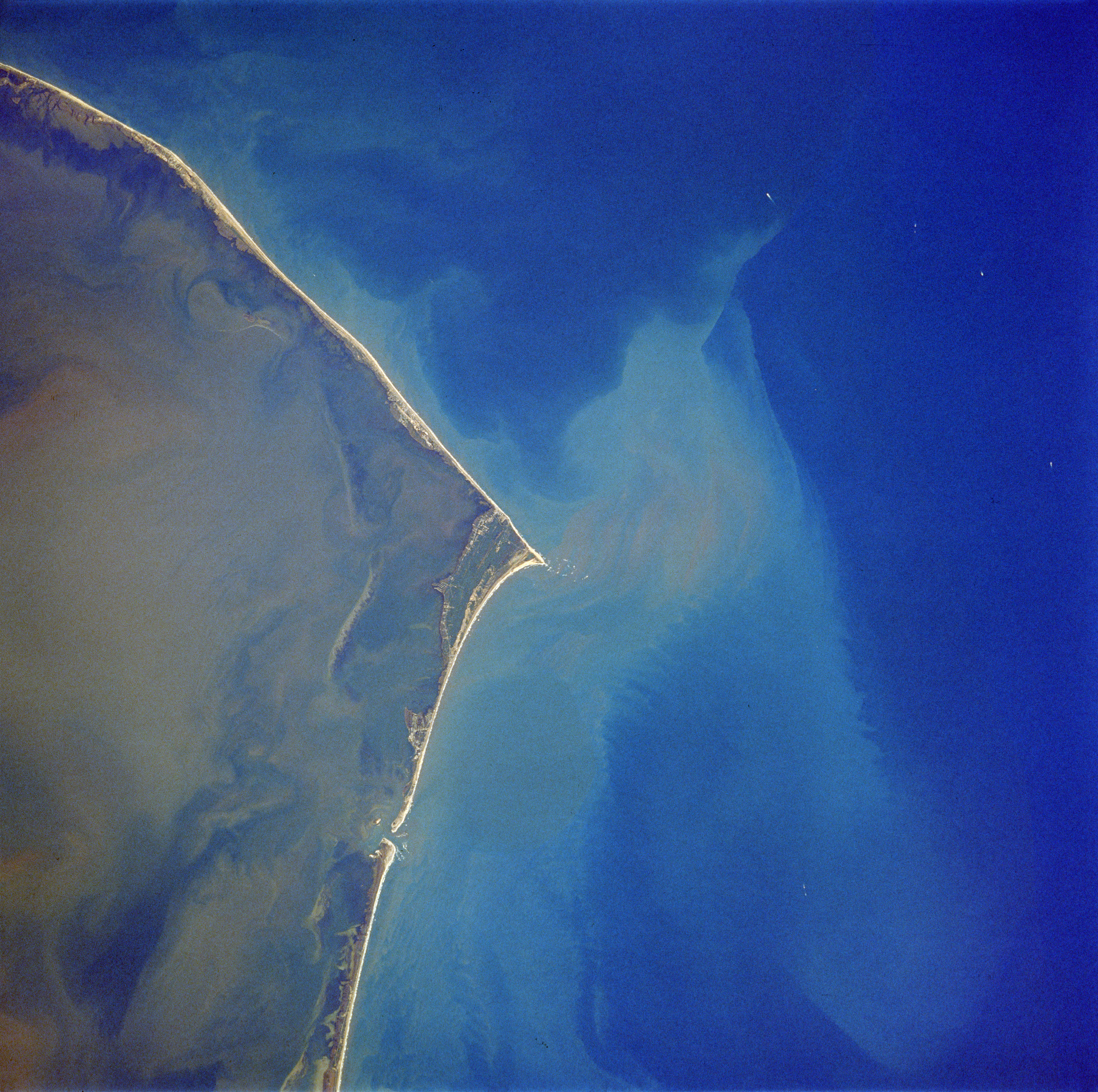
Cape Hatteras is a cape located at a pronounced bend in Hatteras Island, one of the barrier islands of North Carolina. Long stretches of beach, sand dunes, marshes, and maritime forests create a unique environment where wind and waves shape the topography. A large area of the Outer Banks is part of a National Park, called the Cape Hatteras National Seashore. It is also the nearest landmass on the North American mainland to Bermuda, which is about to the east-southeast. The treacherous waters off the coast of the Outer Banks are known as the Graveyard of the Atlantic, Over 600 ships wrecked here as victims of shallow shoals, storms, and war. Diamond Shoals, a bank of shifting sand ridges hidden beneath the turbulent sea off Cape Hatteras, has never promised safe passage for ships. In the past 400 years, the graveyard has claimed many lives, but island villagers saved many. As early as the 1870s, villagers served in the United States Life-Saving Service. Others staffed lightho ... [...More Info...] [...Related Items...] OR: [Wikipedia] [Google] [Baidu] |
Solomons, Maryland
Solomons, also known as Solomons Island, is an unincorporated community and census-designated place (CDP) in Calvert County, Maryland, United States. The population was 2,368 at the 2010 census, up from 1,536 in 2000. Solomons is a popular weekend destination spot in the Baltimore–Washington metropolitan area. Geography Solomons is located at the southern tip of Calvert County at (38.336431, −76.464102). It includes Solomons Island and mainland on the north side of the mouth of Patuxent River, where it meets the Chesapeake Bay. It is just across from the U.S. Naval Air Station Patuxent River (on the south side of the mouth of the Patuxent River). According to the United States Census Bureau, the Solomons CDP has a total area of , of which is land and , or 14.76%, is water, consisting mainly of Back Creek, a tidal inlet that extends north from the Patuxent River. Climate The climate in this area is characterized by hot, humid summers and generally mild to cool winters. Ac ... [...More Info...] [...Related Items...] OR: [Wikipedia] [Google] [Baidu] |
Chesapeake Bay
The Chesapeake Bay ( ) is the largest estuary in the United States. The Bay is located in the Mid-Atlantic (United States), Mid-Atlantic region and is primarily separated from the Atlantic Ocean by the Delmarva Peninsula (including the parts: the Eastern Shore of Maryland / Eastern Shore of Virginia and the state of Delaware) with its mouth of the Bay at the south end located between Cape Henry and Cape Charles (headland), Cape Charles. With its northern portion in Maryland and the southern part in Virginia, the Chesapeake Bay is a very important feature for the ecology and economy of those two states, as well as others surrounding within its watershed. More than 150 major rivers and streams flow into the Bay's drainage basin, which covers parts of six states (New York, Pennsylvania, Delaware, Maryland, Virginia and West Virginia) and all of District of Columbia. The Bay is approximately long from its northern headwaters in the Susquehanna River to its outlet in the Atlantic Ocea ... [...More Info...] [...Related Items...] OR: [Wikipedia] [Google] [Baidu] |
Naval Ordnance Laboratory
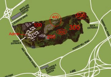
The Naval Ordnance Laboratory (NOL) was a facility in the White Oak area of Montgomery County, Maryland. It is now used as the headquarters of the U.S. Food and Drug Administration. Origins The U.S. Navy Mine Unit, later the Mine Laboratory at the Washington, D.C., Navy Yard, was established in 1918, and the first Officer in Charge (OIC) arrived in February 1919, marking the beginning of the Laboratory. In 1929 the Mine Laboratory was merged with the Experimental Ammunition Station in Indian Head to form the Naval Ordnance Laboratory. NOL began slowly, and it was not until the beginnings of World War II, when Germany's aircraft-laid magnetic mine began to cause serious problems for the Allies. As the importance of NOL's work became apparent, it also became apparent that there wasn't enough space at the Navy Yard to accommodate the necessary research facilities. In 1944, acquisition, planning and construction work began at a wooded site located at 10903 New Hampshire Avenue, S ... [...More Info...] [...Related Items...] OR: [Wikipedia] [Google] [Baidu] |
.png)


