|
US-270
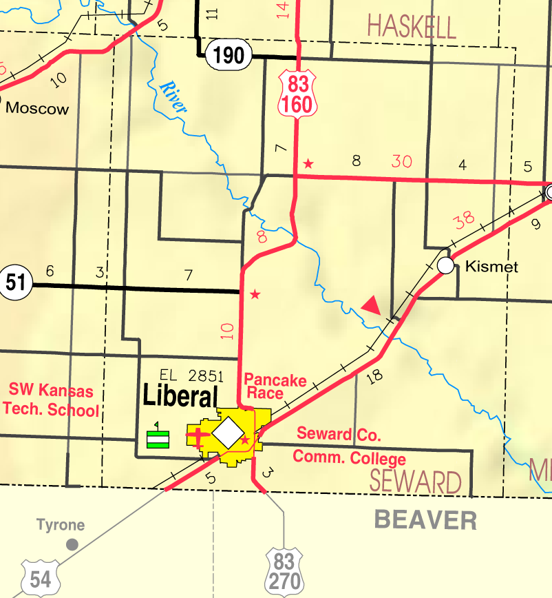
U.S. Route 270 (US 270) is a spur of US 70. It travels for from Liberal, Kansas at US 54 and US 83 to White Hall, Arkansas at Interstate 530 (I-530) and US 65. It travels through the states of Arkansas, Oklahoma, and Kansas. It travels through the cities of Oklahoma City, Oklahoma, Hot Springs, Arkansas, and McAlester, Oklahoma. Route description Kansas US 270 begins in the southeast part of Liberal, Kansas, at an intersection with US 83 (running north–south through the intersection) and US 54. US 270 follows the south leg of this intersection, following US 83 south. US 270 only spends in Kansas before crossing into Oklahoma. Seward County is the only Kansas county that US-270 serves. Oklahoma US 270 enters Oklahoma in Beaver County, the eastern third of the Oklahoma Panhandle. From here it continues east along US 64, then south towards Beaver, the county seat, along SH-23. South of Beaver, the road joins with US 412 (OK) and SH-3 ... [...More Info...] [...Related Items...] OR: [Wikipedia] [Google] [Baidu] |
SH-3 (OK)
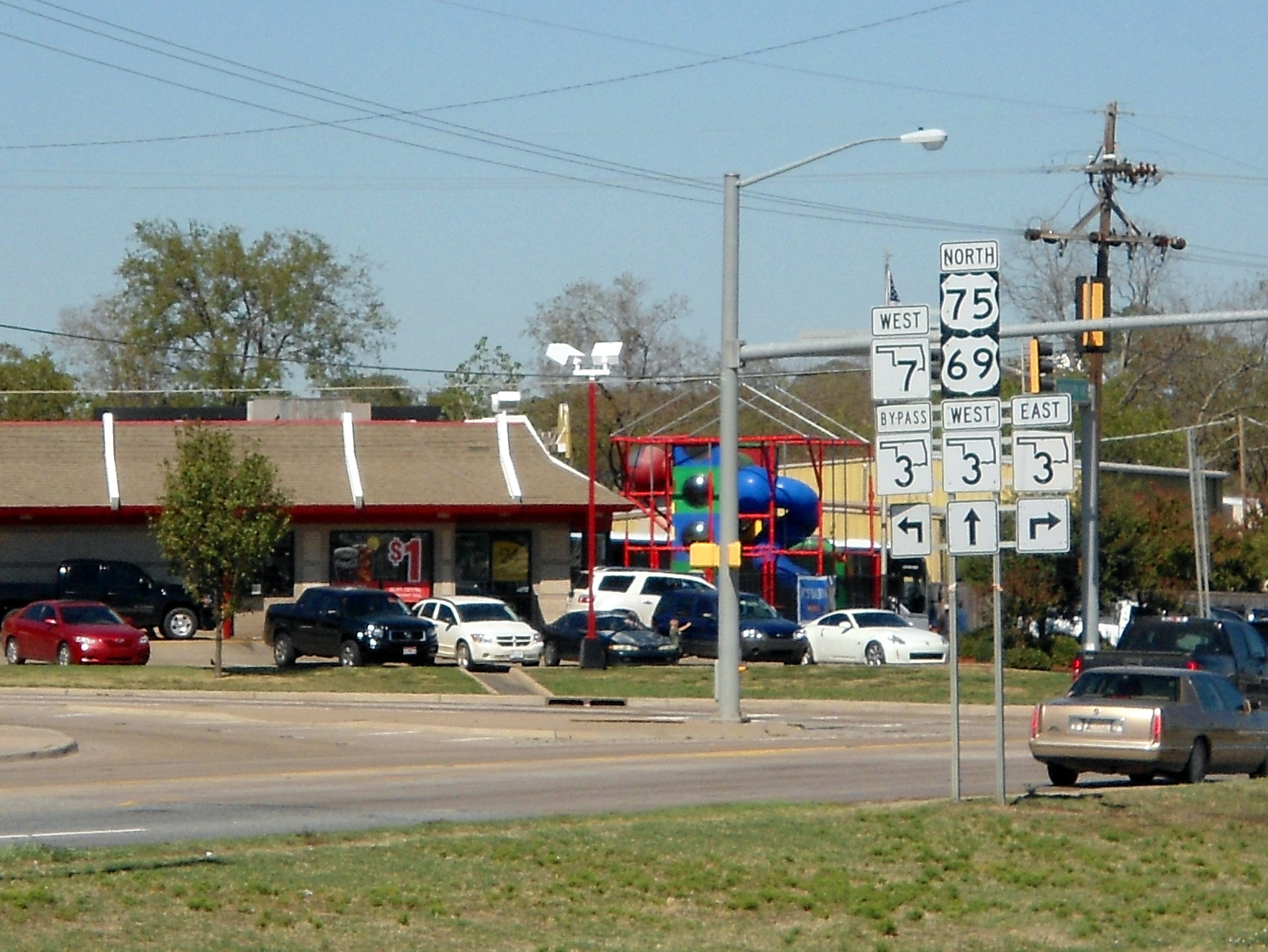
State Highway 3, also abbreviated as SH-3 or OK-3, is a highway maintained by the U.S. state of Oklahoma. Traveling diagonally through Oklahoma, from the Panhandle to the far southeastern corner of the state, SH-3 is the longest state highway in the Oklahoma road system, at a total length of via SH-3E ( see below). Route description In the northwest Highway 3 begins at the Colorado state line north of Boise City, Oklahoma. At this terminus, it is concurrent with US-287/ US-385. It remains concurrent with the two U.S. Routes until reaching Boise City, where it encounters a traffic circle which contains five other highways. After the circle, US-385 splits off, and SH-3 overlaps US-287, US-56, US-64, and US-412, though US-56 and US-287 both split off within the next . In Guymon, US-64 splits off. At Elmwood, US-270 joins US-412, coming from a concurrency with State Highway 23. SH-3 remains concurrent with US-270 through Watonga. In Seiling, US-183 leaves the concurrenc ... [...More Info...] [...Related Items...] OR: [Wikipedia] [Google] [Baidu] |
US 412 (OK)
U.S. Route 412 (abbreviated US-412) is a U.S. highway in the south-central portion of the United States, connecting Springer, New Mexico to Columbia, Tennessee. A section of the highway crosses the state of Oklahoma, traversing the state from west to east. Entering the state southwest of Boise City, US-412 runs the length of the Oklahoma Panhandle and serves the northern portion of the state's main body, before leaving the state at West Siloam Springs. Along the way, the route serves many notable cities and towns, including Boise City, Guymon, Woodward, Enid, and the state's second-largest city, Tulsa. US-412 has two tolled sections, both of them in Oklahoma—the Cimarron Turnpike and the Cherokee Turnpike. The tolled portions of the highway are operated by the Oklahoma Turnpike Authority (OTA), with the remainder of the route maintained by the Oklahoma Department of Transportation (ODOT). In addition to the freeway-grade turnpikes, a large amount of the highway has been ... [...More Info...] [...Related Items...] OR: [Wikipedia] [Google] [Baidu] |
SH-23 (OK)
State Highway 23 (SH-23 or OK-23) is a state highway in Oklahoma. It runs 36.2 miles south-to-north through the center of Beaver County, in the Panhandle, running from the Texas state line to the Kansas state line. There are no letter-suffixed spur highways branching from SH-23. Route description SH-23 begins at the Texas state line north of Booker, Texas. Upon entering Oklahoma, the highway makes a ninety degree turn to parallel the state line for approximately ½ mile (0.8 km), running just north of the line. It then turns back to the north and travels eight miles (13 km) due north to the intersection with US-270/ US-412/SH-3, at the crossroads settlement of Elmwood. US-270 splits away from the other two highways at Elmwood, turning north to join SH-23. A little over one mile (1.8 km) north of Elmwood. US-270/SH-23 cross over Clear Creek, a tributary of the North Canadian River. The two highways enter Beaver, the county seat of Beaver County, about north o ... [...More Info...] [...Related Items...] OR: [Wikipedia] [Google] [Baidu] |
US 64 (OK)
U.S. Route 64 (US-64) is a U.S. highway running from the Four Corners area to the Outer Banks of North Carolina. Between these two points, the highway passes through the entire width of Oklahoma; a total of of US-64 lies in the state of Oklahoma. US-64 enters the state from New Mexico, crossing the line between the two states between Clayton, New Mexico, and Boise City in Cimarron County. The route runs the full length of the Oklahoma Panhandle, then serves the northernmost tier of counties in the main body of the state before dipping southeastward to Tulsa, the state's second-largest city. From Tulsa, the highway continues southeast, leaving Oklahoma just west of Fort Smith, Arkansas. In addition to Tulsa, US-64 serves fifteen Oklahoma counties and the cities of Guymon, Woodward, Enid, and Muskogee. US-64 has been a part of the United States Numbered Highways system from the program's inception in 1926. US-64's route has remained roughly the same since then, although it ... [...More Info...] [...Related Items...] OR: [Wikipedia] [Google] [Baidu] |
SH-33 (OK)
State Highway 33 (SH-33 or OK-33) is a state highway in the U.S. state of Oklahoma. It is a major highway that traverses most of the state, and at one time traversed its entirety. Its general orientation is west to east. Route description Roger Mills County SH-33 begins as Texas State Highway 33 enters from Hemphill County, Texas. At mile 4.2, it intersects SH-30, which leads to Erick. The highway runs alongside the Black Kettle National Grassland to its intersection with US-283 at mile 15.7. Turning southward, SH-33 overlaps US-283 to mile 16.9 at the community of Roll, where SH-47 joins the concurrency. Together, the three routes pass through the National Grassland, and at mile 24.8, SH-33 turns to the east while US-283 and SH-47 continue south toward Cheyenne. At mile 29.5, SH-33 passes Strong City, and at mile 42.7 it passes the town of Hammon with its intersection with SH-34. Custer County The intersection with SH-34 marks the county line. Mile 53.6 marks Butler, ... [...More Info...] [...Related Items...] OR: [Wikipedia] [Google] [Baidu] |
SH-8 (OK)
State Highway 8, also abbreviated as SH-8 or OK-8, is a highway maintained by the U.S. state of Oklahoma. Because it runs mainly north–south, it has an even number (which is normal for Oklahoma state highways, but opposite from national highways). Highway 8 runs from U.S. Highway 277 in Cyril, Oklahoma to the state line south of Kiowa, Kansas, for a total length of The highway has two lettered spur routes. Highway 8 dates from the creation of the state highway system in 1924. Initially a border-to-border route, it was shortened to its current extent due to encroaching U.S. highways. SH-8 has followed its current route since 1966. Route description The highway begins in Cyril, at US-277 (which at the time is concurrent with State Highway 19), and immediately heads northward. later, the highway passes through Anadarko, sharing a brief overlap with US-62/ SH-9. It also becomes concurrent with US-281 here, which it remains with after passing through Anadarko. US-281 a ... [...More Info...] [...Related Items...] OR: [Wikipedia] [Google] [Baidu] |
US 83 (KS)
U.S. Route 83 (US-83) is a part of the U.S. Highway System that runs from the Veterans International Bridge in Brownsville, Texas north to the Canadian border, north of Westhope, North Dakota, where it continues as Manitoba Highway 83. In the U.S. state of Kansas, US-83 is a main north–south highway that runs from the Oklahoma border north to the Nebraska border. In 1926, the highway that first became known as US-83 was established as K-22. Then between 1930 and 1931, US-83 was extended into Kansas along K-22, which was decommissioned. Then between 1941 and 1944, US-83 and US-183 were swapped within Nebraska and a small portion into Kansas. US-83 was changed to turn north just northeast of Selden and the former alignment of US-83 from northeast of Selden to US-183 east of Woodruff became US-383, now K-383. Route description US-83 enters the Sunflower State, overlapped with US-270 in Seward County, approximately south of Liberal. From here it continues north to L ... [...More Info...] [...Related Items...] OR: [Wikipedia] [Google] [Baidu] |
Hot Springs, Arkansas
Hot Springs is a resort city in the state of Arkansas and the county seat of Garland County. The city is located in the Ouachita Mountains among the U.S. Interior Highlands, and is set among several natural hot springs for which the city is named. As of the 2020 United States Census, the city had a population of 37,930. The center of Hot Springs is the oldest federal reserve in the United States, today preserved as Hot Springs National Park. The hot spring water has been popularly believed for centuries to possess healing properties, and was a subject of legend among several Native American tribes. Following federal protection in 1832, the city developed into a successful spa town. Incorporated January 10, 1851, the city has been home to Major League Baseball spring training, illegal gambling, speakeasies and gangsters such as Al Capone, horse racing at Oaklawn Park, the Army and Navy Hospital, and 42nd President Bill Clinton. One of the largest Pentecostal denominations in ... [...More Info...] [...Related Items...] OR: [Wikipedia] [Google] [Baidu] |
Seiling, Oklahoma
Seiling is a city in Dewey County, Oklahoma, United States. The population was 860 at the 2010 census. The town was named in 1899 for Louis Seiling, a local store owner who had acquired a homestead in the Cheyenne-Arapaho land run of April 1892. The Hobson Town and Improvement Company established a town called Hobson, but the name was changed to Seiling in January 1899. It incorporated in 1909. Seiling is now the largest city in Dewey County.Everett, Dianna"Seiling,"''Encyclopedia of Oklahoma History and Culture'', 2009. Retrieved April 3, 2015. Their girls basketball team has also won the Oklahoma State Championship four times in a row (2016-2019). History Seiling developed as a local agricultural center and became the largest town in Dewey County despite the fact that the nearest railroad depot was in Canton, more than away . Moreover, there were no bridges across either of the Canadian rivers until 1906. A horse racing track was built in 1903. Geography Seiling is located ... [...More Info...] [...Related Items...] OR: [Wikipedia] [Google] [Baidu] |
US 54 (KS)
U.S. Route 54 (US-54) is a part of the U.S. Highway System that runs from El Paso, Texas, to Interstate 72 (I-72) in Griggsville, Illinois. In the U.S. state of Kansas, US 54 is a main east–west highway that runs from the Oklahoma border east to the Missouri border. Route description US 54 enters the state from Oklahoma in Seward County, and travels through the cities of Liberal and Plains, where it runs concurrently with US 160 in Meade County. Just east of the city of Meade, US 54 splits from US 160 and continues in a northeasterly direction through Meade and Ford counties before beginning a long concurrency with US 400 in Mullinville in Kiowa County. The highway then travels through the town of Greensburg and continues as a two-lane road through Pratt, Cunningham, and Kingman. At Pratt, the Union Pacific railroad tracks which paralleled the highway for over from El Paso turn to the northeast (towards Topeka) and leave US ... [...More Info...] [...Related Items...] OR: [Wikipedia] [Google] [Baidu] |
Beaver, Oklahoma
Beaver is a town and county seat in Beaver County, Oklahoma, United States. The community is in the Oklahoma Panhandle. As of the 2010 census, the town population was 1,515, a 3.5 percent decrease from 1,570 at the 2000 census. The city is host to the annual World Cow Chip Throwing Championship. Held in April, "Cow Chip" brings attention from nearby cities with a parade, carnival, and cowchip throwing. History Beaver is located by Beaver River, also known as North Canadian River, and began as the location of a fur-trading post in 1879. Its original name was Beaver City, and was planned to be the capital of the short-lived Cimarron Territory. The Federal government never recognized the proposed Territory, but Beaver City remained the center of business and law enforcement for the area. In 1890, the territory was assigned to Oklahoma Territory, and Beaver City became the seat for the entire Oklahoma Panhandle, then known as Seventh County. Beaver began as a stop on the Jones ... [...More Info...] [...Related Items...] OR: [Wikipedia] [Google] [Baidu] |
Liberal, Kansas
Liberal is the county seat of Seward County, Kansas, United States. As of the 2020 census, the population of the city was 19,825. Liberal is home of Seward County Community College. History Early settler S. S. Rogers built the first house in what would become Liberal in 1888. Rogers became famous in the region for giving free water to thirsty travelers. Reportedly, Liberal gained its name from the common response to his acts of kindness, "That's very liberal of you."''History: Over One Hundred Years of Being "Liberal"'' - at City of Liberal.com In 1885 Rogers built a general store, and with it came an official |


