|
U.S. Route 93 In Nevada
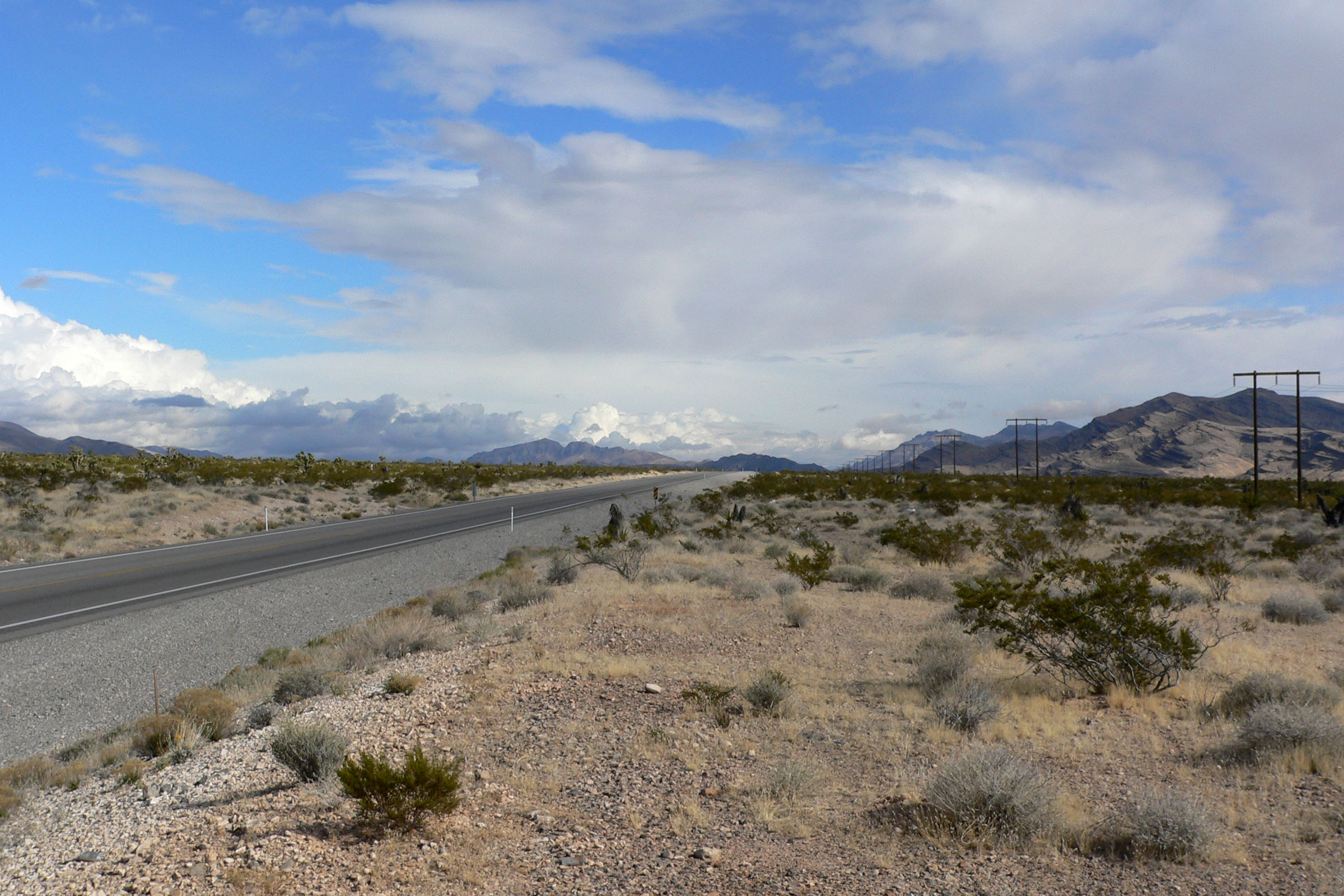
In the U.S. state of Nevada, U.S. Route 93 (US 93) is a major United States Numbered Highway traversing the eastern edge of the state. The highway connects the Las Vegas area to the Great Basin National Park, and provides further connections to Ely and Wells. US 93 also provides the majority of the most direct connection from the major metropolitan areas of Las Vegas and Phoenix (via Boulder City, Kingman and Wickenburg with a final link to Phoenix via US 60) to the Boise, Idaho metropolitan area (with a final connection to Boise via Interstate 84 from Twin Falls, Idaho). Route description U.S. Route 93 in Nevada is known as the Great Basin Highway from Interstate 15 in North Las Vegas to Interstate 80 in Wells. It begins at the Mike O'Callaghan–Pat Tillman Memorial Bridge in Boulder City. The highway overlaps U.S. Route 95 from State Route 173 in Boulder City to Interstate 15 in downtown Las Vegas. It runs to the Las Vegas Valley passing through the cities of Hen ... [...More Info...] [...Related Items...] OR: [Wikipedia] [Google] [Baidu] |
Arizona
Arizona ( ; nv, Hoozdo Hahoodzo ; ood, Alĭ ṣonak ) is a U.S. state, state in the Southwestern United States. It is the list of U.S. states and territories by area, 6th largest and the list of U.S. states and territories by population, 14th most populous of the 50 states. Its capital city, capital and List of largest cities, largest city is Phoenix, Arizona, Phoenix. Arizona is part of the Four Corners region with Utah to the north, Colorado to the northeast, and New Mexico to the east; its other neighboring states are Nevada to the northwest, California to the west and the List of states of Mexico, Mexican states of Sonora and Baja California (state), Baja California to the south and southwest. Arizona is the 48th state and last of the contiguous United States, contiguous states to be admitted to the Union, achieving statehood on February 14, 1912. Historically part of the territory of in New Spain, it became part of independent Mexico in 1821. After being defeated in th ... [...More Info...] [...Related Items...] OR: [Wikipedia] [Google] [Baidu] |
Nevada
Nevada ( ; ) is a state in the Western region of the United States. It is bordered by Oregon to the northwest, Idaho to the northeast, California to the west, Arizona to the southeast, and Utah to the east. Nevada is the 7th-most extensive, the 32nd-most populous, and the 9th-least densely populated of the U.S. states. Nearly three-quarters of Nevada's people live in Clark County, which contains the Las Vegas–Paradise metropolitan area, including three of the state's four largest incorporated cities. Nevada's capital is Carson City. Las Vegas is the largest city in the state. Nevada is officially known as the "Silver State" because of the importance of silver to its history and economy. It is also known as the "Battle Born State" because it achieved statehood during the Civil War (the words "Battle Born" also appear on its state flag); as the " Sagebrush State", for the native plant of the same name; and as the " Sage-hen State". The name means "snowy" in Spanish, ... [...More Info...] [...Related Items...] OR: [Wikipedia] [Google] [Baidu] |
Las Vegas Valley
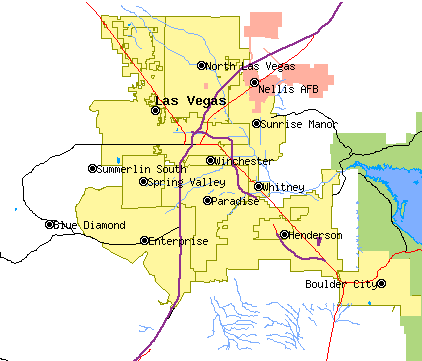
The Las Vegas Valley is a major metropolitan area in the southern part of the U.S. state of Nevada, and the second largest in the Southwestern United States. The state's largest urban agglomeration, the Las Vegas Metropolitan Statistical Area is coextensive since 2003 with Clark County, Nevada. The Valley is largely defined by the Las Vegas Valley landform, a basin area surrounded by mountains to the north, south, east and west of the metropolitan area. The Valley is home to the three largest incorporated cities in Nevada: Las Vegas, Henderson and North Las Vegas. Eleven unincorporated towns governed by the Clark County government are part of the Las Vegas Township and constitute the largest community in the state of Nevada. The names Las Vegas and Vegas are interchangeably used to indicate the Valley, the Strip, and the city, and as a brand by the Las Vegas Convention and Visitors Authority to denominate the region. The Valley is affectionately known as the "ninth island ... [...More Info...] [...Related Items...] OR: [Wikipedia] [Google] [Baidu] |
Nevada State Route 173
State Route 173 (SR 173) is a state highway in Clark County, Nevada. The route provides access to downtown Boulder City from U.S. Route 95 (US 95) to the south. The route was originally part of US 95 until the highway was realigned following the completion of Interstate 11 (I-11) around Boulder City. The entire route of SR 173 is also part of the Veterans Memorial Highway.https://www.nevadadot.com/home/showdocument?id=134 Route description State Route 173 begins at an interchange with I-11/US 93/US 95 approximately southwest of downtown Boulder City. Proceeding northward, the highway ends at an interchange with US 93 Business. History SR 173 was originally part of US 95. US 95 was rerouted onto the Boulder City Bypass concurrent with I-11 upon the completion of Phase 1 on May 23, 2018, and the new state highway was designated over the old route. Major intersections See also * * References External links {{Commons category, Nevada State Route 173 173 ... [...More Info...] [...Related Items...] OR: [Wikipedia] [Google] [Baidu] |
Interstate 80 In Nevada
Interstate 80 (I-80) traverses the northern portion of the US state of Nevada. The freeway serves the Reno metropolitan area and passes through the towns of Fernley, Lovelock, Winnemucca, Battle Mountain, Carlin, Elko, Wells, and West Wendover on its way through the state. I-80 follows the historical routes of the California Trail, first transcontinental railroad and Feather River Route throughout portions of Nevada. Throughout the entire state, I-80 follows the historical routes of the Victory Highway, State Route 1 (SR 1), and US Route 40 (US 40). The freeway corridor follows the paths of the Truckee and Humboldt rivers. These rivers have been used as a transportation corridor since the California Gold Rush of the 1840s. The Nevada portion of I-80 has been designated as the Dwight D. Eisenhower Highway and Purple Heart Trail. Route description Truckee River I-80 enters Nevada in the canyon of the Truckee River, paralleling the California T ... [...More Info...] [...Related Items...] OR: [Wikipedia] [Google] [Baidu] |
Interstate 15 In Nevada
Interstate 15 (I-15) is an Interstate Highway in the U.S. state of Nevada that begins in Primm, continues through Las Vegas and it crosses the border with Arizona in Mesquite. Within the state, the freeway runs entirely in Clark County. The highway was built along the corridor of the older U.S. Route 91 (US 91) and Arrowhead Trail, eventually replacing both of these roads. The entire route of I-15 is designated the Las Vegas Freeway. Route description Motorists in California begin a long descent through Ivanpah Valley and Ivanpah Dry Lake. I-15 crosses the Nevada state line at the first exit, Primm. Once I-15 leaves Primm, the route travels north through the desert with few services. The highway then enters the Las Vegas urban area upon passing the State Route 146 (SR 146, Saint Rose Parkway) interchange. From Silverado Ranch Boulevard to US 95, the freeway has HOV lanes that are currently enforced by both Metro and NHP, 24 hours a day ... [...More Info...] [...Related Items...] OR: [Wikipedia] [Google] [Baidu] |
Great Basin Highway 1
Great may refer to: Descriptions or measurements * Great, a relative measurement in physical space, see Size * Greatness, being divine, majestic, superior, majestic, or transcendent People * List of people known as "the Great" *Artel Great (born 1981), American actor Other uses * ''Great'' (1975 film), a British animated short about Isambard Kingdom Brunel * ''Great'' (2013 film), a German short film * Great (supermarket), a supermarket in Hong Kong * GReAT, Graph Rewriting and Transformation, a Model Transformation Language * Gang Resistance Education and Training Gang Resistance Education And Training, abbreviated G.R.E.A.T., provides a school-based, police officer instructed program that includes classroom instruction and various learning activities. Their intention is to teach the students to avoid gang ..., or GREAT, a school-based and police officer-instructed program * Global Research and Analysis Team (GReAT), a cybersecurity team at Kaspersky Lab *'' Great!'', a 20 ... [...More Info...] [...Related Items...] OR: [Wikipedia] [Google] [Baidu] |
Twin Falls, Idaho
Twin Falls is the county seat and largest city of Twin Falls County, Idaho, United States. The city had a population of 51,807 as of the 2020 census. In the Magic Valley region, Twin Falls is the largest city in a radius, and is the regional commercial center for south-central Idaho and northeastern It is the principal city of the Twin Falls Metropolitan Statistical Area, which officially includes the entirety of Twin Falls and Jerome The border town resort community of Jackpot, Nevada, south at the state line, is unofficially considered part of the greater Located on a broad plain at the south rim of the Snake River Canyon, Twin Falls is where daredevil Evel Knievel attempted to jump across the canyon in 1974 on a steam-powered rocket. The jump site is northeast of central Twin Falls, midway between Shoshone Falls and the Perrine Bridge. History Excavations at Wilson Butte Cave near Twin Falls in 1959 revealed evidence of human activity, including arrowheads, tha ... [...More Info...] [...Related Items...] OR: [Wikipedia] [Google] [Baidu] |
Interstate 84 In Idaho
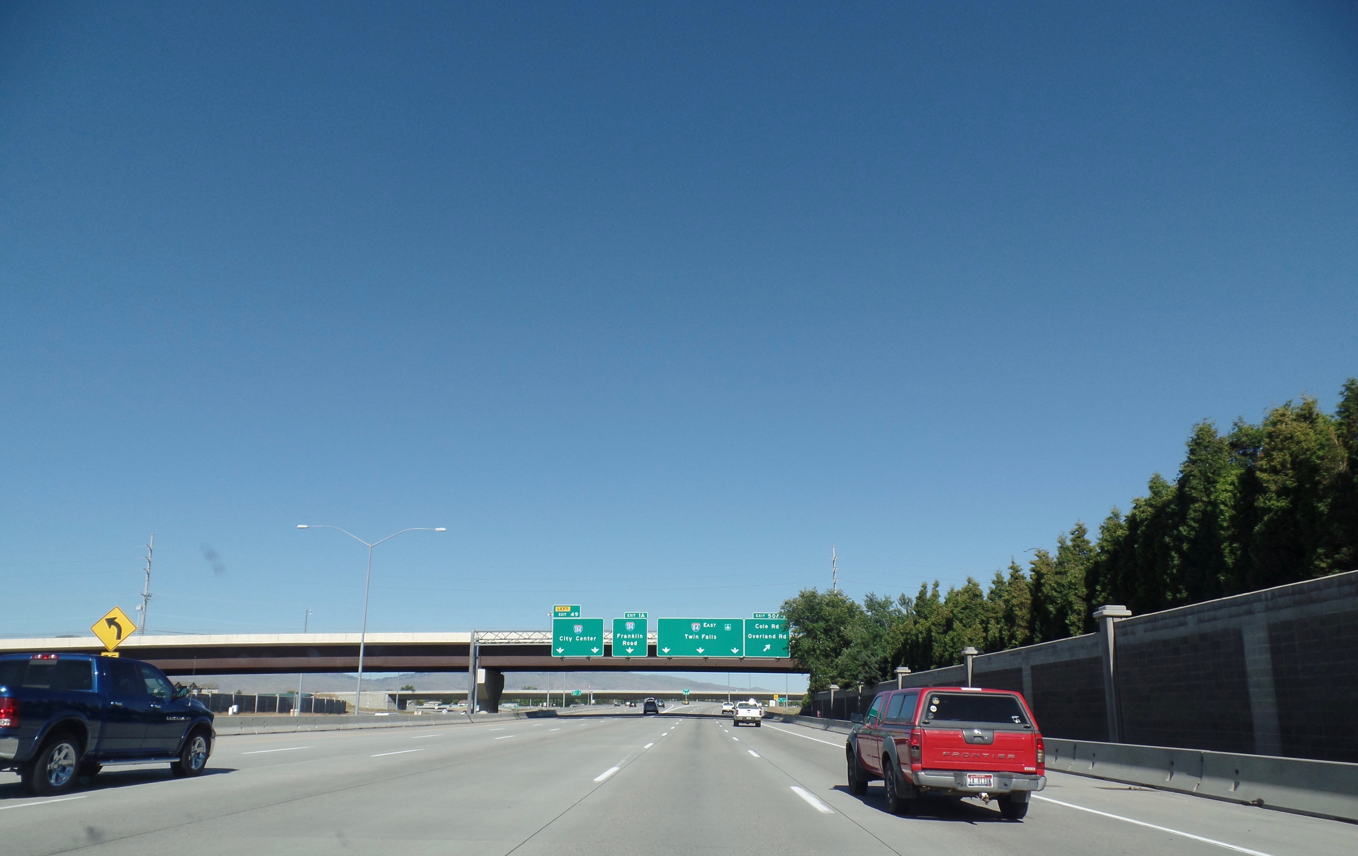
Interstate 84 (I-84) in the U.S. state of Idaho is a major Interstate Highway that traverses the state from the Oregon state line in the northwest to Utah state line in the southeast. It primarily follows the Snake River across a plain that includes the cities of Boise, Mountain Home, and Twin Falls. The highway is one of the busiest in Idaho and is designated as the Vietnam Veterans Memorial Highway. I-84 runs for within Idaho, beginning near Ontario, Oregon, and traveling concurrent with several U.S. routes through the Boise metropolitan area and Mountain Home towards Twin Falls. I-84 splits away from US 30 and the Snake River at a junction with I-86 near Declo, where it turns southeast to cross the Sublett Range into northern Utah. The highway has an auxiliary route, I-184, which serves downtown Boise. Route description I-84 is the longest Interstate highway in Idaho, running for and connecting several of the state's largest metropolitan areas. It has a single ... [...More Info...] [...Related Items...] OR: [Wikipedia] [Google] [Baidu] |
Boise Metropolitan Area
The Boise–Nampa, Idaho Metropolitan Statistical Area (MSA) (commonly known as the Boise Metropolitan Area or the Treasure Valley) is an area that encompasses Ada, Boise, Canyon, Gem, and Owyhee counties in southwestern Idaho, anchored by the cities of Boise and Nampa. It is the main component of the wider Boise–Mountain Home–Ontario, ID–OR Combined Statistical Area, which adds Elmore and Payette counties in Idaho and Malheur County, Oregon. It is the state's largest officially designated metropolitan area and includes Idaho's three largest cities: Boise, Nampa, and Meridian. Nearly 40 percent of Idaho's total population lives in the area. As of the 2021 estimate, the Boise–Nampa, Idaho Metropolitan Statistical Area (MSA) had a population of 795,268, while the larger Boise City–Mountain Home–Ontario, ID–OR Combined Statistical Area (CSA) had a population of 850,341. The metro area is currently the third largest in the U.S. section of the Pacific Northwest ... [...More Info...] [...Related Items...] OR: [Wikipedia] [Google] [Baidu] |
Boise, Idaho
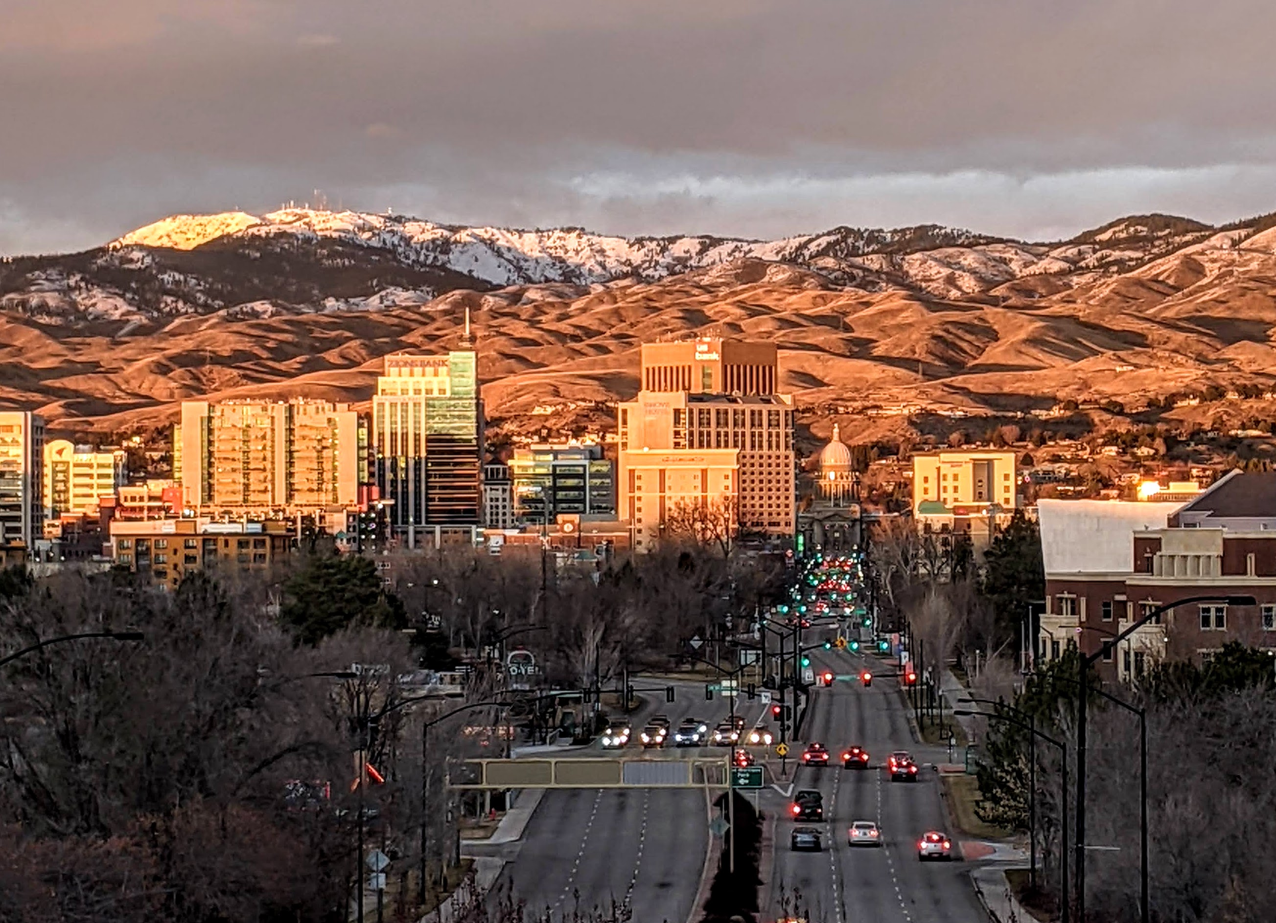
Boise (, , ) is the capital and most populous city of the U.S. state of Idaho and is the county seat of Ada County. On the Boise River in southwestern Idaho, it is east of the Oregon border and north of the Nevada border. The downtown area's elevation is above sea level. The population according to the 2020 US Census was 235,684. The Boise metropolitan area, also known as the Treasure Valley, includes five counties with a combined population of 749,202, the most populous metropolitan area in Idaho. It contains the state's three largest cities: Boise, Nampa, and Meridian. Boise is the 77th most populous metropolitan statistical area in the United States. Downtown Boise is the cultural center and home to many small businesses and a number of high-rise buildings. The area has a variety of shops and restaurants. Centrally, 8th Street contains a pedestrian zone with sidewalk cafes and restaurants. The neighborhood has many local restaurants, bars, and boutiques. The ... [...More Info...] [...Related Items...] OR: [Wikipedia] [Google] [Baidu] |
Wickenburg, Arizona
Wickenburg is a town in Maricopa and Yavapai counties, Arizona, United States. As of the 2020 census, the population of the town was 7,474, up from 6,363 in 2010. History The Wickenburg area, along with much of the Southwest, became part of the United States by the 1848 treaty that ended the Mexican–American War. The first extensive survey was conducted by Gila Rangers who were pursuing Natives who had raided the Butterfield Overland Mail route and attacked miners at Gila City. In 1862, a gold strike on the Colorado River near present-day Yuma brought American prospectors, who searched for minerals throughout central Arizona. Many of the geographic landmarks now bear the names of these pioneers, including the Weaver Mountains, named after mountain man Pauline Weaver, and Peeples Valley, named after a settler. A German named Henry Wickenburg was one of the first prospectors. His efforts were rewarded with the discovery of the Vulture Mine, from which more than $30 ... [...More Info...] [...Related Items...] OR: [Wikipedia] [Google] [Baidu] |


.png)


.jpg)