|
U.S. Highway 52 (Iowa)
U.S. Highway 52 (US 52) is a United States Numbered Highway in northeast Iowa. The route begins at the Dale Gardner Veterans Memorial Bridge over the Mississippi River between Sabula and Savanna, Illinois. From Sabula, it heads north along the Mississippi towards Bellevue and Dubuque. At Dubuque, US 52 briefly shares an expressway with US 61 and US 151 before joining the Southwest Arterial, another expressway diverting traffic around the southern edge of Dubuque. West of Dubuque, the route concurrently follows the US 20 expressway before joining Iowa Highway 136 (Iowa 136) in Dyersville. At Luxemburg, it continues north towards Guttenberg. It then heads northwest where it overlaps US 18 for . At Calmar, US 52 turns to the north towards Decorah. US 52 crosses into Minnesota north of Burr Oak. Despite its even number, US 52 is signed as a north–south route. According to the layout of the U.S. Highway System, even-numbere ... [...More Info...] [...Related Items...] OR: [Wikipedia] [Google] [Baidu] |
Federal Highway Administration
The Federal Highway Administration (FHWA) is a division of the United States Department of Transportation that specializes in highway transportation. The agency's major activities are grouped into two programs, the Federal-aid Highway Program and the Federal Lands Highway Program. Its role had previously been performed by the Office of Road Inquiry, Office of Public Roads and the Bureau of Public Roads. History Background The organization has several predecessor organizations and complicated history. The Office of Road Inquiry (ORI) was founded in 1893. In 1905, that organization's name was changed to the Office of Public Roads (OPR) which became a division of the United States Department of Agriculture. The name was changed again to the Bureau of Public Roads in 1915 and to the Public Roads Administration (PRA) in 1939. It was then shifted to the Federal Works Agency which was abolished in 1949 when its name reverted to Bureau of Public Roads under the Department of Commerce ... [...More Info...] [...Related Items...] OR: [Wikipedia] [Google] [Baidu] |
Iowa Highway 136
Iowa Highway 136 (Iowa 136) is a state highway maintained by the Iowa Department of Transportation. It runs for in eastern Iowa. It begins at the Mississippi River in Clinton on the Mark Morris Memorial Bridge, where it continues as Illinois Route 136. It ends at an interchange with U.S. Highway 20 (US 20) and US 52 in Dyersville. Although signed as a north–south highway throughout, the highway runs east to west between Clinton and Oxford Junction, while turning north at Oxford Junction to complete its run to Dyersville. For most of its existence, Iowa 136 connected Clinton and Luxemburg. During the 1950s-1960s, the northern and southern ends of the route shifted slightly because nearby United States highways changed their alignments. The northern end of Iowa 136 shifted again in early 2022. Route description Iowa Highway 136 begins on the Mark Morris Memorial Bridge over the Mississippi River at Clinton. It descends the approach to the bridge and interse ... [...More Info...] [...Related Items...] OR: [Wikipedia] [Google] [Baidu] |
United States
The United States of America (U.S.A. or USA), commonly known as the United States (U.S. or US) or America, is a country primarily located in North America. It consists of 50 states, a federal district, five major unincorporated territories, nine Minor Outlying Islands, and 326 Indian reservations. The United States is also in free association with three Pacific Island sovereign states: the Federated States of Micronesia, the Marshall Islands, and the Republic of Palau. It is the world's third-largest country by both land and total area. It shares land borders with Canada to its north and with Mexico to its south and has maritime borders with the Bahamas, Cuba, Russia, and other nations. With a population of over 333 million, it is the most populous country in the Americas and the third most populous in the world. The national capital of the United States is Washington, D.C. and its most populous city and principal financial center is New York City. Paleo-Americ ... [...More Info...] [...Related Items...] OR: [Wikipedia] [Google] [Baidu] |
Driftless Area
The Driftless Area, a topographical and cultural region in the American Midwest, comprises southwestern Wisconsin, southeastern Minnesota, northeastern Iowa, and the extreme northwestern corner of Illinois. Never covered by ice during the last ice age, the area lacks the characteristic glacial deposits known as drift. Its landscape is characterized by steep hills, forested ridges, deeply carved river valleys, and karst geology with spring-fed waterfalls and cold-water trout streams. Ecologically, the Driftless Area's flora and fauna are more closely related to those of the Great Lakes region and New England than those of the broader Midwest and central Plains regions. The steep riverine landscape of both the Driftless Area proper and the surrounding Driftless-like region are the result of early glacial advances that forced preglacial rivers that flowed into the Great Lakes southward, causing them to carve a gorge across bedrock cuestas, thereby forming the modern incised upper Mi ... [...More Info...] [...Related Items...] OR: [Wikipedia] [Google] [Baidu] |
Violin On A Grain Silo
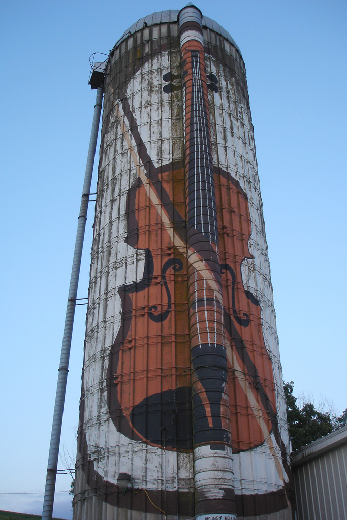
The violin, sometimes known as a ''fiddle'', is a wooden chordophone (string instrument) in the violin family. Most violins have a hollow wooden body. It is the smallest and thus highest-pitched instrument (soprano) in the family in regular use. The violin typically has four strings (some can have five), usually tuned in perfect fifths with notes G3, D4, A4, E5, and is most commonly played by drawing a bow across its strings. It can also be played by plucking the strings with the fingers (pizzicato) and, in specialized cases, by striking the strings with the wooden side of the bow (col legno). Violins are important instruments in a wide variety of musical genres. They are most prominent in the Western classical tradition, both in ensembles (from chamber music to orchestras) and as solo instruments. Violins are also important in many varieties of folk music, including country music, bluegrass music, and in jazz. Electric violins with solid bodies and piezoelectric pickups a ... [...More Info...] [...Related Items...] OR: [Wikipedia] [Google] [Baidu] |
Backwater (river)
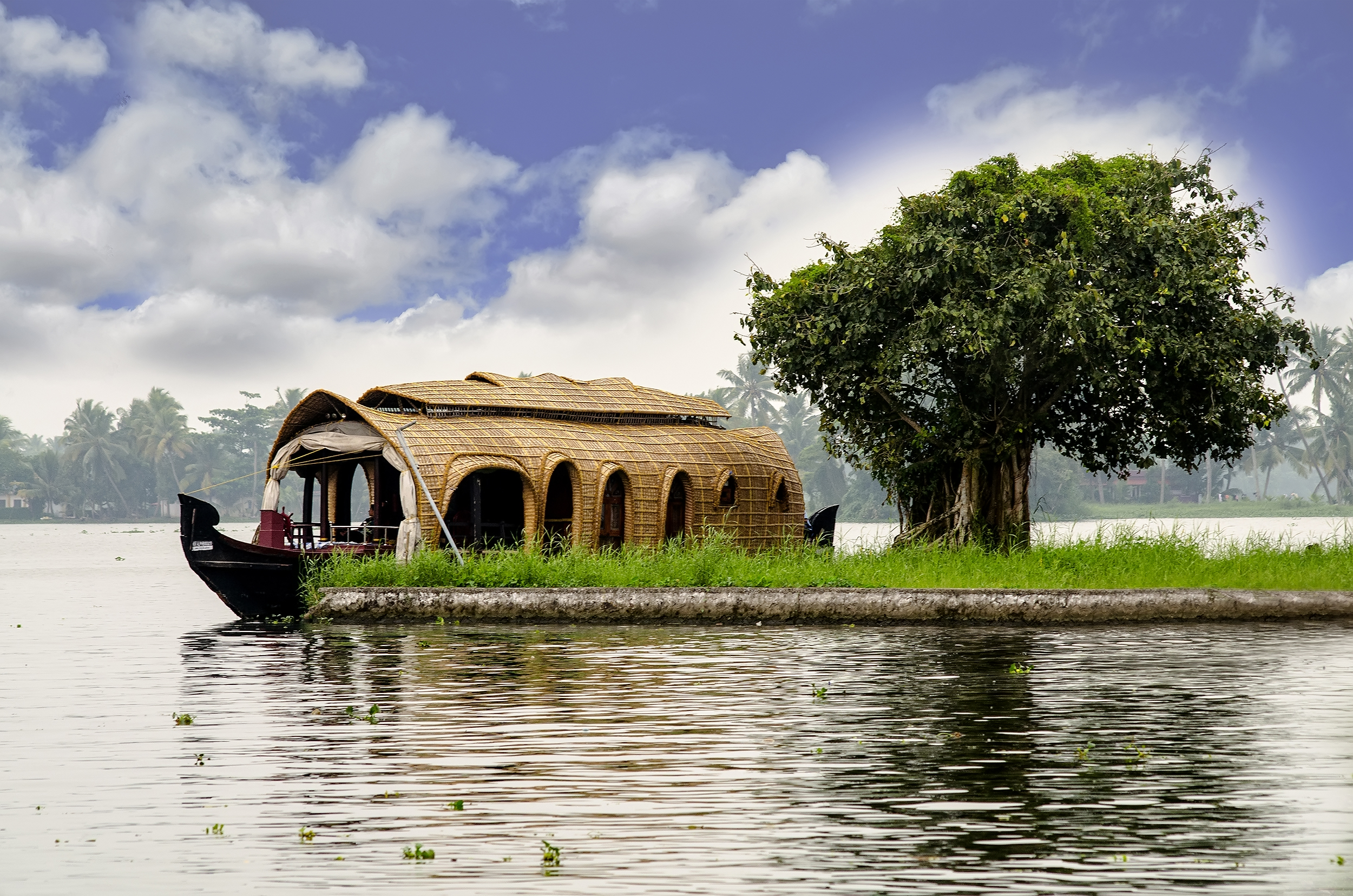
A backwater is a part of a river in which there is little or no current. It can refer to a branch of a main river, which lies alongside it and then rejoins it, or to a body of water in a main river, backed up by the sea tide or by an obstruction such as a dam. Manmade restrictions to natural stream flow or temporary natural obstructions such as ice jams, vegetation blockage, or flooding of a lower stream can create backwater. Alternative channel If a river has developed one or more alternative courses in its evolution, one channel is usually designated the main course, and secondary channels may be termed backwaters. The main river course will usually have the fastest stream and will likely be the main navigation route; backwaters may be shallower and flow more slowly, if at all. Some backwaters are rich in mangrove forest. This results in a more diverse environment of scientific interest and worthy of preservation. Backwaters also provide opportunities for leisure activities such ... [...More Info...] [...Related Items...] OR: [Wikipedia] [Google] [Baidu] |
Causeway
A causeway is a track, road or railway on the upper point of an embankment across "a low, or wet place, or piece of water". It can be constructed of earth, masonry, wood, or concrete. One of the earliest known wooden causeways is the Sweet Track in the Somerset Levels, England, which dates from the Neolithic age. Timber causeways may also be described as both boardwalks and bridges. Etymology When first used, the word ''causeway'' appeared in a form such as "causey way" making clear its derivation from the earlier form "causey". This word seems to have come from the same source by two different routes. It derives ultimately, from the Latin for heel, ''calx'', and most likely comes from the trampling technique to consolidate earthworks. Originally, the construction of a causeway utilised earth that had been trodden upon to compact and harden it as much as possible, one layer at a time, often by enslaved bodies or flocks of sheep. Today, this work is done by machines. The s ... [...More Info...] [...Related Items...] OR: [Wikipedia] [Google] [Baidu] |
Iowa Highway 64
Iowa Highway 64 (Iowa 64) is a state highway that runs through two counties in east central Iowa. It begins at an interchange with U.S. Route 151 (US 151) in Anamosa and ends at the Dale Gardner Veterans Memorial Bridge over the Mississippi River near Sabula. It continues through Illinois as Illinois Route 64. The western half of the highway is the Grant Wood Scenic Byway. Originally, Iowa 64 spanned the length of the state and began at the Missouri River in Council Bluffs where it connected to N-64 in Omaha. It headed northeast and east on highways that today are roughly parallel to Interstate 80 (I-80) and US 30. In 1969, however, Iowa 64 was shortened to its current routing. Route description Iowa 64 begins at an interchange with US 151 in Anamosa. West of the interchange, the road is County Road E28 (CR E28), which becomes Third Street in Anamosa, while to the east, Iowa 64 begins its eastward trek. It leaves Anamosa ... [...More Info...] [...Related Items...] OR: [Wikipedia] [Google] [Baidu] |
Minnesota
Minnesota () is a state in the upper midwestern region of the United States. It is the 12th largest U.S. state in area and the 22nd most populous, with over 5.75 million residents. Minnesota is home to western prairies, now given over to intensive agriculture; deciduous forests in the southeast, now partially cleared, farmed, and settled; and the less populated North Woods, used for mining, forestry, and recreation. Roughly a third of the state is covered in forests, and it is known as the "Land of 10,000 Lakes" for having over 14,000 bodies of fresh water of at least ten acres. More than 60% of Minnesotans live in the Minneapolis–Saint Paul metropolitan area, known as the "Twin Cities", the state's main political, economic, and cultural hub. With a population of about 3.7 million, the Twin Cities is the 16th largest metropolitan area in the U.S. Other minor metropolitan and micropolitan statistical areas in the state include Duluth, Mankato, Moorhead, Rochester, and ... [...More Info...] [...Related Items...] OR: [Wikipedia] [Google] [Baidu] |
Decorah, Iowa
Decorah is a city in and the county seat of Winneshiek County, Iowa, United States. The population was 7,587 at the time of the 2020 census. Decorah is located at the intersection of State Highway 9 and U.S. Route 52, and is the largest community in Winneshiek County. History Decorah was the site of a Ho-Chunk village beginning ''circa'' 1840. Several Ho-Chunks had settled along the Upper Iowa River that year when the U.S. Army forced them to remove from Wisconsin. In 1848, the United States removed the Ho-Chunks again to a new reservation in Minnesota, opening their Iowa villages to white settlers. The first European-Americans to settle were the Day family from Tazewell County, Virginia. According to local Congregationalist minister Rev. Ephraim Adams, the Days arrived in June 1849 with the Ho-Chunks' "tents still standing—with the graves of the dead scattered about where now run our streets and stand our dwellings." Judge Eliphalet Price suggested that the Days name t ... [...More Info...] [...Related Items...] OR: [Wikipedia] [Google] [Baidu] |
Calmar, Iowa
Calmar is a city in Winneshiek County, Iowa, United States. The population was 1,125 at the 2020 census. It is at the junction of U.S. Route 52 and State highways 150 and 24, with both state routes terminating in Calmar. History Calmar was platted in 1854. It was named after Kalmar, a city in Sweden. The settlement experienced growth in 1868 when the railroad was built through it. Calmar was incorporated on July 14, 1869. Geography Calmar is located at (43.182054, -91.866446). According to the United States Census Bureau, the city has a total area of , all land. Demographics 2010 census As of the census of 2010, there were 978 people, 444 households, and 252 families living in the city. The population density was . There were 492 housing units at an average density of . The racial makeup of the city was 98.0% White, 0.3% African American, 0.1% Asian, 0.6% from other races, and 1.0% from two or more races. Hispanic or Latino of any race were 2.0% of the population. There w ... [...More Info...] [...Related Items...] OR: [Wikipedia] [Google] [Baidu] |


.jpg)


