|
U.S. Route 50 In West Virginia
U.S. Route 50 (US 50) in West Virginia runs from the border with Ohio to Virginia, passing briefly through Garrett County, Maryland, and following the Northwestern Turnpike. Prior to the U.S. Highway System it was West Virginia Route 1 and in the 1930s, the road was not finished in Maryland. Today the section of US 50 from Clarksburg to Parkersburg on the Ohio River is part of Corridor D of the Appalachian Development Highway System. For much of its length, Route 50 roughly parallels the North Bend Rail Trail and crosses the trail at three places. Route description Western segment US 50 crosses the Ohio River on a bridge, with Blennerhassett Island in the middle of the river. It continues as a freeway with two interchanges at Route 892, and runs concurrently with Route 68 starting at the second interchange up to where it exits and heads into downtown Parkersburg. US 50 stays on the southern shore of the Little Kanawha River, intersecting Route 14 and then after cros ... [...More Info...] [...Related Items...] OR: [Wikipedia] [Google] [Baidu] |
Federal Highway Administration
The Federal Highway Administration (FHWA) is a division of the United States Department of Transportation that specializes in highway transportation. The agency's major activities are grouped into two programs, the Federal-aid Highway Program and the Federal Lands Highway Program. Its role had previously been performed by the Office of Road Inquiry, Office of Public Roads and the Bureau of Public Roads. History Background The organization has several predecessor organizations and complicated history. The Office of Road Inquiry (ORI) was founded in 1893. In 1905, that organization's name was changed to the Office of Public Roads (OPR) which became a division of the United States Department of Agriculture. The name was changed again to the Bureau of Public Roads in 1915 and to the Public Roads Administration (PRA) in 1939. It was then shifted to the Federal Works Agency which was abolished in 1949 when its name reverted to Bureau of Public Roads under the Department of Commerce ... [...More Info...] [...Related Items...] OR: [Wikipedia] [Google] [Baidu] |
Hampshire County, West Virginia
Hampshire County is a county in the U.S. state of West Virginia. As of the 2020 census, the population was 23,093. Its county seat is Romney, West Virginia's oldest town (1762). The county was created by the Virginia General Assembly in 1754, from parts of Frederick and Augusta Counties (Virginia) and is the state's oldest county. The county lies in both West Virginia's Eastern Panhandle and Potomac Highlands regions. Hampshire County is part of the Winchester, VA-WV Metropolitan Statistical Area. Name Although its creation was authorized in 1754, Hampshire County was not actually organized until 1757 (WV County Founding Dates and Etymology). Other editions available at ASINbr>B009CI6FRIanInternet Archive because the area was not considered safe due to the outbreak of the French and Indian War (1754–1763). According to Samuel Kercheval's ''A History of the Valley of Virginia'' (1833), the county was named in honor of its several prize hogs. The story goes that Thomas Fai ... [...More Info...] [...Related Items...] OR: [Wikipedia] [Google] [Baidu] |
Blennerhassett Island Bridge
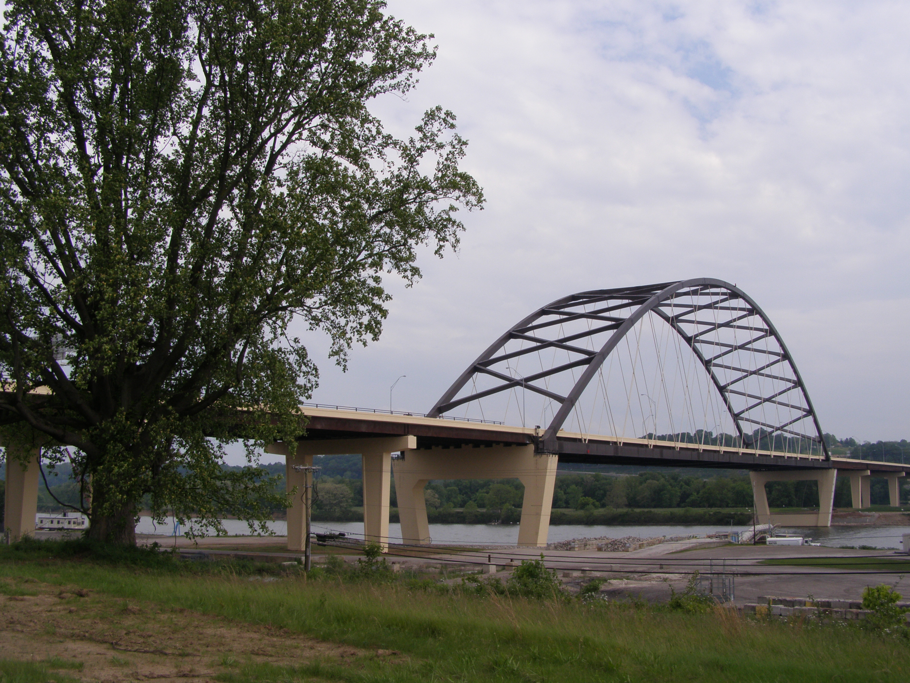
Blennerhassett Island Bridge, with a network arch design, carries U.S. Route 50 ( Appalachian Development Highway System's Corridor D) over the Ohio River and the historic Blennerhassett Island between Belpre Township, Washington County, Ohio and Washington, West Virginia in the United States. Construction of the bridge was overseen by the Walsh Construction Company of Chicago, and it opened to traffic on June 13, 2008. The completion of the span completed Corridor D between Interstate 275 east of Cincinnati Cincinnati ( ) is a city in the U.S. state of Ohio and the county seat of Hamilton County. Settled in 1788, the city is located at the northern side of the confluence of the Licking and Ohio rivers, the latter of which marks the state line wit ... to Interstate 79 at Clarksburg, West Virginia. Photo Gallery File:Blennerhassett Bridge 032.jpg File:Blennerhassett Bridge 002.jpg File:Blennerhassett Bridge 038.jpg File:Blennerhassett Bridge 040.jpg File:Blennerhasse ... [...More Info...] [...Related Items...] OR: [Wikipedia] [Google] [Baidu] |
DeLorme
DeLorme is the producer of personal satellite tracking, messaging, and navigation technology. The company’s main product, ''inReach'', integrates GPS and satellite technologies. ''inReach'' provides the ability to send and receive text messages anywhere in the world (including when beyond cell phone range) by using the Iridium satellite constellation. By pairing with a smart phone, navigation is possible with access to free downloadable topographic maps and NOAA charts. On February 11, 2016, the company announced that it had been purchased by Garmin, a multinational producer of GPS products and services.Garmin® Signs Purchase Agreement to Acquire DeLorme® 11 February 2016 DeLorme also produces printed atlas and topographic software prod ... [...More Info...] [...Related Items...] OR: [Wikipedia] [Google] [Baidu] |
North Bend Rail Trail
The North Bend Rail Trail is a rail trail in north-central and western West Virginia in the United States. It is operated by West Virginia State Parks and is part of the American Discovery Trail. Running parallel to U.S. Route 50, the rail trail extends from the community of Wolf Summit west of Clarksburg at its eastern end to I-77 near Parkersburg at its western end, passing through Harrison, Doddridge, Ritchie and Wood Counties and the towns of Salem, West Union, Pennsboro, Ellenboro and Cairo, as well as North Bend State Park and numerous unincorporated communities. DeLorme (1997). ''West Virginia Atlas & Gazetteer''. Yarmouth, Maine: DeLorme. . History Railroad The North Bend Rail Trail was built on one of the most distinguished railroad lines in U.S. history. Chartered in 1851, the Northwestern Virginia Railroad built 103 miles from the Baltimore & Ohio Railroad (B&O) mainline at Grafton, West Virginia, to the Ohio River at Parkersburg, West Virginia. The l ... [...More Info...] [...Related Items...] OR: [Wikipedia] [Google] [Baidu] |
Appalachian Development Highway System
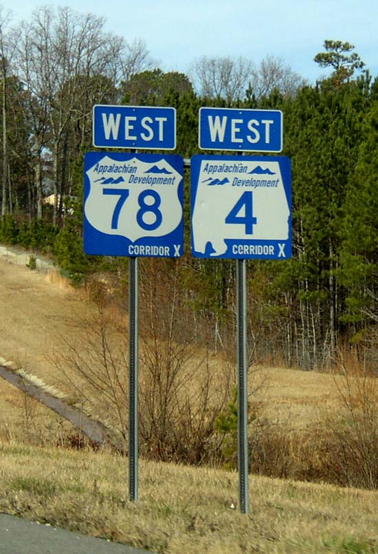
The Appalachian Development Highway System (ADHS) is a series of highway corridors in the Appalachia region of the eastern United States. The routes are designed as local and regional routes for improving economic development in the historically isolated region. It was established as part of the Appalachian Regional Development Act of 1965, and has been repeatedly supplemented by various federal and state legislative and regulatory actions. The system consists of a mixture of state, U.S., and Interstate routes. The routes are formally designated as "corridors" and assigned a letter. Signage of these corridors varies from place to place, but where signed are often done so with a distinctive blue-colored sign. A 2019 study found that the construction of the ADHS led to economic net gains of $54 billion (approximately 0.4 percent of national income) and boosted incomes in the Appalachian region by reducing the costs of trade. History In 1964, the President's Appalachian Re ... [...More Info...] [...Related Items...] OR: [Wikipedia] [Google] [Baidu] |
Corridor D
In the United States, Corridor D is part of the Appalachian Development Highway System. In Ohio, it follows State Route 32 from the eastern Cincinnati suburbs until a point west of Albany, where it becomes concurrent with U.S. Route 50. After crossing into West Virginia, it follows U.S. Route 50 until the Interstate 79 interchange in Clarksburg. The West Virginia portion was constructed during 1967–1977, and the Ohio portion during 2000–2008. ADHS Funding is separate from other Federal Highway funds. Route description Ohio Corridor D begins at the western edge of the Appalachian Regional Commission area at the Hamilton County– Clermont County border east of Cincinnati. It intersects Interstate 275, Cincinnati's beltway, and then U.S. Route 68 and U.S. Route 62 as it crosses the Ohio glacial till plain. Corridor D enters the Allegheny Plateau east of Peebles, crossing the Portage Escarpment near the summit of Tener Mountain before descending into the Scioto ... [...More Info...] [...Related Items...] OR: [Wikipedia] [Google] [Baidu] |
Ohio River
The Ohio River is a long river in the United States. It is located at the boundary of the Midwestern and Southern United States, flowing southwesterly from western Pennsylvania to its mouth on the Mississippi River at the southern tip of Illinois. It is the third largest river by discharge volume in the United States and the largest tributary by volume of the north-south flowing Mississippi River that divides the eastern from western United States. It is also the 6th oldest river on the North American continent. The river flows through or along the border of six states, and its drainage basin includes parts of 14 states. Through its largest tributary, the Tennessee River, the basin includes several states of the southeastern U.S. It is the source of drinking water for five million people. The lower Ohio River just below Louisville is obstructed by rapids known as the Falls of the Ohio where the elevation falls in restricting larger commercial navigation, although in the 18th ... [...More Info...] [...Related Items...] OR: [Wikipedia] [Google] [Baidu] |
Northwestern Turnpike
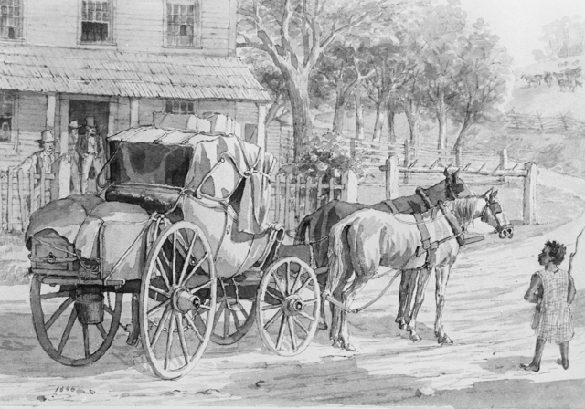
The Northwestern Turnpike is a historic road in West Virginia (Virginia at the time the road was created), important for being historically one of the major roads crossing the Appalachians, financed by the Virginia Board of Public Works in the 1830s. In modern times, west of Winchester, Virginia, U.S. Route 50 follows the path of the Northwestern Turnpike into West Virginia, whose major Corridor D project follows the western section of the original Northwestern Turnpike. History The following description of the Northwestern Turnpike is taken from Dr. J. M. Callahan's ''Semi-Centennial History of West Virginia'', pages 106-9, published in 1913: "The old Northwestern Turnpike, extending from Winchester, Virginia on a general westward course to Parkersburg, West Virginia on the Ohio, is a historic highway which deserves more mention than it has ever received as a factor related to the American westward movement and to the problem of communication between East and West. It was the i ... [...More Info...] [...Related Items...] OR: [Wikipedia] [Google] [Baidu] |
Maryland
Maryland ( ) is a state in the Mid-Atlantic region of the United States. It shares borders with Virginia, West Virginia, and the District of Columbia to its south and west; Pennsylvania to its north; and Delaware and the Atlantic Ocean to its east. Baltimore is the largest city in the state, and the capital is Annapolis. Among its occasional nicknames are '' Old Line State'', the ''Free State'', and the '' Chesapeake Bay State''. It is named after Henrietta Maria, the French-born queen of England, Scotland, and Ireland, who was known then in England as Mary. Before its coastline was explored by Europeans in the 16th century, Maryland was inhabited by several groups of Native Americans – mostly by Algonquian peoples and, to a lesser degree, Iroquoian and Siouan. As one of the original Thirteen Colonies of England, Maryland was founded by George Calvert, 1st Baron Baltimore, a Catholic convert"George Calvert and Cecilius Calvert, Barons Baltimore" William Hand Browne, ... [...More Info...] [...Related Items...] OR: [Wikipedia] [Google] [Baidu] |
Garrett County, Maryland
Garrett County () is the westernmost county of the U.S. state of Maryland. As of the 2020 census, the population was 28,806, making it the third-least populous county in Maryland. Its county seat is Oakland. The county was named for John Work Garrett (1820–1884), president of the Baltimore and Ohio Railroad. Created from Allegany County, Maryland in 1872, it was the last Maryland county to be formed. Garrett County has long been part of the media market of Pittsburgh, Pennsylvania. It is considered to be a part of Western Maryland. The Commonwealth of Pennsylvania is to the north. The Maryland–Pennsylvania boundary is commonly known as the Mason–Dixon line. The eastern border with Allegany County was defined by the Bauer Report, submitted to Governor Lloyd Lowndes, Jr. on November 9, 1898. The Potomac River and State of West Virginia lie to the south and west. Garrett County lies in the Allegheny Mountains, which here form the western flank of the Appalachian Mount ... [...More Info...] [...Related Items...] OR: [Wikipedia] [Google] [Baidu] |
Virginia
Virginia, officially the Commonwealth of Virginia, is a state in the Mid-Atlantic and Southeastern regions of the United States, between the Atlantic Coast and the Appalachian Mountains. The geography and climate of the Commonwealth are shaped by the Blue Ridge Mountains and the Chesapeake Bay, which provide habitat for much of its flora and fauna. The capital of the Commonwealth is Richmond; Virginia Beach is the most-populous city, and Fairfax County is the most-populous political subdivision. The Commonwealth's population was over 8.65million, with 36% of them living in the Baltimore–Washington metropolitan area. The area's history begins with several indigenous groups, including the Powhatan. In 1607, the London Company established the Colony of Virginia as the first permanent English colony in the New World. Virginia's state nickname, the Old Dominion, is a reference to this status. Slave labor and land acquired from displaced native tribes fueled the ... [...More Info...] [...Related Items...] OR: [Wikipedia] [Google] [Baidu] |


