|
Tugby And Keythorpe
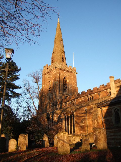
Tugby and Keythorpe is a civil parish comprising the village of Tugby and land surrounding Keythorpe Hall, Hall Farm and Lodge Farm in Leicestershire, England, part of the Harborough district. The Parish covers around 2,200 acres, situated 7 miles west of Uppingham, and 12 miles east of Leicester. According to the 2011 census the population of the parish was 330. The Anglican parish register for the parish dates back to 1568. The boundaries of the parish have not changed throughout the years, meaning that the parish's size remains the same as it did in 1568. In the 1887 Gazetter of the British Isles it is suggested that the town dates back to Norman rule stating: "The church has a Norman tower, and is good." Demographics Population overview Over the years the population has been an ever changing demographic, with there being distinct peaks and troughs. In the 1801 census population sat at 230 people, which then grew, reaching the parish's peak population of 365 in 1851. ... [...More Info...] [...Related Items...] OR: [Wikipedia] [Google] [Baidu] |
United Kingdom Census 2011
A census of the population of the United Kingdom is taken every ten years. The 2011 census was held in all countries of the UK on 27 March 2011. It was the first UK census which could be completed online via the Internet. The Office for National Statistics (ONS) is responsible for the census in England and Wales, the General Register Office for Scotland (GROS) is responsible for the census in Scotland, and the Northern Ireland Statistics and Research Agency (NISRA) is responsible for the census in Northern Ireland. The Office for National Statistics is the executive office of the UK Statistics Authority, a non-ministerial department formed in 2008 and which reports directly to Parliament. ONS is the UK Government's single largest statistical producer of independent statistics on the UK's economy and society, used to assist the planning and allocation of resources, policy-making and decision-making. ONS designs, manages and runs the census in England and Wales. In its capacity a ... [...More Info...] [...Related Items...] OR: [Wikipedia] [Google] [Baidu] |
Harborough District
Harborough () is a local government district of Leicestershire, England, named after its main town, Market Harborough. Covering , the district is by far the largest of the eight district authorities in Leicestershire and covers almost a quarter of the county. The district also covers the town of Lutterworth and villages of Broughton Astley and Ullesthorpe. The district extends south and east from the Leicester Urban Area; on the east it adjoins the county of Rutland; has a boundary on the north with the boroughs of Charnwood (borough), Charnwood and Melton (borough), Melton; on the south it has a long boundary with the county of Northamptonshire comprising the districts of North Northamptonshire and West Northamptonshire. To the west the boundary is with Warwickshire and the borough of Borough of Rugby, Rugby, a boundary formed for much of its length by the line of Watling Street. The north-western boundary of the district adjoins Blaby District and the borough of Oadby and Wigsto ... [...More Info...] [...Related Items...] OR: [Wikipedia] [Google] [Baidu] |
Leicestershire
Leicestershire ( ; postal abbreviation Leics.) is a ceremonial and non-metropolitan county in the East Midlands, England. The county borders Nottinghamshire to the north, Lincolnshire to the north-east, Rutland to the east, Northamptonshire to the south-east, Warwickshire to the south-west, Staffordshire to the west, and Derbyshire to the north-west. The border with most of Warwickshire is Watling Street, the modern A5 road. Leicestershire takes its name from the city of Leicester located at its centre and administered separately from the rest of the county. The ceremonial county – the non-metropolitan county plus the city of Leicester – has a total population of just over 1 million (2016 estimate), more than half of which lives in the Leicester Urban Area. History Leicestershire was recorded in the Domesday Book in four wapentakes: Guthlaxton, Framland, Goscote, and Gartree. These later became hundreds, with the division of Goscote into West Goscote and Ea ... [...More Info...] [...Related Items...] OR: [Wikipedia] [Google] [Baidu] |
Civil Parish
In England, a civil parish is a type of administrative parish used for local government. It is a territorial designation which is the lowest tier of local government below districts and counties, or their combined form, the unitary authority. Civil parishes can trace their origin to the ancient system of ecclesiastical parishes, which historically played a role in both secular and religious administration. Civil and religious parishes were formally differentiated in the 19th century and are now entirely separate. Civil parishes in their modern form came into being through the Local Government Act 1894, which established elected parish councils to take on the secular functions of the parish vestry. A civil parish can range in size from a sparsely populated rural area with fewer than a hundred inhabitants, to a large town with a population in the tens of thousands. This scope is similar to that of municipalities in Continental Europe, such as the communes of France. Howev ... [...More Info...] [...Related Items...] OR: [Wikipedia] [Google] [Baidu] |
Uppingham
Uppingham is a market town in Rutland, England, off the A47 between Leicester and Peterborough, south of the county town, Oakham. It had a population of 4,745 according to the 2011 census, estimated at 4,853 in 2019. It is known for its eponymous public school. With its art galleries Uppingham has become a popular destination for art lovers. Uppingham was named "best place to live in the Midlands in 2022" by ''The Times'' newspaper, who commented on the town by calling it "a discerning market town with art, heart and smarts — plus the magnificent Rutland Water". Toponymy The name of the town means 'Homestead/village of the Yppingas (upland people)'. It stands on a high ridge near Beaumont Chase, hence "upland". History A little over to the north-west at Castle Hill are the earthwork remains of a medieval motte and bailey castle. The town has two active churches; The Church of St Peter and St Paul, a largely 14th-century Church of England parish church and the ... [...More Info...] [...Related Items...] OR: [Wikipedia] [Google] [Baidu] |
Leicester
Leicester ( ) is a city status in the United Kingdom, city, Unitary authorities of England, unitary authority and the county town of Leicestershire in the East Midlands of England. It is the largest settlement in the East Midlands. The city lies on the River Soar and close to the eastern end of the National Forest, England, National Forest. It is situated to the north-east of Birmingham and Coventry, south of Nottingham and west of Peterborough. The population size has increased by 38,800 ( 11.8%) from around 329,800 in 2011 to 368,600 in 2021 making it the most populous municipality in the East Midlands region. The associated Urban area#United Kingdom, urban area is also the 11th most populous in England and the List of urban areas in the United Kingdom, 13th most populous in the United Kingdom. Leicester is at the intersection of two railway lines: the Midland Main Line and the Birmingham to London Stansted Airport line. It is also at the confluence of the M1 motorway, M1/M ... [...More Info...] [...Related Items...] OR: [Wikipedia] [Google] [Baidu] |
NRS Social Grade
The NRS social grades are a system of demographic classification used in the United Kingdom. They were originally developed by the National Readership Survey (NRS) to classify readers, but are now used by many other organisations for wider applications and have become a standard for market research. Wilmshurst, J. & MacKay, A., ''The Fundamentals of Advertising'', (1999) They were developed in the late 1950s and refined in following years and achieved widespread usage in 20th century Britain. Their definition is now maintained by the Market Research Society.Occupation groupings: a job dictionaryMarket Research Society, London, 2006. The distinguishing feature of the NRS social grade is that it is based on occupation, rather than wealth or property ownership. Grades The classifications are based on the occupation of the head of the household. The grades are often grouped into ABC1 and C2DE; these are taken to equate to middle class and working class, respectively. Only arou ... [...More Info...] [...Related Items...] OR: [Wikipedia] [Google] [Baidu] |
Thomas Becket
Thomas Becket (), also known as Saint Thomas of Canterbury, Thomas of London and later Thomas à Becket (21 December 1119 or 1120 – 29 December 1170), was an English nobleman who served as Lord Chancellor from 1155 to 1162, and then notably as Archbishop of Canterbury from 1162 until his murder in 1170. He is venerated as a saint and martyr by the Catholic Church and the Anglican Communion. He engaged in conflict with Henry II, King of England, over the rights and privileges of the Church and was murdered by followers of the king in Canterbury Cathedral. Soon after his death, he was canonised by Pope Alexander III. Sources The main sources for the life of Becket are a number of biographies written by contemporaries. A few of these documents are by unknown writers, although traditional historiography has given them names. The known biographers are John of Salisbury, Edward Grim, Benedict of Peterborough, William of Canterbury, William fitzStephen, Guernes of P ... [...More Info...] [...Related Items...] OR: [Wikipedia] [Google] [Baidu] |
Heritage Lottery Fund
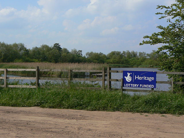
The National Lottery Heritage Fund, formerly the Heritage Lottery Fund (HLF), distributes a share of National Lottery funding, supporting a wide range of heritage projects across the United Kingdom. History The fund's predecessor bodies were the National Land Fund, established in 1946, and the National Heritage Memorial Fund, established in 1980. The current body was established as the "Heritage Lottery Fund" in 1994. It was re-branded as the National Lottery Heritage Fund in January 2019. Activities The fund's income comes from the National Lottery which is managed by Camelot Group. Its objectives are "to conserve the UK's diverse heritage, to encourage people to be involved in heritage and to widen access and learning". As of 2019, it had awarded £7.9 billion to 43,000 projects. In 2006, the National Lottery Heritage Fund launched the Parks for People program with the aim to revitalize historic parks and cemeteries. From 2006 to 2021, the Fund had granted £254millio ... [...More Info...] [...Related Items...] OR: [Wikipedia] [Google] [Baidu] |
Tilton On The Hill
Tilton on the Hill is a village and (as just Tilton) a former civil parish, now in the parish of Tilton on the Hill and Halstead in the Harborough district of Leicestershire. The population of the civil parish of Tilton on the Hill and Halstead at the 2011 census was 601. It lies 2 miles north of the A47, on the B6047 to Melton Mowbray. Halstead civil parish () was merged with Tilton on 1 April 1935, while the deserted medieval village of Whatborough () was merged in on 1 April 1994. Marefield remains a separate civil parish, but is part of the Tilton Electoral Ward. In 1931 the parish of Tilton (prior to the merges) had a population of 152. St Peter's Tilton, the Parish Church is in the parish of Halstead, as is the vicarage. Tilton on the Hill is one of the highest places in East Leicestershire at above sea level, with the Mill House standing at the highest point. Whatborough is the highest summit in the eastern half of the county. The centre of the village was de ... [...More Info...] [...Related Items...] OR: [Wikipedia] [Google] [Baidu] |


