|
Treveneague
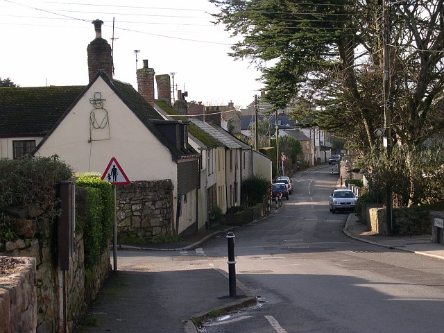
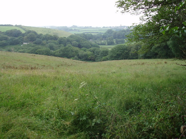
Treveneague is an area near Goldsithney, Penzance, in the civil parish of St Hilary. It was originally composed of two places, North Treveneague and South Treveneague. The Grade II listed early 19th century North Treveneague Farmhouse and Farm Buildings North of Treveneague Farmhouse A farm (also called an agricultural holding) is an area of land that is devoted primarily to agricultural processes with the primary objective of producing food and other crops; it is the basic facility in food production. The name is used fo ... are located here. In the 1860s, an Iron Age fogou was discovered at Treveneague, the location of the fogou was located using Geophysics during a 1996 Time Team episode. References Penzance {{Penwith-geo-stub ... [...More Info...] [...Related Items...] OR: [Wikipedia] [Google] [Baidu] |
Fogou
A fogou or fougou (pronounced "foo-goo") is an underground, dry-stone structure found on Iron Age or Romano-British-defended settlement sites in Cornwall. The original purpose of a fogou is uncertain today. Colloquially called , , , giant holts, or holes in various dialects, fogous have similarities with souterrains or earth-houses of northern Europe and particularly Scotland, including Orkney. Fewer than 15 confirmed fogous have been found. Construction Fogous consist of a buried, usually corbelled stone wall, tapering at the top and capped by stone slabs. They were mainly constructed by excavating a sloping trench about wide and deep, lining it with drystone walling as stated, which was battered inwards and roofed with flat slabs; soil from excavation was heaped on top as at Pendeen Vau or incorporated in the rampart of the enclosure as at Halliggye Fogou, Trelowarren.Fox, Aileen (1973). ''South-West England 3500 BC – AD 600''. Pub. David & Charles. . p. 178. Functi ... [...More Info...] [...Related Items...] OR: [Wikipedia] [Google] [Baidu] |
Goldsithney
Goldsithney ( kw, Golsydhni, meaning ''fair of St Sithney'') is a village in west Cornwall, England, United Kingdom. It is on the B3280 at , about four miles (6 km) east of Penzance and one mile (1.6 km) east of Marazion. It is in the civil parish of Perranuthnoe. The centre of Goldsithney is a conservation area and has two pubs (the Trevelyan Arms and the Crown Inn), a shop and a post office. The village holds a Charter fair A charter fair in England is a street fair or market which was established by Royal Charter. Many charter fairs date back to the Middle Ages, with their heyday occurring during the 13th century. Originally, most charter fairs started as street marke ... in August each year. Fair folklore According to ''Popular Romances of the West of England'' by Robert Hunt: References External links {{authority control Villages in Cornwall Penwith Charter fairs ... [...More Info...] [...Related Items...] OR: [Wikipedia] [Google] [Baidu] |
Penzance
Penzance ( ; kw, Pennsans) is a town, civil parish and port in the Penwith district of Cornwall, United Kingdom. It is the most westerly major town in Cornwall and is about west-southwest of Plymouth and west-southwest of London. Situated in the shelter of Mount's Bay, the town faces south-east onto the English Channel, is bordered to the west by the fishing port of Newlyn, to the north by the civil parish of Madron and to the east by the civil parish of Ludgvan. The civil parish includes the town of Newlyn and the villages of Mousehole, Paul, Gulval, and Heamoor. Granted various royal charters from 1512 onwards and incorporated on 9 May 1614, it has a population of 21,200 (2011 census). Penzance's former main street Chapel Street has a number of interesting features, including the Egyptian House, The Admiral Benbow public house (home to a real life 1800s smuggling gang and allegedly the inspiration for ''Treasure Island''s "Admiral Benbow Inn"), the Union Hotel (includi ... [...More Info...] [...Related Items...] OR: [Wikipedia] [Google] [Baidu] |
St Hilary, Cornwall
St Hilary is a civil parish and village in west Cornwall, England, United Kingdom. It is situated approximately five miles (8 km) east of Penzance and four miles (6.5 km) south of Hayle. Chynoweth is an area immediately north of St Hilary churchtown. The land of the parish is high enough to provide views of bays on both coasts, St Ives Bay five miles north and Mount's Bay two miles south.Mee, Arthur (1937) ''Cornwall''. (The King's England.) London: Hodder & Stoughton; p. 221 For the purposes of local government St Hilary has a parish council and elects councillors every four years. The principal local authority in the area is Cornwall Council. During the height of mining activity the population was three times that in the 1930s. Geology The area has many former mines: especially notable was a mine called Wheal Fortune which extended into the parish of Ludgvan. Penberthy Croft Mine, to the north of the parish, was designated a Site of Special Scientific Interest in 19 ... [...More Info...] [...Related Items...] OR: [Wikipedia] [Google] [Baidu] |
Listed Building
In the United Kingdom, a listed building or listed structure is one that has been placed on one of the four statutory lists maintained by Historic England in England, Historic Environment Scotland in Scotland, in Wales, and the Northern Ireland Environment Agency in Northern Ireland. The term has also been used in the Republic of Ireland, where buildings are protected under the Planning and Development Act 2000. The statutory term in Ireland is " protected structure". A listed building may not be demolished, extended, or altered without special permission from the local planning authority, which typically consults the relevant central government agency, particularly for significant alterations to the more notable listed buildings. In England and Wales, a national amenity society must be notified of any work to a listed building which involves any element of demolition. Exemption from secular listed building control is provided for some buildings in current use for worship, ... [...More Info...] [...Related Items...] OR: [Wikipedia] [Google] [Baidu] |
North Treveneague Farmhouse
North is one of the four compass points or cardinal directions. It is the opposite of south and is perpendicular to east and west. ''North'' is a noun, adjective, or adverb indicating direction or geography. Etymology The word ''north'' is related to the Old High German ''nord'', both descending from the Proto-Indo-European unit *''ner-'', meaning "left; below" as north is to left when facing the rising sun. Similarly, the other cardinal directions are also related to the sun's position. The Latin word ''borealis'' comes from the Greek '' boreas'' "north wind, north", which, according to Ovid, was personified as the wind-god Boreas, the father of Calais and Zetes. ''Septentrionalis'' is from ''septentriones'', "the seven plow oxen", a name of ''Ursa Major''. The Greek ἀρκτικός (''arktikós'') is named for the same constellation, and is the source of the English word ''Arctic''. Other languages have other derivations. For example, in Lezgian, ''kefer'' can mean b ... [...More Info...] [...Related Items...] OR: [Wikipedia] [Google] [Baidu] |
Farm Buildings North Of Treveneague Farmhouse
A farm (also called an agricultural holding) is an area of land that is devoted primarily to agricultural processes with the primary objective of producing food and other crops; it is the basic facility in food production. The name is used for specialized units such as arable farms, vegetable farms, fruit farms, dairy, pig and poultry farms, and land used for the production of natural fiber, biofuel and other commodities. It includes ranches, feedlots, orchards, plantations and estates, smallholdings and hobby farms, and includes the farmhouse and agricultural buildings as well as the land. In modern times the term has been extended so as to include such industrial operations as wind farms and fish farms, both of which can operate on land or sea. There are about 570 million farms in the world, most of which are small and family-operated. Small farms with a land area of fewer than 2 hectares operate about 1% of the world's agricultural land, and family farms comprise about 75 ... [...More Info...] [...Related Items...] OR: [Wikipedia] [Google] [Baidu] |
Iron Age
The Iron Age is the final epoch of the three-age division of the prehistory and protohistory of humanity. It was preceded by the Stone Age (Paleolithic, Mesolithic, Neolithic) and the Bronze Age (Chalcolithic). The concept has been mostly applied to Iron Age Europe and the Ancient Near East, but also, by analogy, to other parts of the Old World. The duration of the Iron Age varies depending on the region under consideration. It is defined by archaeological convention. The "Iron Age" begins locally when the production of iron or steel has advanced to the point where iron tools and weapons replace their bronze equivalents in common use. In the Ancient Near East, this transition took place in the wake of the Bronze Age collapse, in the 12th century BC. The technology soon spread throughout the Mediterranean Basin region and to South Asia (Iron Age in India) between the 12th and 11th century BC. Its further spread to Central Asia, Eastern Europe, and Central Europe is somewhat dela ... [...More Info...] [...Related Items...] OR: [Wikipedia] [Google] [Baidu] |
Time Team
''Time Team'' is a British television programme that originally aired on Channel 4 from 16 January 1994 to 7 September 2014. It returned online in 2022 for two episodes released on YouTube. Created by television producer Tim Taylor and presented by actor Tony Robinson, each episode featured a team of specialists carrying out an archaeological dig over a period of three days, with Robinson explaining the process in lay terms. The specialists changed throughout the programme's run, although it consistently included professional archaeologists such as Mick Aston, Carenza Lewis, Francis Pryor and Phil Harding. The sites excavated ranged in date from the Palaeolithic to the Second World War. In October 2012, Channel 4 announced that the final series would be broadcast in 2013. Series 20 was screened from January–March 2013 and nine specials were screened between May 2013 and September 2014. In May 2021, Taylor announced the ... [...More Info...] [...Related Items...] OR: [Wikipedia] [Google] [Baidu] |


