|
Transwest Air
Transwest Air was a scheduled and charter airline primarily serving the Canadian province of Saskatchewan. Its headquarters and main base was at Prince Albert. Transwest was formed in 2000 by the merger of Air Sask, established as La Ronge Aviation in 1960, and Athabaska Airways. The company offered not only scheduled passenger services, but fishing charters, surveying work, forest fire fighting, and medevac operations. Transwest's equipment includes a number of bush planes and helicopters, and four Saab 340 regional turboprop airliners. The company also operates La Ronge Water Aerodrome, Stony Rapids Water Aerodrome, and Southend/Hans Ulricksen Field Aerodrome. Transwest Air also has maintenance bases in Saskatoon, Prince Albert, La Ronge, and Stony Rapids. Transwest Air was bought by West Wind Aviation on June 30, 2016. In January 2021, it was announced that West Wind Aviation will be merged with Transwest Air, and would be renamed ''Rise Air''. History The company wa ... [...More Info...] [...Related Items...] OR: [Wikipedia] [Google] [Baidu] |
Beechcraft 1900
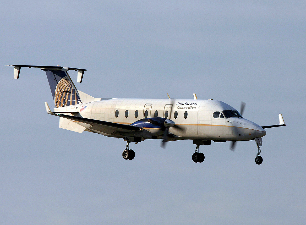
The Beechcraft 1900 is a 19-passenger, pressurized twin-engine turboprop regional airliner manufactured by Beechcraft. It is also used as a freight aircraft and corporate transport, and by several governmental and military organizations. With customers favoring larger regional jets, Raytheon ended production in October 2002. Developed from the Beechcraft Super King Air, the aircraft was designed to carry passengers in all weather conditions from airports with relatively short runways. It is capable of flying in excess of , although few operators use its full-fuel range. In terms of the number of aircraft built and its continued use by many passenger airlines and other users, it is one of the most popular 19-passenger airliners in history. Development The 1900 is Beechcraft's third regional airliner after the Beechcraft Model 18 and Beechcraft Model 99 Airliner. The Beechcraft 1900's design lineage began in 1949 with the Beechcraft Model 50 Twin Bonanza, a 5-passenger, reci ... [...More Info...] [...Related Items...] OR: [Wikipedia] [Google] [Baidu] |
Southend/Hans Ulricksen Field Aerodrome
Southend/Hans Ulricksen Field Aerodrome is located west-northwest of Southend, Saskatchewan, Canada. The airport, which was formerly operated by H. Ulricksen, was closed, then reopened in 2016. See also * List of airports in Saskatchewan * Southend Water Aerodrome Southend Water Aerodrome is located west of Southend, Saskatchewan, Canada. See also * List of airports in Saskatchewan * Southend/Hans Ulricksen Field Aerodrome Southend/Hans Ulricksen Field Aerodrome is located west-northwest of ... References Registered aerodromes in Saskatchewan {{Saskatchewan-airport-stub ... [...More Info...] [...Related Items...] OR: [Wikipedia] [Google] [Baidu] |
Uranium City
Uranium City is a northern settlement in Saskatchewan, Canada. Located on the northern shores of Lake Athabasca near the border of the Northwest Territories, it is above sea level. The settlement is northwest of Prince Albert, northeast of Edmonton and south of the Northwest Territories-Saskatchewan boundary. For census purposes, it is located within the province's Division No. 18 territory. History In 1949, athabascaite was discovered by S. Kaiman while he was researching radioactive materials around Lake Athabasca near Uranium City. In 1952, the provincial government decided to establish a community to service the mines in the Beaverlodge uranium area developed by Eldorado Mining and Refining, a federal crown corporation. In 1954, the local newspaper, ''The Uranium Times'', noted that 52 mines were operating and 12 open-pit mines were next to Beaverlodge Lake. Initially, most of the residences in Uranium City were simply tents. Some of the mines operating in the are ... [...More Info...] [...Related Items...] OR: [Wikipedia] [Google] [Baidu] |
Stony Rapids
Stony Rapids ( chp, Deschaghe, translation=settlement on the other side of the Rapids) is a northern hamlet in Northern Saskatchewan, Canada. It is located south of the border to the Northwest Territories, the community is astride the Fond du Lac River. This river connects the community to Fond-du-Lac, Uranium City and Camsell Portage. Demographics In the 2021 Census of Population conducted by Statistics Canada, Stony Rapids had a population of living in of its total private dwellings, a change of from its 2016 population of . With a land area of , it had a population density of in 2021. Transportation Saskatchewan Highway 905 runs from Highway 102 to Stony Rapids. The highway is approximately long and is entirely unpaved. A section between Points North Landing and Black Lake is a seasonal winter road. A winter ice road connects Fond-du-Lac and Uranium City. There is an all-season road to the community of Black Lake, southeast. Like most northern communities, St ... [...More Info...] [...Related Items...] OR: [Wikipedia] [Google] [Baidu] |
Saskatoon
Saskatoon () is the largest city in the Provinces and territories of Canada, Canadian province of Saskatchewan. It straddles a bend in the South Saskatchewan River in the central region of the province. It is located along the Trans-Canada Highway, Trans-Canada Yellowhead Highway, and has served as the cultural and economic hub of central Saskatchewan since its founding in 1882 as a Temperance movement, Temperance colony. With a Canada 2021 Census, 2021 census population of 266,141, Saskatoon is the List of cities in Saskatchewan, largest city in the province, and the List of census metropolitan areas and agglomerations in Canada, 17th largest Census Metropolitan Area in Canada, with a 2021 census population of 317,480. Saskatoon is home to the University of Saskatchewan, the Meewasin Valley Authority (which protects the South Saskatchewan River and provides for the city's popular riverbank park spaces), and Wanuskewin Heritage Park (a National Historic Site of Canada and UNES ... [...More Info...] [...Related Items...] OR: [Wikipedia] [Google] [Baidu] |
Points North Landing Airport
Points North Landing Airport is a regional airport adjacent to Points North Landing in Saskatchewan, Canada. See also * List of airports in Saskatchewan * Points North Landing Water Aerodrome Points North Landing Water Aerodrome is located adjacent to Points North Landing, Saskatchewan Saskatchewan ( ; ) is a Provinces and territories of Canada, province in Western Canada, western Canada, bordered on the west by Alberta, on ... References Certified airports in Saskatchewan {{Saskatchewan-airport-stub ... [...More Info...] [...Related Items...] OR: [Wikipedia] [Google] [Baidu] |
Points North Landing
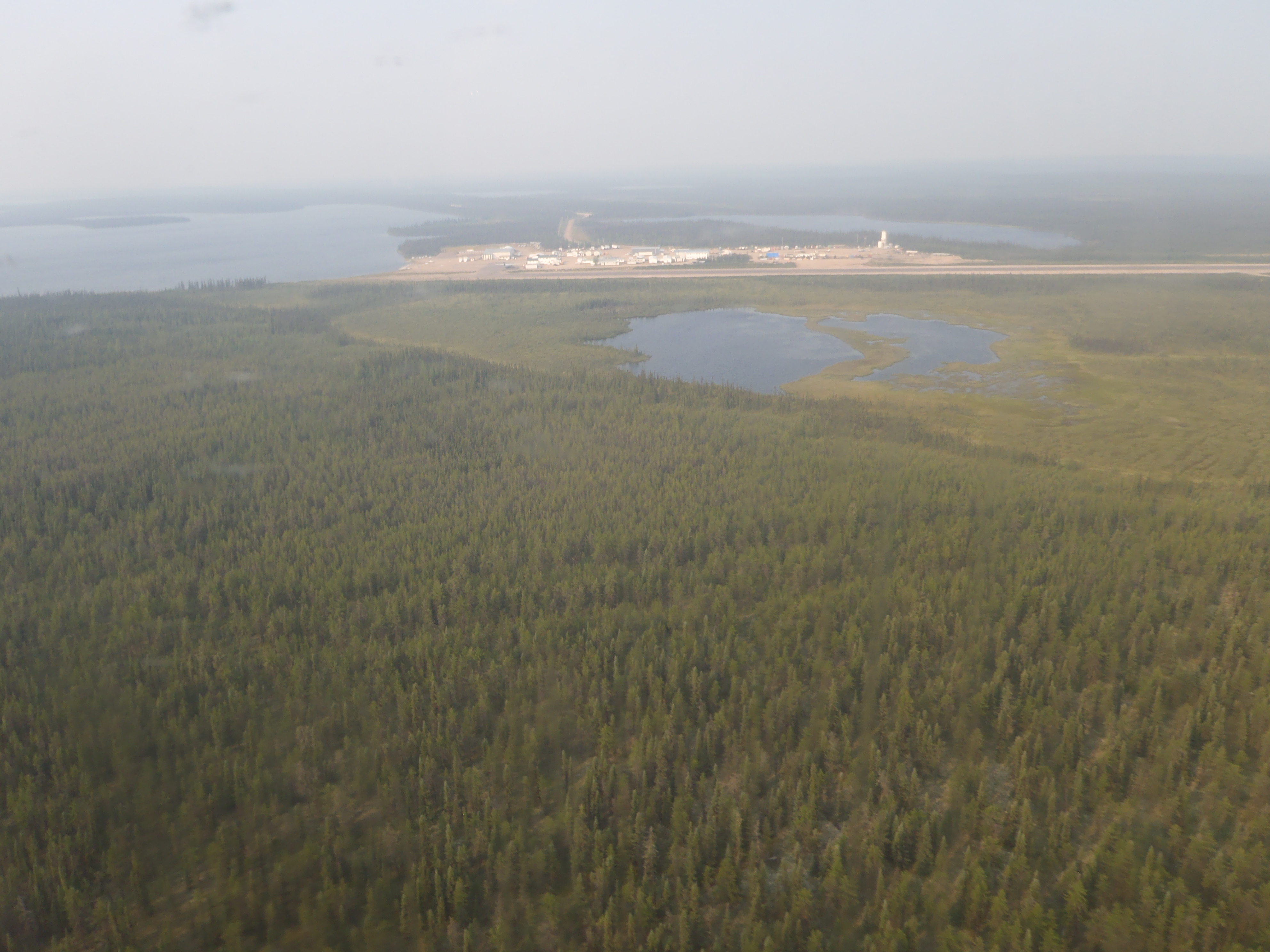
Points North Landing is a camp settlement in northeastern Saskatchewan, Canada. It is 355 kilometres north-east of La Ronge, on Highway 905 and has an airport and a water aerodrome, with almost daily flights provided by West Wind Aviation and Transwest Air. Gasoline, diesel, mechanics, a lumber yard, and accommodations are available. University of Waterloo student Kenton Carnegie was killed by timber wolves within this region on November 8, 2005. It is used as a staging area and logistics area for a variety of activities in northern Saskatchewan. All-weather roads connect the location to the south and temporary winter roads are constructed from Points North Landing to various communities in the North. Several uranium mines are located near this site including Cigar Lake and Key Lake. History Points North Landing was founded by George Eikle, a Norcanair pilot, along with his brother and colleagues. The location was chosen as the easiest place to level for an airstrip. The name ... [...More Info...] [...Related Items...] OR: [Wikipedia] [Google] [Baidu] |
La Ronge (Barber Field) Airport
La Ronge (Barber Field) Airport is located northeast of La Ronge, Saskatchewan, Canada. Airlines and destinations Passenger See also *List of airports in Saskatchewan *La Ronge Water Aerodrome La Ronge Water Aerodrome is located adjacent to La Ronge, Saskatchewan, Canada. See also *List of airports in Saskatchewan *La Ronge (Barber Field) Airport References Registered aerodromes in Saskatchewan Seaplane bases in Sas ... * La Ronge Heliport References External links Certified airports in Saskatchewan {{Saskatchewan-airport-stub ... [...More Info...] [...Related Items...] OR: [Wikipedia] [Google] [Baidu] |
La Ronge
La Ronge is a northern town in the boreal forest of central Saskatchewan, Canada. Its location is approximately north of Prince Albert where Highway 2 becomes Highway 102. La Ronge lies on the western shore of Lac la Ronge, is adjacent to Lac La Ronge Provincial Park, and is on the edge of the Canadian Shield. This town is also the namesake of the larger La Ronge population centre comprising the community, the Northern Village of Air Ronge and the Kitsakie 156B and Lac La Ronge 156 reserves of the Lac La Ronge First Nation. History The name of La Ronge comes from the lake. The origin of the name is uncertain; the most likely explanation is that early French fur traders named it ''la ronge'' (literally ''the chewed'') because of the large amount of beaver activity along the shoreline—many of the trees would have been chewed down for beaver dam construction. In 1782, Swiss born fur trader Jean-Étienne Waddens had a fur trade post on Lac La Ronge. In March 1782, Wadde ... [...More Info...] [...Related Items...] OR: [Wikipedia] [Google] [Baidu] |
Fond Du Lac Dene Nation
Fond du Lac Dene Nation ( chp, Gánį Kóé) is a Dene First Nations in Canada, First Nation located in the taiga, boreal forest area of northern Saskatchewan, Canada. The main settlement is Fond-du-Lac, situated on the east side of Lake Athabasca. It is a remote fly-in community. The population in 2011 was 874, mainly of Dene and Métis people (Canada), Métis descent. 705 residents selected Dene as their mother tongue in 2011. Fond du Lac is a geographic name meaning "far end of the lake" in the French language (literally it translates as "bottom of the lake"). History Founded as a community over 150 years ago, by Chipewyan people, Denesuline First Nations in Canada, First Nations in pursuit of furs, fishing, hunting and trapping the community has seen little changes. Many in the community can trace their ancestral roots to the early 19th century. "Living off the land" is still a way of life in Fond-du-Lac. Many of the residents are descendants of the Maurice's Band who s ... [...More Info...] [...Related Items...] OR: [Wikipedia] [Google] [Baidu] |
British Columbia
British Columbia (commonly abbreviated as BC) is the westernmost province of Canada, situated between the Pacific Ocean and the Rocky Mountains. It has a diverse geography, with rugged landscapes that include rocky coastlines, sandy beaches, forests, lakes, mountains, inland deserts and grassy plains, and borders the province of Alberta to the east and the Yukon and Northwest Territories to the north. With an estimated population of 5.3million as of 2022, it is Canada's third-most populous province. The capital of British Columbia is Victoria and its largest city is Vancouver. Vancouver is the third-largest metropolitan area in Canada; the 2021 census recorded 2.6million people in Metro Vancouver. The first known human inhabitants of the area settled in British Columbia at least 10,000 years ago. Such groups include the Coast Salish, Tsilhqotʼin, and Haida peoples, among many others. One of the earliest British settlements in the area was Fort Victoria, established ... [...More Info...] [...Related Items...] OR: [Wikipedia] [Google] [Baidu] |
Norcanair
Norcanair was the name of a Canadian airline that existed from 1947 to 1987, and again briefly in the early 1990s and from 2001 to 2005. History Norcanair traces its history back to M&C Aviation, founded in Saskatoon, Saskatchewan, in 1930 by private pilots Richmond Mayson and Angus Campbell. Moving soon to Prince Albert, this bush-flying firm survived the Great Depression by concentrating on carrying prospectors and travelers into Saskatchewan's heavily forested north. When the Second World War broke out, the firm's technical expertise was put to work running an overhaul facility in Prince Albert that maintained aircraft used by the British Commonwealth Air Training Plan. M&C Aviation Richmond (Dick) Mayson owned an aircraft in the late 1920s, a Stinson CF-AFF, when he met airframe engineer Angus Campbell, taught him to fly, and they became partners. Their first commercial activity was barnstorming, flying in to agricultural fairs ins Saskatchewan and taking people for air ... [...More Info...] [...Related Items...] OR: [Wikipedia] [Google] [Baidu] |


.jpg)

.jpg)