|
Tomakomai, Hokkaido
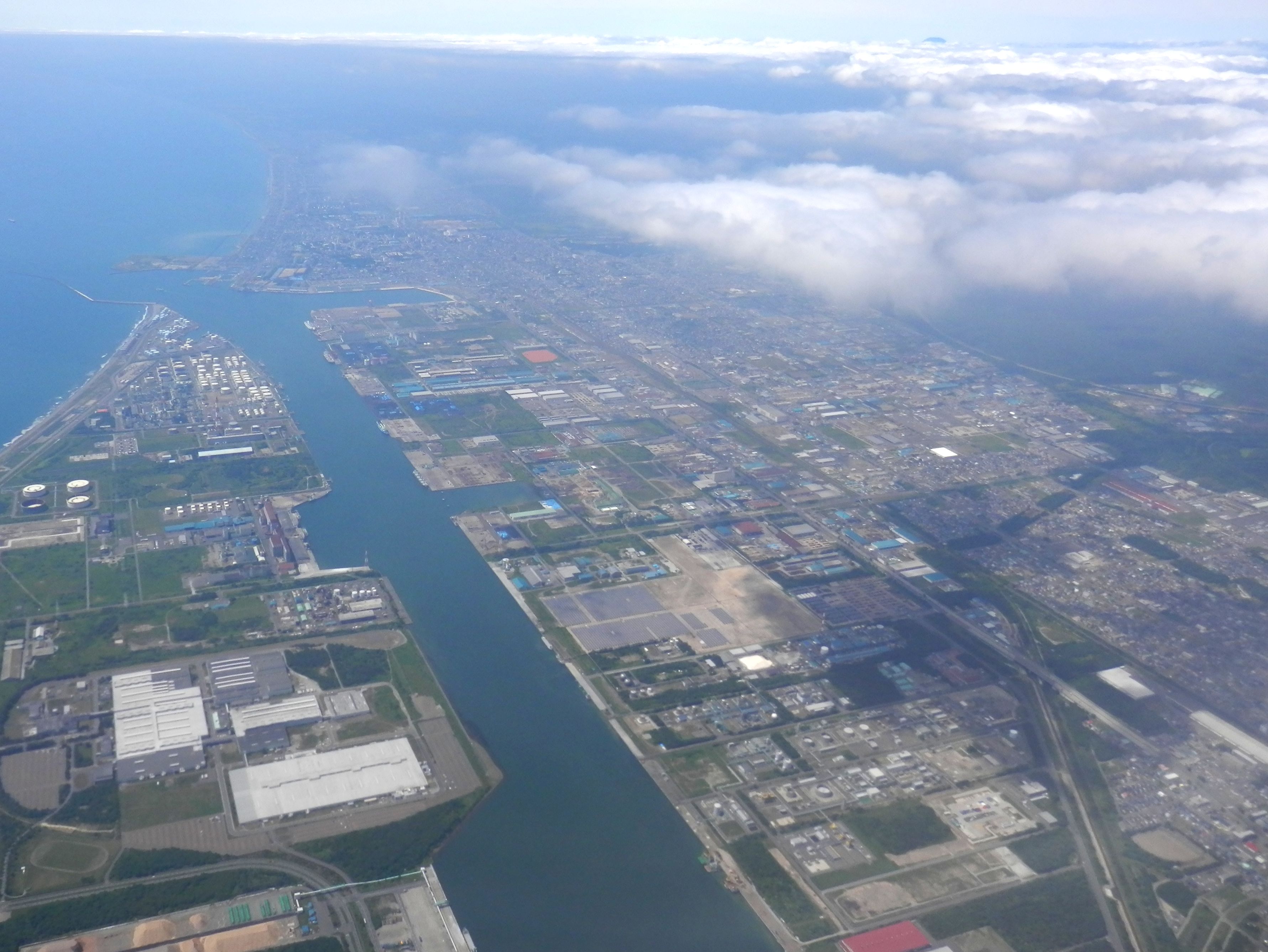
is a city and port in Iburi Subprefecture, Hokkaido, Japan. It is the largest city in the Iburi Subprefecture, and the fourth largest city in Hokkaido. As of 29 February 2012, it had an estimated population of 174,216, with 83,836 households, and a population density of 310.27 persons per km2 (803.60 persons per sq. mi.). The total area is . History The name of Tomakomai is derived from Ainu words "to" and "makomai", meaning "Marsh" and "River which goes into the depths of the mountain", respectively. *1879: Yūfutsu branch of Hokkaidō Development Commission was transferred into Tomakomai (Foundation anniversary). *1902: Tomakomai became second class village. *1918: Tomakomai village became Tomakomai town. *1948: Tomakomai town became Tomakomai city. *1963: Tomakomai Port (West) was opened. *1980: Tomakomai Port (East) was opened. *6 September 2018: Tomakomai City is the nearest city from the epicenter of the 2018 Hokkaido Eastern Iburi earthquake. Geography Mount Tar ... [...More Info...] [...Related Items...] OR: [Wikipedia] [Google] [Baidu] |
Hokkaido
is Japan, Japan's Japanese archipelago, second largest island and comprises the largest and northernmost Prefectures of Japan, prefecture, making up its own List of regions of Japan, region. The Tsugaru Strait separates Hokkaidō from Honshu; the two islands are connected by the undersea railway Seikan Tunnel. The largest city on Hokkaidō is its capital, Sapporo, which is also its only Cities designated by government ordinance of Japan, ordinance-designated city. Sakhalin lies about 43 kilometers (26 mi) to the north of Hokkaidō, and to the east and northeast are the Kuril Islands, which are administered by Russia, though the four most southerly are Kuril Islands dispute, claimed by Japan. Hokkaidō was formerly known as ''Ezo'', ''Yezo'', ''Yeso'', or ''Yesso''.Louis Frédéric, Nussbaum, Louis-Frédéric. (2005). "Hokkaidō" in Although there were Japanese settlers who ruled the southern tip of the island since the 16th century, Hokkaido was considered foreign territo ... [...More Info...] [...Related Items...] OR: [Wikipedia] [Google] [Baidu] |
Cities Of Japan
A is a local administrative unit in Japan. Cities are ranked on the same level as and , with the difference that they are not a component of . Like other contemporary administrative units, they are defined by the Local Autonomy Law of 1947. City status Article 8 of the Local Autonomy Law sets the following conditions for a municipality to be designated as a city: *Population must generally be 50,000 or greater (原則として人口5万人以上) *At least 60% of households must be established in a central urban area (中心市街地の戸数が全戸数の6割以上) *At least 60% of households must be employed in commerce, industry or other urban occupations (商工業等の都市的業態に従事する世帯人口が全人口の6割以上) *Any other conditions set by prefectural ordinance must be satisfied (他に当該都道府県の条例で定める要件を満たしていること) The designation is approved by the prefectural governor and the Minister for Inter ... [...More Info...] [...Related Items...] OR: [Wikipedia] [Google] [Baidu] |
Tomakomai Station
is a railway station in Tomakomai, Hokkaido, Japan, operated by the Hokkaido Railway Company (JR Hokkaido). Lines Tomakomai Station is served by the following lines. * Muroran Main Line ** Chitose Line * Hidaka Main Line The is a railway line in Hokkaido, Japan, operated by Hokkaido Railway Company (JR Hokkaido), between Tomakomai Station in Tomakomai and Samani Station in Samani, running along the coast of Hidaka Subprefecture. Services on the 116.0 km ( ... Limited express trains * '' Hokuto'' ( - ) * '' Suzuran'' ( - ) The Following Services have Discontinued * '' Cassiopeia'' ( - ) * '' Hokutosei'' ( - ) Station layout * Above-ground station with two platforms serving four tracks. History The station opened on 1 August 1892. References External links JR Hokkaido station information Railway stations in Hokkaido Prefecture Railway stations in Japan opened in 1892 {{Hokkaido-rail-station-stub ... [...More Info...] [...Related Items...] OR: [Wikipedia] [Google] [Baidu] |
Aoba Station
is a train station in Tomakomai, Hokkaidō, Japan. Lines *Hokkaido Railway Company **Muroran Main Line The is a railway line in Hokkaido operated by Hokkaido Railway Company (JR Hokkaido), between Oshamambe Station in Oshamambe and Iwamizawa Station in Iwamizawa, approximately paralleling the coast of Iburi Subprefecture. There also is a branch ... Station H19 Adjacent stations Railway stations in Hokkaido Prefecture Railway stations in Japan opened in 1988 {{Hokkaido-rail-station-stub ... [...More Info...] [...Related Items...] OR: [Wikipedia] [Google] [Baidu] |
Itoi Station
is a railway station on the Muroran Main Line in Tomakomai, Hokkaidō, Japan, operated by the Hokkaido Railway Company (JR Hokkaido). It is numbered "H20". Lines Itoi Station is served by the Muroran Main Line. Station layout The unstaffed station consists of two side platforms A side platform (also known as a marginal platform or a single-face platform) is a platform positioned to the side of one or more railway tracks or guideways at a railway station, tram stop, or transitway. A station having dual side platfor ... serving two tracks. Adjacent stations Accidents A 15-year-old junior high school student was killed at the station on 26 December 2011 after being hit by the non-stop '' Super Hokuto'' No. 9 limited express train service from Hakodate to Sapporo while crossing the tracks with a bicycle. Surrounding area * National Route 36 * Shirakaba Onsen (hot spring) References {{Coord, 42.6226, N, 141.5464, E, type:railwaystation_region:JP, display=title ... [...More Info...] [...Related Items...] OR: [Wikipedia] [Google] [Baidu] |
Nishikioka Station
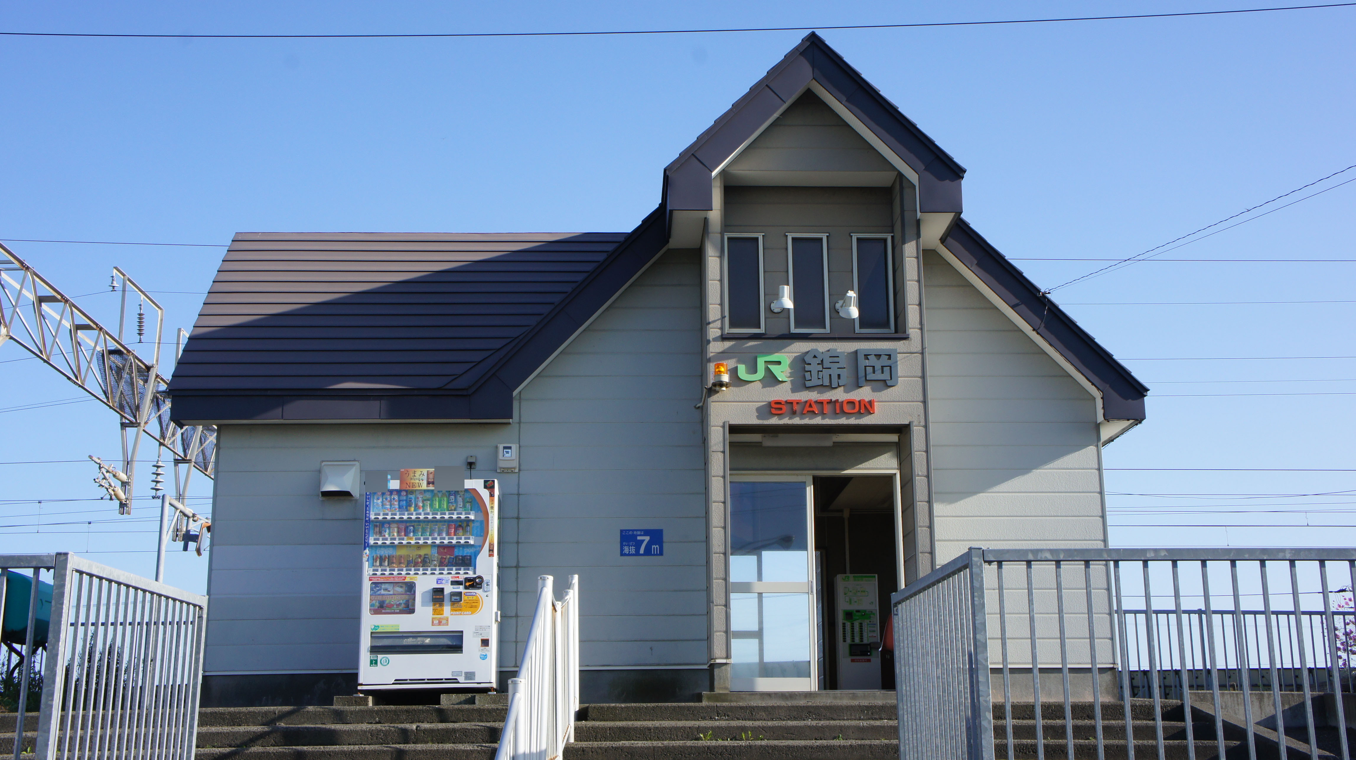
is a train station in Tomakomai, Hokkaidō, Japan. Lines *Hokkaido Railway Company **Muroran Main Line The is a railway line in Hokkaido operated by Hokkaido Railway Company (JR Hokkaido), between Oshamambe Station in Oshamambe and Iwamizawa Station in Iwamizawa, approximately paralleling the coast of Iburi Subprefecture. There also is a branch ... Station H21 Adjacent stations Railway stations in Hokkaido Prefecture Railway stations in Japan opened in 1898 {{Hokkaido-rail-station-stub ... [...More Info...] [...Related Items...] OR: [Wikipedia] [Google] [Baidu] |
Muroran Main Line
The is a railway line in Hokkaido operated by Hokkaido Railway Company (JR Hokkaido), between Oshamambe Station in Oshamambe and Iwamizawa Station in Iwamizawa, approximately paralleling the coast of Iburi Subprefecture. There also is a branch line within Muroran, between Higashi-muroran and Muroran Station. The section between Shiraoi and Numanohata is the longest straight railway section in Japan. On 19 November 2016, JR Hokkaido's President announced plans to rationalise the network by up to 1,237 km, or ~50% of the current network, including the proposed conversion to Third Sector operation of the Tomakomai - Iwamizawa section of the Muroran Main Line. However, if local governments do not come up with an agreement, the section may face closure. Basic data *Operators, distances **Hokkaido Railway Company (Services and tracks) ***From Oshamambe to Iwamizawa: 211.0 km ***From Higashi-Muroran to Muroran: 7.0 km **Japan Freight Railway Company (Services) ** ... [...More Info...] [...Related Items...] OR: [Wikipedia] [Google] [Baidu] |
New Chitose Airport
is an international airport located south-southeast of Chitose and Tomakomai, Hokkaidō, Japan, serving the Sapporo metropolitan area. By both traffic and land area, it is the largest airport in Hokkaidō. It is adjacent to Chitose Air Base, a Japan Air Self-Defense Force base which houses F-15 Eagle fighter jets, the Japanese Air Force One government aircraft and a number of smaller emergency response aircraft and helicopters. Chitose and New Chitose have separate runways but are interconnected by taxiways, and aircraft at either facility can enter the other by ground if permitted; the runways at Chitose are occasionally used to relieve runway closures at New Chitose due to winter weather. JASDF provides air traffic control for both facilities. As of 2018, New Chitose Airport was the fifth-busiest airport in Japan, and ranked 64th in the world in terms of passengers carried. The Sapporo–Tokyo Haneda route is the second busiest air route in the world, with 9.7 mill ... [...More Info...] [...Related Items...] OR: [Wikipedia] [Google] [Baidu] |
Japan Meteorological Agency
The , abbreviated JMA, is an agency of the Ministry of Land, Infrastructure, Transport and Tourism. It is charged with gathering and providing results for the public in Japan that are obtained from data based on daily scientific observation and research into natural phenomena in the fields of meteorology, hydrology, seismology and volcanology, among other related scientific fields. Its headquarters is located in Minato, Tokyo. JMA is responsible for gathering and reporting weather data and forecasts for the general public, as well as providing aviation and marine weather. JMA other responsibilities include issuing warnings for volcanic eruptions, and the nationwide issuance of earthquake warnings of the Earthquake Early Warning (EEW) system. JMA is also designated one of the Regional Specialized Meteorological Centers of the World Meteorological Organization (WMO). It is responsible for forecasting, naming, and distributing warnings for tropical cyclones in the No ... [...More Info...] [...Related Items...] OR: [Wikipedia] [Google] [Baidu] |
Humid Continental Climate
A humid continental climate is a climatic region defined by Russo-German climatologist Wladimir Köppen in 1900, typified by four distinct seasons and large seasonal temperature differences, with warm to hot (and often humid) summers and freezing cold (sometimes severely cold in the northern areas) winters. Precipitation is usually distributed throughout the year but often do have dry seasons. The definition of this climate regarding temperature is as follows: the mean temperature of the coldest month must be below or depending on the isotherm, and there must be at least four months whose mean temperatures are at or above . In addition, the location in question must not be semi-arid or arid. The cooler ''Dfb'', ''Dwb'', and ''Dsb'' subtypes are also known as hemiboreal climates. Humid continental climates are generally found between latitudes 30° N and 60° N, within the central and northeastern portions of North America, Europe, and Asia. They are rare and i ... [...More Info...] [...Related Items...] OR: [Wikipedia] [Google] [Baidu] |
Shikotsu-Tōya National Park
is a national park in the western part of the island of Hokkaidō, Japan. Named after the volcanic caldera lakes of Lake Shikotsu and Lake Tōya, it has a total area of 993.02 square kilometers. The popular hot spring resort of Noboribetsu is also within the park. The park can be divided into roughly five areas: * The Mount Yōtei area * The area around Lake Tōya, Mount Usu and Shōwa-shinzan ( Tōya Caldera and Usu Volcano Geopark) * The area around the hot springs of , , and * The area around , , and * The area around , , and Image gallery Image:Mount Tarumae.jpg, Mount Tarumae as seen from Lake Shikotsu Image:Yotei-zan-from-hirafu.jpg, Mount Yōtei is an active stratovolcano located in Shikotsu-Toya National Park, Hokkaidō, Japan. It is also called , "Ezo" being an old name for the island of Hokkaido, because it resembles Mount Fuji. The mountain is also known as and . It is one of the ... Image:Noboribetsu hot spring jigokudani.JPG, Noboribetsu hot sprin ... [...More Info...] [...Related Items...] OR: [Wikipedia] [Google] [Baidu] |
Mount Tarumae
is located in the Shikotsu-Toya National Park in Hokkaidō, Japan. It is located near both Tomakomai and Chitose towns and can be seen clearly from both. It is on the shores of Lake Shikotsu, a caldera lake. Tarumae is a 1,041 metre active andesitic stratovolcano, with a lava dome. Eruptions The most recent eruption, in 1982, was a phreatic eruption. Previous major eruptions have occurred in 1667, 1739 ( plinian eruption of VEI 5), and 1909. The 1667 and 1739 eruptions were responsible for its present shape. Other eruptions were in 1919–21, 1923, 1926, 1933, 1936, 1944, 1951, 1953–55, and 1978. Tarumae is an 'A' rank volcano — most likely to erupt in the relatively near future. Hokkaido Natural Monument Designated as a Hokkaido Natural Monument, it is popular as an easy climb for hikers who may start at the seventh station and then take an hour to reach the crater. At the foot of Tarumae on the north-west side one can find an impressive moss-covered cave A ca ... [...More Info...] [...Related Items...] OR: [Wikipedia] [Google] [Baidu] |


