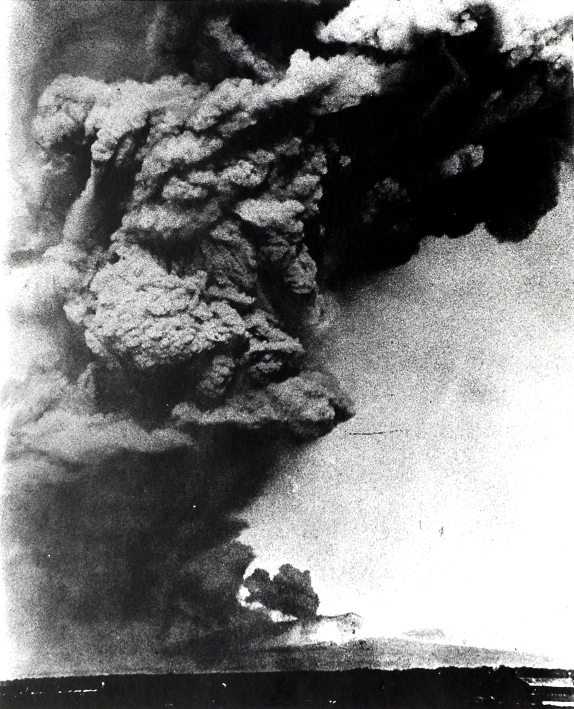
Mount Tarumae on:
[Wikipedia]
[Google]
[Amazon]
 is located in the Shikotsu-Toya National Park in
 The most recent eruption, in 1982, was a
File:Mount Tarumae Relief Map, SRTM-1.jpg, Relief Map
File:Lake Shikotsu, Hokkaido, Japan by Planet Labs.jpg, With Lake Shikotsu. Mount Tarumae in the bottom.
Mount Tarumae.jpg, Mt. Tarumae and Mt. Fuppuishi as seen from the NNE.
File:樽前山火口原.JPG, Lava Dome
Tarumaesan
- Japan Meteorological Agency * - Japan Meteorological Agency
- Geological Survey of Japan * {{DEFAULTSORT:Tarumae Calderas of Hokkaido Active volcanoes Stratovolcanoes of Japan Lava domes Volcanoes of Hokkaido Mountains of Hokkaido Shikotsu-Tōya National Park
 is located in the Shikotsu-Toya National Park in
 Hokkaidō
is Japan's second largest island and comprises the largest and northernmost prefecture, making up its own region. The Tsugaru Strait separates Hokkaidō from Honshu; the two islands are connected by the undersea railway Seikan Tunnel.
The la ...
, Japan
Japan ( ja, 日本, or , and formally , ''Nihonkoku'') is an island country in East Asia. It is situated in the northwest Pacific Ocean, and is bordered on the west by the Sea of Japan, while extending from the Sea of Okhotsk in the north ...
. It is located near both Tomakomai
is a city and port in Iburi Subprefecture, Hokkaido, Japan. It is the largest city in the Iburi Subprefecture, and the fourth largest city in Hokkaido. As of 29 February 2012, it had an estimated population of 174,216, with 83,836 households, ...
and Chitose towns and can be seen clearly from both. It is on the shores of Lake Shikotsu
is a caldera lake in Chitose, Hokkaidō, Japan. It is a part of the Shikotsu-Toya National Park.
Geography
Lake Shikotsu is located in the south-west part of Hokkaidō. It has an average depth of and a maximum depth of , making it the sec ...
, a caldera
A caldera ( ) is a large cauldron-like hollow that forms shortly after the emptying of a magma chamber in a volcano eruption. When large volumes of magma are erupted over a short time, structural support for the rock above the magma chamber is ...
lake. Tarumae is a 1,041 metre active andesitic
Andesite () is a volcanic rock of intermediate composition. In a general sense, it is the intermediate type between silica-poor basalt and silica-rich rhyolite. It is fine-grained (aphanitic) to porphyritic in texture, and is composed predomina ...
stratovolcano
A stratovolcano, also known as a composite volcano, is a conical volcano built up by many layers (strata) of hardened lava and tephra. Unlike shield volcanoes, stratovolcanoes are characterized by a steep profile with a summit crater and per ...
, with a lava dome
In volcanology, a lava dome is a circular mound-shaped protrusion resulting from the slow extrusion of viscous lava from a volcano. Dome-building eruptions are common, particularly in convergent plate boundary settings. Around 6% of eruptions on ...
.
Eruptions
 The most recent eruption, in 1982, was a
 phreatic eruption
A phreatic eruption, also called a phreatic explosion, ultravulcanian eruption or steam-blast eruption, occurs when magma heats ground water or surface water. The extreme temperature of the magma (anywhere from ) causes near-instantaneous evapo ...
. Previous major eruptions have occurred in 1667, 1739 ( plinian eruption of VEI 5), and 1909. The 1667 and 1739 eruptions were responsible for its present shape. Other eruptions were in 1919–21, 1923, 1926, 1933, 1936, 1944, 1951, 1953–55, and 1978.
Tarumae is an 'A' rank volcano — most likely to erupt in the relatively near future.
Hokkaido Natural Monument
Designated as a Hokkaido Natural Monument, it is popular as an easy climb for hikers who may start at the seventh station and then take an hour to reach the crater. At the foot of Tarumae on the north-west side one can find an impressive moss-coveredcave
A cave or cavern is a natural void in the ground, specifically a space large enough for a human to enter. Caves often form by the weathering of rock and often extend deep underground. The word ''cave'' can refer to smaller openings such as sea ...
rn (Koke-no-domon).
Gallery
See also
*List of volcanoes in Japan
This is a list of active and extinct volcanoes in Japan. An Orange background indicates a volcano considered active by the Japan Meteorological Agency.
Hokkaido
Honshū
Izu Islands
Ogasawara Archipelago
The Ogasawara Archipelag ...
*List of mountains in Japan
The following is a list of the mountains and hills of Japan, ordered by height.
Mountains over 1000 meters
Mountains under 1000 meters
As the generally accepted definition of a mountain (versus a hill) is 1000 m of height and 500 m of prom ...
*Tarumaezan Shrine
Tarumaezan Shrine (樽前山神社, ''Tarumaezan Jinja'') is a Shinto shrine in Tomakomai, Iburi Subprefecture, Hokkaidō, Japan. It is located on Mount Tarumae, and it was promoted to a prefectural shrine in 1936. It enshrines the Shinto kam ...
References
External links
Tarumaesan
- Japan Meteorological Agency * - Japan Meteorological Agency
- Geological Survey of Japan * {{DEFAULTSORT:Tarumae Calderas of Hokkaido Active volcanoes Stratovolcanoes of Japan Lava domes Volcanoes of Hokkaido Mountains of Hokkaido Shikotsu-Tōya National Park