|
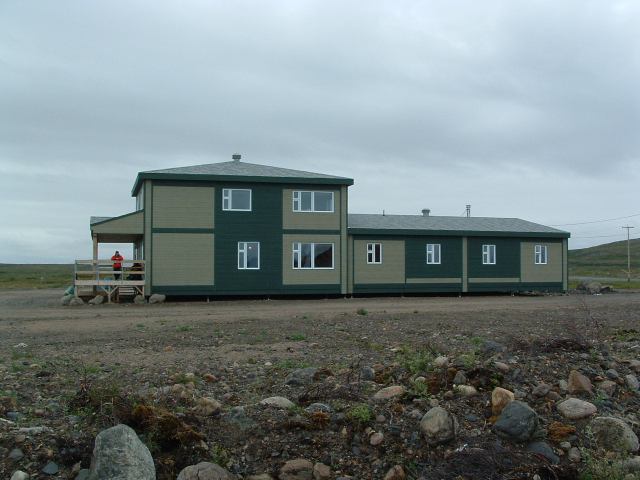
Tasiujaq Airport
Tasiujaq Airport is located southwest of Tasiujaq, Quebec, Canada Canada is a country in North America. Its ten provinces and three territories extend from the Atlantic Ocean to the Pacific Ocean and northward into the Arctic Ocean, covering over , making it the world's second-largest country by tot .... Airlines and destinations References External links Certified airports in Nord-du-Québec {{Quebec-airport-stub ... [...More Info...] [...Related Items...] OR: [Wikipedia] [Google] [Baidu] |
Kativik Regional Government
The Kativik Regional Government (french: Administration régionale Kativik, KGR) encompasses most of the Nunavik region of Quebec. Nunavik is the northern half of the Nord-du-Québec administrative region and includes all the territory north of the 55th parallel. The administrative capital is Kuujjuaq, on the Koksoak River, about 50 kilometres inland from the southern end of the Ungava Bay. In accordance with the 1975 James Bay and Northern Quebec Agreement, the KRG was established by the 1978 ''Act respecting Northern Villages and the Kativik Regional Government''Kativik Act. Representation The Kativik Regional Government includes 14 northern villages, 14 Inuit reserved lands and one Naskapi village municipality. Each Inuit reserved land is near a northern village; the Naskapi village municipality of Kawawachikamach (north of the 55th parallel) is near the Naskapi reserved land that is also called Kawawachikamach, south of the 55th parallel in the Côte-Nord region of Quebe ... [...More Info...] [...Related Items...] OR: [Wikipedia] [Google] [Baidu] |
Tasiujaq, Quebec
Tasiujaq ( iu, ᑕᓯᐅᔭᖅ, meaning: ''Which resembles a lake'') is a northern village (Inuit community) in Nunavik, in northern Quebec, Canada. Its population in the Canada 2021 Census was 420. Geography Tasiujaq was built on the shores of Leaf Lake at the head of Deep Harbour and lies a few kilometres north of the tree line, where the shrub tundra finally gives way to the arctic tundra. Tasiujaq actually refers to the whole of Leaf Basin: Leaf Lake, Leaf Passage and Leaf Bay. Leaf Basin is renowned for its high tides, which regularly exceed 15 metres. The bedrock under Tasiujaq consists of sedimentary and metamorphic formations, chiefly sandstone, slate, greywacke and argillite. Iron ore, dolomite, and mafic rocks are nearby. The region is very rich in marine mammals (seal and beluga), fish (Arctic char, Atlantic salmon, trout), ducks (particularly eider ducks) and many seabirds; also, close to 1000 musk-ox roam the surrounding area. Gyrfalcons and peregrine f ... [...More Info...] [...Related Items...] OR: [Wikipedia] [Google] [Baidu] |
Eastern Time Zone
The Eastern Time Zone (ET) is a time zone encompassing part or all of 23 states in the eastern part of the United States, parts of eastern Canada, the state of Quintana Roo in Mexico, Panama, Colombia, mainland Ecuador, Peru, and a small portion of westernmost Brazil in South America, along with certain Caribbean and Atlantic islands. Places that use: * Eastern Standard Time (EST), when observing standard time (autumn/winter), are five hours behind Coordinated Universal Time ( UTC−05:00). * Eastern Daylight Time (EDT), when observing daylight saving time (spring/summer), are four hours behind Coordinated Universal Time ( UTC−04:00). On the second Sunday in March, at 2:00 a.m. EST, clocks are advanced to 3:00 a.m. EDT leaving a one-hour "gap". On the first Sunday in November, at 2:00 a.m. EDT, clocks are moved back to 1:00 a.m. EST, thus "duplicating" one hour. Southern parts of the zone (Panama and the Caribbean) do not observe daylight saving time ... [...More Info...] [...Related Items...] OR: [Wikipedia] [Google] [Baidu] |
Canada Flight Supplement
The Canada Flight Supplement (CFS) (french: link=no, Supplément de vol Canada) is a joint civil/military publication and is a supplement of the Aeronautical Information Publication (AIP Canada). It is the nation's official airport directory. It contains information on all registered Canadian and certain Atlantic aerodromes and certified airports.''Canada Flight Supplement – Canada and North Atlantic Terminal and Enroute Data''. Nav Canada, 2008. The CFS is published, separately in English and French, as a paper book by Nav Canada and is issued once every 56 days on the ICAO AIRAC schedule. The CFS was published by Natural Resources Canada on behalf of Transport Canada and the Department of National Defence until 15 March 2007 edition, at which time Nav Canada took over production. Contents The CFS presents runway data, arrival and departure procedures, air traffic control (ATC) and other radio frequencies and services such as fuel, hangarage that are available at each liste ... [...More Info...] [...Related Items...] OR: [Wikipedia] [Google] [Baidu] |
Statistics Canada
Statistics Canada (StatCan; french: Statistique Canada), formed in 1971, is the agency of the Government of Canada commissioned with producing statistics to help better understand Canada, its population, resources, economy, society, and culture. It is headquartered in Ottawa.Statistics Canada, 150 Tunney's Pasture Driveway Ottawa, Ontario K1A 0T6; Statistique Canada 150, promenade du pré Tunney Ottawa, Ontario K1A 0T6 The agency is led by the chief statistician of Canada, currently Anil Arora, who assumed the role on September 19, 2016. StatCan is responsible to Parliament through the Minister of Innovation, Science and Industry, currently François-Philippe Champagne. Statistics Canada acts as the national statistical agency for Canada, and Statistics Canada produces statistics for all the provinces as well as the federal government. In addition to conducting about 350 active surveys on virtually all aspects of Canadian life, the '' Statistics Act'' mandates that Statistic ... [...More Info...] [...Related Items...] OR: [Wikipedia] [Google] [Baidu] |
Quebec
Quebec ( ; )According to the Canadian government, ''Québec'' (with the acute accent) is the official name in Canadian French and ''Quebec'' (without the accent) is the province's official name in Canadian English is one of the thirteen provinces and territories of Canada. It is the largest province by area and the second-largest by population. Much of the population lives in urban areas along the St. Lawrence River, between the most populous city, Montreal, and the provincial capital, Quebec City. Quebec is the home of the Québécois nation. Located in Central Canada, the province shares land borders with Ontario to the west, Newfoundland and Labrador to the northeast, New Brunswick to the southeast, and a coastal border with Nunavut; in the south it borders Maine, New Hampshire, Vermont, and New York in the United States. Between 1534 and 1763, Quebec was called ''Canada'' and was the most developed colony in New France. Following the Seven Years' War, Quebec b ... [...More Info...] [...Related Items...] OR: [Wikipedia] [Google] [Baidu] |
Canada
Canada is a country in North America. Its ten provinces and three territories extend from the Atlantic Ocean to the Pacific Ocean and northward into the Arctic Ocean, covering over , making it the world's second-largest country by total area. Its southern and western border with the United States, stretching , is the world's longest binational land border. Canada's capital is Ottawa, and its three largest metropolitan areas are Toronto, Montreal, and Vancouver. Indigenous peoples have continuously inhabited what is now Canada for thousands of years. Beginning in the 16th century, British and French expeditions explored and later settled along the Atlantic coast. As a consequence of various armed conflicts, France ceded nearly all of its colonies in North America in 1763. In 1867, with the union of three British North American colonies through Confederation, Canada was formed as a federal dominion of four provinces. This began an accretion of provinces an ... [...More Info...] [...Related Items...] OR: [Wikipedia] [Google] [Baidu] |
Air Inuit
Air Inuit ( Inuktitut syllabics: ᐃᓄᐃᑦ ᖃᖓᑦᑕᔪᖏᑦ) is an airline based in the Montreal borough of Saint-Laurent, Quebec, Canada. It operates domestic passenger services and charter and cargo services in Nunavik, Labrador and Nunavut. Its main base is Kuujjuaq Airport. History The airline was established and started operations in 1978 using a de Havilland Canada DHC-2 Beaver aircraft. The airline is collectively owned by the Inuit of Nunavik through the Makivik Corporation. In 1984 acquired Chaparal Charters and its fleet of two Twin Otters and one Douglas DC-3. In 2012, Air Inuit relocated their headquarters to a new multi-purpose facility on Côte-Vertu Boulevard near the Montréal–Trudeau International Airport. In 2016, Air Inuit pilot Melissa Haney became the first female Inuk pilot to reach the rank of captain. She was featured on a commemorative postage stamp released by the Canadian Ninety-Nines. Destinations Air Inuit operates scheduled s ... [...More Info...] [...Related Items...] OR: [Wikipedia] [Google] [Baidu] |
Aupaluk Airport
Aupaluk Airport is located east of Aupaluk, Quebec Quebec ( ; )According to the Canadian government, ''Québec'' (with the acute accent) is the official name in Canadian French and ''Quebec'' (without the accent) is the province's official name in Canadian English is one of the thirtee ..., Canada. Airlines and destinations References External linksPage about this airport on COPA's ''Places to Fly'' airport directory Certified airports in Nord-du-Québec {{Quebec-airport-stub ... [...More Info...] [...Related Items...] OR: [Wikipedia] [Google] [Baidu] |
Kangiqsujuaq (Wakeham Bay) Airport
Kangiqsujuaq (Wakeham Bay) Airport is located southeast of Kangiqsujuaq, Quebec, Canada Canada is a country in North America. Its ten provinces and three territories extend from the Atlantic Ocean to the Pacific Ocean and northward into the Arctic Ocean, covering over , making it the world's second-largest country by tot .... Airlines and destinations References External links * Certified airports in Nord-du-Québec {{Quebec-airport-stub ... [...More Info...] [...Related Items...] OR: [Wikipedia] [Google] [Baidu] |
Kangirsuk Airport
Kangirsuk Airport is located east of Kangirsuk, Quebec, Canada Canada is a country in North America. Its ten provinces and three territories extend from the Atlantic Ocean to the Pacific Ocean and northward into the Arctic Ocean, covering over , making it the world's second-largest country by tot .... It has a single gravel runway, Runway 3/21 which is 3521 feet long. It has telephone facilities within the airport terminal. Within a 5 nautical mile range of the airport, patrons have access to food, medical aid and accommodation. Airlines and destinations Air Inuit regularly flies scheduled flights in and out of the airport with the de Havilland Dash 8-300 (DH3) and the de Havilland Canada DHC-6 Twin Otter. Air Inuit provides the following destinations from Kangirsuk Airport: References External links * Certified airports in Nord-du-Québec {{Quebec-airport-stub ... [...More Info...] [...Related Items...] OR: [Wikipedia] [Google] [Baidu] |
Kuujjuaq Airport
Kuujjuaq Airport is located southwest of Kuujjuaq, Quebec, Canada. History The airport site at Fort Chimo was located and surveyed on 12 July 1941 by a United States Army Air Forces (USAAF) team under Captain Elliott Roosevelt, operating by amphibious aircraft out of Gander, Newfoundland and Labrador. The chosen site was upstream from the trading post, on the opposite shore. River access was difficult due to shifting, sandy banks and ice and high tides in the estuary. Code-named Crystal I, Fort Chimo was founded on 10 October 1941 by a 12-man weather station and radio communications crew under Antarctic veteran and former Lieutenant Commander, Isaac Schlossbach. Runway construction commenced next summer. The Crystal stations were part of the Crimson East project for trans-Atlantic ferry flights, Chimo being referred to as "Bookie". Fort Chimo did not actually serve in this intended capacity, but the station was useful for weather reporting, communications, and local support ... [...More Info...] [...Related Items...] OR: [Wikipedia] [Google] [Baidu] |


