|
Tap O' Noth
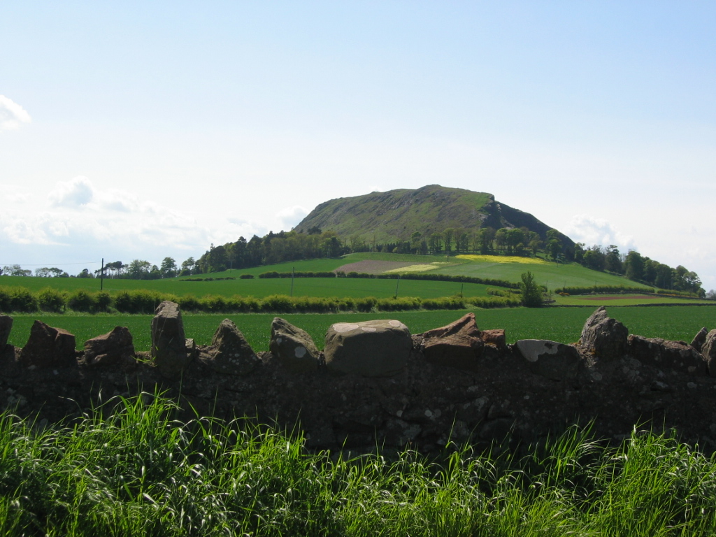
The Tap o' Noth is a hill and fort, 8 miles south of Huntly in Aberdeenshire, Scotland at grid reference NJ485293. It is the second highest fort in Scotland and its main feature is its well-preserved vitrified wall which encloses an area of approximately 100 m by 30 m, 0.3 hectares. Archaeological finds from the site include a stone axe head dated to between c. 2000 BC– c.800 BC, and a decorated bronze rein-ring dated to the 1st–3rd century AD. The site has been designated a scheduled ancient monument. The vitrified fort is the centre of a settlement within another rampart which encloses a much larger area of some 7 hectares. This outer rampart was constructed in the fifth to sixth centuries AD; large scale settlement within the area may date back as far as the third century AD, contemporary with the Pictish culture.Hillfort revealed to be the largest Pictish site ever discovered in Scotland. 14 May 2020. https://www.abdn.ac.uk/news/14019/ Issued by the Communications Team, ... [...More Info...] [...Related Items...] OR: [Wikipedia] [Google] [Baidu] |
Marilyn (hill)
This is a list of Marilyn hills and mountains in the United Kingdom, Isle of Man and Republic of Ireland, Ireland by height. Lists of mountains and hills in the British Isles#Marilyns, Marilyns are defined as peaks with a topographic prominence, prominence of or more, regardless of height or any other merit (e.g. topographic isolation, as used in Lists of mountains and hills in the British Isles#Munros, Munros). Thus, Marilyns can be mountains, with a height above , or relatively small hills. there were 2,011 recorded Marilyns. Definition The Marilyn classification was created by Alan Dawson in his 1992 book ''The Relative Hills of Britain''. The name Marilyn was coined by Dawson as a punning contrast to the ''Munro'' classification of Scottish mountains above , but which has no explicit prominence threshold, being homophonous with (Marilyn) ''Marilyn Monroe, Monroe''. The list of Marilyns was extended to Ireland by Clem Clements. Marilyn was the first of several subsequen ... [...More Info...] [...Related Items...] OR: [Wikipedia] [Google] [Baidu] |
Scheduled Ancient Monument
In the United Kingdom, a scheduled monument is a nationally important archaeological site or historic building, given protection against unauthorised change. The various pieces of legislation that legally protect heritage assets from damage and destruction are grouped under the term "designation." The protection provided to scheduled monuments is given under the Ancient Monuments and Archaeological Areas Act 1979, which is a different law from that used for listed buildings (which fall within the town and country planning system). A heritage asset is a part of the historic environment that is valued because of its historic, archaeological, architectural or artistic interest. Only some of these are judged to be important enough to have extra legal protection through designation. There are about 20,000 scheduled monuments in England representing about 37,000 heritage assets. Of the tens of thousands of scheduled monuments in the UK, most are inconspicuous archaeological sites, but ... [...More Info...] [...Related Items...] OR: [Wikipedia] [Google] [Baidu] |
Scheduled Ancient Monuments In Aberdeenshire
A schedule or a timetable, as a basic time-management tool, consists of a list of times at which possible tasks, events, or actions are intended to take place, or of a sequence of events in the chronological order in which such things are intended to take place. The process of creating a schedule — deciding how to order these tasks and how to commit resources between the variety of possible tasks — is called scheduling,Ofer Zwikael, John Smyrk, ''Project Management for the Creation of Organisational Value'' (2011), p. 196: "The process is called scheduling, the output from which is a timetable of some form". and a person responsible for making a particular schedule may be called a scheduler. Making and following schedules is an ancient human activity. Some scenarios associate this kind of planning with learning life skills. Schedules are necessary, or at least useful, in situations where individuals need to know what time they must be at a specific location to receive a ... [...More Info...] [...Related Items...] OR: [Wikipedia] [Google] [Baidu] |
Pictish Sites In Scotland
Pictish is the extinct Brittonic language spoken by the Picts, the people of eastern and northern Scotland from Late Antiquity to the Early Middle Ages. Virtually no direct attestations of Pictish remain, short of a limited number of geographical and personal names found on monuments and the contemporary records in the area controlled by the kingdoms of the Picts, dating to the early medieval period. Such evidence, however, points strongly to the language being an Insular Celtic language related to the Brittonic language spoken prior to Anglo-Saxon settlement in what is now southern Scotland, England, and Wales. The prevailing view in the second half of the 20th century was that Pictish was a non-Indo-European language isolate, predating a Gaelic colonisation of Scotland or that a non-Indo-European Pictish and Brittonic Pictish language coexisted. Pictish was replaced by – or subsumed into – Gaelic in the latter centuries of the Pictish period. During the reign of Domnall ... [...More Info...] [...Related Items...] OR: [Wikipedia] [Google] [Baidu] |
Hill Forts In Scotland
Hillforts in Scotland are earthworks, sometimes with wooden or stone enclosures, built on higher ground, which usually include a significant settlement, built within the modern boundaries of Scotland. They were first studied in the eighteenth century and the first serious field research was undertaken in the nineteenth century. In the twentieth century there were large numbers of archaeological investigations of specific sites, with an emphasis on establishing a chronology of the forts. Forts have been classified by type and their military and ritual functions have been debated. They were introduced into Scotland during the Bronze Age from around 1000 BCE. The largest group are from the Iron Age, with over 1,000 hillforts, mostly below the Clyde-Forth line, most of which were abandoned during the period of Roman occupation of Britain. There are also large numbers of vitrified forts, which have been subjected to fire, many of which may date to this period and are found across Scot ... [...More Info...] [...Related Items...] OR: [Wikipedia] [Google] [Baidu] |
Archaeological Sites In Aberdeenshire
Archaeology or archeology is the scientific study of human activity through the recovery and analysis of material culture. The archaeological record consists of artifacts, architecture, biofacts or ecofacts, sites, and cultural landscapes. Archaeology can be considered both a social science and a branch of the humanities. It is usually considered an independent academic discipline, but may also be classified as part of anthropology (in North America – the four-field approach), history or geography. Archaeologists study human prehistory and history, from the development of the first stone tools at Lomekwi in East Africa 3.3 million years ago up until recent decades. Archaeology is distinct from palaeontology, which is the study of fossil remains. Archaeology is particularly important for learning about prehistoric societies, for which, by definition, there are no written records. Prehistory includes over 99% of the human past, from the Paleolithic until the adve ... [...More Info...] [...Related Items...] OR: [Wikipedia] [Google] [Baidu] |
Lidar
Lidar (, also LIDAR, or LiDAR; sometimes LADAR) is a method for determining ranges (variable distance) by targeting an object or a surface with a laser and measuring the time for the reflected light to return to the receiver. It can also be used to make digital 3-D representations of areas on the Earth's surface and ocean bottom of the intertidal and near coastal zone by varying the wavelength of light. It has terrestrial, airborne, and mobile applications. ''Lidar'' is an acronym of "light detection and ranging" or "laser imaging, detection, and ranging". It is sometimes called 3-D laser scanning, a special combination of 3-D scanning and laser scanning. Lidar is commonly used to make high-resolution maps, with applications in surveying, geodesy, geomatics, archaeology, geography, geology, geomorphology, seismology, forestry, atmospheric physics, laser guidance, airborne laser swath mapping (ALSM), and laser altimetry. It is also used in control and navigation for som ... [...More Info...] [...Related Items...] OR: [Wikipedia] [Google] [Baidu] |
Picts
The Picts were a group of peoples who lived in what is now northern and eastern Scotland (north of the Firth of Forth) during Late Antiquity and the Early Middle Ages. Where they lived and what their culture was like can be inferred from early medieval texts and Pictish stones. Their Latin name, , appears in written records from the 3rd to the 10th century. Early medieval sources report the existence of a distinct Pictish language, which today is believed to have been an Insular Celtic language, closely related to the Common Brittonic, Brittonic spoken by the Celtic Britons, Britons who lived to the south. Picts are assumed to have been the descendants of the Caledonians, Caledonii and other British Iron Age, Iron Age tribes that were mentioned by Roman historians or on the Ptolemy's world map, world map of Ptolemy. The Pictish kingdom, often called Pictland in modern sources, achieved a large degree of political unity in the late 7th and early 8th centuries through the expa ... [...More Info...] [...Related Items...] OR: [Wikipedia] [Google] [Baidu] |
Vitrified Fort
Vitrified forts are stone enclosures whose walls have been subjected to vitrification through heat. It was long thought that these structures were unique to Scotland, but they have since been identified in several other parts of western and northern Europe. Vitrified forts are generally situated on hills offering strong defensive positions. Their form seems to have been determined by the contour of the flat summits which they enclose. The walls vary in size, a few being upwards of high, and are so broad that they present the appearance of embankments. Weak parts of the defence are strengthened by double or triple walls, and occasionally vast lines of ramparts, composed of large blocks of unhewn and unvitrified stones, envelop the vitrified centre at some distance from it. The walls themselves are termed vitrified ramparts. No lime or cement has been found in any of these structures, all of them presenting the peculiarity of being more or less consolidated by the fusion of the ro ... [...More Info...] [...Related Items...] OR: [Wikipedia] [Google] [Baidu] |
Aberdeenshire
Aberdeenshire ( sco, Aiberdeenshire; gd, Siorrachd Obar Dheathain) is one of the 32 Subdivisions of Scotland#council areas of Scotland, council areas of Scotland. It takes its name from the County of Aberdeen which has substantially different boundaries. The Aberdeenshire Council area includes all of the area of the Counties of Scotland, historic counties of Aberdeenshire and Kincardineshire (except the area making up the City of Aberdeen), as well as part of Banffshire. The county boundaries are officially used for a few purposes, namely land registration and Lieutenancy areas of Scotland, lieutenancy. Aberdeenshire Council is headquartered at Woodhill House, in Aberdeen, making it the only Scottish council whose headquarters are located outside its jurisdiction. Aberdeen itself forms a different council area (Aberdeen City). Aberdeenshire borders onto Angus, Scotland, Angus and Perth and Kinross to the south, Highland (council area), Highland and Moray to the west and Aber ... [...More Info...] [...Related Items...] OR: [Wikipedia] [Google] [Baidu] |
Huntly
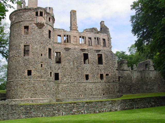
Huntly ( gd, Srath Bhalgaidh or ''Hunndaidh'') is a town in Aberdeenshire, Scotland, formerly known as Milton of Strathbogie or simply Strathbogie. It had a population of 4,460 in 2004 and is the site of Huntly Castle. Its neighbouring settlements include Keith and Rothiemay. Both Huntly and the surrounding district of Gordon are named for a town and family that originated in the Border country. Huntly is the historic home of the Gordon Highlanders regiment which traditionally recruited throughout the North-East of Scotland. Huntly has a primary school (Gordon Primary) and a secondary school (The Gordon Schools) beside Huntly Castle. It is the home of the Deans bakers, which produce shortbread biscuits. In November 2007, Deans of Huntly opened their new visitor centre. Four of the owls from the local falconry centre starred in the Harry Potter films. History Settlement around the confluence of the Bogie and Deveron rivers dates back to the Neolithic period. Settlement rem ... [...More Info...] [...Related Items...] OR: [Wikipedia] [Google] [Baidu] |
Hill Fort
A hillfort is a type of earthwork used as a fortified refuge or defended settlement, located to exploit a rise in elevation for defensive advantage. They are typically European and of the Bronze Age or Iron Age. Some were used in the post-Roman period. The fortification usually follows the contours of a hill and consists of one or more lines of earthworks, with stockades or defensive walls, and external ditches. Hillforts developed in the Late Bronze and Early Iron Age, roughly the start of the first millennium BC, and were used in many Celtic areas of central and western Europe until the Roman conquest. Nomenclature The spellings "hill fort", "hill-fort" and "hillfort" are all used in the archaeological literature. The ''Monument Type Thesaurus'' published by the Forum on Information Standards in Heritage lists ''hillfort'' as the preferred term. They all refer to an elevated site with one or more ramparts made of earth, stone and/or wood, with an external ditch. M ... [...More Info...] [...Related Items...] OR: [Wikipedia] [Google] [Baidu] |


.jpg)


