|
Typhoon Agnes (1984)
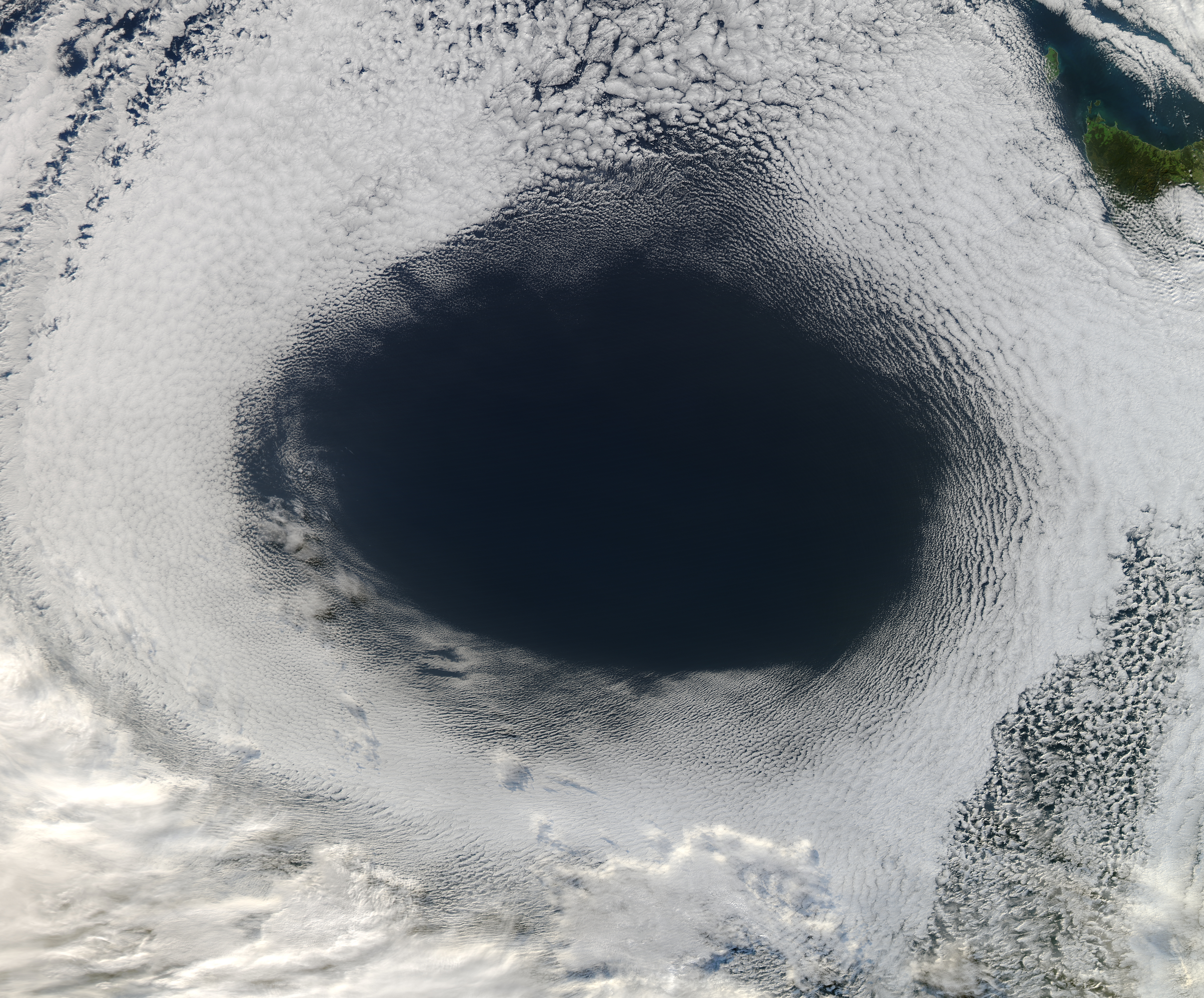
Typhoon Agnes, known in the Philippines as Typhoon Undang, was the fourth final tropical cyclone to affect the Philippines during the 1984 Pacific typhoon season. An area of disturbed weather developed near the equator and the Caroline Islands on October 28. Following an increase in organization, the cyclone was designated a tropical storm on October 31. After tracking northwest initially, Agnes turned west-northwest the next day, a course that the system would maintain for the rest of its lifetime. Agnes intensified into a typhoon on November 2, and on November 4, attained peak intensity. The storm then made landfall on Samar Island, part of the Philippines, at that intensity. The storm weakened over land, but re-intensified over the South China Sea; Agnes obtained a secondary peak intensity on November 6. The next day, Typhoon Agnes moved ashore Vietnam while still at typhoon intensity. The storm rapidly deteriorated over land and dissipated by November& ... [...More Info...] [...Related Items...] OR: [Wikipedia] [Google] [Baidu] |
Philippines
The Philippines (; fil, Pilipinas, links=no), officially the Republic of the Philippines ( fil, Republika ng Pilipinas, links=no), * bik, Republika kan Filipinas * ceb, Republika sa Pilipinas * cbk, República de Filipinas * hil, Republika sang Filipinas * ibg, Republika nat Filipinas * ilo, Republika ti Filipinas * ivv, Republika nu Filipinas * pam, Republika ning Filipinas * krj, Republika kang Pilipinas * mdh, Republika nu Pilipinas * mrw, Republika a Pilipinas * pag, Republika na Filipinas * xsb, Republika nin Pilipinas * sgd, Republika nan Pilipinas * tgl, Republika ng Pilipinas * tsg, Republika sin Pilipinas * war, Republika han Pilipinas * yka, Republika si Pilipinas In the recognized optional languages of the Philippines: * es, República de las Filipinas * ar, جمهورية الفلبين, Jumhūriyyat al-Filibbīn is an archipelagic country in Southeast Asia. It is situated in the western Pacific Ocean and consists of around 7,641 islands t ... [...More Info...] [...Related Items...] OR: [Wikipedia] [Google] [Baidu] |
Panay
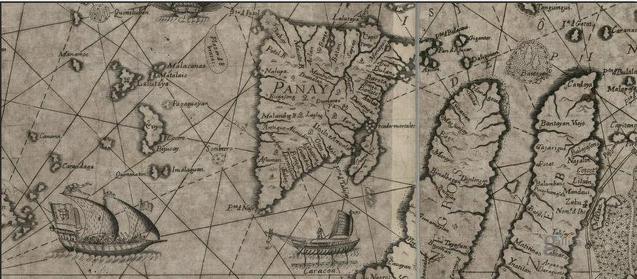
Panay is the sixth-largest and fourth-most populous island in the Philippines, with a total land area of and has a total population of 4,542,926 as of 2020 census. Panay comprises 4.4 percent of the entire population of the country. The City of Iloilo is its largest settlement with a total population of 457,626 inhabitants as of 2020 census. Panay is a triangular island, located in the western part of the Visayas. It is about across. It is divided into four Provinces of the Philippines, provinces: Aklan, Antique (province), Antique, Capiz and Iloilo, all in the Western Visayas Regions of the Philippines, Region. Just closely off the mid-southeastern coast lies the island-province of Guimaras. It is located southeast of the island of Mindoro and northwest of Negros Island, Negros across the Guimaras Strait. To the north and northeast is the Sibuyan Sea, Jintotolo Channel and the island-provinces of Romblon and Masbate; to the west and southwest is the Sulu Sea and the Palawan a ... [...More Info...] [...Related Items...] OR: [Wikipedia] [Google] [Baidu] |
Dvorak Technique
The Dvorak technique (developed between 1969 and 1984 by Vernon Dvorak) is a widely used system to estimate tropical cyclone intensity (which includes tropical depression, tropical storm, and hurricane/typhoon/intense tropical cyclone intensities) based solely on visible and infrared satellite images. Within the Dvorak satellite strength estimate for tropical cyclones, there are several visual patterns that a cyclone may take on which define the upper and lower bounds on its intensity. The primary patterns used are curved band pattern (T1.0-T4.5), shear pattern (T1.5–T3.5), central dense overcast (CDO) pattern (T2.5–T5.0), central cold cover (CCC) pattern, banding eye pattern (T4.0–T4.5), and eye pattern (T4.5–T8.0). Both the central dense overcast and embedded eye pattern use the size of the CDO. The CDO pattern intensities start at T2.5, equivalent to minimal tropical storm intensity (40 mph, 65 km/h). The shape of the central dense overcast is also con ... [...More Info...] [...Related Items...] OR: [Wikipedia] [Google] [Baidu] |
Tropical Cyclone Formation Alert
A Tropical Cyclone Formation Alert (TCFA) is a bulletin released by the U.S. Navy-operated Joint Typhoon Warning Center in Honolulu, Hawaii or the Fleet Weather Center in Norfolk, Virginia, warning of the possibility of a tropical cyclone forming from a tropical disturbance that has been monitored. Such alerts are generally always issued when it is fairly certain that a tropical cyclone will form and are not always released before cyclone genesis, particularly if the cyclone appears suddenly. The TCFA consists of several different checks that are performed by the on-duty meteorologist of the system and its surroundings. If the condition being checked is met, a certain number of points are given to the system. Parts of the TCFA Section 1 The first section of the TCFA contains information on the area of the alert as well as the estimated center of the circulation. The estimated maximum sustained winds are provided as well. Section 2 The second section generally contains more specif ... [...More Info...] [...Related Items...] OR: [Wikipedia] [Google] [Baidu] |
Regional Specialized Meteorological Center
A Regional Specialized Meteorological Centre (RSMC) is responsible for the distribution of information, advisories, and warnings regarding the specific program they have a part of, agreed by consensus at the World Meteorological Organization as part of the World Weather Watch. Environmental emergency response programme As a result of the poor communications between countries following the Chernobyl disaster in the Spring of 1986, the World Meteorological Organization (WMO) was requested by the International Atomic Energy Agency (IAEA) and other international organizations to arrange for early warning messages about nuclear accidents to be transmitted over the Global Telecommunications System (GTS). In addition some WMO member countries that lacked extensive forecasting capability requested that specialized pollutant transport and dispersion forecasts be provided during these emergencies. As a result, during 1989 Meteo-France (MF), Environment Canada (EC) and the United Kingdom's M ... [...More Info...] [...Related Items...] OR: [Wikipedia] [Google] [Baidu] |
Japan Meteorological Agency
The , abbreviated JMA, is an agency of the Ministry of Land, Infrastructure, Transport and Tourism. It is charged with gathering and providing results for the public in Japan that are obtained from data based on daily scientific observation and research into natural phenomena in the fields of meteorology, hydrology, seismology and volcanology, among other related scientific fields. Its headquarters is located in Minato, Tokyo. JMA is responsible for gathering and reporting weather data and forecasts for the general public, as well as providing aviation and marine weather. JMA other responsibilities include issuing warnings for volcanic eruptions, and the nationwide issuance of earthquake warnings of the Earthquake Early Warning (EEW) system. JMA is also designated one of the Regional Specialized Meteorological Centers of the World Meteorological Organization (WMO). It is responsible for forecasting, naming, and distributing warnings for tropical cyclones in the Northwestern ... [...More Info...] [...Related Items...] OR: [Wikipedia] [Google] [Baidu] |
Joint Typhoon Warning Center
The Joint typhoon Warning Center (JTWC) is a joint United States Navy – United States Air Force command in Pearl Harbor, Hawaii. The JTWC is responsible for the issuing of tropical cyclone warnings in the North-West Pacific Ocean, South Pacific Ocean, and Indian Ocean for all branches of the U.S. Department of Defense and other U.S. government agencies. Their warnings are intended for the protection of primarily military ships and aircraft as well as military installations jointly operated with other countries around the world. Its U.S. Navy components are aligned with the Naval Meteorology and Oceanography Command. History The origins of the Joint Typhoon Warning Center (JTWC) can be traced back to June 1945, when the Fleet Weather Center/Typhoon Tracking Center was established on the island of Guam, after multiple typhoons, including Typhoon Cobra of December 1944 and Typhoon Connie in June 1945, had caused a significant loss of men and ships. At this time the center ... [...More Info...] [...Related Items...] OR: [Wikipedia] [Google] [Baidu] |
Anticyclone
An anticyclone is a weather phenomenon defined as a large-scale circulation of winds around a central region of high atmospheric pressure, clockwise in the Northern Hemisphere and counterclockwise in the Southern Hemisphere as viewed from above (opposite to a cyclone). Effects of surface-based anticyclones include clearing skies as well as cooler, drier air. Fog can also form overnight within a region of higher pressure. Mid-tropospheric systems, such as the subtropical ridge, deflect tropical cyclones around their periphery and cause a temperature inversion inhibiting free convection near their center, building up surface-based haze under their base. Anticyclones aloft can form within warm-core lows such as tropical cyclones, due to descending cool air from the backside of upper troughs such as polar highs, or from large-scale sinking such as a subtropical ridge. The evolution of an anticyclone depends upon variables such as its size, intensity, and extent of moist con ... [...More Info...] [...Related Items...] OR: [Wikipedia] [Google] [Baidu] |
Monsoon Trough
The monsoon trough is a portion of the Intertropical Convergence Zone in the Western Pacific,Bin WangThe Asian Monsoon.Retrieved 2008-05-03. as depicted by a line on a weather map showing the locations of minimum sea level pressure, and as such, is a convergence zone between the wind patterns of the southern and northern hemispheres. Westerly monsoon winds lie in its equatorward portion while easterly trade winds exist poleward of the trough. Right along its axis, heavy rains can be found which usher in the peak of a location's respective rainy season. As it passes poleward of a location, hot and dry conditions develop. The monsoon trough plays a role in creating many of the world's rainforests. The term ''monsoon trough'' is most commonly used in monsoonal regions of the Western Pacific such as Asia and Australia. The migration of the ITCZ/monsoon trough into a landmass heralds the beginning of the annual rainy season during summer months. Depressions and tropical cyclones ofte ... [...More Info...] [...Related Items...] OR: [Wikipedia] [Google] [Baidu] |
149th Meridian East
The meridian 149° east of Greenwich is a line of longitude that extends from the North Pole across the Arctic Ocean, Asia, the Pacific Ocean, Australasia, the Southern Ocean, and Antarctica to the South Pole. The 149th meridian east forms a great circle with the 31st meridian west. From Pole to Pole Starting at the North Pole and heading south to the South Pole The South Pole, also known as the Geographic South Pole, Terrestrial South Pole or 90th Parallel South, is one of the two points where Earth's axis of rotation intersects its surface. It is the southernmost point on Earth and lies antipod ..., the 149th meridian east passes through: : See also * 148th meridian east * 150th meridian east {{geographical coordinates, state=collapsed e149 meridian east ... [...More Info...] [...Related Items...] OR: [Wikipedia] [Google] [Baidu] |
Low Pressure Area
In meteorology, a low-pressure area, low area or low is a region where the atmospheric pressure is lower than that of surrounding locations. Low-pressure areas are commonly associated with inclement weather (such as cloudy, windy, with possible rain or storms), while high-pressure areas are associated with lighter winds and clear skies. Winds circle anti-clockwise around lows in the northern hemisphere, and clockwise in the southern hemisphere, due to opposing Coriolis forces. Low-pressure systems form under areas of wind divergence that occur in the upper levels of the atmosphere (aloft). The formation process of a low-pressure area is known as cyclogenesis. In meteorology, atmospheric divergence aloft occurs in two kinds of places: * The first is in the area on the east side of upper troughs, which form half of a Rossby wave within the Westerlies (a trough with large wavelength that extends through the troposphere). * A second is an area where wind divergence aloft occurs a ... [...More Info...] [...Related Items...] OR: [Wikipedia] [Google] [Baidu] |


