|
Tuxertal
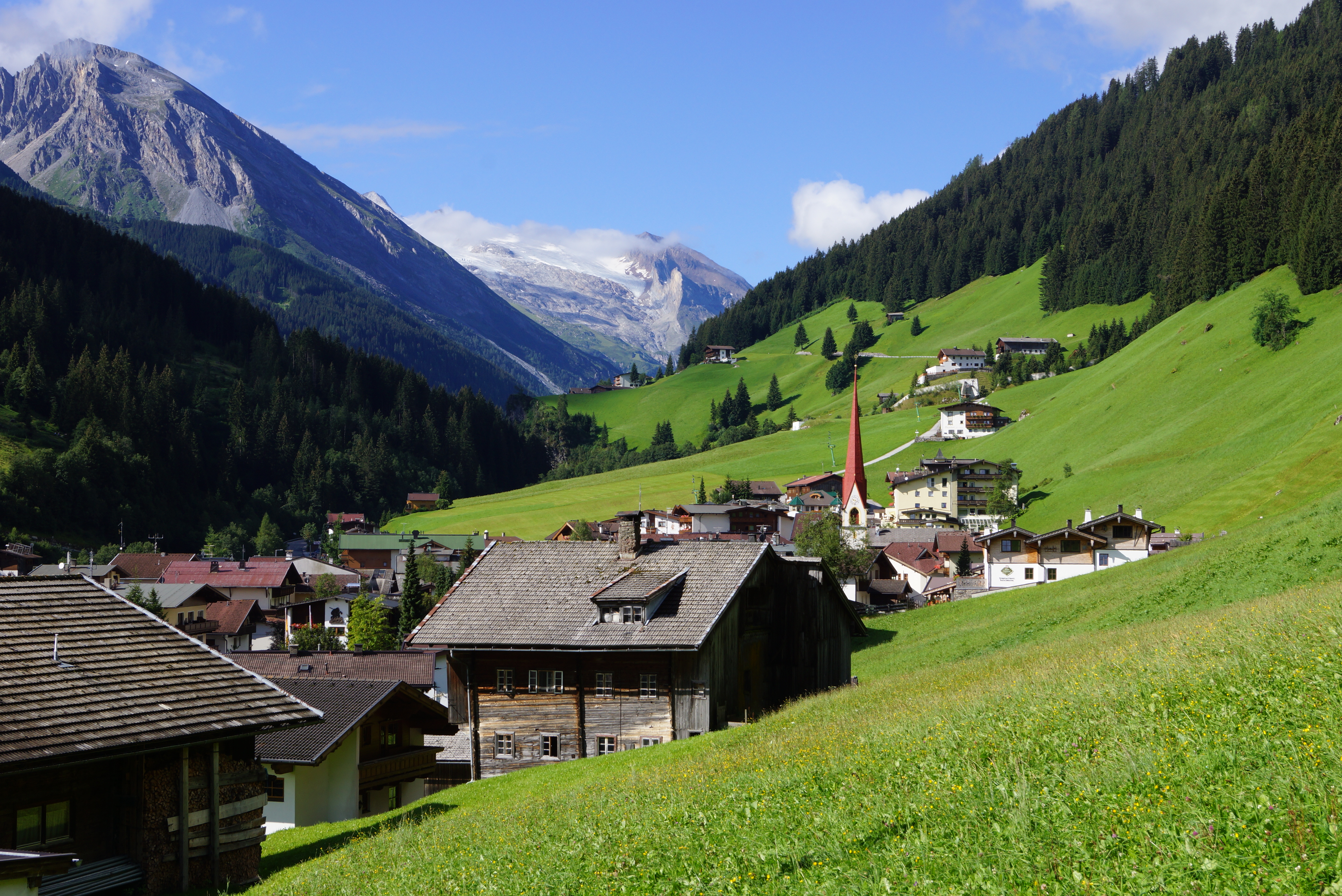
The Tuxertal is a valley located in Tyrol, Austria. A side valley of the Zillertal, from which it branches at Mayrhofen, the Tuxertal is about 13 km long and accessible on the Tuxer Straße (Tux Road). From Mayrhofen () to Hintertux (1500 m) in the municipality of Tux, the village that gives the valley its name, there is a height difference of about 850 m. The valley ends at Hintertux and the Hintertux Glacier. The Tuxbach, which rises near Hintertux, flows as far as Mayrhofen where it empties into the River Ziller. The five main settlements in the Tuxertal are (from the head of the valley): Hintertux (1,500 m), Madseit (1,385 m), Juns (1360 m), Tux (former Lanersbach) (1,300 m), Vorderlanersbach (1,300 m) and the parish of Finkenberg Finkenberg is a municipality in the Schwaz district in the Austrian state of Tyrol. Geography Finkenberg lies about 3 km southwest of Mayrhofen at the entrance to the Tuxer valley. Sightseeing * Garnet C ... [...More Info...] [...Related Items...] OR: [Wikipedia] [Google] [Baidu] |
Tux (Tirol)
Tux is a municipality in the Schwaz district in the Austrian state of Tyrol. Geography The parish of Tux covers the higher and largest part of the Tuxertal, a side valley of the Zillertal that branches off at Mayrhofen. The territory of the parish extends to the glaciated peak of Olperer (3,476 m) and the 2,338 m high saddle of the Tuxer Joch, a crossing between the Zillertal and Wipptal valleys that was heavily used even in the protohistoric period. Other prominent peaks within the municipality are the 3,288 m high Gefrorene Wand Spitze and the 3,231 m high Hoher Riffler. The highest farmsteads lie at a height of 1,630 m. Tux consists of the five villages of Tux-Vorderlanersbach (former Vorderlanersbach), Tux-Lanersbach (former Lanersbach), Juns, Madseit, and Hintertux. On 25 January 2005 the state government renamed Lanersbach to Tux-Lanersbach and Vorderlanersbach to Tux-Vorderlanersbach because, although the municipality as a whole was called Tux, th ... [...More Info...] [...Related Items...] OR: [Wikipedia] [Google] [Baidu] |
Lanersbach
Tux is a municipality in the Schwaz district in the Austrian state of Tyrol. Geography The parish of Tux covers the higher and largest part of the Tuxertal, a side valley of the Zillertal that branches off at Mayrhofen. The territory of the parish extends to the glaciated peak of Olperer (3,476 m) and the 2,338 m high saddle of the Tuxer Joch, a crossing between the Zillertal and Wipptal valleys that was heavily used even in the protohistoric period. Other prominent peaks within the municipality are the 3,288 m high Gefrorene Wand Spitze and the 3,231 m high Hoher Riffler. The highest farmsteads lie at a height of 1,630 m. Tux consists of the five villages of Tux-Vorderlanersbach (former Vorderlanersbach), Tux-Lanersbach (former Lanersbach), Juns, Madseit, and Hintertux. On 25 January 2005 the state government renamed Lanersbach to Tux-Lanersbach and Vorderlanersbach to Tux-Vorderlanersbach because, although the municipality as a whole was called Tux, th ... [...More Info...] [...Related Items...] OR: [Wikipedia] [Google] [Baidu] |
Zillertal
The Ziller Valley (german: Zillertal) is a valley in Tyrol, Austria that is drained by the Ziller River. It is the widest valley south of the Inn Valley (german: Inntal) and lends its name to the Zillertal Alps, the strongly glaciated section of the Alps in which it lies. The Tux Alps lie to its west, while the lower grass peaks of the Kitzbühel Alps are found to the east. The Ziller Valley is one of the valley areas in Tyrol most visited by tourists. Its largest settlement is Mayrhofen. Geography The Ziller Valley branches from the Inn trench near Jenbach, about 40 km northeast of Innsbruck, running mostly in a north–south direction. The Ziller Valley proper stretches from the village of Strass to Mayrhofen, where it separates into four smaller valleys, the Tux valley and the sparsely settled, so-called ''Gründe'' – Zamsergrund, Zillergrund and Stilluppgrund. Along the way, two more ''Gründe'' and the Gerlos valley, which leads to the Gerlos Pass and into Salzburg ... [...More Info...] [...Related Items...] OR: [Wikipedia] [Google] [Baidu] |
Hintertux Glacier
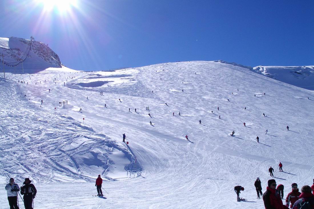
The Hintertux Glacier (german: Hintertuxer Gletscher) is the tourist name for the glaciers of the Gefrorene-Wand-Kees, also called the Tuxer Ferner, and the nearby Riepenkees at the top of the Tuxertal, a side valley of the Zillertal in the Austrian state of Tyrol. Both glaciers are accessed by gondola and chair lifts and is one of only two ski resorts in the world offering skiing 365 days a year (the other being Zermatt in Switzerland). At its highest point the ski region reaches a height of in the saddle between the peaks of the Gefrorene-Wand-Spitzen. Hintertux glacier is one of the most popular glaciers in Austria. It is open all year round with skiing in the winter, and hiking activities in the summer. Ice The ice of the Hintertux Glacier is up to thick at its deepest point. It has a length of about , but this varies annually by up to . As a result, the lifts have to be moved several times a year so that the masts remain vertical. The glacier contains up to about 190 mi ... [...More Info...] [...Related Items...] OR: [Wikipedia] [Google] [Baidu] |
Tux Cattle
The Tux-Zillertal, german: Tux-Zillertaler, italic=no, is an endangered Austrian breed of domestic cattle. It was created in 1982 when two similar Alpine breeds, the Tux and the Zillertal, were merged. The two names derive from those of the municipality of Tux in the Tuxertal, and of the neighbouring Zillertal, both in the Tirol region of Austria. The Tux-Zillertal may derive from the Swiss Hérens breed. Like the Hérens, it was long selected for the fighting ability of the cows, at the expense of productive characteristics. History The Tux-Zillertaler breed was created in 1982 by merging the remaining populations of the two similar Alpine breeds, the Tux and the Zillertal. Both breeds are similar to the Hérens breed of Switzerland, and are sometimes thought to have derived from it. The Tux breed was formerly common in Tyrol and in other parts of Austria. Today it is kept mainly in the Zillertal. In 1930 there were some 4500 head. By 1970 the number had fallen to 30, and s ... [...More Info...] [...Related Items...] OR: [Wikipedia] [Google] [Baidu] |
Tyrol (state)
Tyrol (; german: Tirol ; it, Tirolo) is a States of Austria, state (''Land'') in western Austria. It comprises the Austrian part of the historical County of Tyrol, Princely County of Tyrol. It is a constituent part of the present-day Euroregion Tyrol–South Tyrol–Trentino (together with South Tyrol and Trentino in Italy). The capital of Tyrol is Innsbruck. Geography The state of Tyrol is separated into two parts, divided by a strip. The larger territory is called North Tyrol (''Nordtirol'') and the smaller area is called East Tyrol (''Osttirol''). The neighbouring Austrian state of Salzburg (state), Salzburg stands to the east, while on the south Tyrol has a border with the Italy, Italian province of South Tyrol (Trentino-Alto Adige/Südtirol) which was part of the Austro-Hungarian Empire before the First World War. With a land area of , Tyrol is the third-largest state in Austria. Tyrol shares its borders with the federal state of Salzburg in the east and Vorarlberg in th ... [...More Info...] [...Related Items...] OR: [Wikipedia] [Google] [Baidu] |
Austria
Austria, , bar, Östareich officially the Republic of Austria, is a country in the southern part of Central Europe, lying in the Eastern Alps. It is a federation of nine states, one of which is the capital, Vienna, the most populous city and state. A landlocked country, Austria is bordered by Germany to the northwest, the Czech Republic to the north, Slovakia to the northeast, Hungary to the east, Slovenia and Italy to the south, and Switzerland and Liechtenstein to the west. The country occupies an area of and has a population of 9 million. Austria emerged from the remnants of the Eastern and Hungarian March at the end of the first millennium. Originally a margraviate of Bavaria, it developed into a duchy of the Holy Roman Empire in 1156 and was later made an archduchy in 1453. In the 16th century, Vienna began serving as the empire's administrative capital and Austria thus became the heartland of the Habsburg monarchy. After the dissolution of the H ... [...More Info...] [...Related Items...] OR: [Wikipedia] [Google] [Baidu] |
Side Valley
Side valleys and tributary valleys are valleys whose brooks or rivers flow into greater ones. Upstream, the valleys can be classified in an increasing order which is equivalent to the usual orographic order: the tributaries are ordered from those nearest to the source of the river to those nearest to the mouth of the river. A confluence is where two or more tributaries or rivers flow together. Orographic order (e.g. Humber) In the orographic classification (order of rivers) the tributary river has order ''n+1'', if ''n'' describes the primary (or main) river. A river which flows directly into the ocean (e.g. the English rivers Thames or Humber) has the orographic order n=1, the River Ouse n=2, the Wharfe n=3 and so on. Geomorphology The term "side valley" is used for ''higher order valleys'' near mountains (example above: the Pennines), as opposed to lower valleys that do not have a strong relief. This is because the " main stem river" (into which the secondary river flo ... [...More Info...] [...Related Items...] OR: [Wikipedia] [Google] [Baidu] |
Mayrhofen
Mayrhofen is a town in the Zillertal (Ziller river valley) in the Austrian state of Tyrol. It is located approximately an hour from the Tyrolean capital city of Innsbruck. Population Tourism The town offers a variety of summer and winter sports including skiing, hiking, mountain biking and paragliding. Mayrhofen is situated near the Hintertux glacier, which, at above sea level, is above the snowline. Skiing is available all year round here. Mayrhofen sits between the Penken and the Ahorn mountains which provide ski runs in the winter and mountain biking, hiking and paragliding in the summer. The Ahorn offers mainly easy and intermediate runs, but also has a long, steep black run (formerly red) which was once on the World Cup Downhill circuit but was removed as it was deemed too dangerous. The Penken mountain offers Austria's steepest piste, named Harakiri, as well as a large range of ski runs at different levels of difficulty. It is connected by lifts with the villages of Fink ... [...More Info...] [...Related Items...] OR: [Wikipedia] [Google] [Baidu] |
Ziller
The Ziller () is a right tributary to the Inn, in the Zillertal in Tyrol, Austria. It is long, and its basin area is . It springs from the ridge of the Zillertal Alps, and feeds the Zillergründl Dam. In Mayrhofen it receives the Zemmbach (that in turn receives the Tuxbach. By Zell am Ziller it receives the Gerlosbach, before it flows into the Inn by Strass im Zillertal. For historical reasons, the Ziller—first mentioned in 927 as ''Zilare''—for most of its course makes up the border between the Diocese of Innsbruck on the west and the Archdiocese of Salzburg on the east. The Ziller today shows a good presence of brown trout and rainbow trout The rainbow trout (''Oncorhynchus mykiss'') is a species of trout native to cold-water tributaries of the Pacific Ocean in Asia and North America. The steelhead (sometimes called "steelhead trout") is an anadromous (sea-run) form of the coasta ..., as well as grayling. It is up to wide and deep, and it has an average discha ... [...More Info...] [...Related Items...] OR: [Wikipedia] [Google] [Baidu] |
Finkenberg
Finkenberg is a Municipality (Austria), municipality in the Schwaz (district), Schwaz district in the Austrian state of Tyrol (state), Tyrol. Geography Finkenberg lies about 3 km southwest of Mayrhofen at the entrance to the Tuxer valley. Sightseeing * Garnet Chapel near the Penken. References Cities and towns in Schwaz District {{Tyrol-geo-stub ... [...More Info...] [...Related Items...] OR: [Wikipedia] [Google] [Baidu] |


