|
Tunceli Province
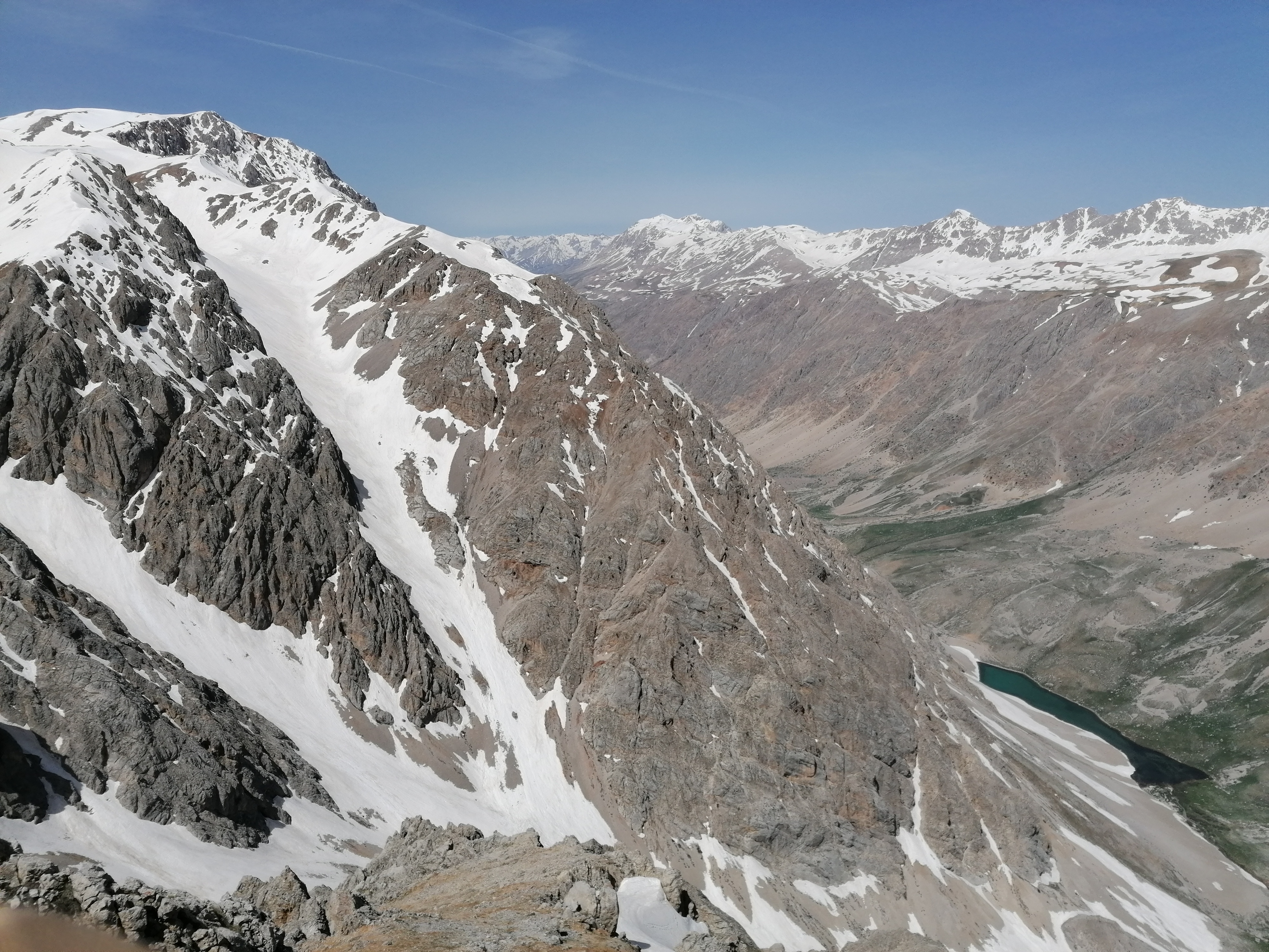
Tunceli Province ( tr, Tunceli ili, ku, Parêzgeha Dêrsimê, Zazaki: ), formerly Dersim Province, is located in the Eastern Anatolia region of Turkey. The least densely-populated province in Turkey, it was originally named ''Dersim Province'' (''Dersim vilayeti''), then demoted to a district (''Dersim kazası'') and incorporated into Elazığ Province in 1926. The province is considered part of Turkish Kurdistan and has a Kurdish majority. Moreover, it is the only province in Turkey with an Alevi majority. Geography The adjacent provinces are Erzincan to the north and west, Elazığ to the south, and Bingöl to the east. The province covers an area of and has a population of 76,699. Tunceli is traversed by the northeasterly line of equal latitude and longitude. The Munzur Valley National Park is also situated in the province. Tunceli Province is a plateau characterized by its high, thickly forested mountain ranges. The historical region of Dersim, which largely corre ... [...More Info...] [...Related Items...] OR: [Wikipedia] [Google] [Baidu] |
Provinces Of Turkey
Turkey is divided into 81 provinces ( tr, il). Each province is divided into a number of districts (). Each provincial government is seated in the central district (). For non- metropolitan municipality designated provinces, the central district bears the name of the province (e.g. the city/district of Rize is the central district of Rize Province Rize Province ( tr, Rize ili) is a province of northeast Turkey, on the eastern Black Sea coast between Trabzon and Artvin. The province of Erzurum is to the south. It was formerly known as Lazistan, the designation of the term of Lazistan was o ...). Each province is administered by an appointed governor () from the Ministry of the Interior (Turkey), Ministry of the Interior. List of provinces Below is a list of the 81 provinces of Turkey, sorted according to their license plate codes. Initially, the order of the codes matched the alphabetical order of the province names. After Zonguldak (code 67), the ordering is not alphab ... [...More Info...] [...Related Items...] OR: [Wikipedia] [Google] [Baidu] |
Agathangelos
Agathangelos (in xcl, Ագաթանգեղոս Agatʿangełos, in Greek "bearer of good news" or angel, 5th century AD ) is the pseudonym of the author of a life of the first apostle of Armenia, Gregory the Illuminator, who died about 332. He claims to be a secretary of Tiridates III, King of Armenia in the early 4th century, but the life was not written before the 5th century. It purports to exhibit the deeds and discourses of Gregory, and has reached us in Armenian, Greek, Georgian, Syriac, Ethiopic, Latin and Arabic. The text of this history has been considerably altered, but it has always been in high favor with the Armenians. Von Gutschmid maintains that the unknown author made use of a genuine life of St. Gregory, also of a history of his martyrdom and of that of Saint Rhipsime and her companions. Historical facts are intermingled in this life with legendary or uncertain additions, and the whole is woven into a certain unity by the narrator, who may have assumed his si ... [...More Info...] [...Related Items...] OR: [Wikipedia] [Google] [Baidu] |
Ptolemy
Claudius Ptolemy (; grc-gre, Πτολεμαῖος, ; la, Claudius Ptolemaeus; AD) was a mathematician, astronomer, astrologer, geographer, and music theorist, who wrote about a dozen scientific treatises, three of which were of importance to later Byzantine, Islamic, and Western European science. The first is the astronomical treatise now known as the '' Almagest'', although it was originally entitled the ''Mathēmatikē Syntaxis'' or ''Mathematical Treatise'', and later known as ''The Greatest Treatise''. The second is the ''Geography'', which is a thorough discussion on maps and the geographic knowledge of the Greco-Roman world. The third is the astrological treatise in which he attempted to adapt horoscopic astrology to the Aristotelian natural philosophy of his day. This is sometimes known as the ''Apotelesmatika'' (lit. "On the Effects") but more commonly known as the '' Tetrábiblos'', from the Koine Greek meaning "Four Books", or by its Latin equivalent ''Quadrip ... [...More Info...] [...Related Items...] OR: [Wikipedia] [Google] [Baidu] |
Daranali
Daranali or Daranaghi () was a district (''gavar'') of the province of Upper Armenia of Greater Armenia. It was located in the basin of the Western Euphrates (Karasu), near modern-day Kemah (Kamakh, Kamacha, Camachus), Turkey. Its center was the fortified settlement of Ani (not to be confused with the medieval Armenian capital), which was located on the right bank of the Western Euphrates, across from Kemah. It was famous for its fertile lands, plentiful waters and salt mines. It likely fell into the region of Acilisene (later Ekegheatsʻ) mentioned in Strabo's ''Geography''. It is first mentioned in Armenian sources by Faustus of Byzantium, who describes it and the district of Ekegheatsʻ as the property of Gregory the Illuminator's family. Daranali is most famous for having contained the burial-place of the Arsacid Armenian kings at Ani. It was also a major religious center in pagan times, as it was home to a temple to Aramazd at Ani and a temple to Mihr at Bagayarichʻ bui ... [...More Info...] [...Related Items...] OR: [Wikipedia] [Google] [Baidu] |
Pliny The Elder
Gaius Plinius Secundus (AD 23/2479), called Pliny the Elder (), was a Roman author, naturalist and natural philosopher, and naval and army commander of the early Roman Empire, and a friend of the emperor Vespasian. He wrote the encyclopedic ''Naturalis Historia'' (''Natural History''), which became an editorial model for encyclopedias. He spent most of his spare time studying, writing, and investigating natural and geographic phenomena in the field. His nephew, Pliny the Younger, wrote of him in a letter to the historian Tacitus: Among Pliny's greatest works was the twenty-volume work ''Bella Germaniae'' ("The History of the German Wars"), which is no longer extant. ''Bella Germaniae'', which began where Aufidius Bassus' ''Libri Belli Germanici'' ("The War with the Germans") left off, was used as a source by other prominent Roman historians, including Plutarch, Tacitus and Suetonius. Tacitus—who many scholars agree had never travelled in Germania—used ''Bella Germani ... [...More Info...] [...Related Items...] OR: [Wikipedia] [Google] [Baidu] |
Kingdom Of Armenia (antiquity)
The Kingdom of Armenia, also the Kingdom of Greater Armenia, or simply Greater Armenia ( hy, Մեծ Հայք '; la, Armenia Maior), sometimes referred to as the Armenian Empire, was a monarchy in the Ancient Near East which existed from 331 BC to 428 AD. Its history is divided into the successive reigns of three royal dynasties: Orontid (331 BC–200 BC), Artaxiad (189 BC–12 AD) and Arsacid (52–428). The root of the kingdom lies in one of the satrapies of the Achaemenid Empire of Persia called Armenia (Satrapy of Armenia), which was formed from the territory of the Kingdom of Ararat (860 BC–590 BC) after it was conquered by the Median Empire in 590 BC. The satrapy became a kingdom in 321 BC during the reign of the Orontid dynasty after the conquest of Persia by Alexander the Great, which was then incorporated as one of the Hellenistic kingdoms of the Seleucid Empire. Under the Seleucid Empire (312–63 BC), the Armenian throne was divided in two—Armenia Maior and ... [...More Info...] [...Related Items...] OR: [Wikipedia] [Google] [Baidu] |
Euphrates
The Euphrates () is the longest and one of the most historically important rivers of Western Asia. Tigris–Euphrates river system, Together with the Tigris, it is one of the two defining rivers of Mesopotamia ( ''the land between the rivers''). Originating in Turkey, the Euphrates flows through Syria and Iraq to join the Tigris in the Shatt al-Arab, which empties into the Persian Gulf. Etymology The Ancient Greek form ''Euphrátēs'' ( grc, Εὐφράτης, as if from Greek εὖ "good" and φράζω "I announce or declare") was adapted from Old Persian 𐎢𐎳𐎼𐎠𐎬𐎢 ''Ufrātu'', itself from Elamite language, Elamite 𒌑𒅁𒊏𒌅𒅖 ''ú-ip-ra-tu-iš''. The Elamite name is ultimately derived from a name spelt in cuneiform as 𒌓𒄒𒉣 , which read as Sumerian language, Sumerian is "Buranuna" and read as Akkadian language, Akkadian is "Purattu"; many cuneiform signs have a Sumerian pronunciation and an Akkadian pronunciation, taken from a Sumerian word a ... [...More Info...] [...Related Items...] OR: [Wikipedia] [Google] [Baidu] |
Murat River
The Murat River, also called Eastern Euphrates ( tr, Murat Nehri, , hy, Արածանի, translit=Aratsani), is a major source of the Euphrates River. The Ancient Greeks and Romans used to call the river ''Arsanias'' ( gr, Ἀρσανίας). It originates near Mount Ararat north of Lake Van, in Eastern Turkey, and flows westward for through mountainous area. Before the construction of the Keban Dam, the Murat River joined the Karasu River or Western Euphrates north of the dam site and north of the town of Keban. In Muş Province, the river is interrupted by the Alpaslan-1 Dam, which was completed in 2009. The Alpaslan-2 Dam was completed in 2021 and is located downstream of Alpaslan-1. The river merges into the reservoir of the Keban Dam, at one time Turkey's largest dam, which was completed in 1974 and provides electrical power. In Bingöl and Elazığ provinces, Kalehan Energy has four dams planned for the river: from upstream to downstream, the Upper Kaleköy Dam, Lower ... [...More Info...] [...Related Items...] OR: [Wikipedia] [Google] [Baidu] |
Karasu (Euphrates)
The Karasu (Turkish for 'black water') or Western Euphrates is a long river in eastern Turkey, one of the two sources of the Euphrates. It has a length of about 450 km. To the ancient Greeks the river was known as the (''Telebóas''). Course The river rises on the Dumlu Dağ in Erzurum Province, and drains the plains around the city of Erzurum. It is joined by the Serçeme River, then flows west through Erzincan Province, turning south, then west and receiving the tributary Tuzla Su. Between Erzincan and Kemah it is joined by the Gönye River and passes through a rocky gorge. Near the small town of Kemaliye it receives its last tributary, the Çaltı Çayı, before turning sharply southeast to flow through a deep canyon into the Keban Dam Lake on the Euphrates. Before construction of the Keban Dam the Karasu joined the Murat River 10 km above the dam site and 13 km above the town of Keban. History It is thought likely that the river Harpasos mentioned b ... [...More Info...] [...Related Items...] OR: [Wikipedia] [Google] [Baidu] |
Munzur Valley National Park
The Munzur Valley National Park ( tr, Munzur Vadisi Milli Parkı), established on December 21, 1971, is the largest and the most biodiverse national park in Turkey. It is located at the Munzur Valley of Munzur Mountain Range within Tunceli Province in eastern Anatolia. The Munzur Valley National Park, part of the Eastern Anatolian deciduous forests ecoregion, is one of the richest floristic areas of Anatolia. The national park was established to protect the region's wildlife and scenic beauty. The protected area is administered by the Directorate-General of Nature Protection and National Parks ( tr, Doğa Koruma ve Milli Parklar Genel Müdürlüğü) of the Ministry of Environment and Forest, although even outside of the administered area the landscape is very well preserved. A large part of this may be due to the Alevi inhabitants of the region, who respect nature as part of their religious beliefs. Geography The national park is situated between northwest from the city cent ... [...More Info...] [...Related Items...] OR: [Wikipedia] [Google] [Baidu] |


.png)

