|
Tully Cross
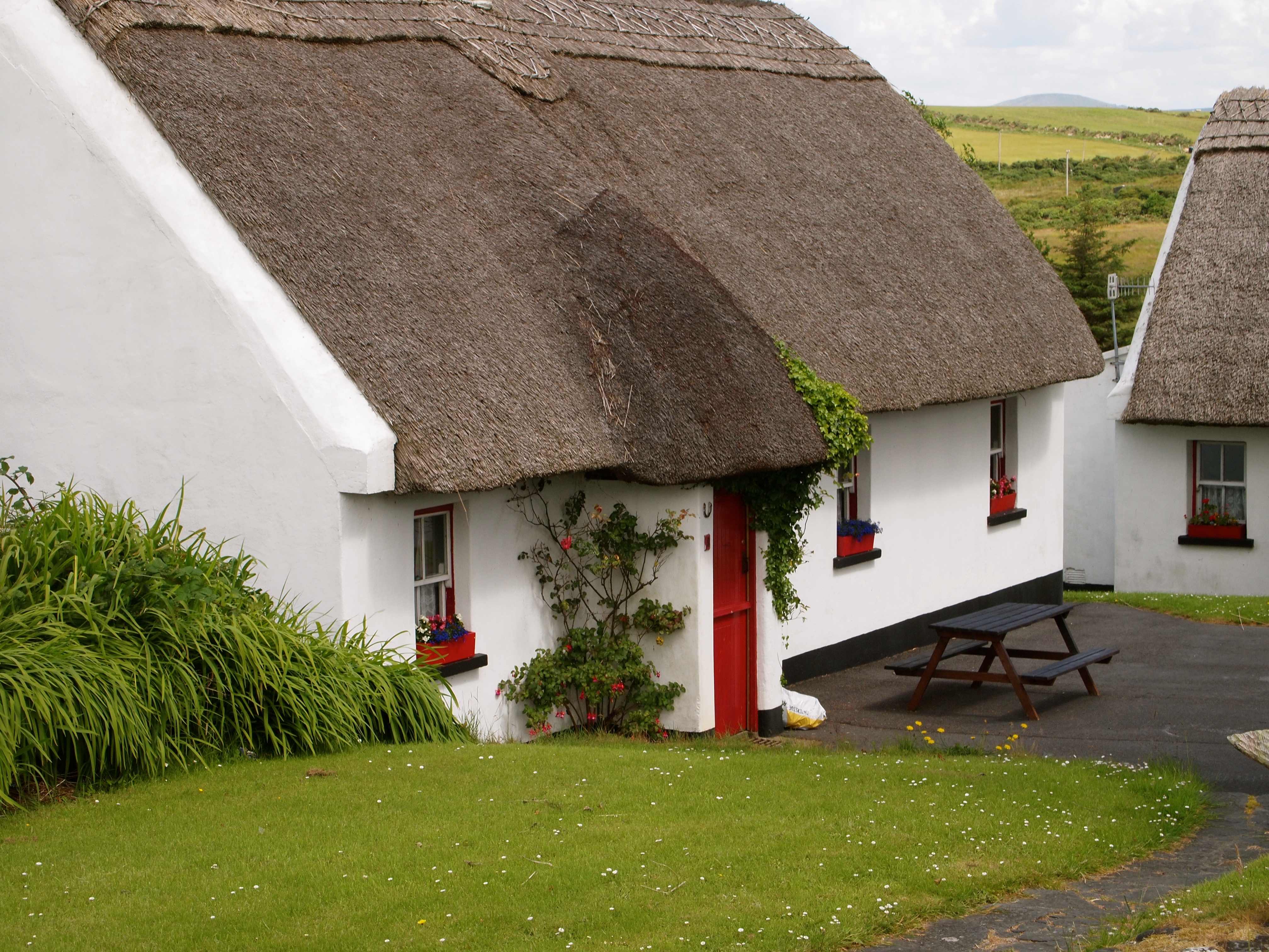
Tully Cross ( ga, Crois na Tulaí, "the cross on the hill") is a small village located on the Renvyle Peninsula in north-west Connemara, in County Galway, Ireland. It is actually situated in the townland of Gorteenclough. The village lies close to the sea and is on the Wild Atlantic Way coastal route. The village contains a Catholic church, Christ the King, as well as two pubs, a hotel, a credit union, a community centre (the Marian Hall) and nine thatched cottages. It is frequented by tourists and hosts the Connemara Mussel Festival, which takes place on the May Bank Holiday Weekend. It is less than a mile east of its sister village of Tully and 3 miles west of Letterfrack. The nearest town is Clifden, situated 13 miles to the south. Tully Cross is affiliated with Renvye GAA, Gráinne Mhaols and West Coast United FC. Church In the Church of Christ the King, there are three dark leaded glass windows (over the altar) which were designed by noted 20th-century stained-glass ... [...More Info...] [...Related Items...] OR: [Wikipedia] [Google] [Baidu] |
Tully Cross Thatched Cottage
Tully may refer to: People * Tully (surname), origins and history of the Tully surname in Ireland ** List of people with surname Tully * List of people with given name Tully * Marcus Tullius Cicero, or Cicero, a Roman philosopher, politician, lawyer and orator Places Australia * Tully (Parish), New South Wales, a civil parish of Yungnulgra County * Tully, Queensland, a town in the Cassowary Coast Region * Tully Falls, Queensland * Tully River, Queensland, Australia France * Tully, Somme, a commune in France Ireland *Tully, a civil parish in Dublin, Republic of Ireland *Tully, County Galway, a village on the Renvyle Peninsula * Tully, County Kildare, a civil parish in County Kildare, Republic of Ireland * Tully, County Offaly, a townland spanning Ardnurcher and Kilmanaghan civil parishes, barony of Kilcoursey, County Offaly, Republic of Ireland United Kingdom * Tully, County Fermanagh, a townland in County Fermanagh, Northern Ireland * Tully, County London ... [...More Info...] [...Related Items...] OR: [Wikipedia] [Google] [Baidu] |
Village
A village is a clustered human settlement or community, larger than a hamlet but smaller than a town (although the word is often used to describe both hamlets and smaller towns), with a population typically ranging from a few hundred to a few thousand. Though villages are often located in rural areas, the term urban village is also applied to certain urban neighborhoods. Villages are normally permanent, with fixed dwellings; however, transient villages can occur. Further, the dwellings of a village are fairly close to one another, not scattered broadly over the landscape, as a dispersed settlement. In the past, villages were a usual form of community for societies that practice subsistence agriculture, and also for some non-agricultural societies. In Great Britain, a hamlet earned the right to be called a village when it built a church. [...More Info...] [...Related Items...] OR: [Wikipedia] [Google] [Baidu] |
Renvyle
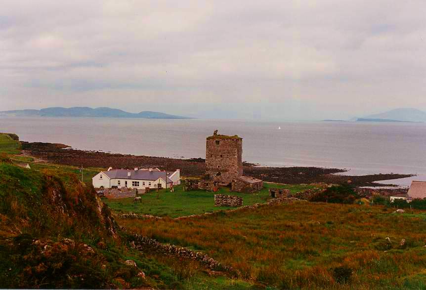
Renvyle or Rinvyle () is a peninsula and electoral division in North-West Connemara in County Galway, close to the border with County Mayo in Ireland. History The ruins of the castle of Grace O'Malley (''Gráinne Mhaol'') can be found on the peninsula's western fringe. Close by, in Cashleen, is the ruined medieval Church of the Seven Daughters which was named after the Seven Sisters of Renvyle who preached in the area. Geography Renvyle is surrounded on three sides by the Atlantic Ocean and by the Dawros river on the other side. It contains the villages of Tully and Tully Cross. Renvyle is situated in the parish of Ballinakill and historically was part of the barony of Ballynahinch. The villages of Leenane and Letterfrack are close by and Clifden is the nearest town, lying 12 miles (9 km) to the south. The peninsula is dominated by Letter Hill (also known as Tully Mountain) which is 356m high. The Twelve Bens Mountains are also visible, as is Mweelrea, the largest moun ... [...More Info...] [...Related Items...] OR: [Wikipedia] [Google] [Baidu] |
Connemara
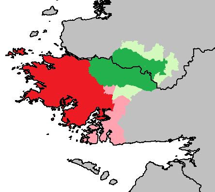
Connemara (; )( ga, Conamara ) is a region on the Atlantic coast of western County Galway, in the west of Ireland. The area has a strong association with traditional Irish culture and contains much of the Connacht Irish-speaking Gaeltacht, which is a key part of the identity of the region and is the largest Gaeltacht in the country. Historically, Connemara was part of the territory of Iar Connacht (West Connacht). Geographically, it has many mountains (notably the Twelve Bens), peninsulas, coves, islands and small lakes. Connemara National Park is in the northwest. It is mostly rural and its largest settlement is Clifden. Etymology "Connemara" derives from the tribal name , which designated a branch of the , an early tribal grouping that had a number of branches located in different parts of . Since this particular branch of the lived by the sea, they became known as the (sea in Irish is , genitive , hence "of the sea"). Definition One common definition of the area is that ... [...More Info...] [...Related Items...] OR: [Wikipedia] [Google] [Baidu] |
County Galway
"Righteousness and Justice" , anthem = () , image_map = Island of Ireland location map Galway.svg , map_caption = Location in Ireland , area_footnotes = , area_total_km2 = 6151 , area_rank = 2nd , seat_type = County town , seat = Galway , population_total = 276451 , population_density_km2 = auto , population_rank = 5th , population_as_of = 2022 , population_footnotes = , leader_title = Local authorities , leader_name = County Council and City Council , leader_title2 = Dáil constituency , leader_name2 = , leader_title3 = EP constituency , leader_name3 = Midlands–North-West , subdivision_type = Country , subdivision_name = Ireland , subdivision_type1 = Province , subdivision_name1 = Connacht , subdivisi ... [...More Info...] [...Related Items...] OR: [Wikipedia] [Google] [Baidu] |
Wild Atlantic Way
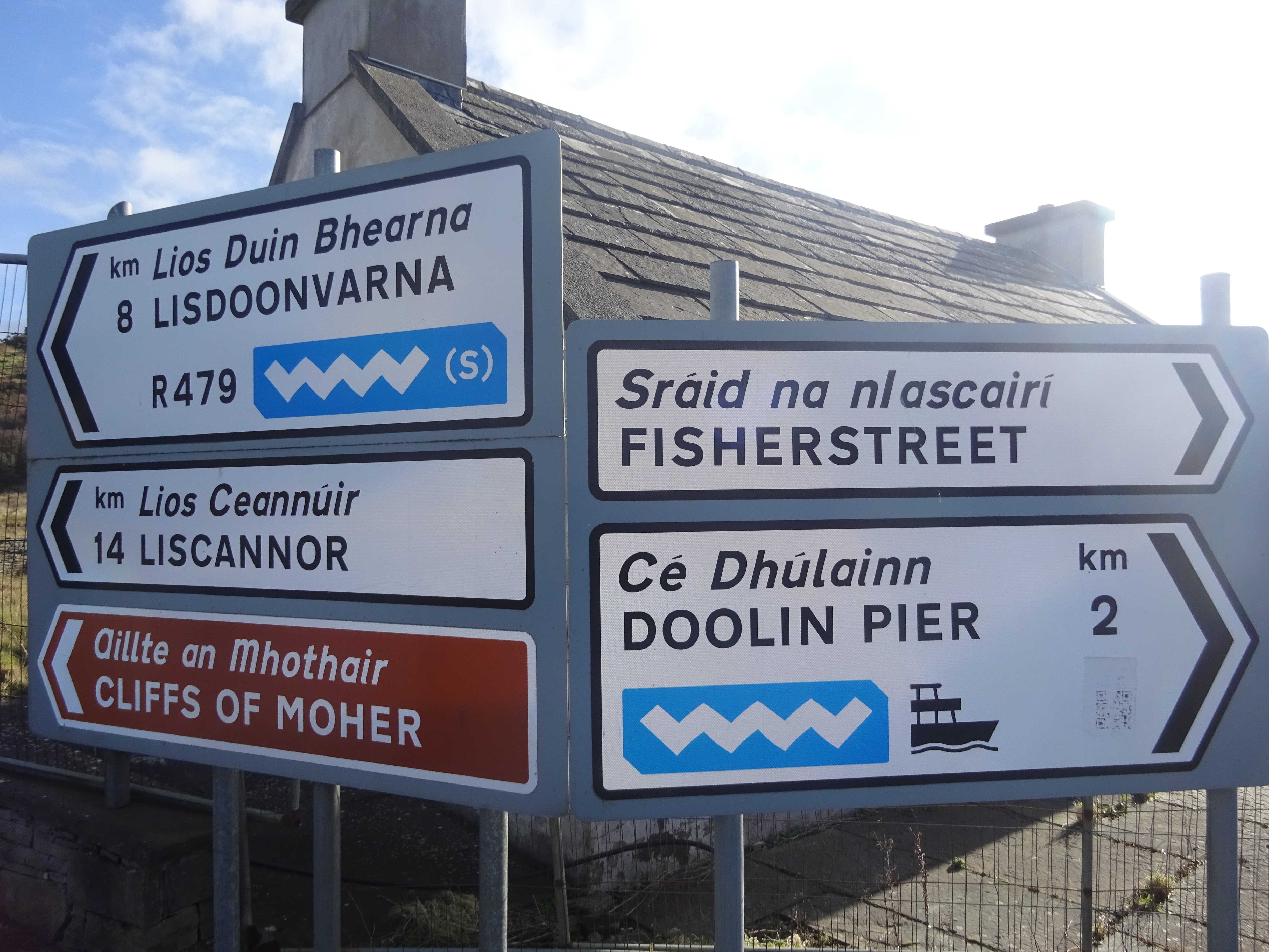
The Wild Atlantic Way ( ga, Slí an Atlantaigh Fhiáin) is a tourism trail on the west coast, and on parts of the north and south coasts, of Ireland. The 2,500 km (1,553 mile) driving route passes through nine counties and three provinces, stretching from County Donegal's Inishowen Peninsula in Ulster to Kinsale, County Cork, in Munster, on the Celtic Sea coast. Description The route is broken down into five sections: * County Donegal * County Donegal to County Mayo * County Mayo to County Clare * County Clare to County Kerry * County Kerry to County Cork Along the route, there are 157 discovery points, 1,000 attractions and more than 2,500 activities. The route was officially launched in 2014 by the Minister of State for Tourism and Sport, Michael Ring, T.D. Key points of interest North West - Donegal, Leitrim and Sligo * Malin Head, Ireland’s most northerly point * Lough Foyle * Lough Swilly * Isle of Doagh * Carrickabraghy Castle * Shrove * Fort ... [...More Info...] [...Related Items...] OR: [Wikipedia] [Google] [Baidu] |
View Just East Of Tully Cross (6047973050)
A view is a sight or prospect or the ability to see or be seen from a particular place. View, views or Views may also refer to: Common meanings * View (Buddhism), a charged interpretation of experience which intensely shapes and affects thought, sensation, and action * Graphical projection in a technical drawing or schematic ** Multiview orthographic projection, standardizing 2D images to represent a 3D object * Opinion, a belief about subjective matters * Page view, a visit to a World Wide Web page * Panorama, a wide-angle view * Scenic viewpoint, an elevated location where people can view scenery * World view, the fundamental cognitive orientation of an individual or society encompassing the entirety of the individual or society's knowledge and point-of-view Places * View, Kentucky, an unincorporated community in Crittenden County * View, Texas, an unincorporated community in Taylor County Arts, entertainment, and media Music * ''View'' (album), the 2003 debut album ... [...More Info...] [...Related Items...] OR: [Wikipedia] [Google] [Baidu] |
Bank Holiday
A bank holiday is a national public holiday in the United Kingdom, Republic of Ireland and the Crown Dependencies. The term refers to all public holidays in the United Kingdom, be they set out in statute, declared by royal proclamation or held by convention under common law. The term "bank holiday" refers to the fact that banking institutions typically close for business on such holidays, as they once used to do on certain Saint's days. List of current holidays Notes See also * List of holidays by country * Bank Holidays Act 1871 * Proposed St David's Day bank holiday Saint David's Day is currently not a bank holiday in Wales. Some Welsh politicians have proposed that St David's Day, a celebration of Welsh identity, observed on 1 March, be designated as a public holiday. Polls show the proposal to have majo ... References External links UK bank holidaysScotland Bank Holidays - Scottish Government* {{DEFAULTSORT:Bank Holiday British culture Irish ... [...More Info...] [...Related Items...] OR: [Wikipedia] [Google] [Baidu] |
Tully, County Galway
Tully ( ga, An Tulaigh, "the hill") is a small village on the Renvyle Peninsula in north-west Connemara, County Galway, Ireland. It is situated on the Wild Atlantic Way coastal route. Tully contains a post office, a hardware shop, a supermarket, a doctor's surgery, a pharmacy, a community centre, and a music house (Teach Ceoil), as well as a horse-riding centre. The village is a quarter of a mile from the sea and has views over the Atlantic Ocean. The Twelve Pins mountain range looms large over the area. The Renvyle House Hotel, former home of poet Oliver St. John Gogarty, lies a mile to the west. Tully's sister village, Tully Cross, is a mile to the east. The nearest town is Clifden, which is thirteen miles to the south. In 1881 the landowner Caroline Blake was in dispute with her tenants. She believed that her tenants were exaggerating the famine caused by crop failure. The Land League were instructing the population to refuse to pay a full rent to the landlord and punishi ... [...More Info...] [...Related Items...] OR: [Wikipedia] [Google] [Baidu] |
Letterfrack
Letterfrack or Letterfrac () is a small village in the Connemara area of County Galway, Ireland. It was founded by Quakers in the mid-19th century. The village is south-east of Renvyle peninsula and north-east of Clifden on Barnaderg Bay and lies at the head of Ballinakill harbour. Letterfrack contains the visitors centre for Connemara National Park. History James and Mary Ellis, a Quaker couple from Bradford in England, moved to Letterfrack, during the Great Famine. Ellis became the resident landlord in Letterfrack in 1849. As Quakers, the Ellises wanted to help with the post-famine relief effort. They leased nearly of rough land and set about farming it and planting it with woodland. They built a schoolhouse, housing for tradesmen, a shop, a dispensary, and a temperance hotel. In 1857 the property was sold to John Hall, a staunch Protestant, and supporter of the Irish Church Mission to Roman Catholics. The ICM used the building with the aim of converting Catholics to Pro ... [...More Info...] [...Related Items...] OR: [Wikipedia] [Google] [Baidu] |
Clifden
Clifden (, meaning "stepping stones") is a coastal town in County Galway, Ireland, in the region of Connemara, located on the Owenglin River where it flows into Clifden Bay. As the largest town in the region, it is often referred to as "the Capital of Connemara". Frequented by tourists, Clifden is linked to Galway city by the N59. History 19th century The town was founded at the start of the 19th century by John D'Arcy (1785–1839) who lived in Clifden Castle (built around 1818, now a ruin) west of Clifden. He had inherited the estate in 1804 when it was mostly inhabited by fishermen and farmers. The idea of establishing a town on the coast was first voiced by him in 1812. Bad communications and a lack of private capital prevented fast progress until the 1820s when the potato crop failed in 1821–22 and D'Arcy petitioned the government in Dublin for assistance. The engineer Alexander Nimmo was sent to the area in 1822. He constructed a quay at Clifden (finished in 1831) an ... [...More Info...] [...Related Items...] OR: [Wikipedia] [Google] [Baidu] |
South
South is one of the cardinal directions or compass points. The direction is the opposite of north and is perpendicular to both east and west. Etymology The word ''south'' comes from Old English ''sūþ'', from earlier Proto-Germanic ''*sunþaz'' ("south"), possibly related to the same Proto-Indo-European root that the word ''sun'' derived from. Some languages describe south in the same way, from the fact that it is the direction of the sun at noon (in the Northern Hemisphere), like Latin meridies 'noon, south' (from medius 'middle' + dies 'day', cf English meridional), while others describe south as the right-hand side of the rising sun, like Biblical Hebrew תֵּימָן teiman 'south' from יָמִין yamin 'right', Aramaic תַּימנַא taymna from יָמִין yamin 'right' and Syriac ܬܰܝܡܢܳܐ taymna from ܝܰܡܝܺܢܳܐ yamina (hence the name of Yemen, the land to the south/right of the Levant). Navigation By convention, the ''bottom or down-facing side'' of ... [...More Info...] [...Related Items...] OR: [Wikipedia] [Google] [Baidu] |


