|
Troy Park
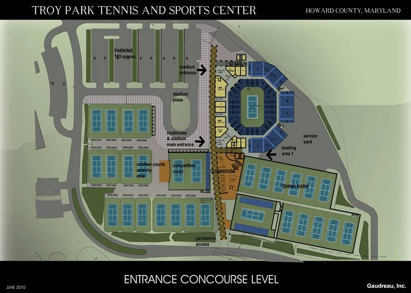
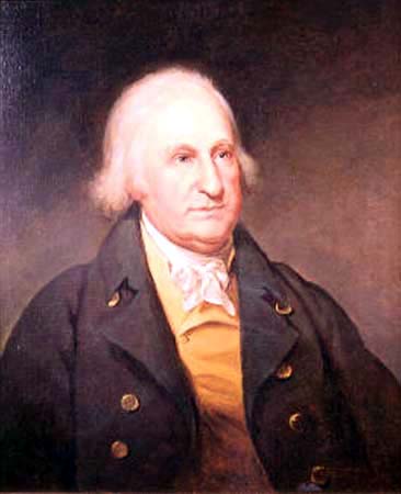
Troy Park is a regional park comprising 101 acres in Elkridge, Maryland. The park is located at 6500 Mansion Lane off Washington Boulevard, near the intersection of Maryland Route 100 and I-95. Troy Park currently features several athletic fields, a playground, and trails. Once completed, the park will include pathways, comfort stations, an indoor sports complex, a community center, and a newly renovated Troy Mansion. All phases of the park's construction are expected to be finished by 2018. History The lands of "Troy" were surveyed by Hon John Dorsey in 1694, where he moved in 1696 with 2 slaves. The property stayed in the family though his great-grandson Col. Thomas Dorsey (-1790) of the American Revolution whose estate sold it in 1808. Troy was inherited by Basil Dorsey in 1714, followed by Caleb Dorsey who reduced the land to 1016 acres which was split into two unequal parts in 1760 and given to Sarah Dorsey and Thomas Dorsey. Thomas Dorsey would use the root cellar as a me ... [...More Info...] [...Related Items...] OR: [Wikipedia] [Google] [Baidu] |
Elkridge, Maryland
Elkridge is an unincorporated community and census-designated place (CDP) in Howard County, Maryland, United States. The population was 15,593 at the 2010 census. Founded early in the 18th century, Elkridge is adjacent to two other counties, Anne Arundel and Baltimore. History Elkridge qualifies as the oldest settlement in its present county, when Howard was a part of Anne Arundel County. Its location on the Patapsco River was a key element in its growth. The Maryland General Assembly elected a law to erect a , forty-lot town at the pre-existing settlement of Elkridge Landing to be called "Jansen Town" in 1733. In 1738 an attempt to formalize the town failed with the death of the commissioners before passage. In 1750 a second attempt to formalize the town was attempted around the lands of Phillip Hammond. By comparison, Baltimore Town consisted of only 25 dwellings at that time. A third petition was filed in 1762. The settlement was founded as a place where planters, who each ... [...More Info...] [...Related Items...] OR: [Wikipedia] [Google] [Baidu] |
Howard County, Maryland
Howard County is located in the U.S. state of Maryland. As of the 2010 census, the population was 287,085. As of the 2020 census its population rose to 328,200. Its county seat is Ellicott City. Howard County is included in the Baltimore-Columbia-Towson, MD Metropolitan Statistical Area, which is also part of the larger Washington-Baltimore-Arlington, DC-MD-VA-WV-PA Combined Statistical Area. Recent south county development has led to some realignment towards the Washington, D.C. media and employment markets. The county is home to Columbia, a major planned community of approximately 100,000 founded in 1967. Howard County is frequently cited for its affluence, quality of life, and excellent schools. Its estimated 2016 median household income of $120,194 raised it to the second-highest median household income of any U.S. county. Many of the most affluent communities in the area, such as Clarksville, Dayton, Glenelg, Glenwood, and West Friendship, are located along the ... [...More Info...] [...Related Items...] OR: [Wikipedia] [Google] [Baidu] |
Maryland Route 100
Maryland Route 100 (MD 100) is a major east–west highway connecting U.S. Route 29 (US 29) in Ellicott City (just north of Columbia) and MD 177 (Mountain Road) in Pasadena. MD 100 also connects to Interstate 95 (I-95), US 1, the Baltimore–Washington Parkway (MD 295), and I-97. The highway connects Howard County to the west with Anne Arundel County and the Chesapeake Bay to the east. MD 100 also provides access to the Baltimore–Washington International Airport (BWI) and the Arundel Mills shopping mall. The eastern section of MD 100 in Anne Arundel County is known as the Paul T. Pitcher Memorial Highway. The name comes in dedication to Paul T. Pitcher, an Anne Arundel County executive, who originally conceived the highway. Route description The route begins as a six-lane divided freeway at US 29 near Ellicott City. There are then interchanges with MD 108, MD 104, Snowden River Parkway and MD 103. At the junction with I-95, the road narrows to four lanes. Th ... [...More Info...] [...Related Items...] OR: [Wikipedia] [Google] [Baidu] |
Interstate 95 In Maryland
Interstate 95 (I-95) is an Interstate Highway running along the East Coast of the United States from Miami, Florida, north to the Canadian border in Houlton, Maine. In Maryland, the route is a major highway that runs diagonally from southwest to northeast, entering from the District of Columbia and Virginia at the Woodrow Wilson Bridge, to Maryland's border with Delaware. It is the longest Interstate Highway within Maryland and is one of the most traveled Interstate Highways in the state, especially between Baltimore and Washington, D.C., despite alternate routes along the corridor, such as the Baltimore–Washington Parkway, U.S. Route 1 (US 1), and US 29. Portions of the highway, including the Fort McHenry Tunnel and the Millard E. Tydings Memorial Bridge, are tolled. From the Woodrow Wilson Bridge to the community of College Park, it follows a portion of the Capital Beltway, completed in 1964 and numbered as I-95 in 1977. Prior to 1977, the route was intended to go on a n ... [...More Info...] [...Related Items...] OR: [Wikipedia] [Google] [Baidu] |
Troy (Dorsey, Maryland)
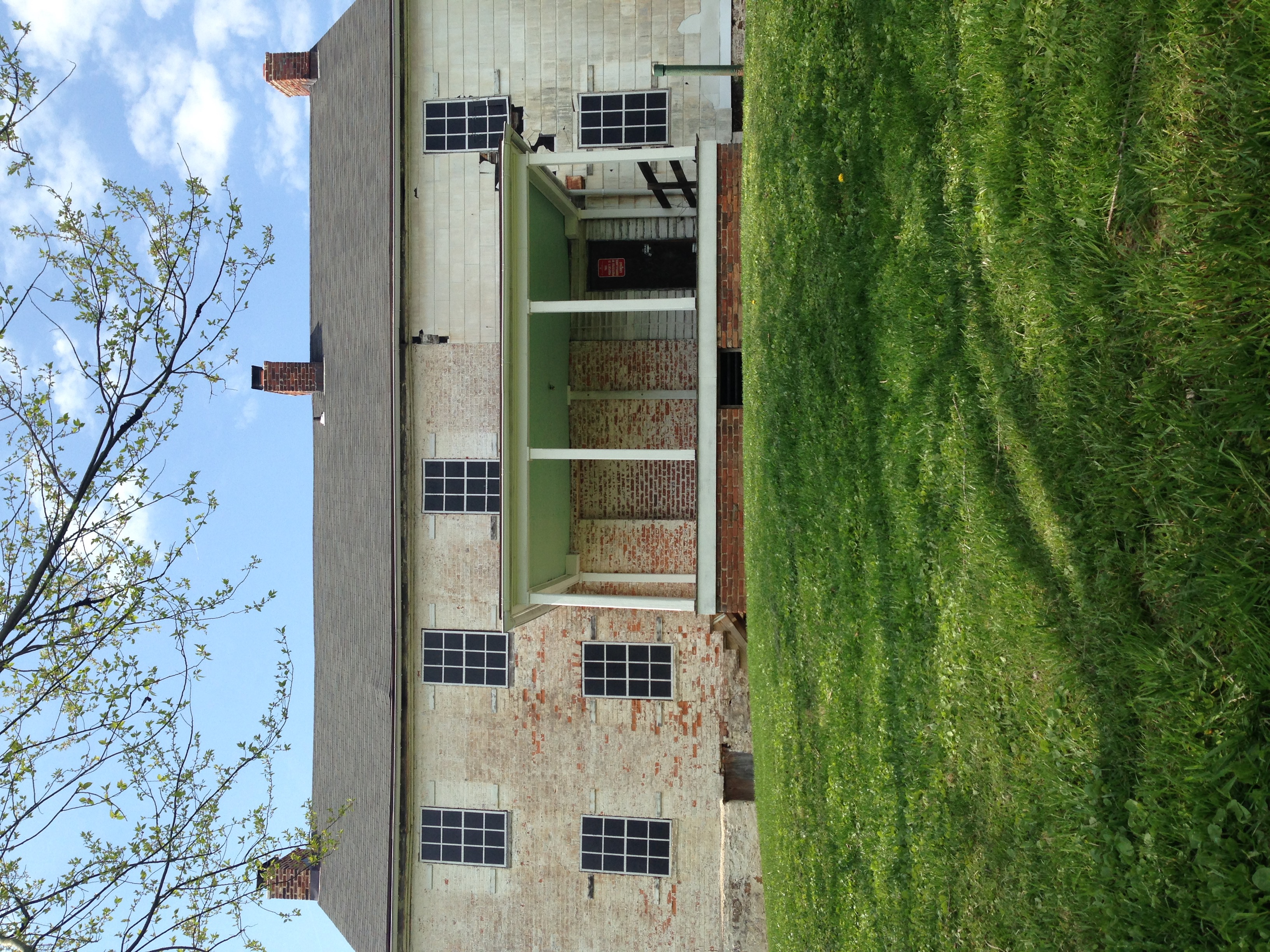
Troy, also known as Troy Hill Farm, is a historic slave plantation home located at Elkridge, Howard County, Maryland, United States. It is associated with the prominent Dorsey family of Howard County, who also built Dorsey Hall. History The lands of "Troy" were surveyed by Hon. John Dorsey in 1694, where he moved in 1696 with 2 slaves. The property stayed in the family though his great-grandson Col. Thomas Dorsey (-1790) of the American Revolution whose estate sold it in 1808. Troy was inherited by Basil Dorsey in 1714, followed by Caleb Dorsey who reduced the land to which was split into two unequal parts in 1760 and given to Sarah Dorsey and Thomas Dorsey. Thomas Dorsey would use the root cellar as a meeting place with Benjamin Warfield of Cherry Grove during the revolutionary war. Thomas's widow Elizabeth split Troy several times to pay debts. Vincent Bailey acquired including Troy for $6,520. A stone house named "Troy Hill" was built about 1808 on the foundation of an mu ... [...More Info...] [...Related Items...] OR: [Wikipedia] [Google] [Baidu] |
Troy Park Layout
Troy ( el, Τροία and Latin: Troia, Hittite: 𒋫𒊒𒄿𒊭 ''Truwiša'') or Ilion ( el, Ίλιον and Latin: Ilium, Hittite: 𒃾𒇻𒊭 ''Wiluša'') was an ancient city located at Hisarlik in present-day Turkey, south-west of Çanakkale and about miles east of the Aegean Sea. It is known as the setting for the Greek myth of the Trojan War. In Ancient Greek literature, Troy is portrayed as a powerful kingdom of the Heroic Age, a mythic era when monsters roamed the earth and gods interacted directly with humans. The city was said to have ruled the Troad until the Trojan War led to its complete destruction at the hands of the Greeks. The story of its destruction was one of the cornerstones of Greek mythology and literature, featuring prominently in the ''Iliad'' and the ''Odyssey'', and referenced in numerous other poems and plays. Its legacy played a large role in Greek society, with many prominent families claiming descent from those who had fought there. In the ... [...More Info...] [...Related Items...] OR: [Wikipedia] [Google] [Baidu] |
Cherry Grove, HO-1
Cherry Grove, located on property formerly called Fredericksburg, 400 acres patented by Orlando Griffith's oldest son Henry Griffith in 1750. Cherry Grove is a historic home and former plantation located at Woodbine, Howard County, Maryland, United States. The home is considered the seat of the Warfield family of Maryland. The multi-part house was built by Captain Benjamin Warfield starting after 1766 after acquiring a 550-acre land grant from Henry Griffith named "Fredericksburg". The complex includes a ca. 1798 log ground barn, an 1860-1890 frame wagon shed with corn crib, an early-20th century frame water tower, frame ground barn with cantilevered forebay, frame shed, frame dairy barn, concrete silo, concrete block dairy, and several frame shelter sheds. The buildings are located on a generally flat site surrounded by gently rolling terrain and are set well back from the road along a gravel drive that winds through the center of the farm. The J.P Tarenz log house was a log s ... [...More Info...] [...Related Items...] OR: [Wikipedia] [Google] [Baidu] |
Georgian Architecture
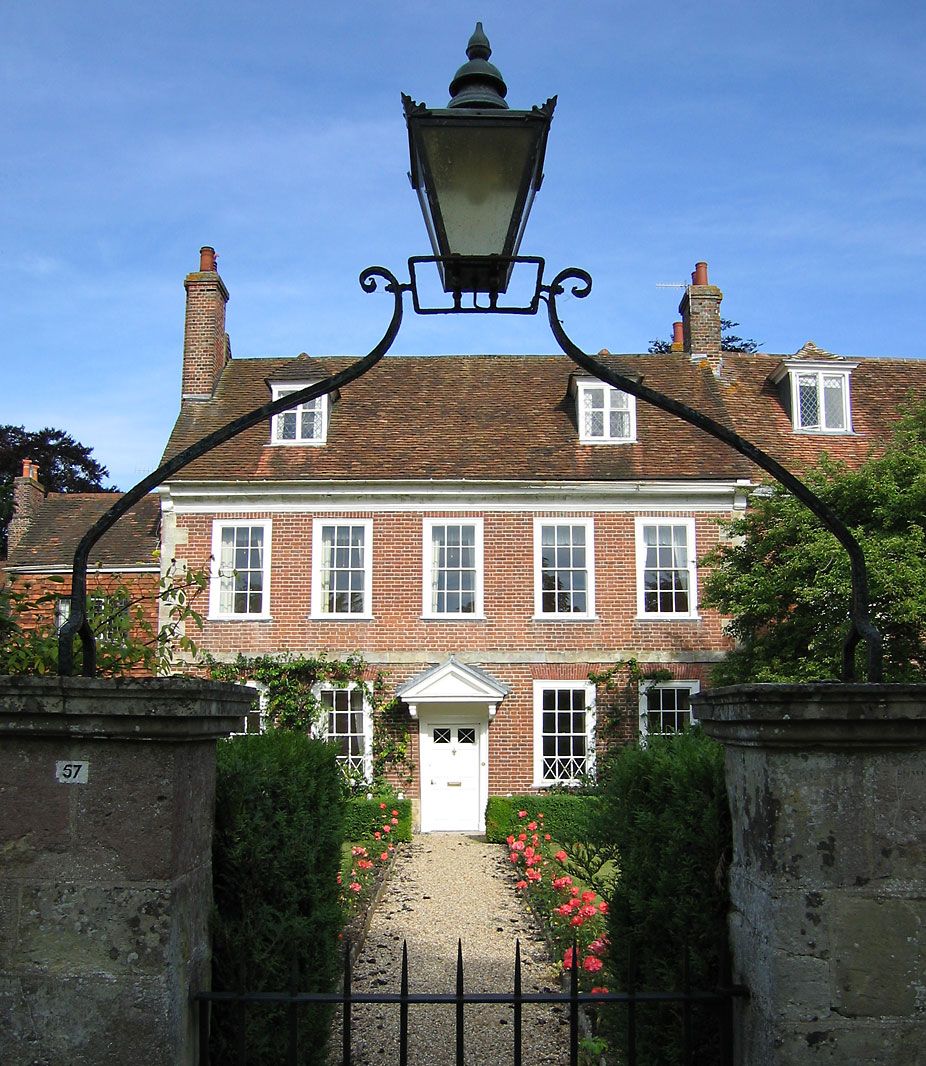
Georgian architecture is the name given in most English-speaking countries to the set of architectural styles current between 1714 and 1830. It is named after the first four British monarchs of the House of Hanover—George I, George II, George III, and George IV—who reigned in continuous succession from August 1714 to June 1830. The so-called great Georgian cities of the British Isles were Edinburgh, Bath, pre-independence Dublin, and London, and to a lesser extent York and Bristol. The style was revived in the late 19th century in the United States as Colonial Revival architecture and in the early 20th century in Great Britain as Neo-Georgian architecture; in both it is also called Georgian Revival architecture. In the United States the term "Georgian" is generally used to describe all buildings from the period, regardless of style; in Britain it is generally restricted to buildings that are "architectural in intention", and have stylistic characteristics that are typical o ... [...More Info...] [...Related Items...] OR: [Wikipedia] [Google] [Baidu] |
Fieldstone
Fieldstone is a naturally occurring type of stone, which lies at or near the surface of the Earth. Fieldstone is a nuisance for farmers seeking to expand their land under cultivation, but at some point it began to be used as a construction material. Strictly speaking, it is stone collected from the surface of fields where it occurs naturally. Collections of fieldstones which have been removed from arable land or pasture to allow for more effective agriculture are called clearance cairns. In practice, fieldstone is any architectural stone used in its natural shape and can be applied to stones recovered from the topsoil or subsoil. Although fieldstone is generally used to describe such material when used for exterior walls, it has come to include its use in other ways including garden features and interiors. It is sometimes cut or split for use in architecture. Glacial deposition Fieldstone is common in soils throughout temperate latitudes due to glacial deposition. The type of f ... [...More Info...] [...Related Items...] OR: [Wikipedia] [Google] [Baidu] |
Bay (architecture)
In architecture, a bay is the space between architectural elements, or a recess or compartment. The term ''bay'' comes from Old French ''baie'', meaning an opening or hole."Bay" ''Online Etymology Dictionary''. http://www.etymonline.com/index.php?allowed_in_frame=0&search=bay&searchmode=none accessed 3/10/2014 __NOTOC__ Examples # The spaces between posts, columns, or buttresses in the length of a building, the division in the widths being called aisles. This meaning also applies to overhead vaults (between ribs), in a building using a vaulted structural system. For example, the Gothic architecture period's Chartres Cathedral has a nave (main interior space) that is '' "seven bays long." '' Similarly in timber framing a bay is the space between posts in the transverse direction of the building and aisles run longitudinally."Bay", n.3. def. 1-6 and "Bay", n.5 def 2. ''Oxford English Dictionary'' Second Edition on CD-ROM (v. 4.0) © Oxford University Press 2009 # Where there a ... [...More Info...] [...Related Items...] OR: [Wikipedia] [Google] [Baidu] |
Rockburn Branch Park
Rockburn Branch Park is a local park in Elkridge, Maryland that follows the , a tributary of the Patapsco River. The park features 7.4 miles of trails, 10 ball diamonds, 2 turf fields, 4 smaller fields, along with tennis and basketball courts. The park is also home to the Pfeiffers Corner Schoolhouse, Clover Hill Historic House, and Rockburn Elementary School. History The park was established in 1975, when the original parcel of land was "sold" to Howard County for $5. The deed of this property stated "The above-described property may not be converted from outdoor public recreation or open space use to any other use without the prior written approval of the Secretary of Natural Resources and the Secretary of the Department of State Planning, or their successors." The property Owner wanted the park protected with this language. Later, in 1979 Howard County bought another piece of land directly next to the original parcel for approximately $525,000.00 and effectively bridging t ... [...More Info...] [...Related Items...] OR: [Wikipedia] [Google] [Baidu] |
Patapsco Valley State Park
Patapsco Valley State Park is a Maryland state park extending along of the Patapsco River south and west of the city of Baltimore, Maryland, Baltimore, Maryland Maryland ( ) is a state in the Mid-Atlantic region of the United States. It shares borders with Virginia, West Virginia, and the District of Columbia to its south and west; Pennsylvania to its north; and Delaware and the Atlantic Ocean to .... The park encompasses multiple developed areas on over acres of land, making it Maryland's largest state park. In 2006, it was officially celebrated as Maryland's first state park, its first formation being in 1906. Patapsco Valley State Park is managed by the Maryland Department of Natural Resources. History ;20th century Formation of the park started with provisions in the Forestry Act of 1906. The completion of Bloede's Dam in 1906 required the implementation of protections to prevent silting from nearby farm erosion. Patapsco Valley State Park was established as Patap ... [...More Info...] [...Related Items...] OR: [Wikipedia] [Google] [Baidu] |


