|
Rockburn Branch Park
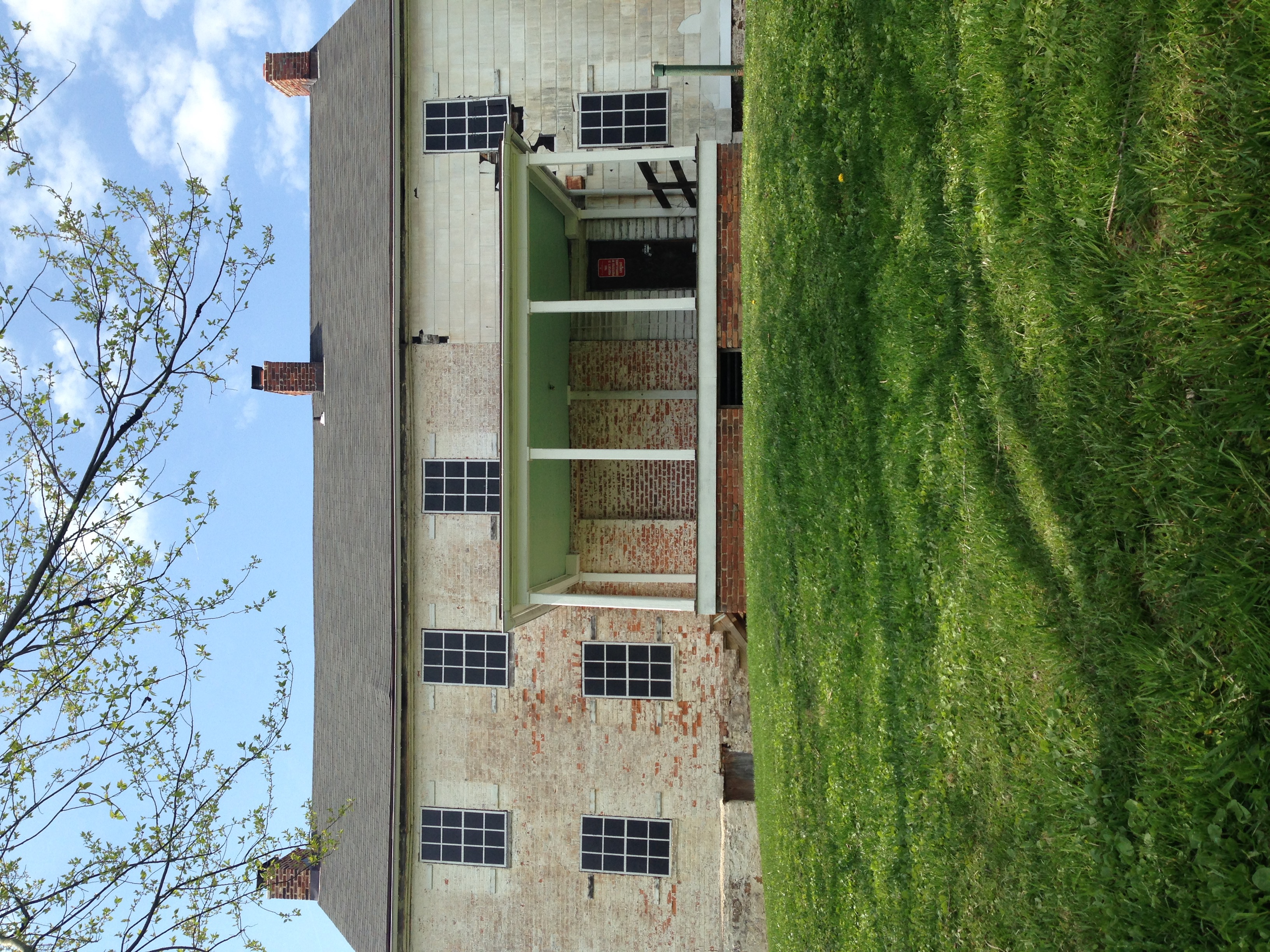
Rockburn Branch Park is a local park in Elkridge, Maryland that follows the , a tributary of the Patapsco River. The park features 7.4 miles of trails, 10 ball diamonds, 2 turf fields, 4 smaller fields, along with tennis and basketball courts. The park is also home to the Pfeiffers Corner Schoolhouse, Clover Hill Historic House, and Rockburn Elementary School. History The park was established in 1975, when the original parcel of land was "sold" to Howard County for $5. The deed of this property stated "The above-described property may not be converted from outdoor public recreation or open space use to any other use without the prior written approval of the Secretary of Natural Resources and the Secretary of the Department of State Planning, or their successors." The property Owner wanted the park protected with this language. Later, in 1979 Howard County bought another piece of land directly next to the original parcel for approximately $525,000.00 and effectively bridging t ... [...More Info...] [...Related Items...] OR: [Wikipedia] [Google] [Baidu] |
Elkridge, Maryland
Elkridge is an unincorporated community and census-designated place (CDP) in Howard County, Maryland, United States. The population was 15,593 at the 2010 census. Founded early in the 18th century, Elkridge is adjacent to two other counties, Anne Arundel and Baltimore. History Elkridge qualifies as the oldest settlement in its present county, when Howard was a part of Anne Arundel County. Its location on the Patapsco River was a key element in its growth. The Maryland General Assembly elected a law to erect a , forty-lot town at the pre-existing settlement of Elkridge Landing to be called "Jansen Town" in 1733. In 1738 an attempt to formalize the town failed with the death of the commissioners before passage. In 1750 a second attempt to formalize the town was attempted around the lands of Phillip Hammond. By comparison, Baltimore Town consisted of only 25 dwellings at that time. A third petition was filed in 1762. The settlement was founded as a place where planters, who each ... [...More Info...] [...Related Items...] OR: [Wikipedia] [Google] [Baidu] |
Howard County, Maryland
Howard County is located in the U.S. state of Maryland. As of the 2010 census, the population was 287,085. As of the 2020 census its population rose to 328,200. Its county seat is Ellicott City. Howard County is included in the Baltimore-Columbia-Towson, MD Metropolitan Statistical Area, which is also part of the larger Washington-Baltimore-Arlington, DC-MD-VA-WV-PA Combined Statistical Area. Recent south county development has led to some realignment towards the Washington, D.C. media and employment markets. The county is home to Columbia, a major planned community of approximately 100,000 founded in 1967. Howard County is frequently cited for its affluence, quality of life, and excellent schools. Its estimated 2016 median household income of $120,194 raised it to the second-highest median household income of any U.S. county. Many of the most affluent communities in the area, such as Clarksville, Dayton, Glenelg, Glenwood, and West Friendship, are located along the ... [...More Info...] [...Related Items...] OR: [Wikipedia] [Google] [Baidu] |
Patapsco River
The Patapsco River mainstem is a U.S. Geological Survey. National Hydrography Dataset high-resolution flowline dataThe National Map , accessed April 1, 2011 river in central Maryland that flows into the Chesapeake Bay. The river's tidal portion forms the harbor for the city of Baltimore. With its South Branch, the Patapsco forms the northern border of Howard County, Maryland. The name "Patapsco" is derived from the Algonquian ''pota-psk-ut'', which translates to "backwater" or "tide covered with froth." History Captain John Smith was the first European to explore the river noting it on his 1612 map as the Bolus River. The "Red river", was named after the clay color, and is considered the "old Bolus", as other branches were also labeled Bolus on maps. As the river was not navigable beyond Elkridge, it was not a major path of commerce with only one ship listed as serving the northern branch, and four others operating around the mouth in 1723. The Patapsco River is referre ... [...More Info...] [...Related Items...] OR: [Wikipedia] [Google] [Baidu] |
Pfeiffers Corner, Maryland
Pfeiffers Corner is an unincorporated area located in Howard County in the state of Maryland, United States. The community straddles the border between the census-designated places of Columbia and Ilchester Ilchester is a village and civil parish, situated on the River Yeo or Ivel, five miles north of Yeovil, in the English county of Somerset. Originally a Roman town, and later a market town, Ilchester has a rich medieval history and was a notable .... The postal community is home to the prominent Pfeiffer family, who owned Troy Hill. The 1895 Pfeiffers Corner Schoolhouse was converted to a private home, then moved to Rockburn Park. References Unincorporated communities in Maryland Unincorporated communities in Howard County, Maryland {{HowardCountyMD-geo-stub ... [...More Info...] [...Related Items...] OR: [Wikipedia] [Google] [Baidu] |
Howard County Public School System
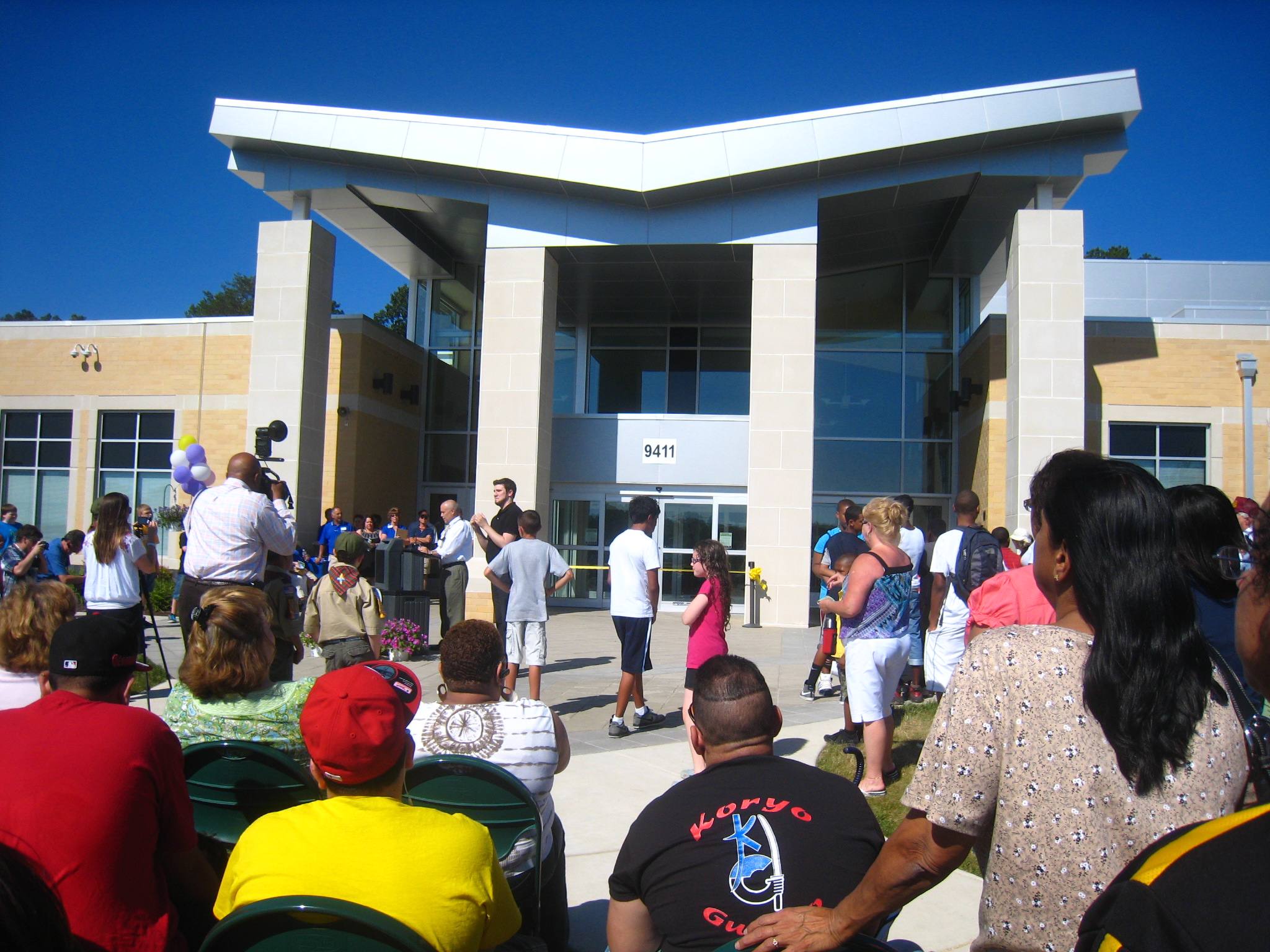
The Howard County Public School System (HCPSS) is the school district that manages and runs the public schools of Howard County, Maryland. It operates under the supervision of an elected, eight-member Board of Education. Antonia Watts is the chair of the board. Michael J. Martirano has served as the superintendent since May 2017. The district operates 77 schools: 42 elementary schools, 20 middle schools, 12 high schools, and 3 special education schools/education centers. As of September 2019, a total of 58,868 students were enrolled. It is headquartered in the Columbia, Maryland census-designated place; the facility has an Ellicott City mailing address. Howard County consistently earns high marks in school performance metrics such as test scores and graduation rates. It gets high percentages at all levels of the Maryland School Assessments. In 2007, Forbes magazine rated Howard County as one of the ten most cost-efficient school systems in the United States. Overview The dis ... [...More Info...] [...Related Items...] OR: [Wikipedia] [Google] [Baidu] |
Clover Hill Mansion
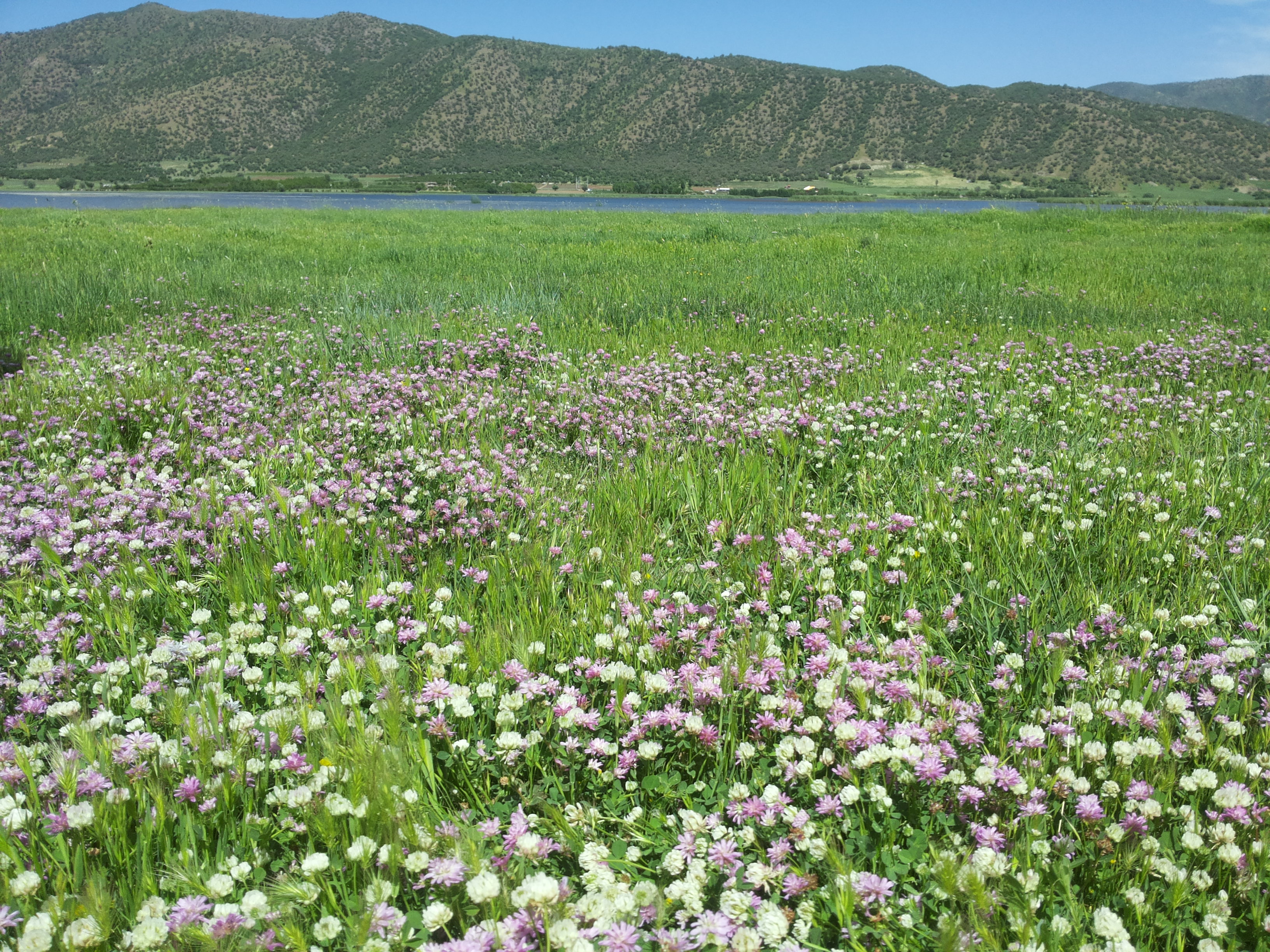
Clover or trefoil are common names for plants of the genus ''Trifolium'' (from Latin ''tres'' 'three' + ''folium'' 'leaf'), consisting of about 300 species of flowering plants in the legume or pea family Fabaceae originating in Europe. The genus has a cosmopolitan distribution with highest diversity in the temperate Northern Hemisphere, but many species also occur in South America and Africa, including at high altitudes on mountains in the tropics. They are small annual, biennial, or short-lived perennial herbaceous plants, typically growing up to 30 cm tall. The leaves are trifoliate (rarely quatrefoiled; see four-leaf clover), monofoil, bifoil, cinquefoil, hexafoil, septfoil, etcetera, with stipules adnate to the leaf-stalk, and heads or dense spikes of small red, purple, white, or yellow flowers; the small, few-seeded pods are enclosed in the calyx. Other closely related genera often called clovers include ''Melilotus'' (sweet clover) and ''Medicago'' (alfalfa or Calvary clover) ... [...More Info...] [...Related Items...] OR: [Wikipedia] [Google] [Baidu] |
Patapsco Valley State Park
Patapsco Valley State Park is a Maryland state park extending along of the Patapsco River south and west of the city of Baltimore, Maryland, Baltimore, Maryland Maryland ( ) is a state in the Mid-Atlantic region of the United States. It shares borders with Virginia, West Virginia, and the District of Columbia to its south and west; Pennsylvania to its north; and Delaware and the Atlantic Ocean to .... The park encompasses multiple developed areas on over acres of land, making it Maryland's largest state park. In 2006, it was officially celebrated as Maryland's first state park, its first formation being in 1906. Patapsco Valley State Park is managed by the Maryland Department of Natural Resources. History ;20th century Formation of the park started with provisions in the Forestry Act of 1906. The completion of Bloede's Dam in 1906 required the implementation of protections to prevent silting from nearby farm erosion. Patapsco Valley State Park was established as Patap ... [...More Info...] [...Related Items...] OR: [Wikipedia] [Google] [Baidu] |
Warfield's Range
Warfield's Range, also known as Philla Terra and Dr. Thomas Chew Warfield's Homestead, is a historic slave plantation home located between Laurel and Columbia in Howard County, Maryland. On 26 March 1696, Richard and John Warfield surveyed a 1,080 acre land patent named Warfield's Range along with others that totaled 1,862 acres. A log cabin was built onsite during this time which survived until 2001. In 1703, Richard Warfield granted 150 acres of Warfield's Range including the cabin to his daughter Rachel Warfield Yates. In 1765, 240 acres of the range were inherited by Benjamin Warfield's son Joshua Warfield. In 1845 Thomas Chew Worthington updated the log cabin interior with random width wood floors. After Peter Gorman completed his railroad contract, he purchased the 500-acre estate Fairview in North Laurel from Dr. Charles Griffith Worthington. The property was part of Warfiled's Range, containing the 1696 log cabin that survived until an arson fire in 2001 when relocated t ... [...More Info...] [...Related Items...] OR: [Wikipedia] [Google] [Baidu] |
North Laurel, Maryland
North Laurel is a census-designated place (CDP) in Howard County, Maryland, United States. The published population was 4,474 at the 2010 census. This population was substantially less than the CDP's population in 2000, and was the result of an error in defining the boundary prior to tabulation and publication of 2010 Census results. The corrected 2010 Census population is 20,259. North Laurel is adjacent to the City of Laurel, which is located across the Patuxent River in Prince George's County. Geography North Laurel is located in the southern corner of Howard County at (39.134343, −76.862690). It is bordered to the north by Savage and Columbia, to the west by Scaggsville, to the south in Prince George's County by the city of Laurel, and to the southeast in Anne Arundel County by Maryland City. The southern boundary of the CDP is defined by the Patuxent River, which is also the Howard County/Prince George's County line. According to the United States Census Bureau, ... [...More Info...] [...Related Items...] OR: [Wikipedia] [Google] [Baidu] |
Blandair
Blandair, also known as Blandair Farm, Blandair Park, and Blandair Regional Park, is 300 acres of former slave plantation located in Columbia, Maryland. The Blandair Foundation estate of Mrs. Smith was purchased by Howard County, Maryland in the late 1990s and is in the process of being developed as a regional park. History In 1689, 1087 acres on Elk Ridge, in what was then colonial Maryland's Anne Arundel County, was surveyed for Edward Talbott. Known as "Talbott's Resolution Manor", Talbott bequeathed the property to his children, John and Elizabeth, who each received half of the property after his death in 1689. The land was patented to John and Elizabeth Talbott in 1714, and by 1716 they had quickly sold off 800 acres of the property. By 1753, four different owners were in possession of the original plot: William Hall (500 acres), Nicholas Gassaway (300 acres), Edward Dorsey (200 acres), and Rachel Norwood (87 acres). In 1804, John Crompton Weems purchased a portion named "La ... [...More Info...] [...Related Items...] OR: [Wikipedia] [Google] [Baidu] |
Belmont Estate
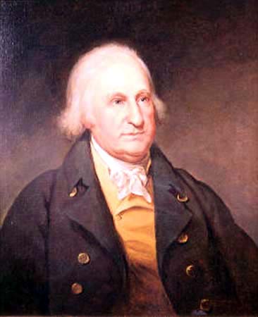
The Belmont Estate, now Belmont Manor and Historic Park, is a former plantation located at Elkridge, Howard County, Maryland, United States. Founded in the 1730s and known in the Colonial period as "Moore's Morning Choice",Stein, p. 197. it was one of the earliest forced-labor farms in Howard County, Maryland. Its 1738 plantation house is one of the finest examples of Colonial Georgian architectural style in Maryland. From the late 17th century until 1962, the property was privately owned and associated with important personages from the late 17th century to the 20th century, including Dr. Mordecai Moore, Caleb Dorsey, Alexander Contee Hanson, and David K. E. Bruce. The property was then successively owned and maintained as the Belmont Conference Center, by the Smithsonian Institution, the American Chemical Society, and Howard Community College. It is now the 68-acre Belmont Manor and Historic Park, owned by Howard County and its Department of Recreation and Parks. It adjo ... [...More Info...] [...Related Items...] OR: [Wikipedia] [Google] [Baidu] |
Allan H
Allan may refer to: People * Allan (name), a given name and surname, including list of people and characters with this name * Allan (footballer, born 1984) (Allan Barreto da Silva), Brazilian football striker * Allan (footballer, born 1989) (Allan dos Santos Natividade), Brazilian football forward * Allan (footballer, born 1991) (Allan Marques Loureiro), Brazilian football midfielder * Allan (footballer, born 1994) (Allan Christian de Almeida), Brazilian football midfielder * Allan (footballer, born 1997) (Allan Rodrigues de Souza), Brazilian football midfielder Places * Allan, Queensland, Australia * Allan, Saskatchewan, Canada * Allan, the Allaine river's lower course, in France * Allan, Drôme, town in France * Allan, Iran (other), places in Iran Other uses * Allan, a Clan Grant split (or sept) * Ahlawat or Allan, an ethnic clan in India * ''Allan'', a 1966 film directed by Donald Shebib * "Allan" (song), a 1988 song recorded by the French artist Mylène Farmer ... [...More Info...] [...Related Items...] OR: [Wikipedia] [Google] [Baidu] |


.jpg)


