|
Tropical Storm Dianmu (2016)
Tropical Storm Dianmu was a weak tropical cyclone that struck Leizhou Peninsula, China and Northern Vietnam in mid August 2016. It was the eighth named storm of the annual typhoon season. Meteorological history Tropical Storm Dianmu was first noted as a tropical disturbance, by the United States Joint Typhoon Warning Center (JTWC) during August 14, while it was located about to the south of Hong Kong, China. The disturbance was located within a narrow area of low vertical windshear and had a good outflow. Over the next day the system's low level circulation centre started to consolidate as it moved westwards, before it was classified as a tropical depression by the Japan Meteorological Agency (JMA) during August 15. Over the next couple of days the system moved gradually westwards, before the JTWC issued a tropical cyclone formation alert on the system during August 17. The depression was named Dianmu by the JMA during August 18, after it had developed into a tropical storm, ... [...More Info...] [...Related Items...] OR: [Wikipedia] [Google] [Baidu] |
Leizhou Peninsula
The Leizhou Peninsula, alternately romanized as the Luichow Peninsula, is a peninsula in the southernmost part of Guangdong province in South China. History Qing naval forces were stationed at the Leizhou Peninsula. During the 19th century, the area was a hotbed of piracy, many pirates, such as Zheng Yi and Wu Shi Er, were based in the area. Geography The Leizhou Peninsula is the third largest peninsula in China with an area of c. located on the southwestern end of Zhanjiang, Guangdong with the Gulf of Tonkin to the west and the 30 km wide Qiongzhou Strait to the south, separating the peninsula from Hainan Island. Geologically, basalt terraces account for 43% of the peninsula's area. The rest is divided up between marine terraces (27%) and alluvial plains (17%). Leizhou Peninsula is dotted with a few dormant volcanoes, beaches, and low-lying diluvial plains. Leizhou has two separate volcanic fields: a Pleistocene–Holocene field at the northern end ... [...More Info...] [...Related Items...] OR: [Wikipedia] [Google] [Baidu] |
Haikou
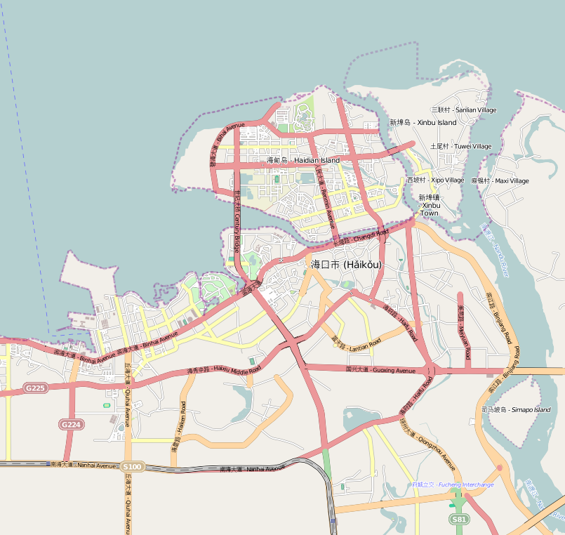
Haikou (; ), also spelled as Hoikow is the capital and most populous city of the Chinese province of Hainan. Haikou city is situated on the northern coast of Hainan, by the mouth of the Nandu River. The northern part of the city is on the Haidian Island, which is separated from the main part of Haikou by the Haidian River, a branch of the Nandu. Administratively, Haikou is a prefecture-level city, comprising four districts, and covering . There are 2,046,189 inhabitants in the built-up area, all living within the four urban districts of the city. Haikou was originally a port city, serving as the port for Qiongshan. During the Chinese Civil War, Haikou was one of the last Nationalist strongholds to be taken by the Communists — with the Battle of Hainan Island in 1950. Currently, more than half of the island's total trade still goes through Haikou's ports. The Temple of the Five Lords is located to the southeast of the city. The city is home to Hainan University, a comprehen ... [...More Info...] [...Related Items...] OR: [Wikipedia] [Google] [Baidu] |
Tropical Cyclones In Myanmar
This article is about the tropical cyclones that affected Myanmar. Myanmar has witnessed some of the deadliest storms in the Bay of Bengal. The country is hit by a powerful storm every 1 or 2 years. The list below contains all storms sorted by their year of formation. List of storms References {{DEFAULTSORT:Tropical Cyclones That Affected Burma, List Of * Lists of events in Myanmar Myanmar Myanmar, ; UK pronunciations: US pronunciations incl. . Note: Wikipedia's IPA conventions require indicating /r/ even in British English although only some British English speakers pronounce r at the end of syllables. As John C. Wells, Joh ... Myanmar history-related lists ... [...More Info...] [...Related Items...] OR: [Wikipedia] [Google] [Baidu] |
Typhoons In Laos
A typhoon is a mature tropical cyclone that develops between 180° and 100°E in the Northern Hemisphere. This region is referred to as the Northwestern Pacific Basin, and is the most active tropical cyclone basin on Earth, accounting for almost one-third of the world's annual tropical cyclones. For organizational purposes, the northern Pacific Ocean is divided into three regions: the eastern (North America to 140°W), central (140°W to 180°), and western (180° to 100°E). The Regional Specialized Meteorological Center (RSMC) for tropical cyclone forecasts is in Japan, with other tropical cyclone warning centers for the northwest Pacific in Hawaii (the Joint Typhoon Warning Center), the Philippines, and Hong Kong. Although the RSMC names each system, the main name list itself is coordinated among 18 countries that have territories threatened by typhoons each year. Within most of the northwestern Pacific, there are no official typhoon seasons as tropical cyclones form thr ... [...More Info...] [...Related Items...] OR: [Wikipedia] [Google] [Baidu] |
Typhoons In China
A typhoon is a mature tropical cyclone that develops between 180° and 100°E in the Northern Hemisphere. This region is referred to as the Northwestern Pacific Basin, and is the most active tropical cyclone basin on Earth, accounting for almost one-third of the world's annual tropical cyclones. For organizational purposes, the northern Pacific Ocean is divided into three regions: the eastern (North America to 140°W), central (140°W to 180°), and western (180° to 100°E). The Regional Specialized Meteorological Center (RSMC) for tropical cyclone forecasts is in Japan, with other tropical cyclone warning centers for the northwest Pacific in Hawaii (the Joint Typhoon Warning Center), the Philippines, and Hong Kong. Although the RSMC names each system, the main name list itself is coordinated among 18 countries that have territories threatened by typhoons each year. Within most of the northwestern Pacific, there are no official typhoon seasons as tropical cyclones form thr ... [...More Info...] [...Related Items...] OR: [Wikipedia] [Google] [Baidu] |
Typhoons In Vietnam
Vietnam is a southeast Asian country, and is the easternmost country of mainland Southeast Asia. It borders the East Sea, hence, seeing the increased likeliness of tropical cyclones. Tropical cyclones in this area are considered to be part of the Northwest Pacific basin, and therefore, storms here are considered as ''typhoons''. Climatologically, in the Northwest Pacific basin, most tropical cyclones tend to develop between May and October. Typhoons impacting this region are relatively common, with most of these storms doing so from the middle of the year. The most active tropical cyclone season for Vietnam is in 2013, with their meteorological agency tracking 15 storms, in which 9 have made landfall. This article includes any tropical cyclone of any intensity that affected Vietnam. Background Vietnam recognises its typhoon season from the beginning of June through to the end of November, with an average of four to six typhoons hitting the country annually. Any tropical cyclon ... [...More Info...] [...Related Items...] OR: [Wikipedia] [Google] [Baidu] |
Tropical Storm Bebinca (2013)
Tropical Storm Bebinca, known in the Philippines as Tropical Depression Fabian, was a weak tropical cyclone that brought minor damage in China and Vietnam, causing a death and an economic loss of about US$13 million.June 2013 Global Catastrophe Recap AON Benfield. Page 7. Retrieved on January 4, 2014. The sixth depression and fifth named storm of the season. Bebinca originated as a low-pressure area south of . As the disturbance is moving westward, favorable conditions allow the system to organize into a tropical depression. On June 21, the depression was upgraded into a tropical storm despite the wind shear, which ... [...More Info...] [...Related Items...] OR: [Wikipedia] [Google] [Baidu] |
Tropical Storm Mujigae (2009)
Tropical Storm Mujigae, known in the Philippines as Tropical Depression Maring was a tropical storm that affected the Philippines, China, Hong Kong, and Vietnam in September 2009. Mujigae originated from an area of convection that developed along with a monsoon trough with favorable conditions on 8 September. The disturbance would organize to a tropical depression and be assigned the names ''14W'' by the Joint Typhoon Warning Center and ''Maring'' by PAGASA later that day. Tropical Depression 14W would rapidly develop and attain tropical storm status by the JMA and be assigned the name ''Mujigae'' on 10 September. Mujigae would later encounter unfavorable conditions with wind shear and make landfall in Hainan Island on 11 September and Vietnam on 12 September before rapidly weakening and dissipating. Meteorological history Early on 8 September 2009, the Joint Typhoon Warning Center reported that an area of convection had persisted about northwest of Manila in the Philippines. T ... [...More Info...] [...Related Items...] OR: [Wikipedia] [Google] [Baidu] |
Tropical Storm Soudelor (2009)
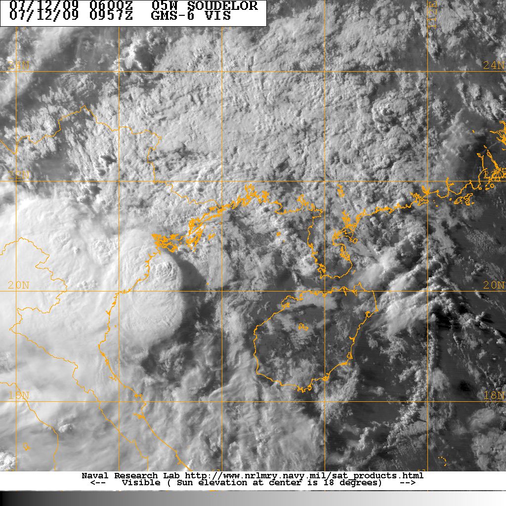
Tropical Storm Soudelor, known in the Philippines as Tropical Depression Gorio, was a weak tropical cyclone that lead to deadly flooding in the Philippines, China and Vietnam in July 2009. Forming out of an area of low pressure on July 9, Soudelor failed to maintain deep convection around its center for the duration of its existence. On July 10, the depression brushed the northern Philippines and intensified into a tropical storm on July 11. Later that day, the storm crossed the Leizhou Peninsula. The last public advisory from the JMA was issued the following day after Soudelor made landfall in southern China. In the Philippines, Soudelor produced severe flooding that killed one person and resulted in the issuance of a state of calamity. The storm later killed 15 people in southern China after a group of hikers were washed away in a flash flood on Hainan Island. In Vietnam, rainfall up to caused widespread flooding. Lightning triggered by the storm killed two peop ... [...More Info...] [...Related Items...] OR: [Wikipedia] [Google] [Baidu] |
Tropical Storm Zita
Severe Tropical Storm Zita, known in the Philippines as Tropical Storm Luming, was a short-lived tropical cyclone that killed seven people throughout southern China in August 1997. Originating from a tropical disturbance over the South China Sea on August 19, Zita tracked westward as it quickly strengthened within a region of light wind shear, attaining winds of as it made landfall along the Leizhou Peninsula early on August 22. Maintaining this intensity, the storm made a second landfall in northern Vietnam later that day before rapidly weakening over land. The remnants of Zita were last noted over extreme northwestern Vietnam on August 24. Although a relatively weak system, Tropical Storm Zita caused significant damage in Southern China. There, seven people were known to have been killed by the storm and damage reached $433 million (1997 USD). However, a report from Dartmouth College states that 345 people were killed by the storm. In Vietnam, significa ... [...More Info...] [...Related Items...] OR: [Wikipedia] [Google] [Baidu] |
Typhoon Hope (1979)
Typhoon Hope, known in the Philippines as Typhoon Ising, was a powerful Category 4 typhoon that killed over 100 people when it struck Hong Kong in 1979. The fifth typhoon and first super typhoon of the 1979 Pacific typhoon season, it formed as a tropical depression southeast of Guam on July 24. It headed to the west-northwest, but upper-level shear from the TUTT caused the depression to dissipate on the 27th. It turned northward then westward, where it regenerated on the 28th. Intensification became more steady, with the depression reaching storm strength on the 28th and typhoon strength on the 29th. On the 31st, Hope reached a peak of 150 mph winds, but land interaction with Taiwan to the north weakened the storm. On August 2, Typhoon Hope struck southern China, only 10 miles east of Hong Kong. It weakened over the country while moving westward, but retained its satellite signature. Upon reaching the Bay of Bengal on the 7th, Hope restrengthened to a severe tropical ... [...More Info...] [...Related Items...] OR: [Wikipedia] [Google] [Baidu] |


