|
Trogtalite
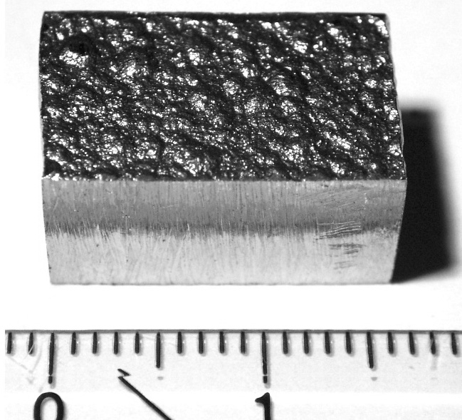
Trogtalite is a rare selenide mineral with the formula Co Se2. It crystallizes in the cubic system and is part of the pyrite group, consisting of Co2+ and Se22− ions. It has a rose-violet colour and its crystals are opaque. It often occurs as grains. It was thought to be dimorphous with hastite, but this was discredited in 2009. Hastite turned out to be the iron selenide mineral ferroselite. It forms a solid solution series with krut'aite. Occurrence Trogtalite was first found in 1955 in Trogtal quarry, Lautenthal, Harz Mountains, Germany, after which it was also named. It often occurs intergrown with clausthalite grains at this locality. It has also been found in the Musonoi Cu–Co mine, Kolwezi, Katanga Province, Congo and in Argentina, in Tuminico, Sierra de Cacho, and in Los Llantenes, La Rioja Province. It is often found together with clausthalite, ferroselite, bornhardtite, native selenium, gold, and oosterboschite. See also * List of minerals This is a list ... [...More Info...] [...Related Items...] OR: [Wikipedia] [Google] [Baidu] |
Oosterboschite
Oosterboschite is a rare selenide mineral with the formula . It crystallises in the orthorhombic crystal system. It has a creamy yellow colour and a Moh's hardness of 5. It is often found as grains with no clear shape. The crystals are opaque and often no bigger than 0.4 mm. Occurrence The mineral was approved by the IMA in 1970, after being discovered in the Musonoi Cu–Co mine, near Kolwezi, Katanga Province, Congo. It was later also discovered at the Copper Hills prospect, East Pilbara, Australia Australia, officially the Commonwealth of Australia, is a Sovereign state, sovereign country comprising the mainland of the Australia (continent), Australian continent, the island of Tasmania, and numerous List of islands of Australia, sma ..., and at Hope’s Nose, Torquay, Devon, England. It is often found in the oxidation zones of the mines, together with verbeekite, trogtalite, selenian digenite, covellite, gold, and chrisstanleyite. It was named aft ... [...More Info...] [...Related Items...] OR: [Wikipedia] [Google] [Baidu] |
Harz
The Harz () is a highland area in northern Germany. It has the highest elevations for that region, and its rugged terrain extends across parts of Lower Saxony, Saxony-Anhalt, and Thuringia. The name ''Harz'' derives from the Middle High German word ''Hardt'' or ''Hart'' (hill forest). The name ''Hercynia'' derives from a Celtic name and could refer to other mountain forests, but has also been applied to the geology of the Harz. The Brocken is the highest summit in the Harz with an elevation of above sea level. The Wurmberg () is the highest peak located entirely within the state of Lower Saxony. Geography Location and extent The Harz has a length of , stretching from the town of Seesen in the northwest to Eisleben in the east, and a width of . It occupies an area of , and is divided into the Upper Harz (''Oberharz'') in the northwest, which is up to 800 m high, apart from the 1,100 m high Brocken massif, and the Lower Harz (''Unterharz'') in the east which is up to ar ... [...More Info...] [...Related Items...] OR: [Wikipedia] [Google] [Baidu] |
Cobalt Minerals
Cobalt is a chemical element with the symbol Co and atomic number 27. As with nickel, cobalt is found in the Earth's crust only in a chemically combined form, save for small deposits found in alloys of natural meteoric iron. The free element, produced by reductive smelting, is a hard, lustrous, silver-gray metal. Cobalt-based blue pigments ( cobalt blue) have been used since ancient times for jewelry and paints, and to impart a distinctive blue tint to glass, but the color was for a long time thought to be due to the known metal bismuth. Miners had long used the name ''kobold ore'' (German for ''goblin ore'') for some of the blue-pigment-producing minerals; they were so named because they were poor in known metals, and gave poisonous arsenic-containing fumes when smelted. In 1735, such ores were found to be reducible to a new metal (the first discovered since ancient times), and this was ultimately named for the ''kobold''. Today, some cobalt is produced specifically from one of ... [...More Info...] [...Related Items...] OR: [Wikipedia] [Google] [Baidu] |
List Of Minerals
This is a list of minerals for which there are articles on Wikipedia. Minerals are distinguished by various chemical and physical properties. Differences in chemical composition and crystal structure distinguish the various ''species''. Within a mineral species there may be variation in physical properties or minor amounts of impurities that are recognized by mineralogists or wider society as a mineral ''variety''. Mineral variety names are listed after the valid minerals for each letter. For a more complete listing of all mineral names, see List of minerals recognized by the International Mineralogical Association. A :Varieties that are not valid species: * Adamantine spar (variety of corundum) *Agate (variety of chalcedony and quartz) *Alabaster (variety of gypsum) *Alexandrite (variety of chrysoberyl) * Allingite (synonym of amber) *Alum *Amazonite (variety of microcline) *Amethyst (purple variety of quartz) *Ametrine (variety of quartz) *Ammolite (organic; also a ge ... [...More Info...] [...Related Items...] OR: [Wikipedia] [Google] [Baidu] |
Gold
Gold is a chemical element with the symbol Au (from la, aurum) and atomic number 79. This makes it one of the higher atomic number elements that occur naturally. It is a bright, slightly orange-yellow, dense, soft, malleable, and ductile metal in a pure form. Chemically, gold is a transition metal and a group 11 element. It is one of the least reactive chemical elements and is solid under standard conditions. Gold often occurs in free elemental (native state), as nuggets or grains, in rocks, veins, and alluvial deposits. It occurs in a solid solution series with the native element silver (as electrum), naturally alloyed with other metals like copper and palladium, and mineral inclusions such as within pyrite. Less commonly, it occurs in minerals as gold compounds, often with tellurium ( gold tellurides). Gold is resistant to most acids, though it does dissolve in aqua regia (a mixture of nitric acid and hydrochloric acid), forming a soluble tetrachloroau ... [...More Info...] [...Related Items...] OR: [Wikipedia] [Google] [Baidu] |
La Rioja Province, Argentina
La Rioja () is a province of Argentina located in the west of the country. The landscape of the province consist of a series of arid to semi-arid mountain ranges and agricultural valleys in between. It is in one of these valleys that the capital of the province, the city of la La Rioja, lies. Neighboring provinces are from the north clockwise Catamarca, Córdoba, San Luis and San Juan. The dinosaur ''Riojasaurus'' is named after the province. History Petroglyphs created by early indigenous peoples at the Talampaya National Park are dated around 10,000 years BC. Succeeding cultures of indigenous peoples developed here. The Diaguita, Capayan and the Olongasta peoples inhabited the territory of present-day La Rioja Province at the time of encounter with the Spanish colonists in the 16th century. Juan Ramírez de Velazco founded ''Todos Los Santos de la Nueva Rioja'' in 1591 under the government of Tucumán of the Viceroyalty of Peru. In 1630 the Calchaquí people revolted ... [...More Info...] [...Related Items...] OR: [Wikipedia] [Google] [Baidu] |
Democratic Republic Of The Congo
The Democratic Republic of the Congo (french: République démocratique du Congo (RDC), colloquially "La RDC" ), informally Congo-Kinshasa, DR Congo, the DRC, the DROC, or the Congo, and formerly and also colloquially Zaire, is a country in Central Africa. It is bordered to the northwest by the Republic of the Congo, to the north by the Central African Republic, to the northeast by South Sudan, to the east by Uganda, Rwanda, and Burundi, and by Tanzania (across Lake Tanganyika), to the south and southeast by Zambia, to the southwest by Angola, and to the west by the South Atlantic Ocean and the Cabinda exclave of Angola. By area, it is the second-largest country in Africa and the 11th-largest in the world. With a population of around 108 million, the Democratic Republic of the Congo is the most populous officially Francophone country in the world. The national capital and largest city is Kinshasa, which is also the nation's economic center. Centered on the Congo ... [...More Info...] [...Related Items...] OR: [Wikipedia] [Google] [Baidu] |
Katanga Province
Katanga was one of the four large provinces created in the Belgian Congo in 1914. It was one of the eleven provinces of the Democratic Republic of the Congo between 1966 and 2015, when it was split into the Tanganyika, Haut-Lomami, Lualaba, and Haut-Katanga provinces. Between 1971 and 1997 (during the rule of Mobutu Sese Seko when Congo was known as Zaire), its official name was Shaba Province. Katanga's area encompassed . Farming and ranching are carried out on the Katanga Plateau. The eastern part of the province is considered to be a rich mining region, which supplies cobalt, copper, tin, radium, uranium, and diamonds. The region's former capital, Lubumbashi, is the second-largest city in the Congo. History Copper mining in Katanga dates back over 1,000 years, and mines in the region were producing standard-sized ingots of copper for international transport by the end of the 10th century CE. In the 1890s, the province was beleaguered from the south by Cecil Rhod ... [...More Info...] [...Related Items...] OR: [Wikipedia] [Google] [Baidu] |
Kolwezi
Kolwezi or Kolwesi is the capital city of Lualaba Province in the south of the Democratic Republic of the Congo, west of Likasi. It is home to an airport and a railway to Lubumbashi. Just outside of Kolwezi there is the static inverter plant of the HVDC Inga-Shaba. The population is approximately 573,000. Before the creation of Lualaba province in 2015 Kolwezi had two territories attached to it and the whole was known as the Kolwezi District. History The settlement was created in 1938 to be the headquarters for the western mining group of the '' Union Minière du Haut Katanga''. In 1971 it obtained city status and consisted of the communes of Dilala and Manika. In 1976 the territories of Lubudi and Mutshatsha, both previously part of Lualaba District, were attached to it to form the Kolwezi District (districts were called sub-regions at the time). In the 2015 repartitioning this was undone, the two territories and the city proper became separate parts of Lualaba ... [...More Info...] [...Related Items...] OR: [Wikipedia] [Google] [Baidu] |
Clausthalite
Clausthalite is a lead selenide mineral, PbSe. It forms a solid solution series with galena PbS. Occurrence It occurs in low-sulfur hydrothermal deposits with other selenides and in mercury deposits. It is associated with tiemannite, klockmannite, berzelianite, umangite, gold, stibiopalladinite and uraninite. It was first described in 1832 and named for the discovery locality of Clausthal-Zellerfeld in the Harz Mountains, Germany. See also * Classification of minerals The classification of minerals is a process of determining to which of several groups minerals belong based on their chemical characteristics. Since the 1950s, this classification has been carried out by the International Mineralogical Association, ... * List of minerals References Lead minerals Selenide minerals Galena group {{mineral-stub ... [...More Info...] [...Related Items...] OR: [Wikipedia] [Google] [Baidu] |
Lautenthal
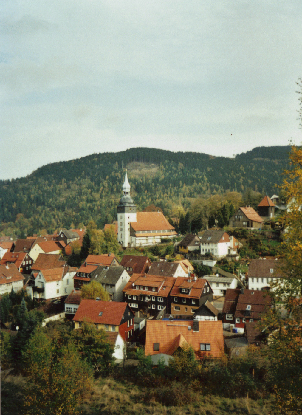
The formerly free mining town ('' Bergstadt'') of Lautenthal in Germany is a state-recognised, climatic spa with around 1,570 inhabitants and has been part of the borough of Langelsheim since 1972. Geography Lautenthal lies in the Innerste valley between Clausthal-Zellerfeld and Langelsheim in the northwestern Upper Harz. The town is located at a height of about in a valley bowl, the surrounding mountains being up to . The two rivers of the Innerste and the Laute flow through the town. Towards Langelsheim the Innerste is impounded by the Innerste Dam. History Mining of copper, lead and silver in the area around Lautenthal started about 1225. In the middle of the 14th century, however, the Harz was depopulated because of plague and mining came to an end. Mining in the Harz was started again in 1524. Lautenthal was founded in 1538 as a mining settlement on the river Laute, a small tributary of the Innerste, and had already been given the status of a town by 1580. Sixteen ... [...More Info...] [...Related Items...] OR: [Wikipedia] [Google] [Baidu] |


