|
Trengale
Higher Trengale and Lower Trengale are two farming hamlets in the parish of St Cleer, Cornwall, England. It is located to the northwest of Liskeard. They are located between Dobwalls (to the south) and Draynes (to the north). The principal river in the area is the River Fowey, which flows to the north on the other side of Trengale Wood. Ordnance Survey Trengale is mentioned in Domesday Book. It documents a Richard holding Trengale, also referred to a Turgoil, from Saint Petroc in 1086. St Neo ... [...More Info...] [...Related Items...] OR: [Wikipedia] [Google] [Baidu] |
List Of Farms In Cornwall
This is a list of farms in Cornwall. Cornwall is a ceremonial county and unitary authority area of England within the United Kingdom. Farms in Cornwall * Arrallas * Bodanna * Bodgate * Bodrean * Carn Arthen * Carnebone * Churchtown Farm * Cornish Cyder Farm * Crossgate, Cornwall * Dannonchapel * Dizzard * Duchy Farm * Froxton * Great Bosullow * Halton Barton * Hay, Cornwall * Haye * Hendra, Cornwall – the name of seven hamlets in Cornwall * Hendraburnick * Higher Menadew * Lanjew * Lantuel * Lezerea * Lower Croan * Mayon, Cornwall * Menherion * Nanceddan * New Downs – near Camborne in Cornwall, England, UK. * Penpoll * Pentire, Cornwall * Polgear * Porthmeor * Rescassa * Rosevine * Tregidden * Tregolls * Tregullon * Trengale * Trenoon * Tresawson * Treveal * Trevilder * Trevilla * Trevowhan * Troswell * West Curry File:St Teath, Dannonchapel - geograph.org.uk - 934329.jpg, Dannonchapel Fi ... [...More Info...] [...Related Items...] OR: [Wikipedia] [Google] [Baidu] |
St Cleer
St Cleer ( kw, Ryskarasek) is a civil parish and village in east Cornwall, England, United Kingdom. The village is situated on the southeast flank of Bodmin Moor approximately two miles (3 km) north of Liskeard. The population of the parish in 2001 numbered 3257. This includes Common Moor and had increased to 3,297 at the 2011 census. An electoral ward also exists. The population at the 2011 census is 4,366. Parish church St Cleer parish church, at an elevation of approximately 690 feet (210 metres), is dedicated to Saint Clarus. Its three-stage tower is 97 feet (30 metres) high and contains a ring of six bells. First built in 800 but rebuilt in the 13th century, the tower suffered damage and was repaired in the 15th century. The church is a Grade I listed building, having been so designated on 21 August 1964. It is of Norman origin, with early fifteenth century additions, further substantial additions in the late fifteenth century and late nineteenth century restoratio ... [...More Info...] [...Related Items...] OR: [Wikipedia] [Google] [Baidu] |
Cornwall
Cornwall (; kw, Kernow ) is a historic county and ceremonial county in South West England. It is recognised as one of the Celtic nations, and is the homeland of the Cornish people. Cornwall is bordered to the north and west by the Atlantic Ocean, to the south by the English Channel, and to the east by the county of Devon, with the River Tamar forming the border between them. Cornwall forms the westernmost part of the South West Peninsula of the island of Great Britain. The southwesternmost point is Land's End and the southernmost Lizard Point. Cornwall has a population of and an area of . The county has been administered since 2009 by the unitary authority, Cornwall Council. The ceremonial county of Cornwall also includes the Isles of Scilly, which are administered separately. The administrative centre of Cornwall is Truro, its only city. Cornwall was formerly a Brythonic kingdom and subsequently a royal duchy. It is the cultural and ethnic origin of the Cornish dias ... [...More Info...] [...Related Items...] OR: [Wikipedia] [Google] [Baidu] |
Liskeard
Liskeard ( ; kw, Lyskerrys) is a small ancient stannary and market town in south-east Cornwall, South West England. It is situated approximately 20 miles (32 km) west of Plymouth, west of the Devon border, and 12 miles (20 km) east of Bodmin. The Bodmin Moor lies to the north-west of the town. The total population of the town at the 2011 census was 11,366 History The Cornish place name element ''Lis'', along with ancient privileges accorded the town, indicates that the settlement was once a high status 'court'. King Dungarth whose cross is a few miles north near St Cleer is thought to be a descendant of the early 8th century king Gerren of Dumnonia and is said to have held his court in Liskeard (''Lis-Cerruyt''). Liskeard (Liscarret) was at the time of the Domesday Survey an important manor with a mill rendering 12d. yearly and a market rendering 4s. William the Conqueror gave it to Robert, Count of Mortain by whom it was held in demesne. Ever since that time ... [...More Info...] [...Related Items...] OR: [Wikipedia] [Google] [Baidu] |
Dobwalls
Dobwalls ( kw, Fos an Mogh) is a village and civil parish in south-east Cornwall, England, United Kingdom. It is situated 3 mi (5 km) west of Liskeard. The name is spelt ''Dubwalls'' on Bartholomew's map and '' Black's Guide'' of 1879. The A38 trunk road ran through the village until the bypass was opened on 19 December 2008. The bypass has two of the most elaborate bat bridges built so far in the UK (previous examples in Wales being wooden posts with cables). Twelve native species of bats are found in the area. Until 2006, the Dobwalls Adventure Park tourist attraction was located north of the village. Civil parish At the 2011 census the population of the village was included in the civil parish of Dobwalls and Trewidland. In 2020 Cornwall Council announced that from 1 April 2021 the part of Dobwalls and Trewidland parish surrounding the village of Trewidland Trewidland ( kw, Trewythelan) is a hamlet in the civil parish of St Keyne and Trewidland, in east Cornw ... [...More Info...] [...Related Items...] OR: [Wikipedia] [Google] [Baidu] |
River Fowey
The River Fowey ( ; kw, Fowi) is a river in Cornwall, England, United Kingdom. It rises at Fowey Well (originally kw, Fenten Fowi, meaning ''spring of the river Fowey'') about north-west of Brown Willy on Bodmin Moor, not far from one of its tributaries rising at Dozmary Pool and Colliford Lake, passes Lanhydrock House, Restormel Castle and Lostwithiel, then broadens below Milltown before joining the English Channel at Fowey. The estuary is called Uzell ( kw, Usel, meaning ''howling place''). It is only navigable by larger craft for the last . There is a ferry between Fowey and Bodinnick. The first road crossing going upstream is in Lostwithiel. The river has seven tributaries, the largest being the River Lerryn. The section of the Fowey Valley between Doublebois and Bodmin Parkway railway station is known as the Glynn Valley ( kw, Glyn, meaning ''deep wooded valley''). The valley is the route of both the A38 trunk road and the railway line (built by the Cornwall Railw ... [...More Info...] [...Related Items...] OR: [Wikipedia] [Google] [Baidu] |
Ordnance Survey
, nativename_a = , nativename_r = , logo = Ordnance Survey 2015 Logo.svg , logo_width = 240px , logo_caption = , seal = , seal_width = , seal_caption = , picture = , picture_width = , picture_caption = , formed = , preceding1 = , dissolved = , superseding = , jurisdiction = Great BritainThe Ordnance Survey deals only with maps of Great Britain, and, to an extent, the Isle of Man, but not Northern Ireland, which has its own, separate government agency, the Ordnance Survey of Northern Ireland. , headquarters = Southampton, England, UK , region_code = GB , coordinates = , employees = 1,244 , budget = , minister1_name = , minister1_pfo = , chief1_name = Steve Blair , chief1_position = CEO , agency_type = , parent_agency = , child1_agency = , keydocument1 = , website = , footnotes = , map = , map_width = , map_caption = Ordnance Survey (OS) is the national mapping agency for Great Britain. The agency's name indicates its original military purpose (se ... [...More Info...] [...Related Items...] OR: [Wikipedia] [Google] [Baidu] |
Domesday Book
Domesday Book () – the Middle English spelling of "Doomsday Book" – is a manuscript record of the "Great Survey" of much of England and parts of Wales completed in 1086 by order of King William I, known as William the Conqueror. The manuscript was originally known by the Latin name ''Liber de Wintonia'', meaning "Book of Winchester", where it was originally kept in the royal treasury. The '' Anglo-Saxon Chronicle'' states that in 1085 the king sent his agents to survey every shire in England, to list his holdings and dues owed to him. Written in Medieval Latin, it was highly abbreviated and included some vernacular native terms without Latin equivalents. The survey's main purpose was to record the annual value of every piece of landed property to its lord, and the resources in land, manpower, and livestock from which the value derived. The name "Domesday Book" came into use in the 12th century. Richard FitzNeal wrote in the ''Dialogus de Scaccario'' ( 1179) that the book ... [...More Info...] [...Related Items...] OR: [Wikipedia] [Google] [Baidu] |
Saint Petroc
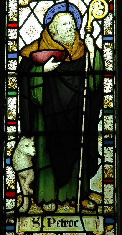
Saint Petroc or Petrock ( lat-med, Petrocus; cy, Pedrog; french: link=no, Perreux; ) was a British prince and Christian saint. Probably born in South Wales, he primarily ministered to the Britons of Devon (Dewnans) and Cornwall (Kernow) then forming the kingdom of Dumnonia where he is associated with a monastery at Padstow, which is named after him (Pedroc-stowe, or 'Petrock's Place'). Padstow appears to have been his earliest major cult centre, but Bodmin became the major centre for his veneration when his relics were moved to the monastery there in the later ninth century. Bodmin monastery became one of the wealthiest Cornish foundations by the eleventh century. There is a second ancient dedication to him nearby at Little Petherick or "Saint Petroc Minor". In Devon ancient dedications total a probable seventeen (plus Timberscombe just over the border in Somerset), mostly coastal and including one within the old Roman walls of Exeter as well as the villages of Petrockstowe an ... [...More Info...] [...Related Items...] OR: [Wikipedia] [Google] [Baidu] |
Hamlets In Cornwall
A hamlet is a human settlement that is smaller than a town or village. Its size relative to a parish can depend on the administration and region. A hamlet may be considered to be a smaller settlement or subdivision or satellite entity to a larger settlement. The word and concept of a hamlet has roots in the Anglo-Norman settlement of England, where the old French ' came to apply to small human settlements. Etymology The word comes from Anglo-Norman ', corresponding to Old French ', the diminutive of Old French ' meaning a little village. This, in turn, is a diminutive of Old French ', possibly borrowed from (West Germanic) Franconian languages. Compare with modern French ', Dutch ', Frisian ', German ', Old English ' and Modern English ''home''. By country Afghanistan In Afghanistan, the counterpart of the hamlet is the qala (Dari: قلعه, Pashto: کلي) meaning "fort" or "hamlet". The Afghan ''qala'' is a fortified group of houses, generally with its own commu ... [...More Info...] [...Related Items...] OR: [Wikipedia] [Google] [Baidu] |


