|
Tregajorran
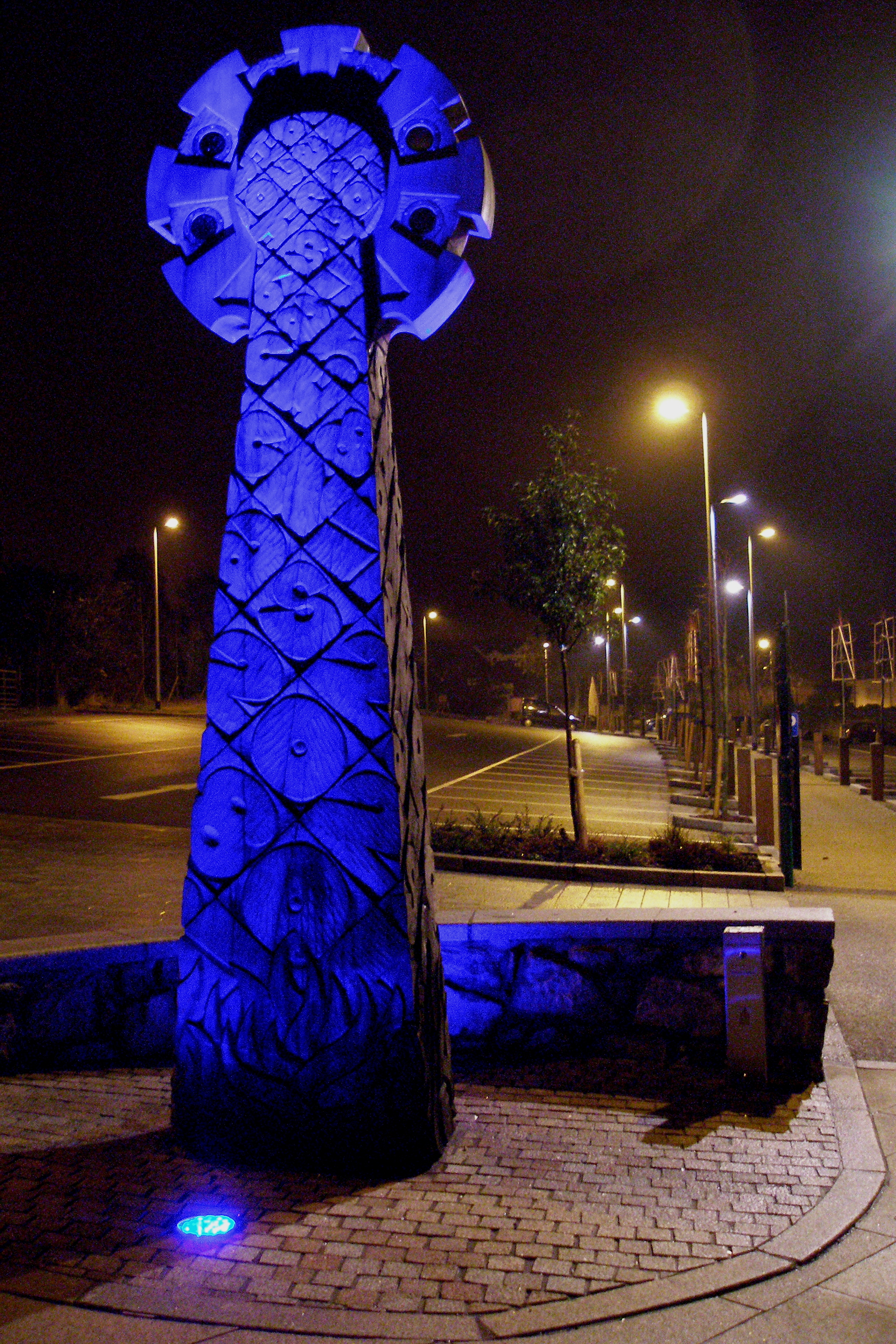
Tregajorran is a hamlet in Cornwall, England, UK. It is southwest of Redruth, in the civil parish of Carn Brea. Notable residents Richard Trevithick, inventor and mining engineer, was born in the hamlet (then in the ecclesiastical parish of Illogan Illogan (pronounced ''il'luggan'', kw, Egloshalow) is a village and civil parish in west Cornwall, UK, two miles (3 km) northwest of Redruth. The population of Illogan was 5,404 at the 2011 census. In the same year the population of the Ca ...). References Hamlets in Cornwall {{Cornwall-geo-stub ... [...More Info...] [...Related Items...] OR: [Wikipedia] [Google] [Baidu] |
Tregajorran - Geograph
Tregajorran is a hamlet in Cornwall, England, UK. It is southwest of Redruth, in the civil parish of Carn Brea. Notable residents Richard Trevithick, inventor and mining engineer, was born in the hamlet (then in the ecclesiastical parish of Illogan Illogan (pronounced ''il'luggan'', kw, Egloshalow) is a village and civil parish in west Cornwall, UK, two miles (3 km) northwest of Redruth. The population of Illogan was 5,404 at the 2011 census. In the same year the population of the Ca ...). References Hamlets in Cornwall {{Cornwall-geo-stub ... [...More Info...] [...Related Items...] OR: [Wikipedia] [Google] [Baidu] |
Richard Trevithick
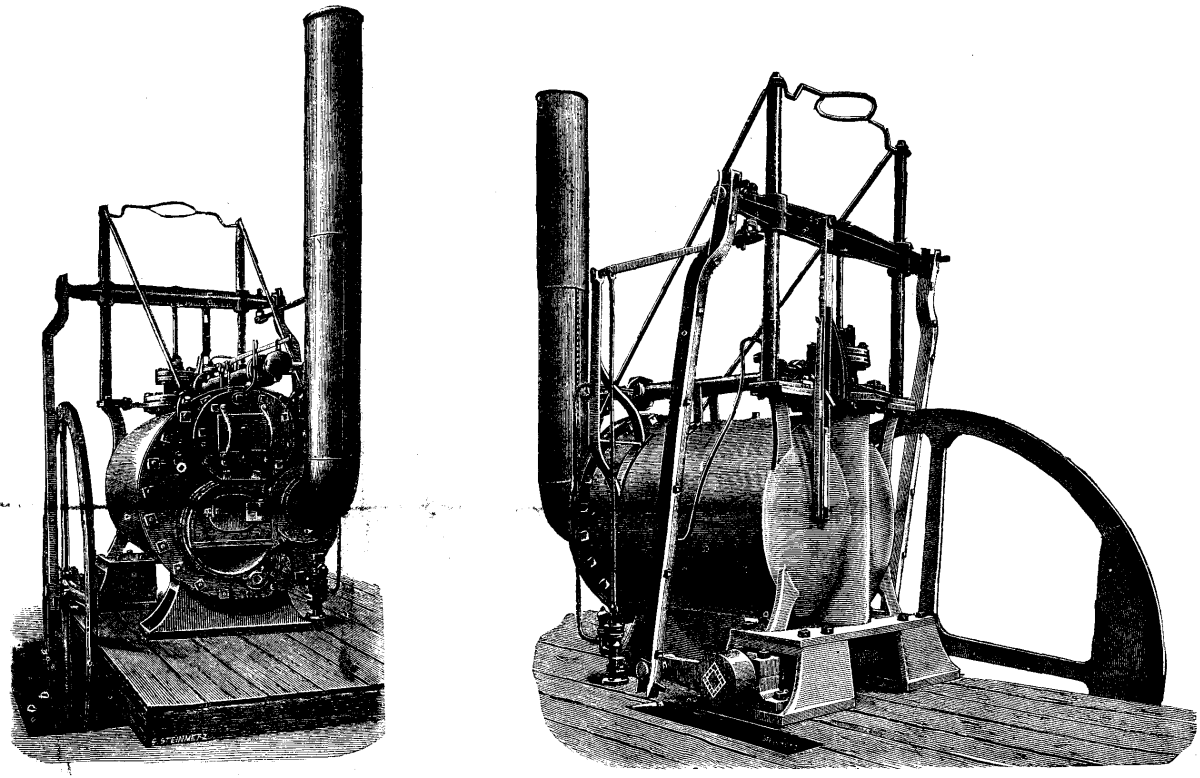
Richard Trevithick (13 April 1771 – 22 April 1833) was a British inventor and mining engineer. The son of a mining captain, and born in the mining heartland of Cornwall, Trevithick was immersed in mining and engineering from an early age. He was an early pioneer of steam-powered road and rail transport, and his most significant contributions were the development of the first high-pressure steam engine and the first working railway steam locomotive. The world's first locomotive-hauled railway journey took place on 21 February 1804, when Trevithick's unnamed steam locomotive hauled a train along the tramway of the Penydarren Ironworks, in Merthyr Tydfil, Wales. Turning his interests abroad Trevithick also worked as a mining consultant in Peru and later explored parts of Costa Rica. Throughout his professional career he went through many ups and downs and at one point faced financial ruin, also suffering from the strong rivalry of many mining and steam engineers of the day. Durin ... [...More Info...] [...Related Items...] OR: [Wikipedia] [Google] [Baidu] |
Carn Brea, Redruth
Carn Brea ( kw, Karnbre) is a civil parish and hilltop site in Cornwall, England, United Kingdom. The population of Carn Brea including Bosleake and Church Coombe was 8,013 at the 2011 census. The hilltop site is situated approximately one mile (1.6 km) southwest of Redruth. The settlements of Bosleake, Brea, Broad Lane, Carn Arthen, Carn Brea Village, Carnkie, Four Lanes, Grillis, Illogan Highway, Pencoys, Penhallick, Piece, Pool, Tolskithy, Tregajorran, Treskillard, Tuckingmill and West Tolgus are in the parish. Neolithic settlement The Neolithic settlement at Carn Brea was a tor enclosure occupied between around 3700 and 3400 BC. Roger Mercer directed archaeological excavations of the site in 1970. https://cornisharchaeology.org.uk/volume-9-1970/ and 1972. https://cornisharchaeology.org.uk/volume-11-1972/ A two-acre (0.8 ha) inner enclosure was surrounded by one of eleven acres (4.5 ha). The ramparts consisted of stone walls with an earth bank and ditch. T ... [...More Info...] [...Related Items...] OR: [Wikipedia] [Google] [Baidu] |
Cornwall
Cornwall (; kw, Kernow ) is a historic county and ceremonial county in South West England. It is recognised as one of the Celtic nations, and is the homeland of the Cornish people. Cornwall is bordered to the north and west by the Atlantic Ocean, to the south by the English Channel, and to the east by the county of Devon, with the River Tamar forming the border between them. Cornwall forms the westernmost part of the South West Peninsula of the island of Great Britain. The southwesternmost point is Land's End and the southernmost Lizard Point. Cornwall has a population of and an area of . The county has been administered since 2009 by the unitary authority, Cornwall Council. The ceremonial county of Cornwall also includes the Isles of Scilly, which are administered separately. The administrative centre of Cornwall is Truro, its only city. Cornwall was formerly a Brythonic kingdom and subsequently a royal duchy. It is the cultural and ethnic origin of the Cornish dias ... [...More Info...] [...Related Items...] OR: [Wikipedia] [Google] [Baidu] |
United Kingdom
The United Kingdom of Great Britain and Northern Ireland, commonly known as the United Kingdom (UK) or Britain, is a country in Europe, off the north-western coast of the continental mainland. It comprises England, Scotland, Wales and Northern Ireland. The United Kingdom includes the island of Great Britain, the north-eastern part of the island of Ireland, and many smaller islands within the British Isles. Northern Ireland shares a land border with the Republic of Ireland; otherwise, the United Kingdom is surrounded by the Atlantic Ocean, the North Sea, the English Channel, the Celtic Sea and the Irish Sea. The total area of the United Kingdom is , with an estimated 2020 population of more than 67 million people. The United Kingdom has evolved from a series of annexations, unions and separations of constituent countries over several hundred years. The Treaty of Union between the Kingdom of England (which included Wales, annexed in 1542) and the Kingdom of Scotland in 170 ... [...More Info...] [...Related Items...] OR: [Wikipedia] [Google] [Baidu] |
Redruth
Redruth ( , kw, Resrudh) is a town and civil parishes in Cornwall, civil parish in Cornwall, England. The population of Redruth was 14,018 at the 2011 census. In the same year the population of the Camborne-Redruth urban area, which also includes Carn Brea, Redruth, Carn Brea, Illogan and several satellite villages, stood at 55,400 making it the largest conurbation in Cornwall. Redruth lies approximately at the junction of the Great Britain road numbering scheme, A393 and A3047 roads, on the route of the old London to Land's End trunk road (now the A30 road, A30), and is approximately west of Truro, east of St Ives, Cornwall, St Ives, north east of Penzance, Cornwall, Penzance and north west of Falmouth, Cornwall, Falmouth. Camborne and Redruth together form the largest urban area in Cornwall and before local government reorganisation were an Urban district (Great Britain and Ireland), urban district. Toponymy The name Redruth derives from its older Cornish name, ''Rhy ... [...More Info...] [...Related Items...] OR: [Wikipedia] [Google] [Baidu] |
Civil Parish
In England, a civil parish is a type of administrative parish used for local government. It is a territorial designation which is the lowest tier of local government below districts and counties, or their combined form, the unitary authority. Civil parishes can trace their origin to the ancient system of ecclesiastical parishes, which historically played a role in both secular and religious administration. Civil and religious parishes were formally differentiated in the 19th century and are now entirely separate. Civil parishes in their modern form came into being through the Local Government Act 1894, which established elected parish councils to take on the secular functions of the parish vestry. A civil parish can range in size from a sparsely populated rural area with fewer than a hundred inhabitants, to a large town with a population in the tens of thousands. This scope is similar to that of municipalities in Continental Europe, such as the communes of France. However, ... [...More Info...] [...Related Items...] OR: [Wikipedia] [Google] [Baidu] |
Parish
A parish is a territorial entity in many Christian denominations, constituting a division within a diocese. A parish is under the pastoral care and clerical jurisdiction of a priest, often termed a parish priest, who might be assisted by one or more curates, and who operates from a parish church. Historically, a parish often covered the same geographical area as a manor. Its association with the parish church remains paramount. By extension the term ''parish'' refers not only to the territorial entity but to the people of its community or congregation as well as to church property within it. In England this church property was technically in ownership of the parish priest ''ex-officio'', vested in him on his institution to that parish. Etymology and use First attested in English in the late, 13th century, the word ''parish'' comes from the Old French ''paroisse'', in turn from la, paroecia, the latinisation of the grc, παροικία, paroikia, "sojourning in a foreign ... [...More Info...] [...Related Items...] OR: [Wikipedia] [Google] [Baidu] |
Illogan
Illogan (pronounced ''il'luggan'', kw, Egloshalow) is a village and civil parish in west Cornwall, UK, two miles (3 km) northwest of Redruth. The population of Illogan was 5,404 at the 2011 census. In the same year the population of the Camborne-Redruth urban area, which also includes Carn Brea, Illogan and several satellite villages, stood at 55,400 making it the largest conurbation in Cornwall. Originally a rural area supporting itself by farming and agriculture, Illogan shared in the general leap into prosperity brought about by the mining boom, which was experienced by the whole Camborne-Redruth area. History Antiquities In 1931 the ruins of a Roman villa at Magor Farm were found by Nicholas Warren and excavated under the guidance of the Royal Institution of Cornwall. The villa was probably the residence of a wealthy Dumnonian who had adopted the Roman lifestyle. Church The Church of England parish church was dedicated to St Illogan (Ylloganus or Euluganus) and St ... [...More Info...] [...Related Items...] OR: [Wikipedia] [Google] [Baidu] |


