|
Tree Ring Enclosure
A tree ring, also once popularly called a "folly", is a decorative feature of 18th and early 19th century planned landscapes in Britain and Ireland, comprising a circular earthen enclosure (a "tree ring enclosure") planted with trees.Williams, B. B. “Excavation of a Tree-Ring at Gallanagh, County Tyrone and Some Observations on Tree-Rings.” Ulster Journal of Archaeology, vol. 43, 1980, p 97. JSTOR, http://www.jstor.org/stable/20567855 While several different species of tree were used, beech and Scots pine were especially popular for their tall, straight growth and landscape value. Tree rings are a development of the naturalistic 18th century style of landscape architecture.Williams (1980), 100 History and construction Tree rings were created by 18th century landowners seeking to 'improve' and enhance the views across their properties. Beech became particularly valued in the 18th century as a landscape tree and for its timber, where previously it had been largely regarded as ... [...More Info...] [...Related Items...] OR: [Wikipedia] [Google] [Baidu] |
Ingleby Greenhow
Ingleby Greenhow is a village and civil parish in the Hambleton district of North Yorkshire, England. It is on the border of the North York Moors and south of Great Ayton. The parish of Ingleby Greenhow has records of a John Thomasson de Grenehow, a member of the clergy, who in 1376 "''had to appear before a Commission appointed to be tried with several others for either poaching or cutting down timber, or destroying property belonging to Peter de Malo Luca the 6th, of Mulgrave Castle''". The name may derive from the Saxon for Englishman's green hill. How, derived from the Old Norse word ''haugr'', means hill or mound. The manor was bought by a Scottish courtier David Foulis in 1608. The parish church, St Andrew, was almost entirely rebuilt in 1741, but has an early Norman chancel arch inside. In 1931, British altitude and distance records for gliders were established over the moors near here, as recounted by the novelist, pilot, and aeronautical engineer Nevil Shute in his ... [...More Info...] [...Related Items...] OR: [Wikipedia] [Google] [Baidu] |
Wayland's Smithy
Wayland's Smithy is an Early Neolithic chambered long barrow located near the village of Ashbury in the south-central English county of Oxfordshire. The barrow is believed to have been constructed about 3600 BC by pastoral communities shortly after the introduction of agriculture to the British Isles from continental Europe. Although part of an architectural tradition of long barrow building that was widespread across Neolithic Europe, Wayland's Smithy belongs to a localised regional variant of barrows - found only in south-west of Britain - known as the Severn-Cotswold group. Wayland's Smithy is one of the best surviving examples of this type of barrow. The site's appearance is a result of restoration following excavations undertaken by archaeologists, Stuart Piggott and Richard Atkinson, in 1962–63. Their research of the site showed it had been built in two different phases. First as a timber-chambered oval barrow built around 3590 and 3550 BC and then later as a stone-c ... [...More Info...] [...Related Items...] OR: [Wikipedia] [Google] [Baidu] |
Somerset
( en, All The People of Somerset) , locator_map = , coordinates = , region = South West England , established_date = Ancient , established_by = , preceded_by = , origin = , lord_lieutenant_office =Lord Lieutenant of Somerset , lord_lieutenant_name = Mohammed Saddiq , high_sheriff_office =High Sheriff of Somerset , high_sheriff_name = Mrs Mary-Clare Rodwell (2020–21) , area_total_km2 = 4171 , area_total_rank = 7th , ethnicity = 98.5% White , county_council = , unitary_council = , government = , joint_committees = , admin_hq = Taunton , area_council_km2 = 3451 , area_council_rank = 10th , iso_code = GB-SOM , ons_code = 40 , gss_code = , nuts_code = UKK23 , districts_map = , districts_list = County council area: , MPs = * Rebecca Pow (C) * Wera Hobhouse ( LD) * Liam Fox (C) * David Warburton (C) * Marcus Fysh (C) * Ian Liddell-Grainger (C) * James Heappey (C) * Jacob Rees-Mogg (C) * John Penrose (C) , police = Avon and Somerset Police ... [...More Info...] [...Related Items...] OR: [Wikipedia] [Google] [Baidu] |
Seven Sisters (Quantock Hills)
The Seven Sisters is a clump of beech trees on Cothelstone Hill in the Quantock Hills, England. Originally planted in the 18th century, they form a well-known and prominent landmark visible from large areas of Somerset and South Wales. The hill is currently leased to the South West Heritage Trust by its owner Somerset County Council, and managed by the Quantock Hills AONB Service under a Higher Level Stewardship Scheme. Three large trees remain from the original planting, while recently planted replacements grow nearby. History The trees are sited on a Bronze Age disc barrow near the summit of Cothelstone Hill. They are thought to have originally been planted by Mary Hill, Lady Hillsborough (1726-1780) in the later 18th century; Hill also planted two other circles of beeches in the area and built an ornamental folly, Cothelstone Beacon or Beacon Tower, nearby. A newspaper article of the time referred to "Cotherston, the place in Somersetshire, where lady Hilsborough has lately ... [...More Info...] [...Related Items...] OR: [Wikipedia] [Google] [Baidu] |
Berkshire
Berkshire ( ; in the 17th century sometimes spelt phonetically as Barkeshire; abbreviated Berks.) is a historic county in South East England. One of the home counties, Berkshire was recognised by Queen Elizabeth II as the Royal County of Berkshire in 1957 because of the presence of Windsor Castle, and letters patent were issued in 1974. Berkshire is a county of historic origin, a ceremonial county and a non-metropolitan county without a county council. The county town is Reading. The River Thames formed the historic northern boundary, from Buscot in the west to Old Windsor in the east. The historic county, therefore, includes territory that is now administered by the Vale of White Horse and parts of South Oxfordshire in Oxfordshire, but excludes Caversham, Slough and five less populous settlements in the east of the Royal Borough of Windsor and Maidenhead. All the changes mentioned, apart from the change to Caversham, took place in 1974. The towns of Abingdon, Didcot, Far ... [...More Info...] [...Related Items...] OR: [Wikipedia] [Google] [Baidu] |
Lancing Ring
Lancing Ring is a Local Nature Reserve in Lancing, West Sussex, Lancing in West Sussex. It is owned and managed by Adur District Council. This chalk grassland site is notable for Butterfly, butterflies, Vipera berus, adders, and Viviparous lizard, common lizards. There is also deciduous woodland with wildflowers including early purple orchids and a dew pond, the habitat of Dragonfly, dragonflies such as the broad-bodied chaser, ''Libellula depressa'', and numerous newts. There is access from Mill Road via the main car park and Halewick Lane has an area for parking beside the children's play area at the foot of the hill. There is a volunteer group that assists Adur District council with conservation management, the Friends of Lancing Ring, formed in 1989. History Archaeological research at Lancing Ring has identified it as the likely site of an Iron Age shrine and Romano-Celtic temple. The Romano-Celtic temple site has been identified as the large sloping field above the recy ... [...More Info...] [...Related Items...] OR: [Wikipedia] [Google] [Baidu] |
Sussex
Sussex (), from the Old English (), is a historic county in South East England that was formerly an independent medieval Anglo-Saxon kingdom. It is bounded to the west by Hampshire, north by Surrey, northeast by Kent, south by the English Channel, and divided for many purposes into the ceremonial counties of West Sussex and East Sussex. Brighton and Hove, though part of East Sussex, was made a unitary authority in 1997, and as such, is administered independently of the rest of East Sussex. Brighton and Hove was granted city status in 2000. Until then, Chichester was Sussex's only city. The Brighton and Hove built-up area is the 15th largest conurbation in the UK and Brighton and Hove is the most populous city or town in Sussex. Crawley, Worthing and Eastbourne are major towns, each with a population over 100,000. Sussex has three main geographic sub-regions, each oriented approximately east to west. In the southwest is the fertile and densely populated coastal plain. Nort ... [...More Info...] [...Related Items...] OR: [Wikipedia] [Google] [Baidu] |
Chanctonbury Ring
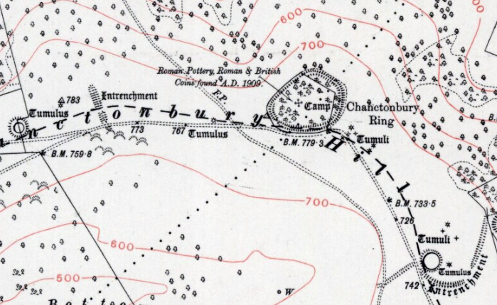
Chanctonbury Ring is a prehistoric hill fort atop Chanctonbury Hill on the South Downs, on the border of the civil parishes of Washington and Wiston in the English county of West Sussex. A ridgeway, now part of the South Downs Way, runs along the hill. It forms part of an ensemble of associated historical features created over a span of more than 2,000 years, including round barrows dating from the Bronze Age to the Saxon periods and dykes dating from the Iron Age and Roman periods. Consisting of a roughly circular low earthen rampart surrounded by a ditch, Chanctonbury Ring is thought to date to the late Bronze Age or early Iron Age. The purpose of the structure is unknown but it could have filled a variety of roles, including a defensive position, a cattle enclosure or even a religious shrine. After a few centuries of usage, it was abandoned for about five hundred years until it was reoccupied during the Roman period. Two Romano-British temples were built in the hill fort's in ... [...More Info...] [...Related Items...] OR: [Wikipedia] [Google] [Baidu] |
Tilia Cordata
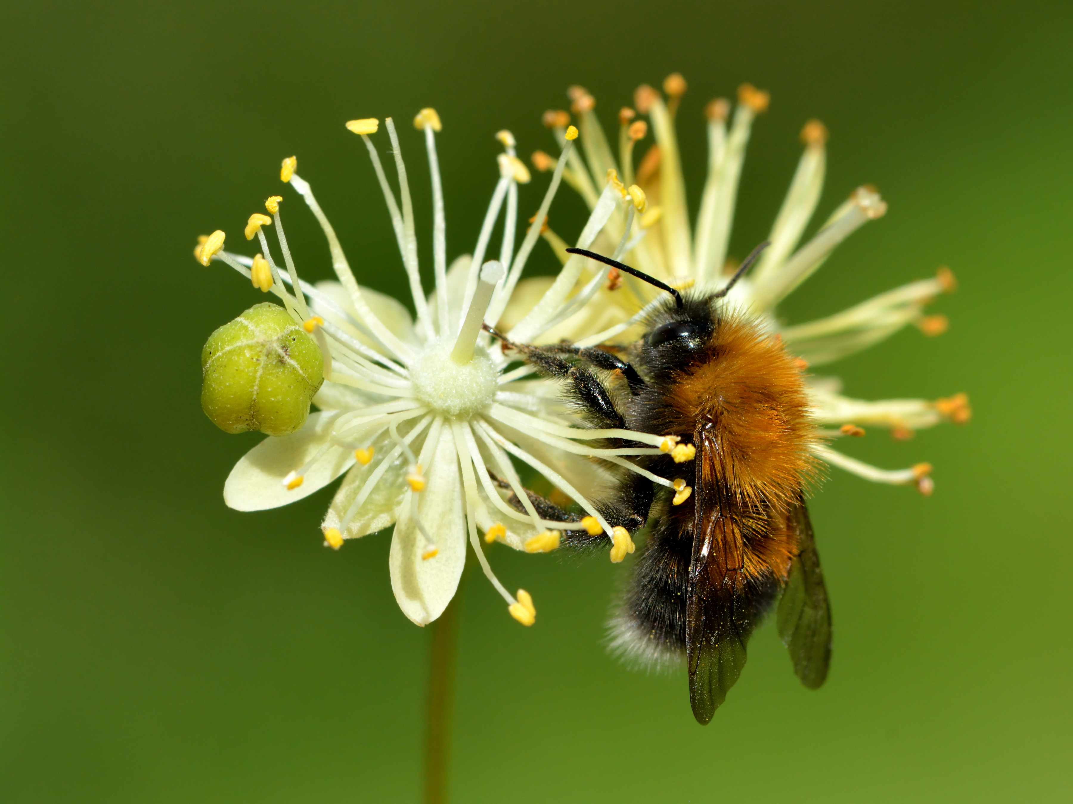
''Tilia cordata'', the small-leaved lime or small-leaved linden, is a species of tree in the family Malvaceae, native to much of Europe. Other common names include little-leaf or littleleaf linden, or traditionally in South East England, pry or pry tree. Its range extends from Britain through mainland Europe to the Caucasus and western Asia. In the south of its range it is restricted to high elevations.Rushforth, K. (1999). ''Trees of Britain and Europe''. Collins .Den Virtuella Floran''Tilia cordata'' (in Swedish; with maps/ref> Description ''Tilia cordata'' is a deciduous tree growing to tall, diameter 1/3 to 1/2 the height, with a trunk up to 1 m diameter. The largest known trunk circumference was a specimen in Närke, Sweden, that measured 8.35 meters diameter at chest height. Lindar in Germany is said to be over 1000 years old. The bark is smooth and grayish when young, firm with vertical ridges and horizontal fissures when older. The crown is rounded in a formal oval ... [...More Info...] [...Related Items...] OR: [Wikipedia] [Google] [Baidu] |
Carpinus Betulus
''Carpinus betulus'', the European or common hornbeam, is a species of tree in the birch family Betulaceae, native to Western Asia and central, eastern, and southern Europe, including southern England. It requires a warm climate for good growth, and occurs only at elevations up to . It grows in mixed stands with oak, and in some areas beech, and is also a common tree in scree forests. Hornbeam was also known as 'Yoke Elm'. Description It is a deciduous small to medium-size tree reaching heights of , rarely , and often has a fluted and crooked trunk. The bark is smooth and greenish-grey, even in old trees. The buds, unlike those of the beech, are long at the most, and pressed close to the twig. The leaves are alternate, long, with prominent veins giving a distinctive corrugated texture, and a serrated margin. It is monoecious, and the wind-pollinated male and female catkins appear in early summer after the leaves. The fruit is a small long nut, partially surrounded by a thre ... [...More Info...] [...Related Items...] OR: [Wikipedia] [Google] [Baidu] |
Earth Trust
Founded in 1967, Earth Trust is an environmental charity (not-for-profit organisation) which was originally known as the Northmoor Trust for Countryside Conservation. Earth Trust was initially established by the British engineer Sir Martin Wood to promote environmental conservation through land management, education, and land science. It is a registered charity under English law. Since 1982 Earth Trust has been providing and championing accessible natural green spaces and running inspiring, award-winning programmes to help connect people with nature and the environment. Earth Trust inspire people to address climate, biodiversity and wellbeing with the power of natural green spaces. Earth Trust is the owner and manager of the largest freely accessible natural green space landscape in Oxfordshire - the iconic Wittenham Clumps: 500 hectares of woodland, farmland, wildflower meadows and wetlands. Earth Trust also care for a growing number of smaller community reserves - special plac ... [...More Info...] [...Related Items...] OR: [Wikipedia] [Google] [Baidu] |


