|
Tolmachevo
Tolmachevo (russian: Толмачево) is the name of several types of inhabited localities in Russia, inhabited localities in Russia. Urban localities *Tolmachevo, Leningrad Oblast, an urban-type settlement under the administrative jurisdiction of Tolmachevskoye Settlement Municipal Formation in Luzhsky District of Leningrad Oblast Rural localities *Tolmachevo, Bryansk Oblast, a ''village#Russia, selo'' in Snezhsky Selsoviet of Bryansky District of Bryansk Oblast *Tolmachevo, Kaluga Oblast, a village#Russia, village in Tarussky District of Kaluga Oblast *Tolmachevo, Brezhnevsky Selsoviet, Kursky District, Kursk Oblast, a village in Brezhnevsky Selsoviet of Kursky District, Kursk Oblast, Kursky District of Kursk Oblast *Tolmachevo, Lebyazhensky Selsoviet, Kursky District, Kursk Oblast, a village in Lebyazhensky Selsoviet of Kursky District of Kursk Oblast *Tolmachevo, Moscow Oblast, a village in Nikonovskoye Rural Settlement of Ramensky District of Moscow Oblast *Tolmachevo, ... [...More Info...] [...Related Items...] OR: [Wikipedia] [Google] [Baidu] |
Types Of Inhabited Localities In Russia
The classification system of inhabited localities in Russia and some other post-Soviet states has certain peculiarities compared with those in other countries. Classes During the Soviet time, each of the republics of the Soviet Union, including the Russian SFSR, had its own legislative documents dealing with classification of inhabited localities. After the dissolution of the Soviet Union, the task of developing and maintaining such classification in Russia was delegated to the federal subjects.Articles 71 and 72 of the Constitution of Russia do not name issues of the administrative and territorial structure among the tasks handled on the federal level or jointly with the governments of the federal subjects. As such, all federal subjects pass their own laws establishing the system of the administrative-territorial divisions on their territories. While currently there are certain peculiarities to classifications used in many federal subjects, they are all still largely ba ... [...More Info...] [...Related Items...] OR: [Wikipedia] [Google] [Baidu] |
Soskovsky District
Soskovsky District (russian: Сосковский райо́н) is an administrativeLaw #522-OZ and municipalLaw #433-OZ district (raion), one of the twenty-four in Oryol Oblast, Russia. It is located in the west of the oblast. The area of the district is . Its administrative center is the rural locality In general, a rural area or a countryside is a geographic area that is located outside towns and cities. Typical rural areas have a low population density and small settlements. Agricultural areas and areas with forestry typically are describ ... (a '' selo'') of Soskovo. Population: 5,982 ( 2010 Census); The population of Soskovo accounts for 30.0% of the district's total population. See also * Yelkovo References Notes Sources * * {{Use mdy dates, date=October 2012 Districts of Oryol Oblast ... [...More Info...] [...Related Items...] OR: [Wikipedia] [Google] [Baidu] |
Oryol Oblast
Oryol Oblast (russian: Орло́вская о́бласть, ''Orlovskaya oblast''), also known as Orlovshchina (russian: Орловщина) is a federal subjects of Russia, federal subject of Russia (an oblast). Its administrative center is the types of inhabited localities in Russia, city of Oryol. Population: 714,094 (Estimate 2022) (Russian Census (2010), 2010 Census — 786,935). Geography It is located in the southwestern part of the Central Federal District, in the Central Russian Upland. In terms of area, at it is one of the smallest federal subjects. From north to south, it extends for more than , and from west to east—for over . Kaluga Oblast border it to the north-west; Tula Oblast is located to the north; Lipetsk Oblast — to the east; Kursk Oblast — to the south, and Bryansk Oblast is to the west. There are of black earth soils (chernozems) in the oblast, which amounts to three-quarters of the world chernozem reserves. Climate The climate is tempera ... [...More Info...] [...Related Items...] OR: [Wikipedia] [Google] [Baidu] |
Mtsensky District
Mtsensky District (russian: Мце́нский райо́н) is an administrativeLaw #522-OZ and municipalLaw #434-OZ district (raion), one of the twenty-four in Oryol Oblast, Russia. It is located in the north of the oblast An oblast (; ; Cyrillic (in most languages, including Russian and Ukrainian): , Bulgarian: ) is a type of administrative division of Belarus, Bulgaria, Kazakhstan, Kyrgyzstan, Russia, and Ukraine, as well as the Soviet Union and the Kingdom of .... The area of the district is . Its administrative center is the types of inhabited localities in Russia , town of Mtsensk (which is not administratively a part of the district). Population: 19,233 (Russian Census (2010) , 2010 Census); Geography Within the Oryol Oblast the Mtsensk District borders: * the Bolkhovsky District (to the north-west) * the Orlovsky District, Oryol Oblast , Orlovsky District (to the south-west) * the Zalegoshchensky District (to the south) * the Novosilsky District (to the south-e ... [...More Info...] [...Related Items...] OR: [Wikipedia] [Google] [Baidu] |
Novosibirsk Oblast
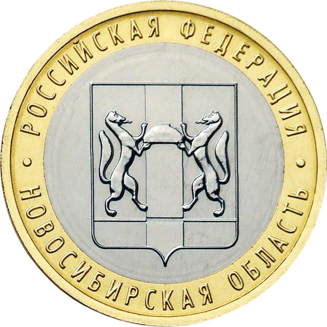
Novosibirsk Oblast (russian: Новосиби́рская о́бласть, ''Novosibirskaya oblast'') is a federal subject of Russia (an oblast) located in southwestern Siberia. Its administrative and economic center is the city of Novosibirsk. The population was 2,788,849 as of the 2018 Census. Geography Overview Novosibirsk Oblast is located in the south of the West Siberian Plain, at the foothills of low Salair ridge, between the Ob and Irtysh Rivers. The oblast borders Omsk Oblast in the west, Kazakhstan (Pavlodar Province) in the southwest, Tomsk Oblast in the north, Kemerovo Oblast in the east, and Altai Krai in the south. The territory of the oblast extends for more than from west to east, and for over from north to south. The oblast is mainly plain; in the south the steppes prevail; in the north enormous tracts of woodland with great number of marshes prevail. There are many lakes, the largest ones located at the south. The majority of the rivers belong to the ... [...More Info...] [...Related Items...] OR: [Wikipedia] [Google] [Baidu] |
Novosibirsky District
Novosibirsky District (russian: Новосиби́рский райо́н) is an administrative and municipalLaw #200-OZ district (raion), one of the thirty in Novosibirsk Oblast, Russia. It is located in the east of the oblast. The area of the district is . Its administrative center is the city of Novosibirsk (which is not administratively a part of the district). Population: 127,891 ( 2010 Census); Administrative and municipal status Within the framework of administrative divisions, Novosibirsky District is one of the thirty in the oblast. The city of Novosibirsk serves as its administrative center An administrative center is a seat of regional administration or local government, or a county town, or the place where the central administration of a commune is located. In countries with French as administrative language (such as Belgium, Lu ..., despite being incorporated separately as an administrative unit with the status equal to that of the districts. As a municipal ... [...More Info...] [...Related Items...] OR: [Wikipedia] [Google] [Baidu] |
Nizhny Novgorod Oblast
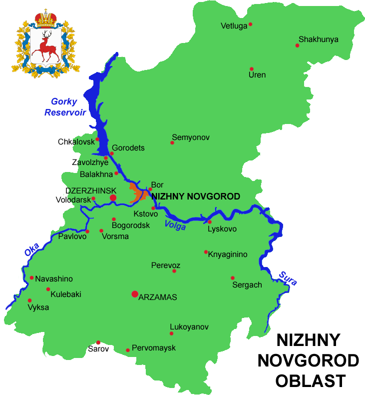
Nizhny Novgorod Oblast (russian: link=no, Нижегородская область, ''Nizhegorodskaya oblast''), is a federal subjects of Russia, federal subject of Russia (an oblast). Its administrative center is the types of inhabited localities in Russia, city of Nizhny Novgorod. It has a population of 3,310,597 as of the Russian Census (2010), 2010 Census. From 1932 to 1990 it was known as Gorky Oblast. The oblast is crossed by the Volga River. Apart from Nizhny Novgorod's metropolitan area (including Dzerzhinsk, Russia, Dzerzhinsk, Bor, Nizhny Novgorod Oblast, Bor and Kstovo) the biggest city is Arzamas. Near the town of Sarov there is the Serafimo-Diveyevsky Monastery, one of the largest convents in Russia, established by Seraphim of Sarov, Saint Seraphim of Sarov. The Makaryev Monastery opposite of the town of Lyskovo, Nizhny Novgorod Oblast, Lyskovo used to be the location of the largest fair in Eastern Europe. Other historic towns include Gorodets, Nizhny Novgorod Oblast ... [...More Info...] [...Related Items...] OR: [Wikipedia] [Google] [Baidu] |
Kstovsky District
Kstovsky District (russian: Ксто́вский райо́н) is an administrative district (raion), one of the forty in Nizhny Novgorod Oblast, Russia.Order #3-od Municipally, it is incorporated as Kstovsky Municipal District.Resolution #670 It is located in the center of the oblast. The area of the district is . Its administrative center is the town of Kstovo. Population: 112,823 ( 2010 Census); The population of Kstovo accounts for 59.1% of the district's total population. Geography Kstovsky District is located along the southern shore of the Volga River. The westernmost part of the district is adjacent to the city of Nizhny Novgorod. It is gradually becoming more suburban, its housing developments and shopping centers closely linked to the life of the city. The east of the district is more rural, with potato, root crops, and grain fields and cattle pastures alternating with forests and dacha areas. History The district was established in 1929 and given its present name in 19 ... [...More Info...] [...Related Items...] OR: [Wikipedia] [Google] [Baidu] |


