|
Tilicho Lake
Tilicho Lake () is a lake located in the Manang district of Nepal, as the crow flies from the city of Pokhara. It is situated at an elevation of in the Annapurna range of the Himalayas. Another source lists the elevation of Lake Tilicho as being . According to the Nepali Department of Hydrology & Meteorology (2003), no aquatic organism has been recorded in the lake. Tilicho Lake is the destination of one of the most popular side hikes of the Annapurna Circuit trek. The hike takes additional 3–4 days. No camping is required, as new lodges have been built between Manang and the lake. The final approach to the lake is done in a day hike from the lodge at Tilicho Base Camp. Trekkers attempting the Annapurna Circuit route usually cross the watershed between Manang and Kali Gandaki valleys over the 5416 meters high Thorong La pass. The alternate route, skirting Tilicho Lake from the north, has been gaining popularity. This route is more demanding and requires at least one night of ... [...More Info...] [...Related Items...] OR: [Wikipedia] [Google] [Baidu] |
Annapurna
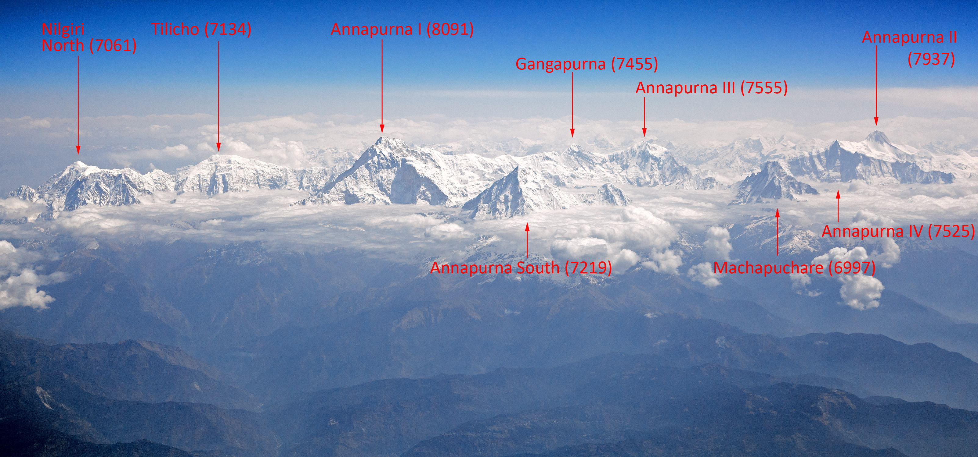
Annapurna (; ne, अन्नपूर्ण) is a mountain situated in the Annapurna mountain range of Gandaki Province, north-central Nepal. It is the tenth highest mountain in the world at above sea level and is well known for the difficulty and danger involved in its ascent. Maurice Herzog led a French expedition to its summit through the north face in 1950, making it the first eight-thousand meter peak ever successfully climbed. The entire massif and surrounding area are protected within the Annapurna Conservation Area, the first and largest conservation area in Nepal. The Annapurna Conservation Area is home to several world-class treks, including Annapurna Sanctuary and Annapurna Circuit. For decades, Annapurna I Main held the highest fatality-to-summit rate of all principal eight-thousander summits; it has, however, seen great climbing successes in recent years, with the fatality rate falling from 32% to just under 20% from 2012 to 2022. This figure places it ju ... [...More Info...] [...Related Items...] OR: [Wikipedia] [Google] [Baidu] |
Nepal
Nepal (; ne, नेपाल ), formerly the Federal Democratic Republic of Nepal ( ne, सङ्घीय लोकतान्त्रिक गणतन्त्र नेपाल ), is a landlocked country in South Asia. It is mainly situated in the Himalayas, but also includes parts of the Indo-Gangetic Plain, bordering the Tibet Autonomous Region of China to the north, and India in the south, east, and west, while it is narrowly separated from Bangladesh by the Siliguri Corridor, and from Bhutan by the Indian state of Sikkim. Nepal has a diverse geography, including fertile plains, subalpine forested hills, and eight of the world's ten tallest mountains, including Mount Everest, the highest point on Earth. Nepal is a multi-ethnic, multi-lingual, multi-religious and multi-cultural state, with Nepali as the official language. Kathmandu is the nation's capital and the largest city. The name "Nepal" is first recorded in texts from the Vedic period of the India ... [...More Info...] [...Related Items...] OR: [Wikipedia] [Google] [Baidu] |
Manang
Manang ( ne, मनाङ) is a town in the Manang District of Nepal. It is located at 28°40'0N 84°1'0E with an elevation of . According to the preliminary result of the 2011 Nepal census it has a population of 6,527 people living in 1,495 individual households. Its population density is 3 persons/km2.. It is situated in the broad valley of the Marshyangdi River to the north of the Annapurna mountain range. The river flows to the east. To the west, the Thorong La pass leads to Muktinath shrine and the valley of the Gandaki River. To the north there is the Chulu East peak of . Most groups trekking around the Annapurna range will take resting days in Manang to acclimatize to the high elevation, before taking on Thorong La pass. The village is situated on the northern slope, which gets the most sunlight and the least snow cover in the winter. The cultivation fields are on the north slope with terraces. There are now motorable road as well as trails where goods are transported on ... [...More Info...] [...Related Items...] OR: [Wikipedia] [Google] [Baidu] |
As The Crow Flies
__NOTOC__ The expression ''as the crow flies'' is an idiom for the most direct path between two points, rather similar to "in a beeline". This meaning is attested from the early 19th century, and appeared in Charles Dickens's 1838 novel '' Oliver Twist'': Crows do conspicuously fly alone across open country, but neither crows nor bees (as in "beeline") fly in particularly straight lines.Villazon, Luis.“Do crows actually fly in a straight line?” BBC Focus (August 30, 2017). While crows do not swoop in the air like swallows or starlings, they often circle above their nests. One suggested origin of the term is that before modern navigational methods were introduced, cages of crows were kept upon ships and a bird would be released from the crow's nest when required to assist navigation, in the hope that it would fly directly towards land. However, the earliest recorded uses of the term are not nautical in nature, and the crow's nest of a ship is thought to derive from its sha ... [...More Info...] [...Related Items...] OR: [Wikipedia] [Google] [Baidu] |
Pokhara
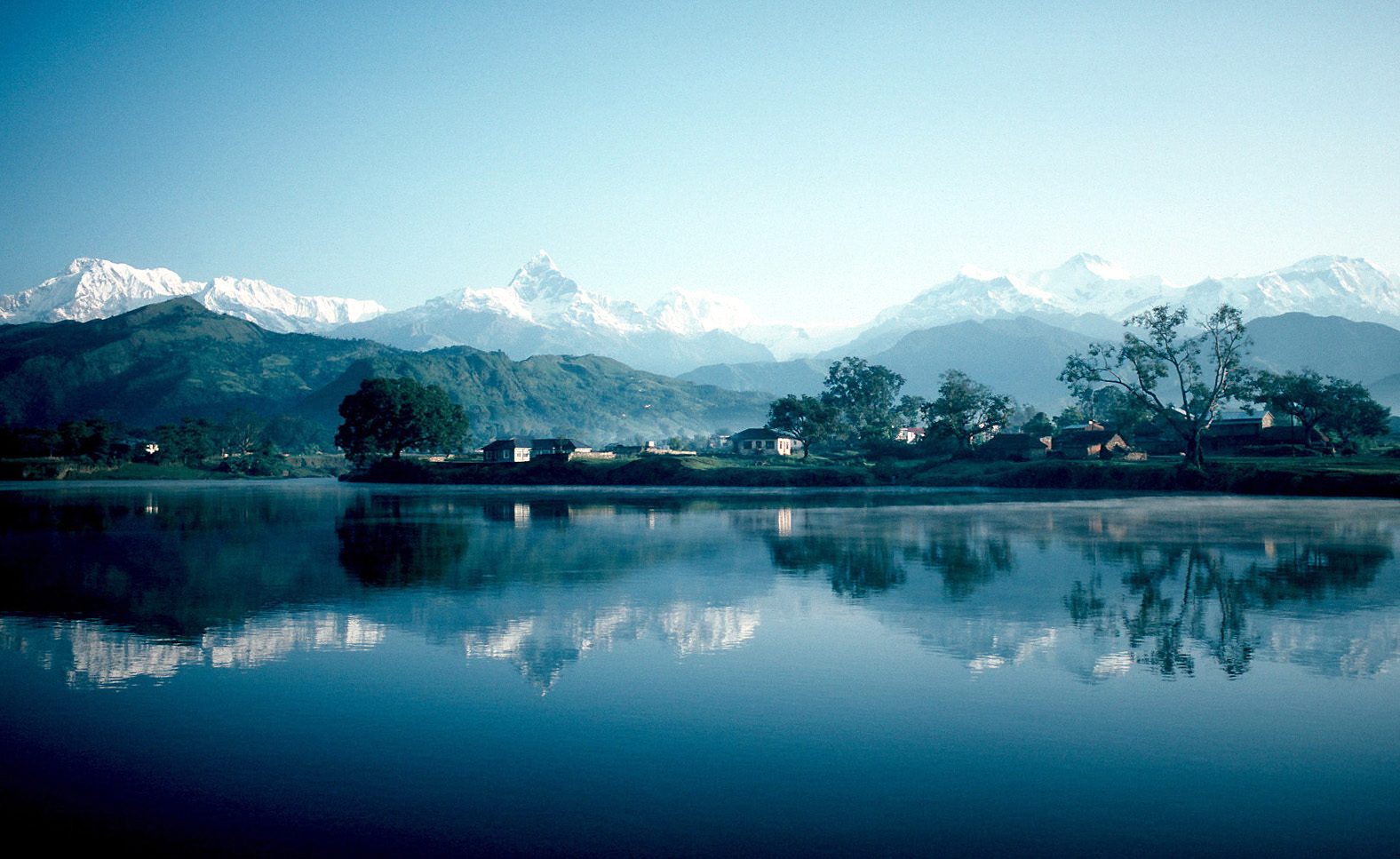
Pokhara ( ne, पोखरा, ) is a metropolis, metropolitan city in Nepal, which serves as the capital of Gandaki Province. It is the List of cities in Nepal, second most populous city of Nepal after Kathmandu, with 518,452 inhabitants living in 101,669 households in 2021 Nepal census, 2021. It is the country's largest metropolitan city in terms of area. The city also serves as the headquarters of Kaski District. Pokhara is located west of the capital, Kathmandu. The city is on the shore of Phewa Lake, and sits at an elevation of approximately 822m. The Annapurna Range, with three out of the ten highest peaks in the world—Dhaulagiri, Annapurna, Annapurna I and Manaslu—is within of the valley. Pokhara is considered the tourism capital of Nepal, being a base for trekkers undertaking the Annapurna Circuit through the Annapurna Conservation Area region of the Annapurna ranges in the Himalayas. The city is also home to many of the elite Gurkha soldiers, soldiers native to So ... [...More Info...] [...Related Items...] OR: [Wikipedia] [Google] [Baidu] |
Himalayas
The Himalayas, or Himalaya (; ; ), is a mountain range in Asia, separating the plains of the Indian subcontinent from the Tibetan Plateau. The range has some of the planet's highest peaks, including the very highest, Mount Everest. Over 100 peaks exceeding in elevation lie in the Himalayas. By contrast, the highest peak outside Asia (Aconcagua, in the Andes) is tall. The Himalayas abut or cross five countries: Bhutan, India, Nepal, China, and Pakistan. The sovereignty of the range in the Kashmir region is disputed among India, Pakistan, and China. The Himalayan range is bordered on the northwest by the Karakoram and Hindu Kush ranges, on the north by the Tibetan Plateau, and on the south by the Indo-Gangetic Plain. Some of the world's major rivers, the Indus, the Ganges, and the Tsangpo–Brahmaputra, rise in the vicinity of the Himalayas, and their combined drainage basin is home to some 600 million people; 53 million people live in the Himalayas. The Himalayas have ... [...More Info...] [...Related Items...] OR: [Wikipedia] [Google] [Baidu] |
Annapurna Circuit
The Annapurna Circuit is a trek within the mountain ranges of central Nepal. The total length of the route varies between 160–230 km (100-145 mi), depending on where motor transportation is used and where the trek is ended. This trek crosses two different river valleys and encircles the Annapurna Massif. The path reaches its highest point at Thorung La pass (5416m/17769 ft), reaching the edge of the Tibetan plateau. Most trekkers hike the route anticlockwise, as this way the daily altitude gain is slower, and crossing the high Thorong La pass is easier and safer. The mountain scenery, seen at close quarters includes the Annapurna Massif (Annapurna I-IV), Dhaulagiri, Machhapuchhre, Manaslu, Gangapurna, Tilicho Peak, Pisang Peak, and Paungda Danda. Numerous other peaks of 6000-8000m in elevation rise from the Annapurna range. The trek begins at Besisahar or Bhulbhule in the Marshyangdi river valley and concludes in the Kali Gandaki Gorge. Besisahar can be reach ... [...More Info...] [...Related Items...] OR: [Wikipedia] [Google] [Baidu] |
Thorong La
Thorong La or Thorung La is a mountain pass with an elevation of above sea level in the Damodar Himal, north of the Annapurna Himal, in central Nepal. Khatung Kang and Yakawa Kang are the mountains forming Thorong La. The pass is located on a trail which connects the village of Manang in the Manang District to the east, with the temple of Muktinath and the nearby village of Ranipauwa, in the Mustang District to the west. Thorong La is the highest point on the Annapurna Circuit, a route around the Annapurna mountain range. In addition to trekkers, the pass is regularly used by local traders. Mountaineering Most trekkers cross the pass from east to west (Manang to Muktinath), which is the easiest and safest direction. It is not possible to cross Thorong La from Manang to Muktinath in one day. Trekkers usually spend the first night in Yak Kharka and second night in Thorong Phedi — which is situated at , or at Thorong High Camp — which is situated at before attempting to ... [...More Info...] [...Related Items...] OR: [Wikipedia] [Google] [Baidu] |
Altitude Diving
Altitude diving is underwater diving using scuba or surface supplied diving equipment where the surface is or more above sea level (for example, a mountain lake). Altitude is significant in diving because it affects the decompression requirement for a dive, so that the stop depths and decompression times used for dives at altitude are different from those used for the same dive profile at sea level. The U.S. Navy tables recommend that no alteration be made for dives at altitudes lower than and for dives between 91 and 300 meters correction is required for dives deeper than of sea water. Most recently manufactured decompression computers can automatically compensate for altitude. Measurement of depth at altitude Special consideration must be given to measurement of depth given the effect of pressure on gauges. The use of bourdon tube, diaphragm, and digital depth gauges may require adjustment for use at altitude. Capillary gauges have been shown to be a conservative method ... [...More Info...] [...Related Items...] OR: [Wikipedia] [Google] [Baidu] |
Tilicho Peak
Tilicho Peak is a mountain in the Nepalese Himalaya, near Annapurna. The peak was first seen by Europeans in 1950 by members of the 1950 French Annapurna expedition led by Maurice Herzog who were attempting to find Annapurna I. Lake Tilicho is located on the northern side of the peak. The first ascent was made in 1978 by the French climber Emanuel Schmutz using the northwest shoulder. In 1982 a winter ascent was made by Ang Serky, Dawa Gyalzen and Serky Tshering in what anthropologist Sherry Ortner Sherry Beth Ortner (born September 19, 1941) is an American cultural anthropologist and has been a Distinguished Professor of Anthropology at UCLA since 2004. Biography Ortner grew up in a Jewish family in Newark, New Jersey, and attended Weequa ... believes to be the first all-Sherpa mountaineering expedition. anpdf/ref> Image:Tilicho Base Camp.jpg, Tilicho Base Camp File:Tilicho Himal, Himalaya, Nepal.jpg, Tilicho Himal from Jomsom Valley References External links "Tilich ... [...More Info...] [...Related Items...] OR: [Wikipedia] [Google] [Baidu] |
Gurudongmar Lake
Gurudongmar Lake is one of the highest lakes in the world and in India, at an elevation of according to the Government of Sikkim. It is located in the Great Himalayas in the North Sikkim district, Mangan District in States and union territories of India, Indian state of Sikkim, and considered sacred by Buddhists, Sikhs and Hindus. The lake is named after Guru Padmasambhava—also known as Guru Rinpoche—founder of Tibetan Buddhism, who visited in the 8th century. Geography The high altitude lake is located away from Gangtok, the capital city of Sikkim, and about south of the Tibetan (Chinese) border, in the district of North Sikkim. The lake can be reached by road from Lachen, Sikkim, Lachen via Thangu Valley. The road from Thangu to Gurudongmar passes through rugged terrain with moraine, which has high alpine pastures covered with many rhododendron trees. While Indian tourists are allowed to visit the lake, foreigners need to get a special permit from the Ministry of Home ... [...More Info...] [...Related Items...] OR: [Wikipedia] [Google] [Baidu] |
Lake Tsongmo
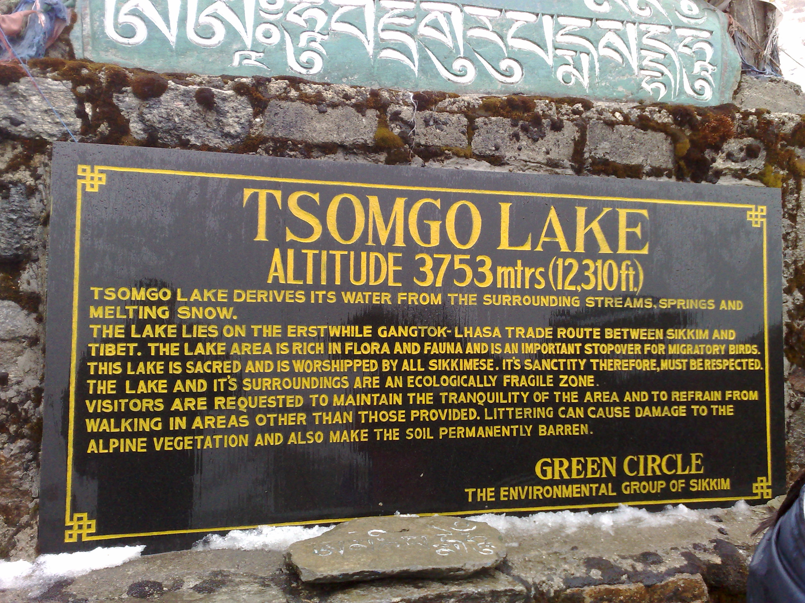
Tsomgo Lake'','' also known as Tsongmo Lake or Changgu Lake, is a glacial lake in the East Sikkim district of the Indian state of Sikkim, some from the capital Gangtok. Located at an elevation of , the lake remains frozen during the winter season. The lake surface reflects different colours with change of seasons and is held in great reverence by the local Sikkimese people. Buddhist monks prognosticated after studying the changing colours of the lake. Etymology In Bhutia language the name Tsomgo is made of two words 'Tso' meaning "lake" and 'Mgo' meaning "head" which gives the literal meaning as "source of the lake". Topography The lake is surrounded by steep mountains which are covered with snow during winter. During summer the snow cover melts and forms the source for the lake. The lake which remains frozen in winter season, sometimes extending up to May, receives an average annual precipitation of with temperatures recorded in the range of . The lake is about away ... [...More Info...] [...Related Items...] OR: [Wikipedia] [Google] [Baidu] |


