|
Tepuka
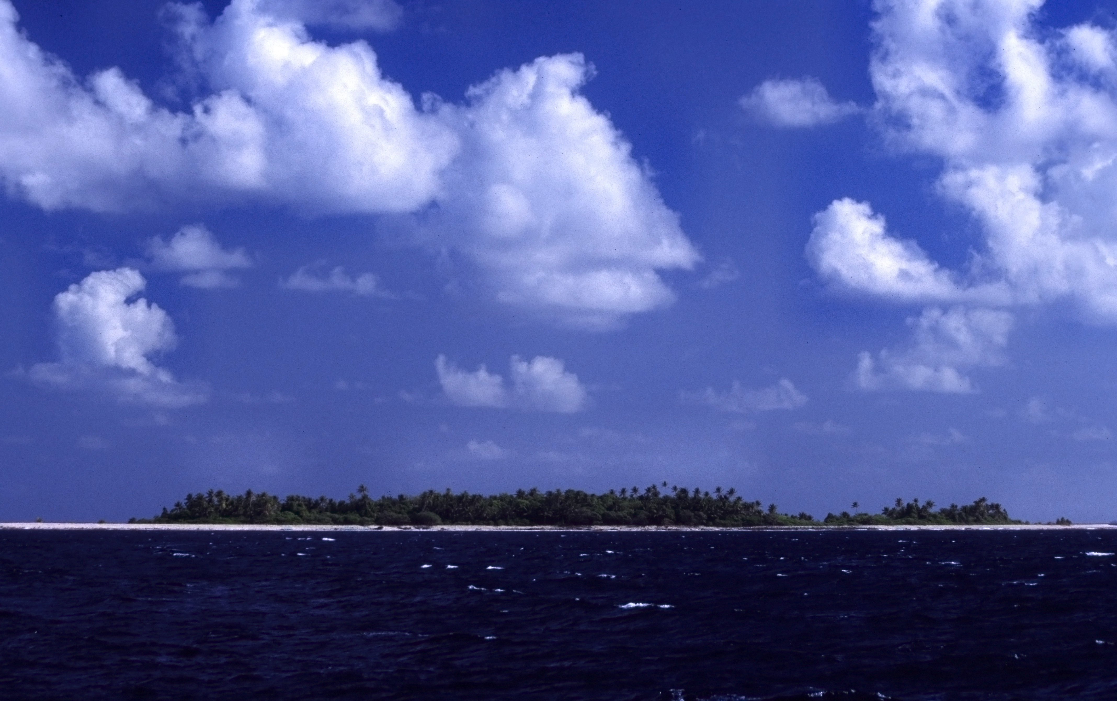
Tepuka is an island eighteen kilometers west of Fongafale, in the northwest of Funafuti, the main atoll of the Oceanian nation of Tuvalu. Te puka, or Pouka, is the name of a tree - ''Hernandia peltata''.There is a well-preserved underground bunker on the island, which was an American communications outpost built during the Pacific War, which was connected to the military airfield on Fongafale. The island lies between the smaller islet of Tepuka Vili Vili in the southwest, the smaller islet of Te Afualiku in the northeast, the Pacific Ocean on the west and the Funafuti lagoon called Te Namo on the east. In recent years the island has been majorly eroded. Te Ava Tepuka and Te Avua Sari are two neighbouring passages through Funafuti atoll in the northeast, between the islets of Te Afualiku to the northeast and Tepuka to the southwest. Tepuka is to the north of the Funafuti Conservation Area, which encompasses 33 square kilometers (12.74 square miles) of reef, lagoon and six ''mo ... [...More Info...] [...Related Items...] OR: [Wikipedia] [Google] [Baidu] |
Funafuti
Funafuti is the capital of the island nation of Tuvalu. It has a population of 6,320 people (2017 census), and so it has more people than the rest of Tuvalu combined, with approximately 60% of the population. It consists of a narrow sweep of land between wide, encircling a large lagoon (''Te Namo'') long and wide. The average depth of the Funafuti lagoon is about 20 fathoms (36.5 metres or 120 feet). With a surface area of , it is by far the largest lagoon in Tuvalu. The land area of the 33 islets around the atoll of Funafuti totals ; taken together, they constitute less than one percent of the total area of the atoll. Cargo ships can enter Funafuti's lagoon and dock at the port facilities on Fongafale. The capital of Tuvalu is sometimes said to be Fongafale or Vaiaku, but, officially, the entire atoll of Funafuti is its capital, since it has a single government that is responsible for the whole atoll. Fongafale The largest island is Fongafale. The island houses four villag ... [...More Info...] [...Related Items...] OR: [Wikipedia] [Google] [Baidu] |
Tepuka Vili Vili
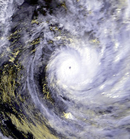
Tepuka Vili Vili or Tepuka Savilivili is an islet of Funafuti, Tuvalu. Tepuka Vili Vili is part of the Funafuti Conservation Area, established in 1996 with the aim of preserving the natural fauna and flora of the area. Tepuka Vili Vili was devastated by Cyclone Keli Severe Tropical Cyclone Keli ( NPMOC/JTWC Designation: 38P) was the first recorded post-season tropical cyclone to form in June within the South Pacific Ocean. The system formed on June 7, 1997, about 460 kilometers (285 mi) to the north of T ... in 1997, with all its vegetation and most of its sand swept away during the cyclone. Tepuka Vili Vili is an example of dynamic action of a coral atoll changing with the effect of cyclones and wave action: Te Ava Kum Kum is the passage through the Funafuti atoll in the middle of the western rim, south of Te Ava Tepuka Vili, between the islets of Tepuka Vili Vili to the north and Fualopa immediately south. References Islands of Tuvalu Pacific islands claime ... [...More Info...] [...Related Items...] OR: [Wikipedia] [Google] [Baidu] |
Funafuti Conservation Area
The Funafuti Conservation Area is a marine conservation area covering 33 square kilometers (12.74 square miles) of reef, lagoon and ''motu'' (islets) on the western side of Funafuti atoll in Tuvalu. The marine environment of the conservation area includes reef, lagoon, channel and ocean; and are home to many species of fish, corals, algae and invertebrates. The islets are nesting sites for the green sea turtle (''Chelonia mydas'') and Fualopa hosts a breeding colony of black noddy (''Anous minutes''). The decision to create a protected area (''Kogatapu'') was made in 1999; the purpose of the Funafuti Conservation Area is the conservation of the marine and land based biodiversity (plants, animals and ecosystems) within the protected area. The boundaries of the Funafuti Conservation Area encompass about 20 percent of the total coral reef area of Funafuti lagoon (''Te Namo''), and is an important part of the protection of the coral reefs of Tuvalu. History The project to create t ... [...More Info...] [...Related Items...] OR: [Wikipedia] [Google] [Baidu] |
Te Afualiku
Te Afualiku is an Island, islet of Funafuti, Tuvalu. Te Ava Tepuka and Te Avua Sari are two neighbouring passages through Funafuti atoll in the northeast, between the islets of Te Afualiku to the northeast and Tepuka to the southwest. Te Ava i te Lape is the favoured entrance into the lagoon, although it has a depth of only 5.8 metres, and a width of barely 500 metres. It is in the north, between the islets of Pava to the east and Te Afualiku to the west. References Islands of Tuvalu Pacific islands claimed under the Guano Islands Act Funafuti {{tuvalu-geo-stub ... [...More Info...] [...Related Items...] OR: [Wikipedia] [Google] [Baidu] |
Lepidodactylus Tepukapili
''Lepidodactylus tepukapili'' is a species of gecko, which is known as the Tuvalu forest gecko and is known in the Tuvaluan language as ''moko'' or ''pili''. It is the only recorded vertebrate that is endemic to Tuvalu. It has been located on Fuagea (also called Fuakea) and on Tepuka. ''Lepidodactylus tepukapili's'' naming is based upon the Tuvaluan language words for "small lizard" and the island of Tepuka, where specimens were first discovered. In 2021, the IUCN published its assessment of the Tuvalu forest gecko, classifying it as Critically Endangered due to the ongoing threat of sea-level rise, as related to anthropogenic climate change. The two small low-lying islands on which it occurs average just 2 metres above sea level. IUCN Red List The International Union for Conservation of Nature (IUCN) Red List of Threatened Species, also known as the IUCN Red List or Red Data Book, founded in 1964, is the world's most comprehensive inventory of the global conservation st ... [...More Info...] [...Related Items...] OR: [Wikipedia] [Google] [Baidu] |
Fualopa
Fualopa is an islet of Funafuti, Tuvalu. It is part of the Funafuti Conservation Area, established in 1996 with the aim of preserving the natural fauna and flora of the area.Fualopa hosts a breeding colony of black noddy (''Anous minutus'' or white-capped noddy). Te Ava Kum Kum is the passage through the Funafuti atoll of the western rim, south of Te Ava Tepuka Vili, between the islets of Tepuka Vili Vili Tepuka Vili Vili or Tepuka Savilivili is an islet of Funafuti, Tuvalu. Tepuka Vili Vili is part of the Funafuti Conservation Area, established in 1996 with the aim of preserving the natural fauna and flora of the area. Tepuka Vili Vili was devasta ... to the north and Fualopa immediately south. References Islands of Tuvalu Pacific islands claimed under the Guano Islands Act Funafuti {{tuvalu-geo-stub ... [...More Info...] [...Related Items...] OR: [Wikipedia] [Google] [Baidu] |
Fongafale
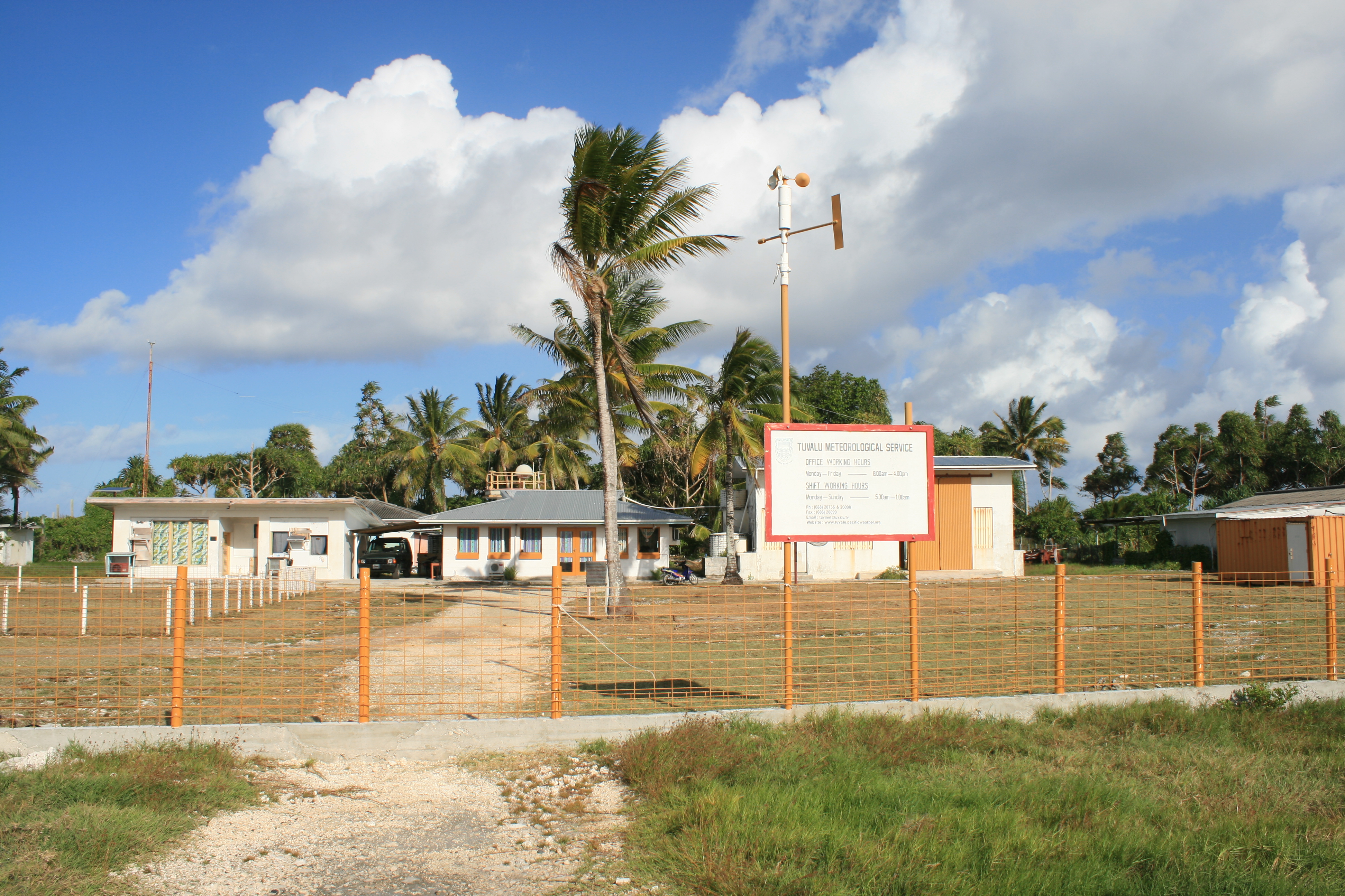
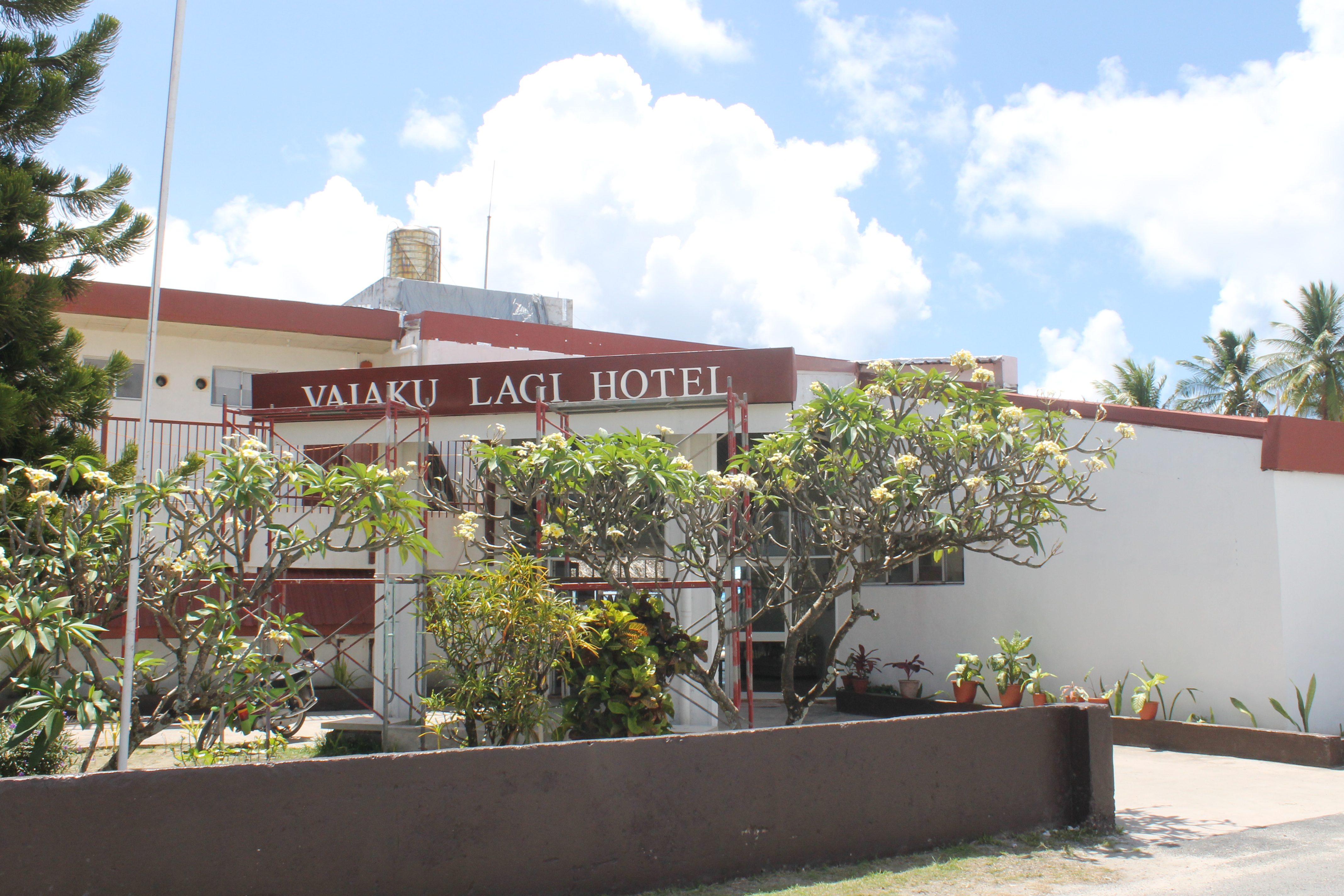
Fongafale (also spelled Fogale or Fagafale) is the largest of Funafuti's islets in Tuvalu. It is a long narrow sliver of land, 12 kilometres long and between 10 and 400 metres wide, with the South Pacific Ocean and reef on the east and the protected lagoon on the west. The north part is the Tengako peninsula, and Funafuti International Airport runs from northeast to southwest on the widest part of the island, with the village and administrative centre of Vaiaku on the lagoon side. On Fongafale, the Funafuti Kaupule is responsible for approval of the construction of houses or extensions to existing buildings on private land, and the Lands Management Committee is the responsible authority in relation to lands leased by government. In 1972, Funafuti was in the path of Cyclone Bebe. Cyclone Bebe knocked down 90% of the houses and trees on Fongafale. The storm surge created a wall of coral rubble along the ocean side of Fongafale and Funafala that was about long, and about to thic ... [...More Info...] [...Related Items...] OR: [Wikipedia] [Google] [Baidu] |
Fuagea
Fuagea is an Island, islet located in the archipelago of Tuvalu in the south-western part of the atoll of Funafuti. Fuagea (also known as Fuakea), is part of the Funafuti Conservation Area, established in 1996 with the aim of preserving the natural fauna and flora of the area. Lepidodactylus tepukapili is a species of gecko, which has been located on Fuagea and on Tepuka. References Islands of Tuvalu Pacific islands claimed under the Guano Islands Act Funafuti {{tuvalu-geo-stub ... [...More Info...] [...Related Items...] OR: [Wikipedia] [Google] [Baidu] |
Funafuti International Airport
Funafuti International Airport is an airport in Funafuti, in the capital city of the island nation of Tuvalu. It is the sole international airport in Tuvalu. Fiji Airways (trading as Fiji Link) operates between Suva and Funafuti. Air Kiribati provides one flight a week from Tarawa to Funafuti. History Funafuti Airport was built by a Seabee detachment of the 2nd Naval Construction Battalion of the United States Navy in 1943 during World War II. The military airfield included an airstrip, control tower and facilities, with a radio station at Tepuka, connected by cable to the airfield. The base headquarters buildings were at the present-day Teagai Apelu's residence, and a bunker is there to this day. The first offensive operation was launched on 20 April 1943 when 22 B-24 Liberator aircraft from 371 and 372 Bombardment Squadrons bombed Nauru. The next day the Japanese made a predawn raid on the strip at Funafuti that destroyed one B-24 and caused damage to five other planes. On ... [...More Info...] [...Related Items...] OR: [Wikipedia] [Google] [Baidu] |
Tuvalu
Tuvalu ( or ; formerly known as the Ellice Islands) is an island country and microstate in the Polynesian subregion of Oceania in the Pacific Ocean. Its islands are situated about midway between Hawaii and Australia. They lie east-northeast of the Santa Cruz Islands (which belong to the Solomon Islands), northeast of Vanuatu, southeast of Nauru, south of Kiribati, west of Tokelau, northwest of Samoa and Wallis and Futuna, and north of Fiji. Tuvalu is composed of three reef islands and six atolls. They are spread out between the latitude of 5th parallel south, 5° and 10th parallel south, 10° south and between the longitude of 176th meridian east, 176° and 180th meridian, 180°. They lie west of the International Date Line. Tuvalu has a population of 10,507 (2017 census). The total land area of the islands of Tuvalu is . The first inhabitants of Tuvalu were Polynesians, according to well-established theories regarding a History of the Polynesian people, migration of Polynes ... [...More Info...] [...Related Items...] OR: [Wikipedia] [Google] [Baidu] |
Islands Of Tuvalu
Tuvalu consists of nine separate islands: six atolls and three reef islands. An atoll typically consists of several islets: Tuvalu has a total of 124 islands and islets. Each island is surrounded by a coral reef. Tuvalu's small, widely scattered atolls have poor soil and a total land area of only about making Tuvalu the fourth-smallest country in the world. The sea level at the Funafuti tide gauge has been rising at a rate of 3.9 mm per year, and it has been determined that rising sea levels are causing more wave energy to be transferred across reef surfaces, which has tended to push more sand onto island shorelines, increasing islands’ land area. Over a recent four-decade period, there was a net increase in the land area of the islets of 2.9% (73.5 ha), although the changes were not uniform: About 74% of them increased in size and about 27% decreased in size. Islands of Tuvalu The islands of Tuvalu are spread out between the latitude of 5° to 10° south and longitude ... [...More Info...] [...Related Items...] OR: [Wikipedia] [Google] [Baidu] |
Gecko
Geckos are small, mostly carnivorous lizards that have a wide distribution, found on every continent except Antarctica. Belonging to the infraorder Gekkota, geckos are found in warm climates throughout the world. They range from . Geckos are unique among lizards for their vocalisations, which differ from species to species. Most geckos in the family Gekkonidae use chirping or clicking sounds in their social interactions. Tokay geckos (''Gekko gecko'') are known for their loud mating calls, and some other species are capable of making hissing noises when alarmed or threatened. They are the most species-rich group of lizards, with about 1,500 different species worldwide. All geckos, except species in the family Eublepharidae lack eyelids; instead, the outer surface of the eyeball has a transparent membrane, the cornea. They have a fixed lens within each iris that enlarges in darkness to let in more light. Since they cannot blink, species without eyelids generally lick t ... [...More Info...] [...Related Items...] OR: [Wikipedia] [Google] [Baidu] |


