|
Fualopa
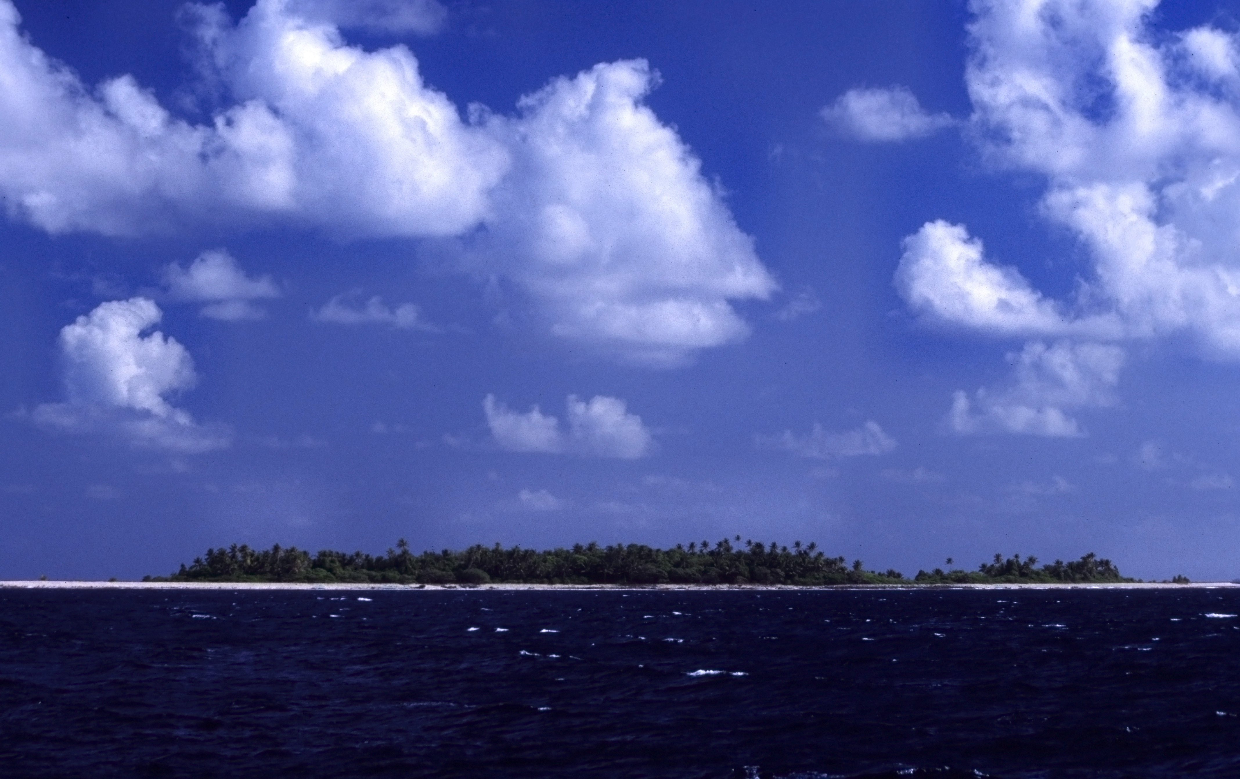
Fualopa is an islet of Funafuti, Tuvalu. It is part of the Funafuti Conservation Area, established in 1996 with the aim of preserving the natural fauna and flora of the area.Fualopa hosts a breeding colony of black noddy (''Anous minutus'' or white-capped noddy). Te Ava Kum Kum is the passage through the Funafuti atoll of the western rim, south of Te Ava Tepuka Vili, between the islets of Tepuka Vili Vili Tepuka Vili Vili or Tepuka Savilivili is an islet of Funafuti, Tuvalu. Tepuka Vili Vili is part of the Funafuti Conservation Area, established in 1996 with the aim of preserving the natural fauna and flora of the area. Tepuka Vili Vili was devasta ... to the north and Fualopa immediately south. References Islands of Tuvalu Pacific islands claimed under the Guano Islands Act Funafuti {{tuvalu-geo-stub ... [...More Info...] [...Related Items...] OR: [Wikipedia] [Google] [Baidu] |
Funafuti Conservation Area
The Funafuti Conservation Area is a marine conservation area covering 33 square kilometers (12.74 square miles) of reef, lagoon and ''motu'' (islets) on the western side of Funafuti atoll in Tuvalu. The marine environment of the conservation area includes reef, lagoon, channel and ocean; and are home to many species of fish, corals, algae and invertebrates. The islets are nesting sites for the green sea turtle (''Chelonia mydas'') and Fualopa hosts a breeding colony of black noddy (''Anous minutes''). The decision to create a protected area (''Kogatapu'') was made in 1999; the purpose of the Funafuti Conservation Area is the conservation of the marine and land based biodiversity (plants, animals and ecosystems) within the protected area. The boundaries of the Funafuti Conservation Area encompass about 20 percent of the total coral reef area of Funafuti lagoon (''Te Namo''), and is an important part of the protection of the coral reefs of Tuvalu. History The project to create t ... [...More Info...] [...Related Items...] OR: [Wikipedia] [Google] [Baidu] |
Funafuti
Funafuti is the capital of the island nation of Tuvalu. It has a population of 6,320 people (2017 census), and so it has more people than the rest of Tuvalu combined, with approximately 60% of the population. It consists of a narrow sweep of land between wide, encircling a large lagoon (''Te Namo'') long and wide. The average depth of the Funafuti lagoon is about 20 fathoms (36.5 metres or 120 feet). With a surface area of , it is by far the largest lagoon in Tuvalu. The land area of the 33 islets around the atoll of Funafuti totals ; taken together, they constitute less than one percent of the total area of the atoll. Cargo ships can enter Funafuti's lagoon and dock at the port facilities on Fongafale. The capital of Tuvalu is sometimes said to be Fongafale or Vaiaku, but, officially, the entire atoll of Funafuti is its capital, since it has a single government that is responsible for the whole atoll. Fongafale The largest island is Fongafale. The island houses four villag ... [...More Info...] [...Related Items...] OR: [Wikipedia] [Google] [Baidu] |
Tepuka Vili Vili
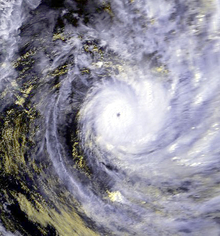
Tepuka Vili Vili or Tepuka Savilivili is an islet of Funafuti, Tuvalu. Tepuka Vili Vili is part of the Funafuti Conservation Area, established in 1996 with the aim of preserving the natural fauna and flora of the area. Tepuka Vili Vili was devastated by Cyclone Keli Severe Tropical Cyclone Keli ( NPMOC/JTWC Designation: 38P) was the first recorded post-season tropical cyclone to form in June within the South Pacific Ocean. The system formed on June 7, 1997, about 460 kilometers (285 mi) to the north of T ... in 1997, with all its vegetation and most of its sand swept away during the cyclone. Tepuka Vili Vili is an example of dynamic action of a coral atoll changing with the effect of cyclones and wave action: Te Ava Kum Kum is the passage through the Funafuti atoll in the middle of the western rim, south of Te Ava Tepuka Vili, between the islets of Tepuka Vili Vili to the north and Fualopa immediately south. References Islands of Tuvalu Pacific islands claime ... [...More Info...] [...Related Items...] OR: [Wikipedia] [Google] [Baidu] |
Islet
An islet is a very small, often unnamed island. Most definitions are not precise, but some suggest that an islet has little or no vegetation and cannot support human habitation. It may be made of rock, sand and/or hard coral; may be permanent or tidal (i.e. surfaced reef or seamount); and may exist in the sea, lakes, rivers or any other sizeable bodies of water. Definition As suggested by its origin ''islette'', an Old French diminutive of "isle", use of the term implies small size, but little attention is given to drawing an upper limit on its applicability. The World Landforms website says, "An islet landform is generally considered to be a rock or small island that has little vegetation and cannot sustain human habitation", and further that size may vary from a few square feet to several square miles, with no specific rule pertaining to size. Other terms * Ait (/eɪt/, like eight) or eyot (/aɪ(ə)t, eɪt/), a small island. It is especially used to refer to river i ... [...More Info...] [...Related Items...] OR: [Wikipedia] [Google] [Baidu] |
Tuvalu
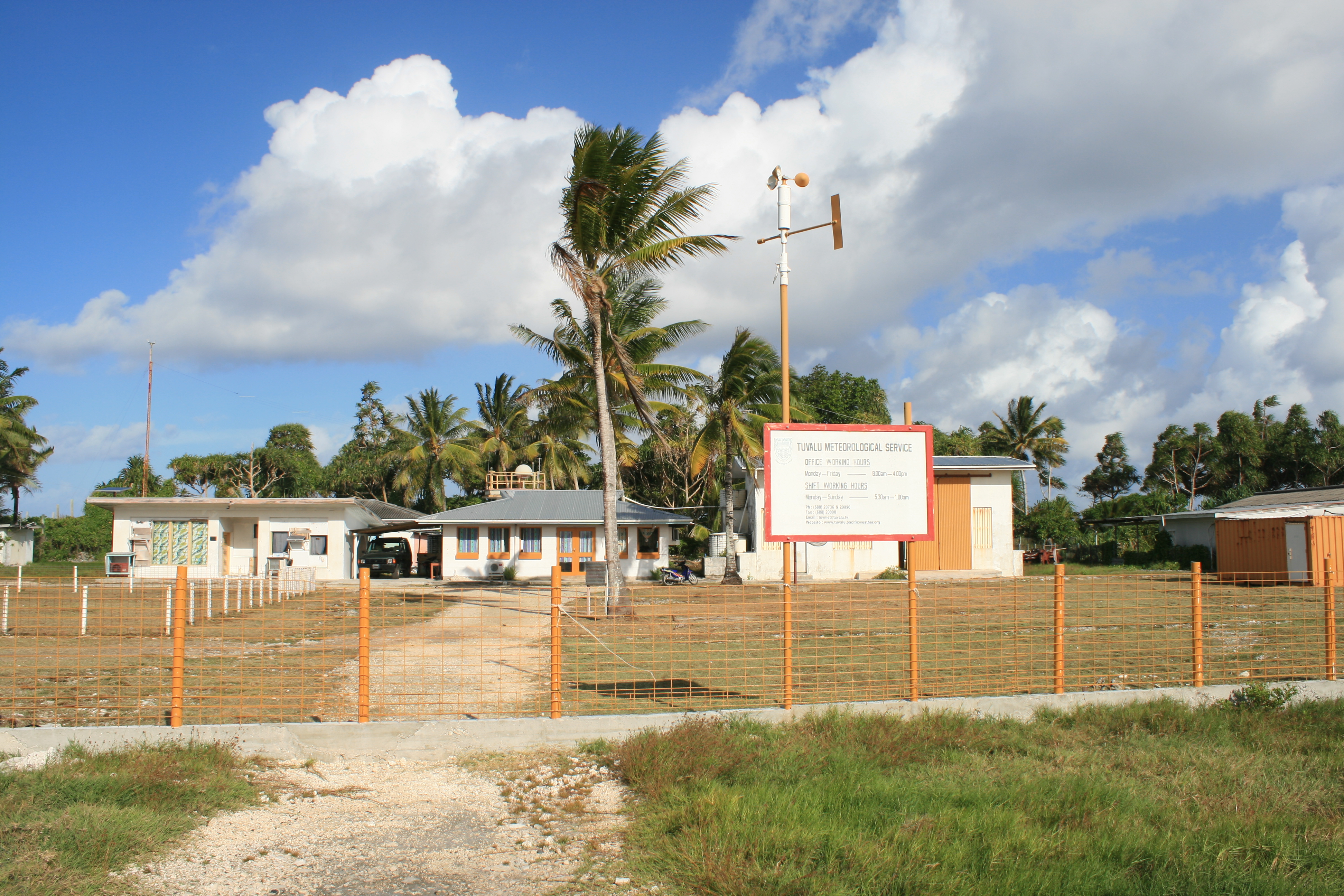
Tuvalu ( or ; formerly known as the Ellice Islands) is an island country and microstate in the Polynesian subregion of Oceania in the Pacific Ocean. Its islands are situated about midway between Hawaii and Australia. They lie east-northeast of the Santa Cruz Islands (which belong to the Solomon Islands), northeast of Vanuatu, southeast of Nauru, south of Kiribati, west of Tokelau, northwest of Samoa and Wallis and Futuna, and north of Fiji. Tuvalu is composed of three reef islands and six atolls. They are spread out between the latitude of 5th parallel south, 5° and 10th parallel south, 10° south and between the longitude of 176th meridian east, 176° and 180th meridian, 180°. They lie west of the International Date Line. Tuvalu has a population of 10,507 (2017 census). The total land area of the islands of Tuvalu is . The first inhabitants of Tuvalu were Polynesians, according to well-established theories regarding a History of the Polynesian people, migration of Polynes ... [...More Info...] [...Related Items...] OR: [Wikipedia] [Google] [Baidu] |
Black Noddy
The black noddy or white-capped noddy (''Anous minutus'') is a seabird from the family Laridae. It is a medium-sized species of tern with black plumage and a white cap. It closely resembles the lesser noddy (''Anous tenuirostris'') with which it was at one time considered conspecific. The black noddy has slightly darker plumage and dark rather than pale lores. Taxonomy The black noddy was first formally described by German naturalist and lawyer Friedrich Boie in 1844 under its current binomial name. The genus name ''Anous'' is ancient Greek for "stupid" or "foolish". The specific name ''minutus'' is the Latin for "small". There are seven subspecies: *''A. m. worcesteri'' (McGregor, 1911) – Cavilli Island and Tubbataha Reef ( Sulu Sea) *''A. m. minutus'' Boie, 1844 – northeast Australia and New Guinea to Tuamotu Archipelago *''A. m. marcusi'' (Bryan, 1903) – Marcus and Wake Islands through Micronesia to the Caroline Islands *''A. m. melanogenys'' Gray, 1846 – Hawaiian I ... [...More Info...] [...Related Items...] OR: [Wikipedia] [Google] [Baidu] |
Islands Of Tuvalu
Tuvalu consists of nine separate islands: six atolls and three reef islands. An atoll typically consists of several islets: Tuvalu has a total of 124 islands and islets. Each island is surrounded by a coral reef. Tuvalu's small, widely scattered atolls have poor soil and a total land area of only about making Tuvalu the fourth-smallest country in the world. The sea level at the Funafuti tide gauge has been rising at a rate of 3.9 mm per year, and it has been determined that rising sea levels are causing more wave energy to be transferred across reef surfaces, which has tended to push more sand onto island shorelines, increasing islands’ land area. Over a recent four-decade period, there was a net increase in the land area of the islets of 2.9% (73.5 ha), although the changes were not uniform: About 74% of them increased in size and about 27% decreased in size. Islands of Tuvalu The islands of Tuvalu are spread out between the latitude of 5° to 10° south and longitude ... [...More Info...] [...Related Items...] OR: [Wikipedia] [Google] [Baidu] |
Pacific Islands Claimed Under The Guano Islands Act
The Pacific Ocean is the largest and deepest of Earth's five oceanic divisions. It extends from the Arctic Ocean in the north to the Southern Ocean (or, depending on definition, to Antarctica) in the south, and is bounded by the continents of Asia and Oceania in the west and the Americas in the east. At in area (as defined with a southern Antarctic border), this largest division of the World Ocean—and, in turn, the hydrosphere—covers about 46% of Earth's water surface and about 32% of its total surface area, larger than Earth's entire land area combined .Pacific Ocean . '' Britannica Concise.'' 2008: Encyclopædia Britannica, Inc. The centers of both the |


.jpg)