|
Teltow Stadt Station
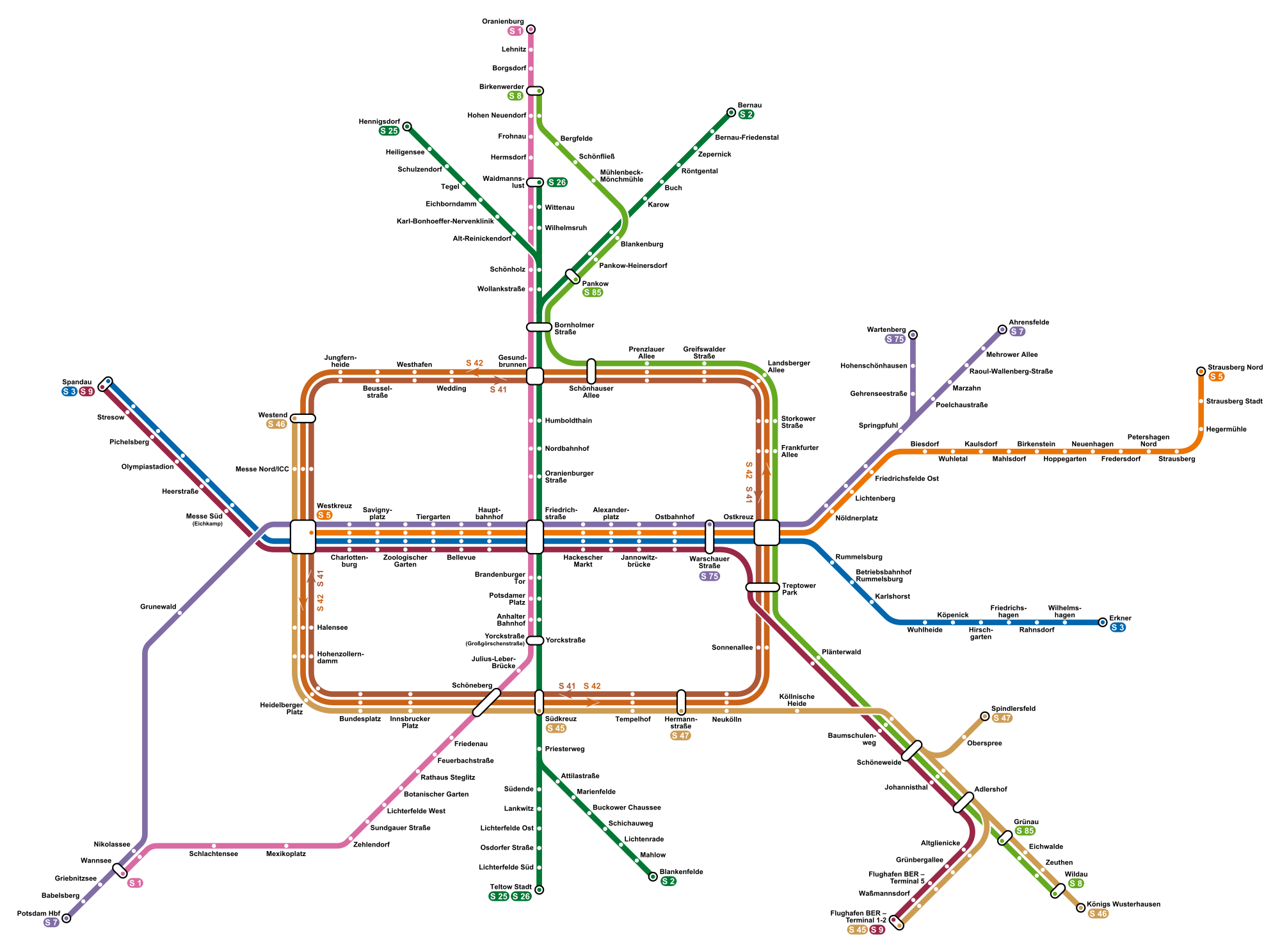
Teltow Stadt (town) station is located about east of the centre of Teltow in the German state Brandenburg to the south of Berlin on the Berlin-Lichterfelde Süd–Teltow Stadt railway. The line and the station were opened on 24 February 2005. It has two tracks next to an island platform and is located in a cutting. Mahlower Straße crosses over it on a bridge. Stairs and a lift connect the station to the street. Although the town of Teltow is in the Potsdam-Mittelmark district, the station is in the adjoining Teltow-Fläming district. The station should not be confused with Teltow railway station, which is to the south-east on the Anhalt Railway itself, and is served by Regional-Express lines 3, 4 and 5. Train services Teltow Stadt is the southern terminus of the S-Bahn lines and , at the end of a single line stub from the main line of the former Anhalt Railway at Lichterfelde Süd. Since the opening of the line, the line has been served at 20-minute intervals. In July 2011, s ... [...More Info...] [...Related Items...] OR: [Wikipedia] [Google] [Baidu] |
Teltow
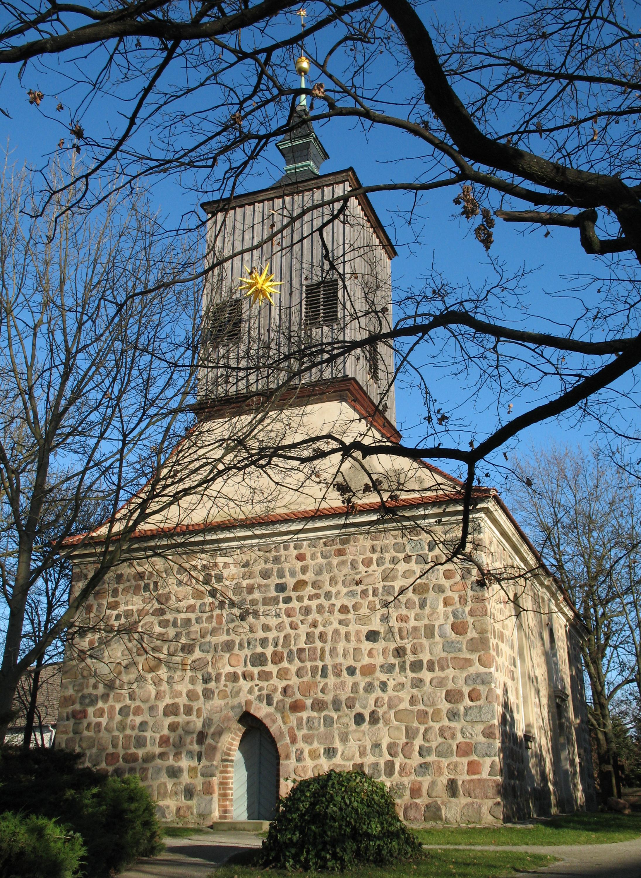
Teltow [] is a town in the Potsdam-Mittelmark district, in Brandenburg, Germany. Geography Teltow is part of the agglomeration of Berlin. The distance to the Berlin city centre is , while the distance to Potsdam is . The Teltow Canal links the River Havel near the city of Potsdam with the River Dahme near Köpenick in Berlin's eastern suburbs. It passes immediately to the north of Teltow, forming the border between Brandenburg and Berlin. The central Teltow Stadt railway station is part of the Berlin S-Bahn line . Teltow railway station is to the south-east and is served by RegionalExpress lines 3, 4 and 5. Protected specialty Teltower Rübchen (English: Teltow turnips) are a well known regional specialty; however, yield, homogeneity and handling properties are sub-optimal. Since 1993 they have been registered as a trademark. History The settlement was first mentioned in a 1265 deed issued by Margrave Otto III of Brandenburg. It received its name from the eponymous pla ... [...More Info...] [...Related Items...] OR: [Wikipedia] [Google] [Baidu] |
Regional-Express
In Germany, Luxembourg and Austria, the Regional-Express (RE, or in Austria: REX) is a type of regional train. It is similar to a semi-fast train, with average speed at about 70–90 km/h (top speed often 160 km/h) as it calls at fewer stations than '' Regionalbahn'' or S-Bahn trains, but stops more often than ''InterCity'' services. Operations The first Regional-Express services were operated by DB Regio, though since the liberalisation of the German rail market (''Bahnreform'') in the 1990s many operators have received franchise rights on lines from the federal states. Some private operators currently operate trains that are similar to a Regional-Express service, but have decided to use their own names for the sake of brand awareness instead. Regional-Express services are carried out with a variety of vehicles such as DMUs (of Class 612), EMUs (of Class 425 or 426) or, most commonly, electric or diesel locomotives with double-deck cars, the latter often with ... [...More Info...] [...Related Items...] OR: [Wikipedia] [Google] [Baidu] |
Railway Stations In Brandenburg
Rail transport (also known as train transport) is a means of transport that transfers passengers and goods on wheeled vehicles running on rails, which are incorporated in Track (rail transport), tracks. In contrast to road transport, where the vehicles run on a prepared flat surface, rail vehicles (rolling stock) are directionally guided by the tracks on which they run. Tracks usually consist of steel rails, installed on Railroad tie, sleepers (ties) set in track ballast, ballast, on which the rolling stock, usually fitted with metal wheels, moves. Other variations are also possible, such as "slab track", in which the rails are fastened to a concrete foundation resting on a prepared subsurface. Rolling stock in a rail transport system generally encounters lower friction, frictional resistance than rubber-tyred road vehicles, so passenger and freight cars (carriages and wagons) can be coupled into longer trains. The rail transport operations, operation is carried out by a ... [...More Info...] [...Related Items...] OR: [Wikipedia] [Google] [Baidu] |
Berlin S-Bahn Stations
Berlin ( , ) is the capital and largest city of Germany by both area and population. Its 3.7 million inhabitants make it the European Union's most populous city, according to population within city limits. One of Germany's sixteen constituent states, Berlin is surrounded by the State of Brandenburg and contiguous with Potsdam, Brandenburg's capital. Berlin's urban area, which has a population of around 4.5 million, is the second most populous urban area in Germany after the Ruhr. The Berlin-Brandenburg capital region has around 6.2 million inhabitants and is Germany's third-largest metropolitan region after the Rhine-Ruhr and Rhine-Main regions. Berlin straddles the banks of the Spree, which flows into the Havel (a tributary of the Elbe) in the western borough of Spandau. Among the city's main topographical features are the many lakes in the western and southeastern boroughs formed by the Spree, Havel and Dahme, the largest of which is Lake Müggelsee. Due to its location ... [...More Info...] [...Related Items...] OR: [Wikipedia] [Google] [Baidu] |
Blankenfelde-Mahlow
Blankenfelde-Mahlow is a municipality in the Teltow-Fläming district of Brandenburg, Germany. It is situated approximately south of Berlin. History The municipality shared its borders with the former West Berlin, and so during the period 1961-1990 it was separated. Blankenfelde Blankenfelde was first mentioned in documents in 1375. However, a substantial part of this district, the so-called Gagfah settlement, did not develop until the 1930s, after the Süd-Berlin Bodenaktiengesellschaft had acquired and parceled out the area. As a result, the population increased significantly - from 766 inhabitants in 1930 to 6228 inhabitants in 1939. Mahlow Mahlow was first mentioned in documents in 1287. After the place had received a station in 1875, the immigration of wealthy Berliners. Its constituency is under Teltow from 1945 until its dissolution in 1952. As early as 1950, the community Glasow was merged with the community Mahlow. The construction of the Berlin Wall from 13 August ... [...More Info...] [...Related Items...] OR: [Wikipedia] [Google] [Baidu] |
Ludwigsfelde
Ludwigsfelde is a town in the north of the district Teltow-Fläming in Brandenburg. Geography Location The town is located south of Berlin in the district Teltow-Fläming on the plateau of Teltow. In earlier times, it was part of the district Zossen. Parts of the town Since 1997/2003 the following villages are part of the city: * Ahrensdorf *Genshagen (with Genshagen Palace) *Gröben * Groß Schulzendorf * Jütchendorf * Kerzendorf * Löwenbruch * Mietgendorf * Schiaß * Siethen * Wietstock Demography File:Bevölkerungsentwicklung Ludwigsfelde.pdf, Development of Population since 1875 within the Current Boundaries (Blue Line: Population; Dotted Line: Comparison to Population Development of Brandenburg state; Grey Background: Time of Nazi rule; Red Background: Time of Communist rule) File:Bevölkerungsprognosen Ludwigsfelde.pdf, Recent Population Development and Projections (Population Development before Census 2011 (blue line); Recent Population Development according to the ... [...More Info...] [...Related Items...] OR: [Wikipedia] [Google] [Baidu] |
Stahnsdorf
Stahnsdorf is a municipality in the Potsdam-Mittelmark district, in Brandenburg, Germany. Geography It is situated on the Teltow plateau, about southwest of the Berlin city centre, and east of Potsdam. Neighbouring municipalities are the town of Teltow in the east and Kleinmachnow in the north, both immediately bordering the Berlin city limits. The municipal area is bound by the Teltow Canal in the north. It comprises Stahnsdorf proper and the villages of Güterfelde, Schenkenhorst, and Sputendorf. History Stahnsdorf in the Margraviate of Brandenburg was first documented in a 1264 purchase contract of Margrave Otto III and the Brandenburg bishop. It originally consisted only of its old village green on a formerly important merchant road from Leipzig in Saxony via Güterfelde and Stahnsdorf, crossing the Bäke creek (the present-day Teltow Canal) at Kleinmachnow, and running northwards to Spandau. With the construction of the Teltow Canal in the early 20th century, the openin ... [...More Info...] [...Related Items...] OR: [Wikipedia] [Google] [Baidu] |
Potsdam
Potsdam () is the capital and, with around 183,000 inhabitants, largest city of the German state of Brandenburg. It is part of the Berlin/Brandenburg Metropolitan Region. Potsdam sits on the River Havel, a tributary of the Elbe, downstream of Berlin, and lies embedded in a hilly morainic landscape dotted with many lakes, around 20 of which are located within Potsdam's city limits. It lies some southwest of Berlin's city centre. The name of the city and of many of its boroughs are of Slavic origin. Potsdam was a residence of the Prussian kings and the German Kaiser until 1918. Its planning embodied ideas of the Age of Enlightenment: through a careful balance of architecture and landscape, Potsdam was intended as "a picturesque, pastoral dream" which would remind its residents of their relationship with nature and reason. The city, which is over 1000 years old, is widely known for its palaces, its lakes, and its overall historical and cultural significance. Landmarks include ... [...More Info...] [...Related Items...] OR: [Wikipedia] [Google] [Baidu] |
Lichterfelde Süd Station
Berlin-Lichterfelde Süd station is a Berlin S-Bahn station on the Anhalt Suburban Line in Lichterfelde (Berlin), Lichterfelde in the Berlin borough of Steglitz-Zehlendorf. The station was the southern terminus for S-Bahn trains on the Anhalt Suburban Line between 1943 and 1951, between 1961 and 1984 and between 1998 and 2005. From 1951 until the building of the Berlin Wall, services continued past the city limits to nearby Teltow railway station, Teltow. The station was closed between 1984 and 1998. Since 2005, the trains have run to Teltow Stadt station, Teltow Stadt. Together with Osdorfer Straße station, this connects the Thermometersiedlung high-rise housing estate to the Berlin S-Bahn network. History Lichterfelde experienced a construction boom in the Gründerzeit (in the late 19th century) and new estates extended to Giesensdorf (now part of Lichterfelde Süd). At the beginning of the 1890s, it was proposed to build another ''Villenviertel'' (villa estate) next to the Be ... [...More Info...] [...Related Items...] OR: [Wikipedia] [Google] [Baidu] |
Anhalt Railway
Saxony-Anhalt (german: Sachsen-Anhalt ; nds, Sassen-Anholt) is a state of Germany, bordering the states of Brandenburg, Saxony, Thuringia and Lower Saxony. It covers an area of and has a population of 2.18 million inhabitants, making it the 8th-largest state in Germany by area and the 11th-largest by population. Its capital is Magdeburg and its largest city is Halle (Saale). The state of Saxony-Anhalt was formed in July 1945 after World War II, when the Soviet army administration in Allied-occupied Germany formed it from the former Prussian Province of Saxony and the Free State of Anhalt. Saxony-Anhalt became part of the German Democratic Republic in 1949, but was dissolved in 1952 during administrative reforms and its territory divided into the districts of Halle and Magdeburg. Following German reunification the state of Saxony-Anhalt was re-established in 1990 and became one of the new states of the Federal Republic of Germany. Saxony-Anhalt is renowned for its r ... [...More Info...] [...Related Items...] OR: [Wikipedia] [Google] [Baidu] |
Berlin S-Bahn
The Berlin S-Bahn () is a rapid transit railway system in and around Berlin, the capital city of Germany. It has been in operation under this name since December 1930, having been previously called the special tariff area ''Berliner Stadt-, Ring- und Vorortbahnen'' (Berlin city, orbital, and suburban railways). It complements the Berlin U-Bahn and is the link to many outer-Berlin areas, such as Berlin Brandenburg Airport. As such, the Berlin S-Bahn blends elements of a commuter rail service and a rapid transit system. In its first decades of operation, the trains were steam-drawn; even after the electrification of large parts of the network, a number of lines remained under steam. Today, the term ''S-Bahn'' is used in Berlin only for those lines and trains with third-rail electrical power transmission and the special Berlin S-Bahn loading gauge. The third unique technical feature of the Berlin S-Bahn, the , is being phased out and replaced by a communications-based train control ... [...More Info...] [...Related Items...] OR: [Wikipedia] [Google] [Baidu] |
Teltow Railway Station
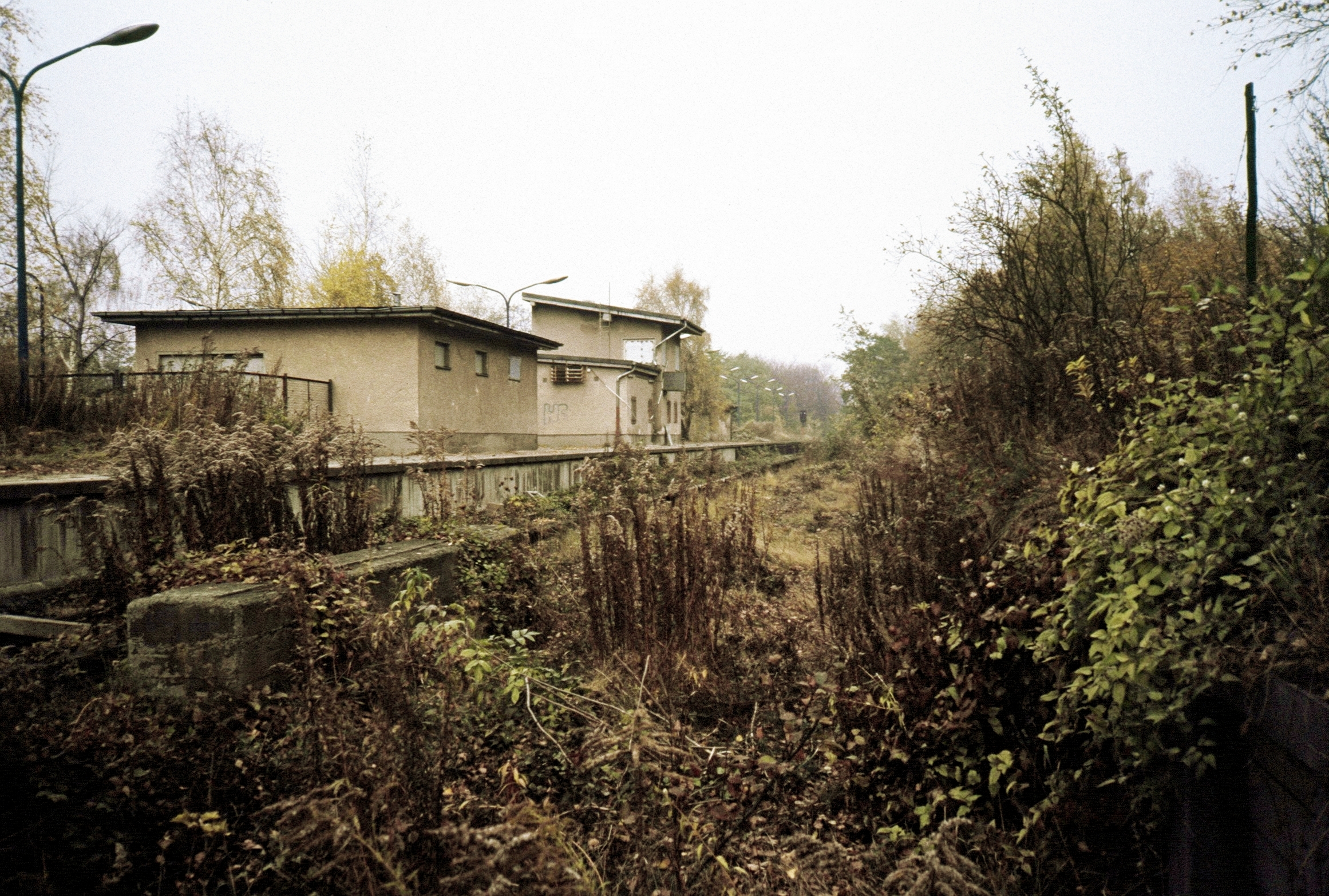
Teltow station is located in the town of Teltow on the Anhalt Railway south of Berlin and was opened in 1901. Since then, the station has been repeatedly remodelled. The station served regional passenger and freight traffic and was the terminus of a Berlin S-Bahn service from 1950 to 1961. The direct connection to Berlin was lost with the construction of the Berlin Wall in 1961. It was restored in 2006. Teltow Station should not be confused with Teltow Stadt (town) station, which opened in 2005 and is near the centre of the town at the end of a branch line of the S-Bahn and about 2 kilometres to the north-west of Teltow station. Location The railway station is located south of Berlin at the intersection of Berlin–Halle railway with Mahlower Straße (the road to Mahlow) about three kilometres east of central Teltow in the district of Potsdam-Mittelmark in the state of Brandenburg. Originally, the station was built far outside the town in open fields, but the area between the ... [...More Info...] [...Related Items...] OR: [Wikipedia] [Google] [Baidu] |

_(2).jpg)


