|
Tell Ain Saouda
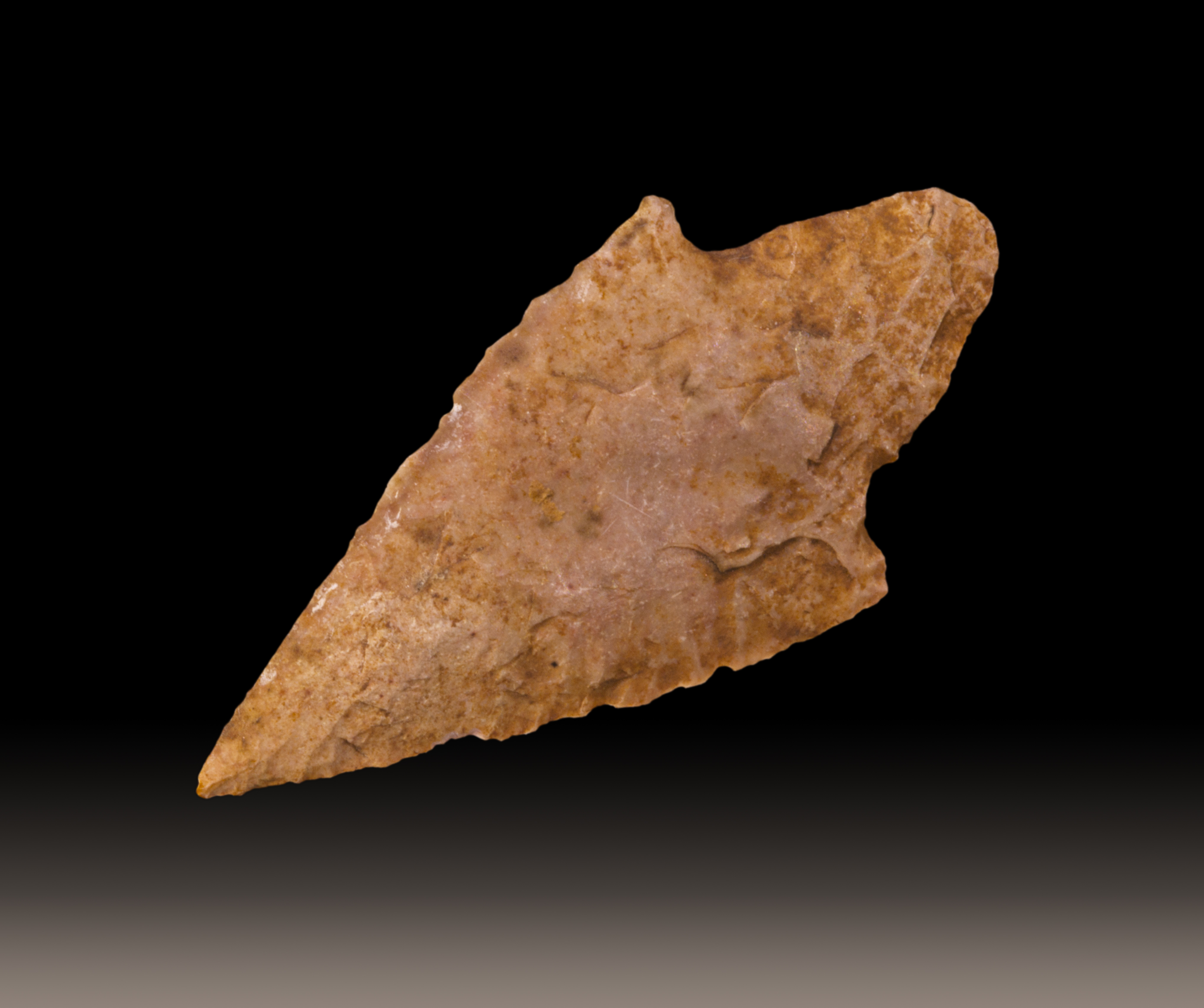
Tell Ain Saouda is a small neolithic, archaeological tell, approximately south of Tell Neba'a Litani, Lebanon. It is a grey soiled site next to two springs and the Litani River. Materials recovered include flints such as tanged arrowheads, sickle blades, scrapers, and an axe. Pottery included flat bottomed jars, globe shaped jars and bowls. These were burnished, painted and red-washed with some incised decorations. These finds were similar to those from Tell Ain Nfaikh and other Beqaa Valley The Beqaa Valley ( ar, links=no, وادي البقاع, ', Lebanese ), also transliterated as Bekaa, Biqâ, and Becaa and known in classical antiquity as Coele-Syria, is a fertile valley in eastern Lebanon. It is Lebanon's most important ... sites with a later neolithic dating and settlements extending into the Bronze Age and classical periods. Footnotes Neolithic settlements Archaeological sites in Lebanon Great Rift Valley {{NEast-archaeology-stub ... [...More Info...] [...Related Items...] OR: [Wikipedia] [Google] [Baidu] |
Tell Neba'a Litani
Tell Neba'a Litani or Neba'a Litani is a medium size tell west of Baalbek in the northern Beqaa Valley of Lebanon. I It is located near the spring which is the main source of the Litani River at a height of . It was first studied by Lorraine Copeland and Peter Wescombe in 1965-1966 and is accessible via a road which turns from Hoch Barada to the left. Materials recovered included flint tools such as scrapers and the blade from a segmented sickle. Pottery included burnished, painted and red-washed shards, some with incised decoration or lattice patterns. The material resembled finds from Byblos and Ard Tlaili Ard Tlaili or Tell Ard Tlaili is a small tell mound archaeological site in a plain at the foot of the Lebanon Mountains northwest of Baalbeck, in the Beqaa Valley in Lebanon. IIt was first surveyed and studied in 1965–66 by Lorraine Copeland ... leading Copeland and Wescombe to suggest a late Neolithic occupation for the tell that extended into the Bronze Age. ... [...More Info...] [...Related Items...] OR: [Wikipedia] [Google] [Baidu] |
Flint
Flint, occasionally flintstone, is a sedimentary cryptocrystalline form of the mineral quartz, categorized as the variety of chert that occurs in chalk or marly limestone. Flint was widely used historically to make stone tools and start fires. It occurs chiefly as nodules and masses in sedimentary rocks, such as chalks and limestones.''The Flints from Portsdown Hill'' Inside the nodule, flint is usually dark grey, black, green, white or brown in colour, and often has a glassy or waxy appearance. A thin layer on the outside of the nodules is usually different in colour, typically white and rough in texture. The nodules can often be found along s and |
Neolithic Settlements
The Neolithic period, or New Stone Age, is an Old World archaeological period and the final division of the Stone Age. It saw the Neolithic Revolution, a wide-ranging set of developments that appear to have arisen independently in several parts of the world. This "Neolithic package" included the introduction of farming, domestication of animals, and change from a hunter-gatherer lifestyle to one of settlement. It began about 12,000 years ago when farming appeared in the Epipalaeolithic Near East, and later in other parts of the world. The Neolithic lasted in the Near East until the transitional period of the Chalcolithic (Copper Age) from about 6,500 years ago (4500 BC), marked by the development of metallurgy, leading up to the Bronze Age and Iron Age. In other places the Neolithic followed the Mesolithic (Middle Stone Age) and then lasted until later. In Ancient Egypt, the Neolithic lasted until the Protodynastic period, 3150 BC.Karin Sowada and Peter Grave. Egypt in the ... [...More Info...] [...Related Items...] OR: [Wikipedia] [Google] [Baidu] |
Beqaa Valley
The Beqaa Valley ( ar, links=no, وادي البقاع, ', Lebanese ), also transliterated as Bekaa, Biqâ, and Becaa and known in classical antiquity as Coele-Syria, is a fertile valley in eastern Lebanon. It is Lebanon's most important farming region. Industry also flourishes in Beqaa, especially that related to agriculture. The Beqaa is located about east of Beirut. The valley is situated between Mount Lebanon to the west and the Anti-Lebanon Mountains to the east. It forms the northeasternmost extension of the Great Rift Valley, which stretches from Syria to the Red Sea. Beqaa Valley is long and wide on average. It has a Mediterranean climate of wet, often snowy winters and dry, warm summers. The region receives limited rainfall, particularly in the north, because Mount Lebanon creates a rain shadow that blocks precipitation coming from the sea. The northern section has an average annual rainfall of , compared to in the central valley. Nevertheless, two rivers ... [...More Info...] [...Related Items...] OR: [Wikipedia] [Google] [Baidu] |
Tell Ain Nfaikh
Tell Ain Nfaikh or Ain Nfaikh is an archaeological site in an area c. of a ploughed field east of the Litani, north of Rayak on the west of the Beqaa Valley in Lebanon. It was first studied by Lorraine Copeland and Peter Wescombe in 1965–1966. A wide variety of materials were recovered from the site and its immediate area that are now held in the Saint Joseph University in Beirut. Stone tools from the surface included numerous short, wide, sickle blades with fine denticulation or nibbling along with tanged arrowheads, scrapers, chisels, axes, burins, obsidian and a small green stone axe. Pottery resembled middle periods at Byblos and coloured similar to at Ard Tlaili with red or black washes. Both fine and coarse shards were found of jars with a variety of collared and flared necks and flat bases along with bow rims such as those found at Jericho. Vessels were decorated with stabbed and incised designs, finger pressed around the rim and smoothed by hand or with stra ... [...More Info...] [...Related Items...] OR: [Wikipedia] [Google] [Baidu] |
Sickle
A sickle, bagging hook, reaping-hook or grasshook is a single-handed agricultural tool designed with variously curved blades and typically used for harvesting, or reaping, grain crops or cutting succulent forage chiefly for feeding livestock, either freshly cut or dried as hay. Falx was a synonym but was later used to mean any of a number of tools that had a curved blade that was sharp on the inside edge such as a scythe. Since the beginning of the Iron Age hundreds of region-specific variants of the sickle have evolved, initially of iron and later steel. This great diversity of sickle types across many cultures can be divided into smooth or serrated blades, both of which can be used for cutting either green grass or mature cereals using slightly different techniques. The serrated blade that originated in prehistoric sickles still dominates in the reaping of grain and is even found in modern grain-harvesting machines and in some kitchen knives. History Pre-Neolithic The d ... [...More Info...] [...Related Items...] OR: [Wikipedia] [Google] [Baidu] |
Arrowhead
An arrowhead or point is the usually sharpened and hardened tip of an arrow, which contributes a majority of the projectile mass and is responsible for impacting and penetrating a target, as well as to fulfill some special purposes such as signaling. The earliest arrowheads were made of stone and of organic materials; as human civilizations progressed, other alloy materials were used. Arrowheads are important archaeological artifacts; they are a subclass of projectile points. Modern enthusiasts still "produce over one million brand-new spear and arrow points per year". A craftman who manufactures arrowheads is called an arrowsmith.Paterson ''Encyclopaedia of Archery'' p. 20 History In the Stone Age, people used sharpened bone, flintknapped stones, flakes, and chips and bits of rock as weapons and tools. Such items remained in use throughout human civilization, with new materials used as time passed. As archaeological artifacts such objects are classed as projectile p ... [...More Info...] [...Related Items...] OR: [Wikipedia] [Google] [Baidu] |
Tang (tools)
A tang or shank is the back portion of the blade component of a tool where it extends into stock material or connects to a handle – as on a knife, sword, spear, arrowhead, chisel, file, coulter, pike, scythe, screwdriver, etc. One can classify various tang designs by their appearance, by the manner in which they attach to a handle, and by their length in relation to the handle. ''Nakago'' is the term in Japanese, used especially when referring to the tang of the katana or the wakizashi. Full vs partial tang A full tang extends the full length of the grip-portion of a handle, versus a ''partial'' tang which does not. A full tang may or may not be as wide as the handle itself, but will still run the full length of the handle. There are a wide variety of full and partial tang designs. In perhaps the most common design in full tang knives, the handle is cut in the shape of the tang and handle scales are then fastened to the tang by means of pins, screws, bolts, metal tubing, ... [...More Info...] [...Related Items...] OR: [Wikipedia] [Google] [Baidu] |
Litani River
The Litani River ( ar, نهر الليطاني, Nahr al-Līṭānī), the classical Leontes ( grc-gre, Λέοντες, Léontes, lions), is an important water resource in southern Lebanon. The river rises in the fertile Beqaa Valley, west of Baalbek, and empties into the Mediterranean Sea north of Tyre. Exceeding 140 km in length, the Litani River is the longest river in Lebanon and provides an average annual flow estimated at 920 million cubic meters. The waters of the Litani both originate and flow entirely within the borders of Lebanon. It provides a major source for water supply, irrigation and hydroelectricity both within Southern Lebanon, and the country as a whole. Etymology The Litani River is named after the Ugaritic deity Ltn (pronounced ''līyitānu''), a seven-headed sea serpent and servant of the sea god Yam. The ''ī'' in the Lebanese name preserves the hypothesized ''ī'' in Ugaritic. The river that winds and coils like a serpent through the Beqaa Valley ... [...More Info...] [...Related Items...] OR: [Wikipedia] [Google] [Baidu] |
Lebanon
Lebanon ( , ar, لُبْنَان, translit=lubnān, ), officially the Republic of Lebanon () or the Lebanese Republic, is a country in Western Asia. It is located between Syria to the north and east and Israel to the south, while Cyprus lies to its west across the Mediterranean Sea; its location at the crossroads of the Mediterranean Basin and the Arabian hinterland has contributed to its rich history and shaped a cultural identity of religious diversity. It is part of the Levant region of the Middle East. Lebanon is home to roughly six million people and covers an area of , making it the second smallest country in continental Asia. The official language of the state is Arabic, while French is also formally recognized; the Lebanese dialect of Arabic is used alongside Modern Standard Arabic throughout the country. The earliest evidence of civilization in Lebanon dates back over 7000 years, predating recorded history. Modern-day Lebanon was home to the Phoenicians, a m ... [...More Info...] [...Related Items...] OR: [Wikipedia] [Google] [Baidu] |
Tell (archaeology)
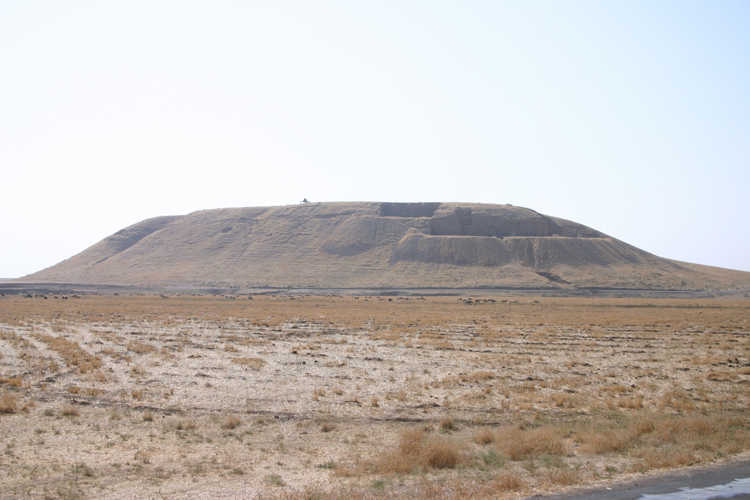
In archaeology, a tell or tel (borrowed into English from ar, تَلّ, ', 'mound' or 'small hill'), is an artificial topographical feature, a species of mound consisting of the accumulated and stratified debris of a succession of consecutive settlements at the same site, the refuse of generations of people who built and inhabited them, and of natural sediment. (Very limited snippet view).Matthews (2020)Introduction and Definition/ref> Tells are most commonly associated with the ancient Near East, but they are also found elsewhere, such as Southern and parts of Central Europe, from Greece and Bulgaria to Hungary and SpainBlanco-González & Kienlin, eds (2020), 6th page of chapter 1, see map. and in North Africa. Within the Near East, they are concentrated in less arid regions, including Upper Mesopotamia, the Southern Levant, Anatolia and Iran, which had more continuous settlement. Eurasian tells date to the Neolithic,Blanco-González & Kienlin, eds (2020), 2nd page of chapter 1 ... [...More Info...] [...Related Items...] OR: [Wikipedia] [Google] [Baidu] |
Neolithic
The Neolithic period, or New Stone Age, is an Old World archaeological period and the final division of the Stone Age. It saw the Neolithic Revolution, a wide-ranging set of developments that appear to have arisen independently in several parts of the world. This "Neolithic package" included the introduction of farming, domestication of animals, and change from a hunter-gatherer lifestyle to one of settlement. It began about 12,000 years ago when farming appeared in the Epipalaeolithic Near East, and later in other parts of the world. The Neolithic lasted in the Near East until the transitional period of the Chalcolithic (Copper Age) from about 6,500 years ago (4500 BC), marked by the development of metallurgy, leading up to the Bronze Age and Iron Age. In other places the Neolithic followed the Mesolithic (Middle Stone Age) and then lasted until later. In Ancient Egypt, the Neolithic lasted until the Protodynastic period, 3150 BC.Karin Sowada and Peter Grave. Egypt in th ... [...More Info...] [...Related Items...] OR: [Wikipedia] [Google] [Baidu] |


.jpg)


