|
Tazawako, Akita
was a town located in Senboku District, Akita Prefecture, Japan. In 2003, the town had an estimated population of 12,471 and a density of 18.56 persons per km². The total area was 672.06 km². On September 20, 2005, Tazawako, along with the town of Kakunodate, and the village of Nishiki (all from Senboku District), was merged to create the city of Semboku. Eponymous Lake Tazawa is the deepest lake in Japan at 423 meters. The town has several popular onsen. The area is served by Tazawako Station, which is served by the Akita Shinkansen and the Tazawako Line The is a railway line operated by East Japan Railway Company (JR East) connecting Morioka Station in Morioka, Iwate and Ōmagari Station in Daisen, Akita, Japan. Akita Shinkansen '' Komachi'' trains travel over the line, which was regauge .... External links Official Website(English) (Japanese) Dissolved municipalities of Akita Prefecture Semboku, Akita {{Akita-geo-stub ... [...More Info...] [...Related Items...] OR: [Wikipedia] [Google] [Baidu] |
List Of Towns In Japan
A town (町; ''chō'' or ''machi'') is a local administrative unit in Japan. It is a local public body along with prefecture (''ken'' or other equivalents), city (''shi''), and village (''mura''). Geographically, a town is contained within a district. Note that the same word (町; ''machi'' or ''chō'') is also used in names of smaller regions, usually a part of a ward in a city. This is a legacy of when smaller towns were formed on the outskirts of a city, only to eventually merge into it. Towns See also * Municipalities of Japan * Japanese addressing system The Japanese addressing system is used to identify a specific location in Japan. When written in Japanese characters, addresses start with the largest geographical entity and proceed to the most specific one. When written in Latin characters, ad ... References {{reflist External links "Large_City_System_of_Japan";_graphic_shows_towns_compared_with_other_Japanese_city_types_at_p._1_[PDF_7_of_40/nowiki>">DF_7_of_4 ... [...More Info...] [...Related Items...] OR: [Wikipedia] [Google] [Baidu] |
Senboku District, Akita
is a rural district located in Akita, Japan. At present time (as of June 2013), the district consists of only the town of Misato with an estimated population of 20,771 and an area of 168.36 km2. All of the city of Senboku, most of the city of Daisen and part of the city of Yokote were formerly part of Senboku District. Towns and villages * Misato History The area of Senboku District was formerly part of Dewa Province, and was originally created out of Hiraka District in the year 870. Dewa Province was divided into the provinces of Ugo Province and Uzen Province following the Meiji Restoration on January 19, 1869, with the area of Semboku becoming part of Ugo Province. At the time, the area consisted of one town ( Kakunodate) and 181 villages formerly under the control of Kubota Domain. Akita Prefecture was founded on December 13, 1871. With the establishment of the municipality system on April 1, 1889, modern Senboku District, with one town (Kakunodate) and 37 vill ... [...More Info...] [...Related Items...] OR: [Wikipedia] [Google] [Baidu] |
Akita Prefecture
is a Prefectures of Japan, prefecture of Japan located in the Tōhoku region of Honshu.Nussbaum, Louis-Frédéric. (2005). "Provinces and prefectures" in ; "Tōhoku" in . Its population is approximately 966,000 (as of 1 October 2019) and its geographic area is 11,637 Square kilometre, km2 (4,493 sq mi). Akita Prefecture is bordered by Aomori Prefecture to the north, Iwate Prefecture to the east, Miyagi Prefecture to the southeast, and Yamagata Prefecture to the south. Akita, Akita, Akita is the capital and largest city of Akita Prefecture. Other major cities include Yokote, Akita, Yokote, Daisen, Akita, Daisen, and Yurihonjō. Akita Prefecture is located on the coast of the Sea of Japan and extends east to the Ōu Mountains, the longest mountain range in Japan, at the border with Iwate Prefecture. Akita Prefecture formed the northern half of the historic Dewa Province with Yamagata Prefecture. History The region of Akita was created from the ancient provinces of Dewa Provi ... [...More Info...] [...Related Items...] OR: [Wikipedia] [Google] [Baidu] |
Japan
Japan ( ja, 日本, or , and formally , ''Nihonkoku'') is an island country in East Asia. It is situated in the northwest Pacific Ocean, and is bordered on the west by the Sea of Japan, while extending from the Sea of Okhotsk in the north toward the East China Sea, Philippine Sea, and Taiwan in the south. Japan is a part of the Ring of Fire, and spans Japanese archipelago, an archipelago of List of islands of Japan, 6852 islands covering ; the five main islands are Hokkaido, Honshu (the "mainland"), Shikoku, Kyushu, and Okinawa Island, Okinawa. Tokyo is the Capital of Japan, nation's capital and largest city, followed by Yokohama, Osaka, Nagoya, Sapporo, Fukuoka, Kobe, and Kyoto. Japan is the List of countries and dependencies by population, eleventh most populous country in the world, as well as one of the List of countries and dependencies by population density, most densely populated and Urbanization by country, urbanized. About three-fourths of Geography of Japan, the c ... [...More Info...] [...Related Items...] OR: [Wikipedia] [Google] [Baidu] |
Population
Population typically refers to the number of people in a single area, whether it be a city or town, region, country, continent, or the world. Governments typically quantify the size of the resident population within their jurisdiction using a census, a process of collecting, analysing, compiling, and publishing data regarding a population. Perspectives of various disciplines Social sciences In sociology and population geography, population refers to a group of human beings with some predefined criterion in common, such as location, race, ethnicity, nationality, or religion. Demography is a social science which entails the statistical study of populations. Ecology In ecology, a population is a group of organisms of the same species who inhabit the same particular geographical area and are capable of interbreeding. The area of a sexual population is the area where inter-breeding is possible between any pair within the area and more probable than cross-breeding with in ... [...More Info...] [...Related Items...] OR: [Wikipedia] [Google] [Baidu] |
Population Density
Population density (in agriculture: standing stock or plant density) is a measurement of population per unit land area. It is mostly applied to humans, but sometimes to other living organisms too. It is a key geographical term.Matt RosenberPopulation Density Geography.about.com. March 2, 2011. Retrieved on December 10, 2011. In simple terms, population density refers to the number of people living in an area per square kilometre, or other unit of land area. Biological population densities Population density is population divided by total land area, sometimes including seas and oceans, as appropriate. Low densities may cause an extinction vortex and further reduce fertility. This is called the Allee effect after the scientist who identified it. Examples of the causes of reduced fertility in low population densities are * Increased problems with locating sexual mates * Increased inbreeding Human densities Population density is the number of people per unit of area, usuall ... [...More Info...] [...Related Items...] OR: [Wikipedia] [Google] [Baidu] |
Kakunodate, Akita
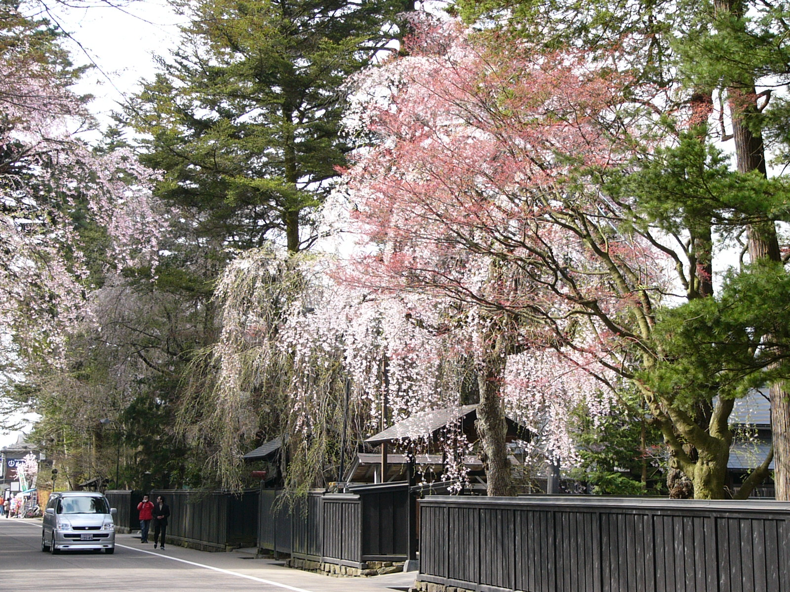
is a town located in Senboku District, Akita Prefecture, Japan. In 2003, the town had an estimated population of 14,138 and a density of 90.26 persons per km². The total area was 156.63 km². On September 20, 2005, Kakunodate, along with the town of Tazawako, and the village of Nishiki (all from Senboku District), was merged to create the city of Semboku. The town is famed for its well-preserved samurai houses and the proliferation of cherry trees. It is a popular destination for hanami, or cherry blossom viewing. It is sometimes referred as 'the little Kyoto of Tōhoku' (みちのくの小京都 ''Michinoku no sho-Kyōto''). There are the ruins of Kakunodate Castle, and Kakunodate Matsuri is an Important Intangible Folk Cultural Property. This city also hosts a "fire and snow" festival featuring kamakura snow domes each winter. See also *Groups of Traditional Buildings is a Japanese category of historic preservation introduced by a 1975 amendment of the law whic ... [...More Info...] [...Related Items...] OR: [Wikipedia] [Google] [Baidu] |
Nishiki, Akita
was a village located in Senboku District, Akita Prefecture, Japan. In 2003, the village had an estimated population of 5,793 and a density Density (volumetric mass density or specific mass) is the substance's mass per unit of volume. The symbol most often used for density is ''ρ'' (the lower case Greek letter rho), although the Latin letter ''D'' can also be used. Mathematical ... of 21.86 persons per km². The total area was 264.95 km². On September 20, 2005, Nishiki, along with the towns of Kakunodate and Tazawako (all from Senboku District), was merged to create the city of Semboku. External links City of Semboku official website Dissolved municipalities of Akita Prefecture Semboku, Akita {{Akita-geo-stub ... [...More Info...] [...Related Items...] OR: [Wikipedia] [Google] [Baidu] |
Semboku, Akita
is a city located in Akita Prefecture, Japan. , the city had an estimated population of 25,857 in 10,584 households, and a population density of 24 persons per km2. The total area of the city is . Geography Semboku is located in the mountains of central Akita Prefecture, bordering on Iwate Prefecture and the Ōu Mountains on the east. Lake Tazawa, the deepest lake in Japan, is located in the center of the city borders. Parts of the city are within the borders of the Towada-Hachimantai National Park. Neighboring municipalities *Akita Prefecture **Akita **Kitaakita **Kazuno ** Daisen *Iwate Prefecture ** Hachimantai **Shizukuishi ** Nishiwaga Climate Semboku has a Humid continental climate (Köppen climate classification ''Dfa'') with large seasonal temperature differences, with warm to hot (and often humid) summers and cold (sometimes severely cold) winters. Precipitation is significant throughout the year, but is heaviest from August to October. The average annual temperature ... [...More Info...] [...Related Items...] OR: [Wikipedia] [Google] [Baidu] |
Lake Tazawa
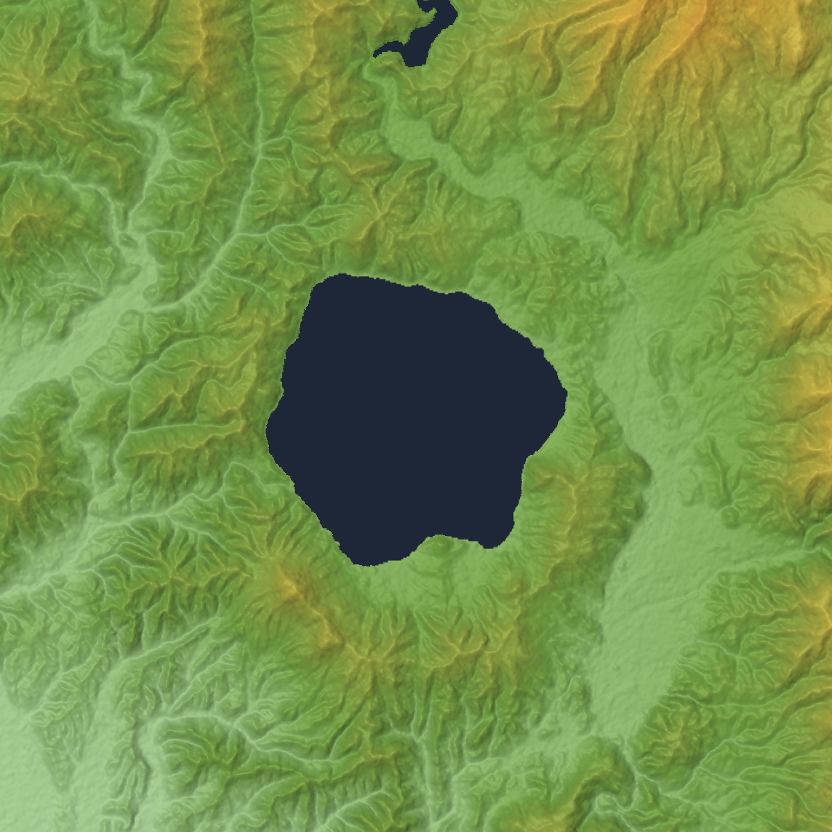
is a caldera lake in the city of Semboku, Akita Prefecture, northern Japan. It is the deepest lake in Japan at . The area is a popular vacation area and several hot spring resorts can be found in the hills above the lake. Akita Prefecture's largest ski area, Tazawako Ski Area a overlooks the lake. Hydrology Lake Tazawa has a surface elevation of 249 meters, and its deepest point is 174.4 meters below sea level. Due to this depth, there is no possibility that the lake is frozen in the dead of winter. At , it is slightly deeper than Lake Shikotsu in Hokkaidō (423.4 meters), and is the 17th deepest lake in the world. Lake Tazawa has no natural inflow or outflow, and in 1931, had a measured transparency of 31 meters, comparable with Lake Mashū, but with abundant aquatic organisms. However, due to the construction of hydroelectric power plant facilities and agricultural runoff, coupled with an influx of highly acidic water from Tamagawa Hot Spring, transparency has been re ... [...More Info...] [...Related Items...] OR: [Wikipedia] [Google] [Baidu] |
Onsen
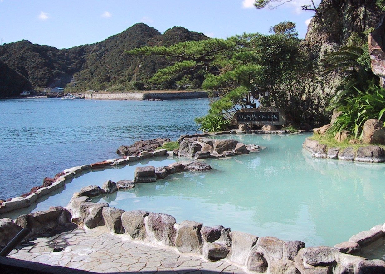
In Japan, are the country's hot springs and the bathing facilities and traditional inns around them. As a volcanically active country, Japan has many onsens scattered throughout all of its major islands. There are approximately 25,000 hot spring sources throughout Japan that provide hot mineral water to about 3,000 genuine onsen establishments. Onsens come in many types and shapes, including and . Baths may be either publicly run by a municipality or privately, often as part of a hotel, ''ryokan'', or . The presence of an onsen is often indicated on signs and maps by the symbol ♨ or the kanji (''yu'', meaning "hot water"). Sometimes the simpler hiragana character ゆ (''yu''), understandable to younger children, is used. Traditionally, onsens were located outdoors, although many inns have now built indoor bathing facilities as well. Nowadays, as most households have their own bath, the number of traditional public baths has decreased, but the number of sightseeing ho ... [...More Info...] [...Related Items...] OR: [Wikipedia] [Google] [Baidu] |
Tazawako Station
is a railway station on the Tazawako Line in Semboku, Akita, Japan, operated by East Japan Railway Company (JR East). Lines Tazawako Station is served by the Tazawako Line and the Akita Shinkansen, and is located 40.1 rail km from the terminus of both lines at Morioka Station. Station layout Tazawako Station consists of a single side platform and an island platform. The station building, by architect Shigeru Ban, with its glass facade, received the Good Design Prize. Tazawako Station was selected to be one of the Hundred Stations of Tohoku. Platforms History Tazawako Station opened on August 31, 1923, as on the Japanese Government Railways, which became Japanese National Railways (JNR) after World War II. The station was renamed to its present name on October 1, 1966. The station was absorbed into the JR East network upon the privatization of JNR on April 1, 1987. Services on the Akita Shinkansen began on March 22, 1997. Surrounding area * Nyūtō hot spring village * ... [...More Info...] [...Related Items...] OR: [Wikipedia] [Google] [Baidu] |


