|
Tankai Fort
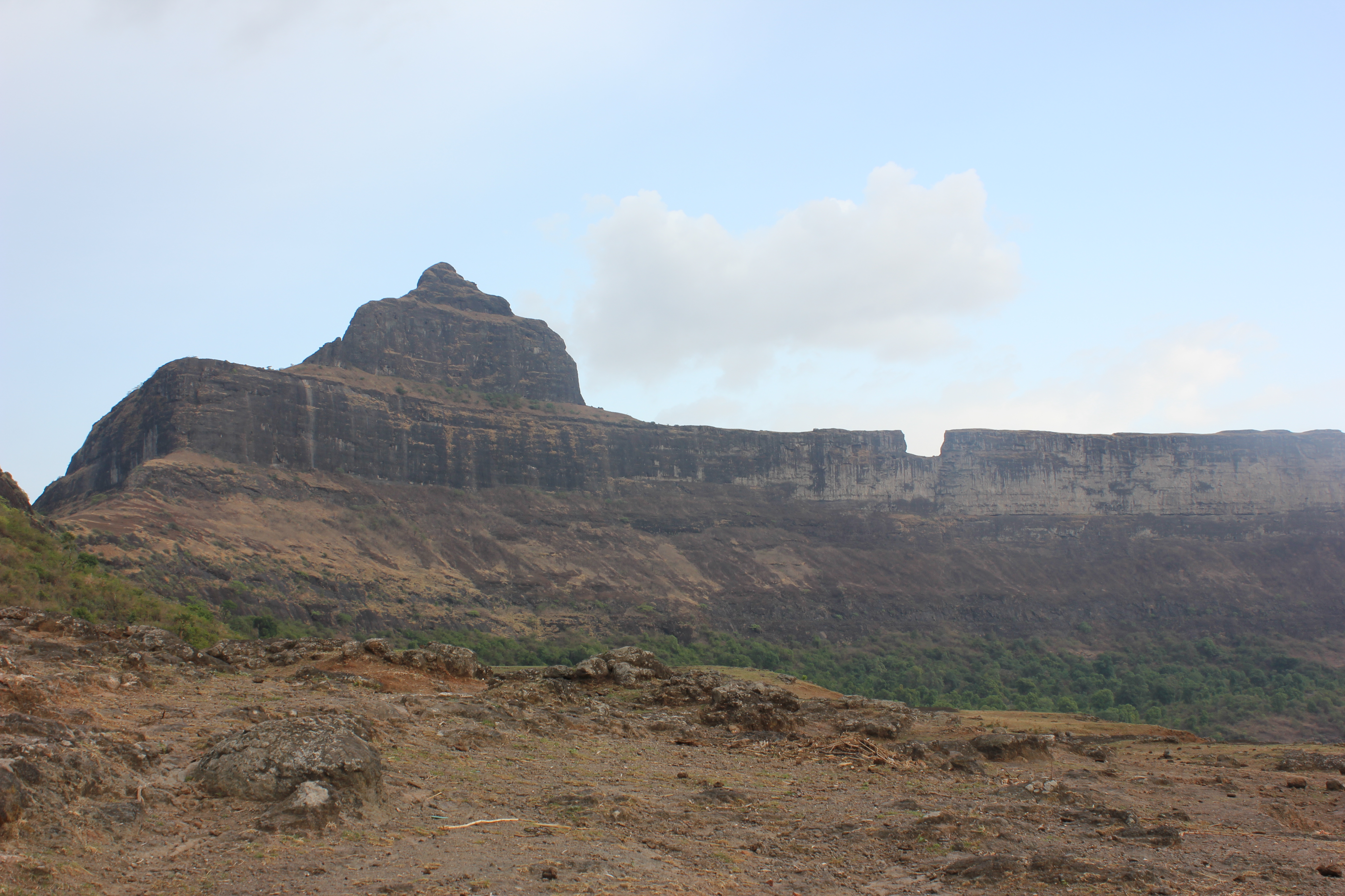
Tankai fort is a hill, part of the Satmala Range, with the ruins of a large Maratha hill fort on the peak. With Ankai Fort near this fort are known as Ankai-Tankai, the strongest hill fort in the Nashik district, rises about 900 feet above the plain and 3200 feet above the sea. It is located from Manmad in Yeola taluka of Nashik district in Maharashtra, India India, officially the Republic of India (Hindi: ), is a country in South Asia. It is the seventh-largest country by area, the second-most populous country, and the most populous democracy in the world. Bounded by the Indian Ocean on the so .... References Forts in Nashik district {{India-struct-stub ... [...More Info...] [...Related Items...] OR: [Wikipedia] [Google] [Baidu] |
Nashik District
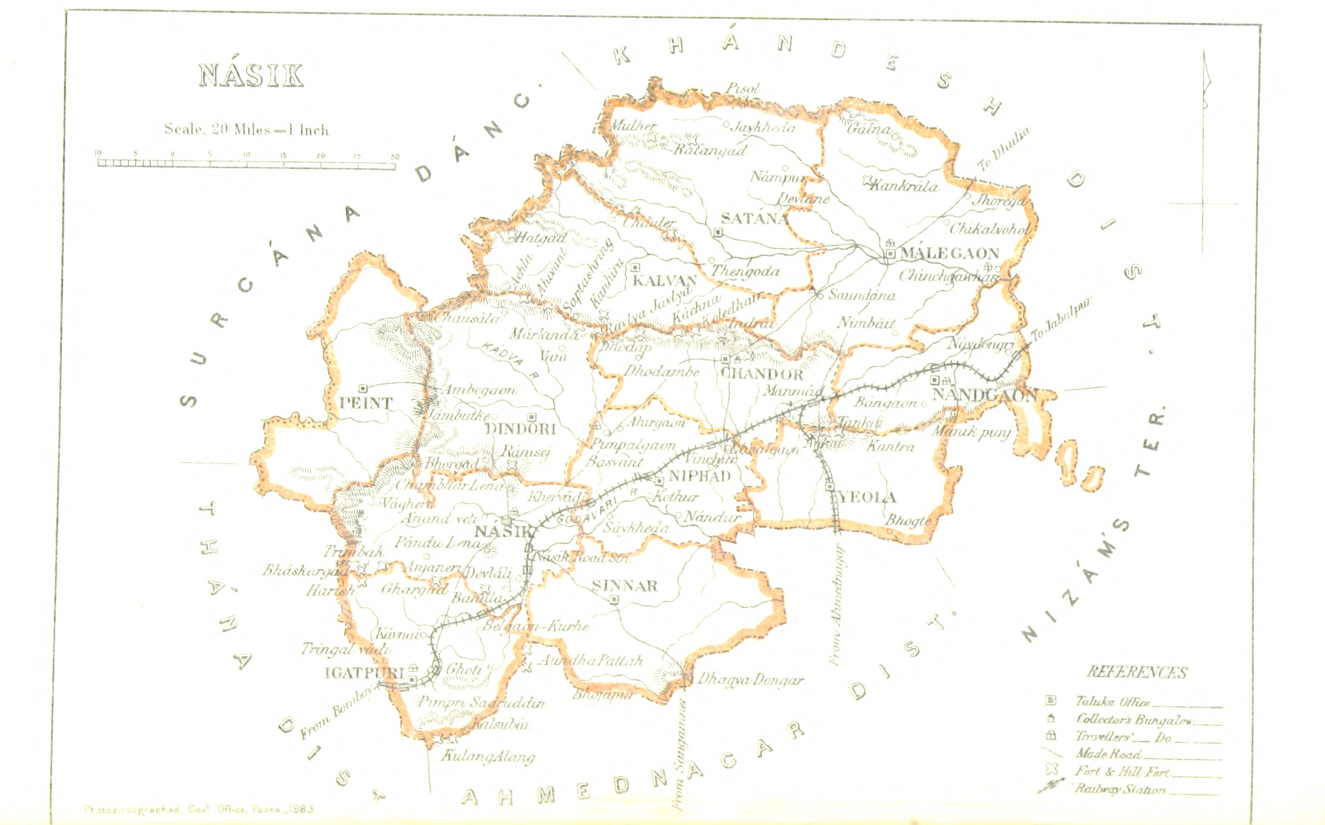
Nashik district, also known as Nasik district, is a district in Maharashtra, India. The city of Nashik is the administrative headquarters of the district. Nashik is well known for the production of wine. Nashik is also known as Mini Maharashtra, because the climate and soil conditions of Surgana, Peth, Igatpuri resembles with Konkan. Niphad, Sinnar, Dindori, Baglan blocks are like Western Maharashtra and Yeola, Nandgaon, Chandwad blocks are like Vidarbha Region. Nashik is the biggest city in the district while Malegaon is the second biggest city. Manmad, Igatpuri, sinnar are some of the big cities situated in the Nashik District. Manmad is one of the biggest railway junction in india while the city of Malegaon is famous for its powerloom. Nashik district is the third largest district in Maharashtra state in terms of population of 8,107,187 and occupying an area of 15,582 square kilometres in the north Maharashtra region. It is bounded by Dhule District to the north, Jalgaon D ... [...More Info...] [...Related Items...] OR: [Wikipedia] [Google] [Baidu] |
Maharashtra
Maharashtra (; , abbr. MH or Maha) is a states and union territories of India, state in the western India, western peninsular region of India occupying a substantial portion of the Deccan Plateau. Maharashtra is the List of states and union territories of India by population, second-most populous state in India and the second-most populous country subdivision globally. It was formed on 1 May 1960 by splitting the bilingual Bombay State, which had existed since 1956, into majority Marathi language, Marathi-speaking Maharashtra and Gujarati language, Gujarati-speaking Gujarat. Maharashtra is home to the Marathi people, the predominant ethno-linguistic group, who speak the Marathi language, Marathi language, the official language of the state. The state is divided into 6 Divisions of Maharashtra, divisions and 36 List of districts of Maharashtra, districts, with the state capital being Mumbai, the List of million-plus urban agglomerations in India, most populous urban area in India ... [...More Info...] [...Related Items...] OR: [Wikipedia] [Google] [Baidu] |
Satmala Range
Satmala (pronunciation: ɐtmaːla is a mountain range which runs across Nashik District, Maharashtra. They are an integral part of the Sahyadris range within Nashik. These peaks are visible from a greater part of the district and form prominent landmarks. The highest of them is Dhodap (1,451 metres). Dhodap hill is the third highest hill peak in Maharashtra after Kalsubai and Salher Salher is a place located near Waghamba in Satana tehsil in Nashik district of Maharashtra, India.The old name of Salher was Gavalgarh, which was based on the name of the local Bhil king named Gaval Bhil, he was the discoverer of this place. I ... and 29th highest peak in the Western Ghats. At the eastern side of this range lies the Chandvad range. There is a range with the same name Satmala in Telangana. The most important range of Nashik is the Satmala range. This range looks like a necklace placed along Nashik. It passes right through the center of the city. From Saputara to Vani, from Chan ... [...More Info...] [...Related Items...] OR: [Wikipedia] [Google] [Baidu] |
Ankai Fort
Ankai Fort is a historic site found in the Satmala Range hills in western India. It is located in Yeola Taluka of Nashik district in the state of Maharashtra. The fort was built by Yadava of Devgiri. Geographically, it is near Manmad. The Ankai fort and Tankai fort are two different forts on adjacent hills. A common fortification is constructed to secure both. The Ankai fort is located on a hill with perpendicular scarps on all the sides, except for a narrow nose on the eastern side. History The Jain caves located at the foothills of the fort, spanning two levels. On the lower level there are two caves, neither of which has idols. On the upper level, there are five caves which feature Mahavir idols in good condition. They are secured by lock and key at night to avoid vandalism. There are carvings of Yaksha, Indrani, lotus and Lord Mahavir in the main cave. the fort at the base of the fort depict that Ankai was constructed around 1000 years ago. The fort was built by Yadava of D ... [...More Info...] [...Related Items...] OR: [Wikipedia] [Google] [Baidu] |
Manmad
Manmad ( ənmaːɖ is one of the towns in Nashik district in the state of Maharashtra in India. It is the third largest city in Nashik district, with a population of approximately 80,000. Geographically it lies within Nandgaon Tehsil in Nashik District. Though it has a larger area and population than most Tehsils in the district, it does not have a Tehsil office. Manmad houses the largest grain storage warehouses of Asia which are administered by Food Corporation of India, and also the offices of petroleum companies like Bharat Petroleum, Hindustan Petroleum and Indian Oil. This is predominantly Railway town. All development in the city took place around railway activity. The city also has a popular Sikh Gurudwara. Manmad is one of the largest markets for onion producing farmers after Lasalgaon; many farmers from nearby villages sell their farm produce in Manmad to wholesale traders, who in turn sell it in Mumbai. The Central Railway Engineering workshop at Manmad, which co ... [...More Info...] [...Related Items...] OR: [Wikipedia] [Google] [Baidu] |
India
India, officially the Republic of India (Hindi: ), is a country in South Asia. It is the seventh-largest country by area, the second-most populous country, and the most populous democracy in the world. Bounded by the Indian Ocean on the south, the Arabian Sea on the southwest, and the Bay of Bengal on the southeast, it shares land borders with Pakistan to the west; China, Nepal, and Bhutan to the north; and Bangladesh and Myanmar to the east. In the Indian Ocean, India is in the vicinity of Sri Lanka and the Maldives; its Andaman and Nicobar Islands share a maritime border with Thailand, Myanmar, and Indonesia. Modern humans arrived on the Indian subcontinent from Africa no later than 55,000 years ago., "Y-Chromosome and Mt-DNA data support the colonization of South Asia by modern humans originating in Africa. ... Coalescence dates for most non-European populations average to between 73–55 ka.", "Modern human beings—''Homo sapiens''—originated in Africa. Then, int ... [...More Info...] [...Related Items...] OR: [Wikipedia] [Google] [Baidu] |


