|
Tanfiliev Island
ja, 水晶島 , image_name = Tanfilyev Island, Lesser Kuril Chain, Sentinel-2 satellite image, 2016-06-06.jpg , image_size = 300px , image_caption = 2016 Copernicus (ESA) satellite image of Tanfiliev , pushpin_map = Japan Hokkaido , location = Pacific Ocean , coordinates = , archipelago = Habomai Islands, Lesser Kuril Chain, Kuril Islands , area_km2 = 12.1 , area_footnotes = , elevation_m = 16 , elevation_footnotes = , country = , country_admin_divisions_title_1 = Federal subject , country_admin_divisions_1 = Sakhalin Oblast , country_admin_divisions_title_2 = District , country_admin_divisions_2 = Yuzhno-Kurilsky , country1 = , country1_admin_divisions_title_1 = Prefecture , country1_admin_divisions_1 = Hokkaido , country1_admin_divisions_title_2 = Subprefectur ... [...More Info...] [...Related Items...] OR: [Wikipedia] [Google] [Baidu] |
Copernicus Programme
Copernicus is the European Union's Earth observation programme coordinated and managed for the European Commission by the European Union Agency for the Space Programme in partnership with the European Space Agency (ESA), the EU Member States. It aims at achieving a global, continuous, autonomous, high quality, wide range Earth observation capacity. Providing accurate, timely and easily accessible information to, among other things, improve the management of the environment, understand and mitigate the effects of climate change, and ensure civil security. The objective is to use vast amount of global data from satellites and from ground-based, airborne and seaborne measurement systems to produce timely and quality information, services and knowledge, and to provide autonomous and independent access to information in the domains of environment and security on a global level in order to help service providers, public authorities and other international organizations improve the ... [...More Info...] [...Related Items...] OR: [Wikipedia] [Google] [Baidu] |
Kuril Islands Dispute
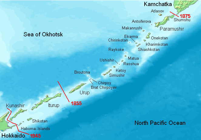
The Kuril Islands dispute, known as the Northern Territories dispute in Japan, is a territorial dispute between Japan and Russia over the ownership of the four southernmost Kuril Islands. The Kuril Islands are a chain of islands that stretch between the Japanese island of Hokkaido at their southern end and the Russian Kamchatka Peninsula at their northern end. The islands separate the Sea of Okhotsk from the Pacific Ocean. The four disputed islands, like other islands in the Kuril chain that are not in dispute, were unilaterally annexed by the Soviet Union following the Kuril Islands landing operation at the end of World War II. The disputed islands are under Russian administration as the South Kuril District and part of Kuril District of the Sakhalin Oblast (Сахалинская область, ''Sakhalinskaya oblast''). They are claimed by Japan, which refers to them as its Northern Territories or Southern Chishima, and considers them part of the Nemuro Subprefecture of ... [...More Info...] [...Related Items...] OR: [Wikipedia] [Google] [Baidu] |
Birdlife International
BirdLife International is a global partnership of non-governmental organizations that strives to conserve birds and their habitats. BirdLife International's priorities include preventing extinction of bird species, identifying and safeguarding important sites for birds, maintaining and restoring key bird habitats, and empowering conservationists worldwide. It has a membership of more than 2.5 million people across 116 country partner organizations, including the Royal Society for the Protection of Birds, the Wild Bird Society of Japan, the National Audubon Society and American Bird Conservancy. BirdLife International has identified 13,000 Important Bird and Biodiversity Areas and is the official International Union for Conservation of Nature’s Red List authority for birds. As of 2015, BirdLife International has established that 1,375 bird species (13% of the total) are threatened with extinction ( critically endangered, endangered or vulnerable). BirdLife International p ... [...More Info...] [...Related Items...] OR: [Wikipedia] [Google] [Baidu] |
Important Bird Area
An Important Bird and Biodiversity Area (IBA) is an area identified using an internationally agreed set of criteria as being globally important for the conservation of bird populations. IBA was developed and sites are identified by BirdLife International. There are over 13,000 IBAs worldwide. These sites are small enough to be entirely conserved and differ in their character, habitat or ornithological importance from the surrounding habitat. In the United States the Program is administered by the National Audubon Society. Often IBAs form part of a country's existing protected area network, and so are protected under national legislation. Legal recognition and protection of IBAs that are not within existing protected areas varies within different countries. Some countries have a National IBA Conservation Strategy, whereas in others protection is completely lacking. History In 1985, following a specific request from the European Economic Community, Birdlife International ... [...More Info...] [...Related Items...] OR: [Wikipedia] [Google] [Baidu] |
Kunashir
, other_names = kz, Kün Ashyr; ja, 国後島 , location = Sea of Okhotsk , locator_map = File:Kurily Kunashir.svg , coordinates = , archipelago = Kuril Islands , total_islands = , major_islands = , area = , length = , width = from to , coastline = , highest_mount = Chacha , elevation = , country = , country_admin_divisions_title_1 = Federal subject , country_admin_divisions_1 = Sakhalin Oblast , country_admin_divisions_title_2 = District , country_admin_divisions_2 = Yuzhno-Kurilsky , country_largest_city = , country_largest_city_population = , country_leader_title = , country_leader_name = , population = approx. 7000 , population_as_of = 2007 , density = , ethnic_groups = , additional_info = , country_claim = , country_claim_divisions_title_1 = Prefecture , country_claim_divisions_1 = Hokkaido , country_claim_divisions_titl ... [...More Info...] [...Related Items...] OR: [Wikipedia] [Google] [Baidu] |
Nihon Rekishi Chimei Taikei
In Japanese, encyclopedias are known as ''hyakka jiten'' (), which literally means "book of a hundred subjects," and can trace their origins to the early Heian period, in the ninth century. Encyclopedic works were published in Japan for well over a thousand years before Japan's first modern encyclopedias were published after Japan's opening to the West, during the Meiji Period (1868–1912). Several encyclopedias have been published in Japan since World War II, including several children's encyclopedias, and two major titles are currently available: the ''Encyclopedia Nipponica'', published by Shogakukan, and the ''Sekai Dai-Hyakka Jiten'', compiled by the Heibonsha publishing company. A Japanese ''Wikipedia'' is also available. History The antecedents of the modern Japanese encyclopedia date from the ancient period and the Middle Ages. Encyclopedic books were imported from China from an early date, but the first proto-encyclopedia produced in Japan was the 1000-scroll '' Hif ... [...More Info...] [...Related Items...] OR: [Wikipedia] [Google] [Baidu] |
Nemuro Peninsula
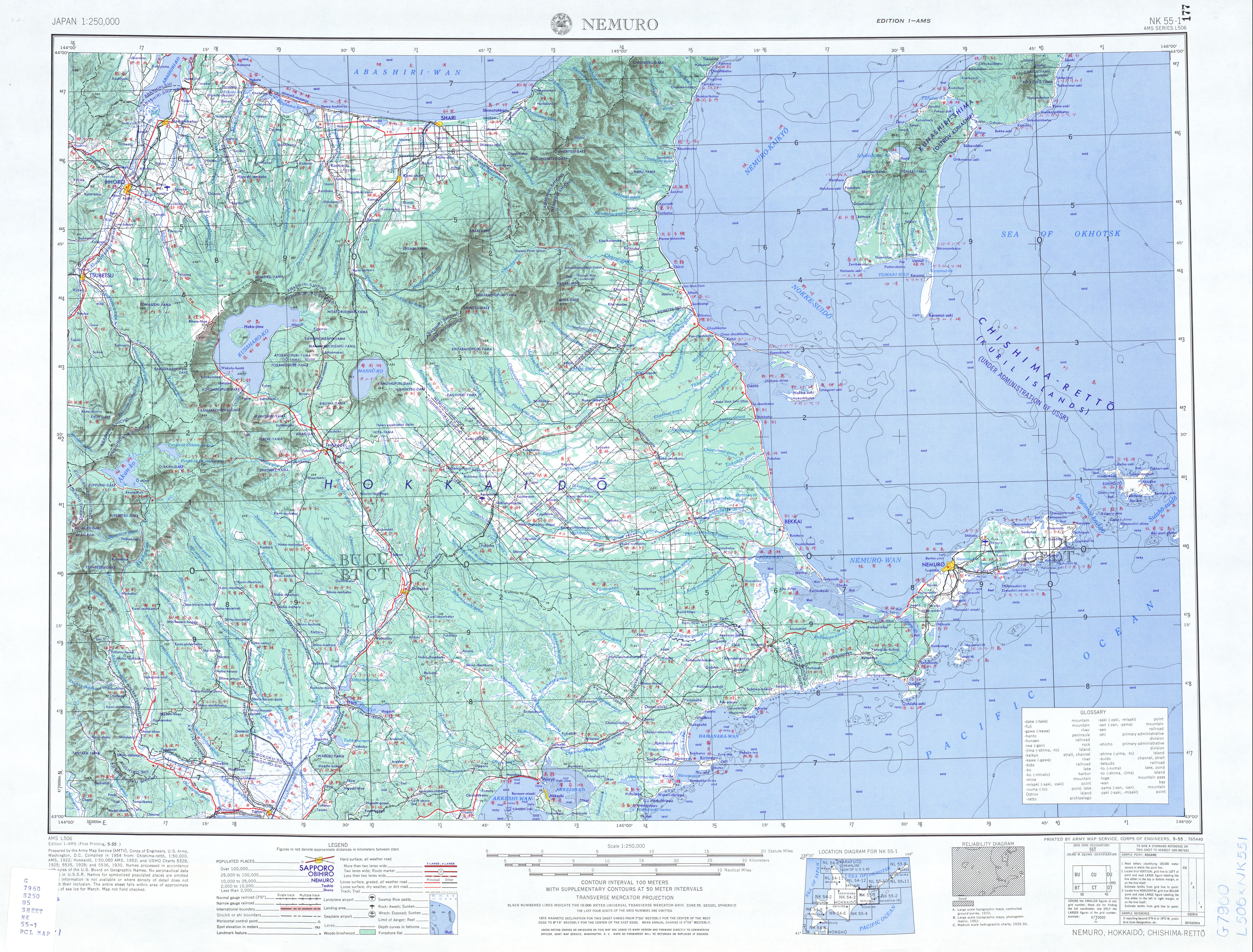
The Nemuro Peninsula (根室半島 ''Nemuro-hantō'') is a peninsula which extends from the east coast of Hokkaidō, Japan. It is some long and wide, and forms part of Nemuro City. Cape Nosappu at its tip is the easternmost point of Hokkaidō. The northern coastline is on Nemuro Bay, while the south faces the Pacific Ocean. Islands of the Habomai (Khabomai) Archipelago, administered by Russia but claimed by Japan, extend eastward from the peninsula. Climate Most of the Nemuro Peninsula has a humid continental climate (Köppen climate classification ''Dfb''). However, due to the influence of the Seasonal lag, the midsummer season is often scheduled from the end of August to the beginning of September. For example, spring in Cape Nosappu often doesn't arrive until the end of May, and in some years winter doesn't even end until the end of June. In 1983, due to the continuous cold wave, the winter in the area did not end until the end of July, and in August it immediately entered t ... [...More Info...] [...Related Items...] OR: [Wikipedia] [Google] [Baidu] |
Cape Nosappu
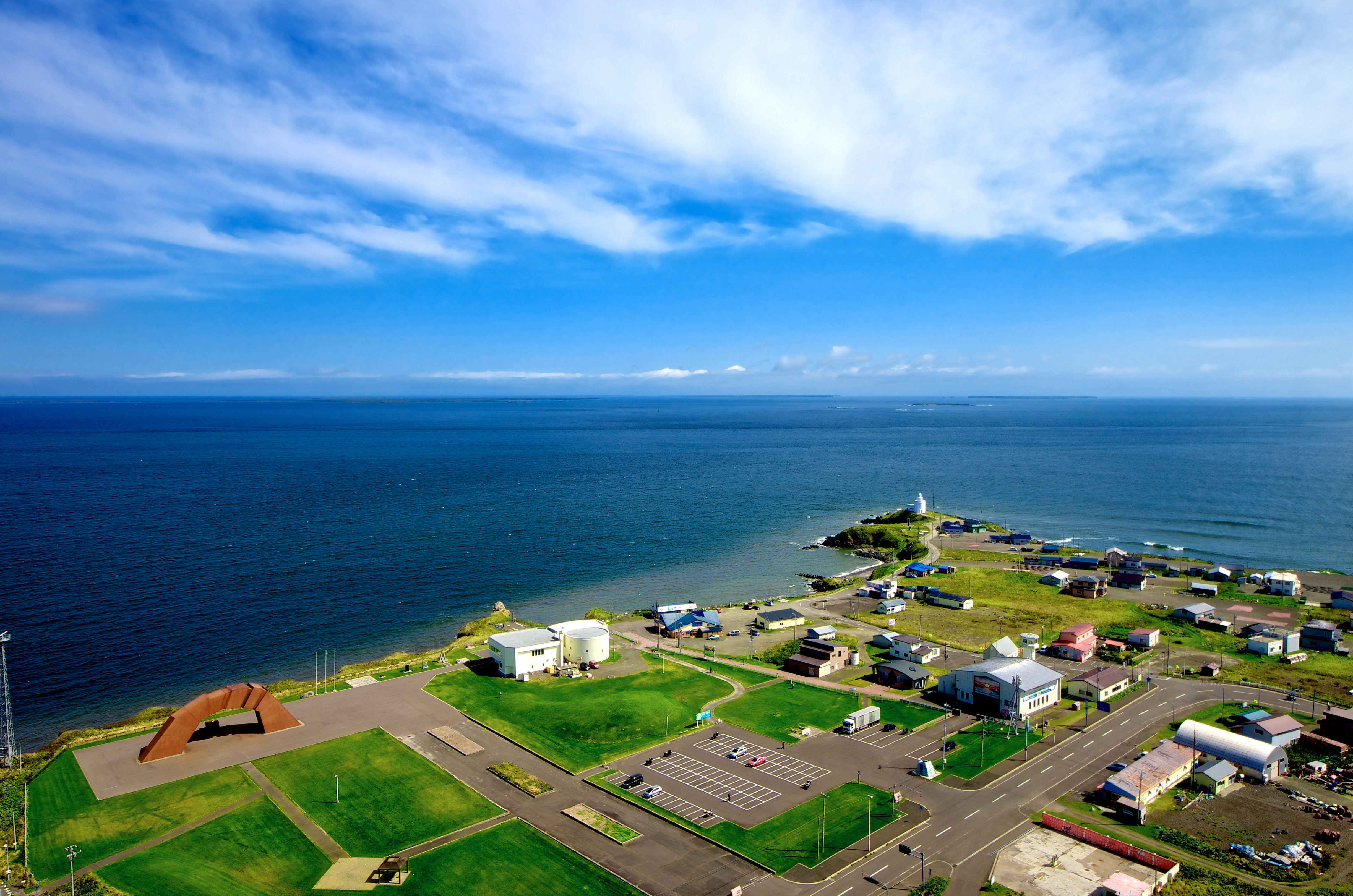
is a point on the Nemuro Peninsula, Nemuro, Japan which is the easternmost point in Hokkaidō. It is also the easternmost point in Japan which is open to the public. It is located where the waters from the Pacific Ocean meet those from the Sea of Okhotsk. The Cape Nosappu Lighthouse is the oldest in Hokkaidō, built in 1872. The cape is very close to the Habomai Archipelago, which is administered by Russia. The closest island, Signalny Rock, is just 3.7 km away. As such, Russian patrol boats frequently appear on the strait. However, Japan claims the sovereignty over these islands. (See Kuril Islands dispute.) Consequently, the cape houses a lot of monuments dealing with Japanese claims on the territories, such as the House of Nostalgia for the Homeland, the Bridge on the Four Islands, and others. Gallery File:Stranding ship at Nossapu cape.JPG, Russian ship abandoned after being stranded off Cape Nosappu Lighthouse (2009 August) File:Hokkaido pref road No35 Nosappu ... [...More Info...] [...Related Items...] OR: [Wikipedia] [Google] [Baidu] |
Protected Planet
The World Database on Protected Areas (WDPA) is the largest assembly of data on the world's terrestrial and marine protected areas, containing more than 260,000 protected areas as of August 2020, with records covering 245 countries and territories throughout the world. The WDPA is a joint venture between the United Nations Environment Programme World Conservation Monitoring CentreUNEP-WCMC and the International Union for Conservation of NatureIUCN World Commission on Protected AreasWCPA. Data for the WDPA is collected from international convention secretariats, governments and collaborating NGOs, but the role of custodian is allocated to the Protected Areas Programme of UNEP-WCMC, based in Cambridge, UK, who have hosted the database since its creation in 1981. The WDPA delivers invaluable information to decision-makers around the world, particularly in terms of measuring the extent and effectiveness of protected areas as an indicator for meeting global biodiversity targets. In Oct ... [...More Info...] [...Related Items...] OR: [Wikipedia] [Google] [Baidu] |


