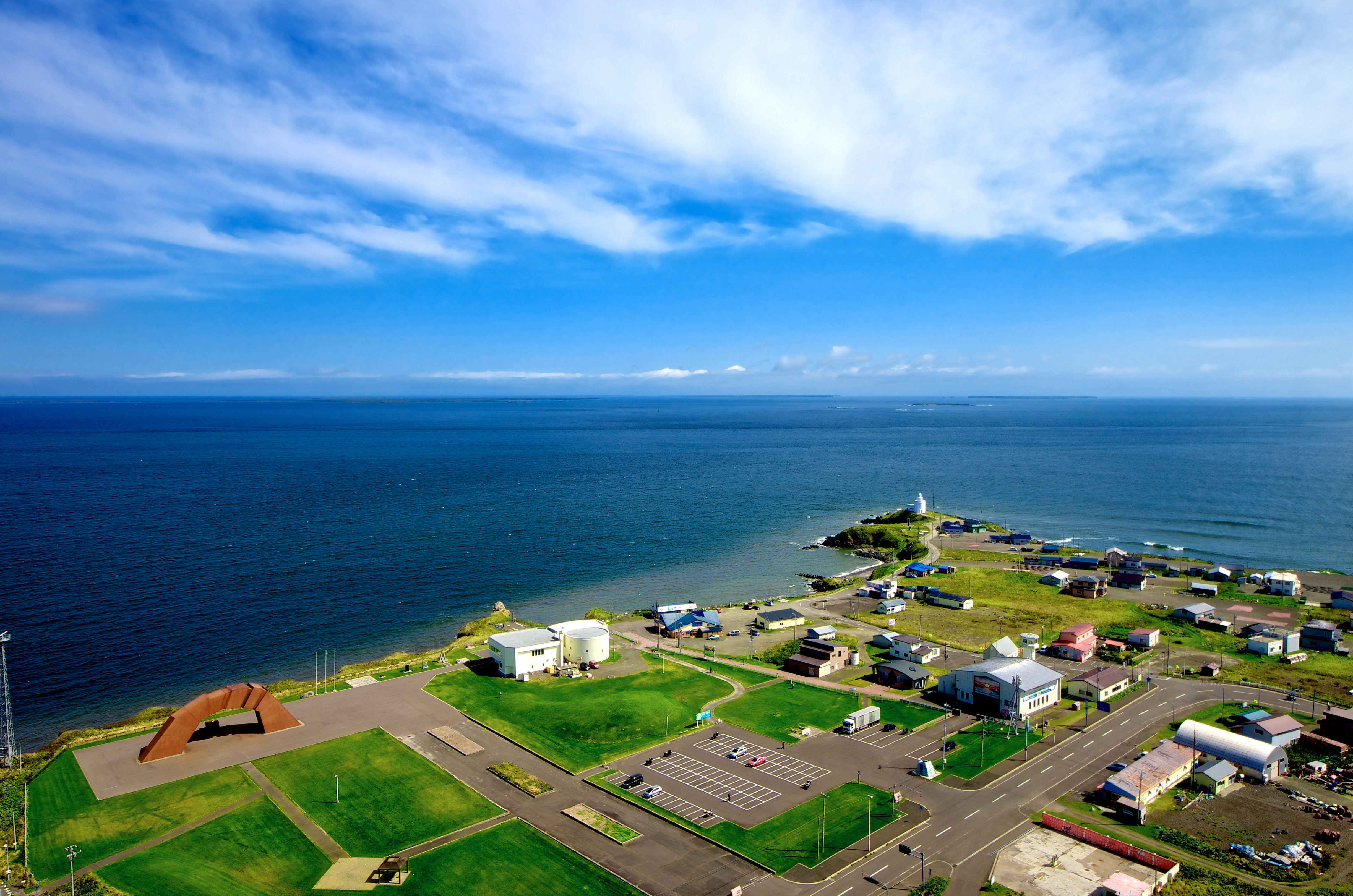
Cape Nosappu on:
[Wikipedia]
[Google]
[Amazon]
 is a point on the
File:Stranding ship at Nossapu cape.JPG, Russian ship abandoned after being stranded off Cape Nosappu Lighthouse (2009 August)
File:Hokkaido pref road No35 Nosappu Cape.jpg, Aurora Tower
File:Signalny Rock.jpg, Signalny Rock, viewed from Cape Nosappu
File:Nemuro Peninsula Hokkaido Japan SRTM.jpg, Landsat Image
File:The bridge of 4 Island monument.JPG, ''The Four Islands Bridge'', a monument dedicated to praying for the return of the
Nosappu Lighthouse
Landforms of Hokkaido Nosappu Nemuro, Hokkaido {{Hokkaido-geo-stub
 is a point on the
 Nemuro Peninsula
The Nemuro Peninsula (根室半島 ''Nemuro-hantō'') is a peninsula which extends from the east coast of Hokkaidō, Japan. It is some long and wide, and forms part of Nemuro City. Cape Nosappu at its tip is the easternmost point of Hokkaidō. ...
, Nemuro Nemuro may refer to:
* Nemuro Subprefecture, Hokkaido Prefecture, Japan
** Nemuro, Hokkaido, a city
** Nemuro Peninsula
** Nemuro Strait
** Nemuro Bay
* Nemuro Province
was an old province in Japan in what is today Nemuro Subprefecture, Hokkai ...
, Japan
Japan ( ja, 日本, or , and formally , ''Nihonkoku'') is an island country in East Asia. It is situated in the northwest Pacific Ocean, and is bordered on the west by the Sea of Japan, while extending from the Sea of Okhotsk in the north ...
which is the easternmost point in Hokkaidō
is Japan's second largest island and comprises the largest and northernmost prefecture, making up its own region. The Tsugaru Strait separates Hokkaidō from Honshu; the two islands are connected by the undersea railway Seikan Tunnel.
The la ...
. It is also the easternmost point in Japan which is open to the public. It is located where the waters from the Pacific Ocean
The Pacific Ocean is the largest and deepest of Earth's five oceanic divisions. It extends from the Arctic Ocean in the north to the Southern Ocean (or, depending on definition, to Antarctica) in the south, and is bounded by the continen ...
meet those from the Sea of Okhotsk
The Sea of Okhotsk ( rus, Охо́тское мо́ре, Ohótskoye móre ; ja, オホーツク海, Ohōtsuku-kai) is a marginal sea of the western Pacific Ocean. It is located between Russia's Kamchatka Peninsula on the east, the Kuril Islands ...
. The Cape Nosappu Lighthouse is the oldest in Hokkaidō, built in 1872.
The cape is very close to the Habomai Archipelago, which is administered by Russia
Russia (, , ), or the Russian Federation, is a List of transcontinental countries, transcontinental country spanning Eastern Europe and North Asia, Northern Asia. It is the List of countries and dependencies by area, largest country in the ...
. The closest island, Signalny Rock, is just 3.7 km away. As such, Russian patrol boat
A patrol boat (also referred to as a patrol craft, patrol ship, or patrol vessel) is a relatively small naval vessel generally designed for coastal defence, border security, or law enforcement. There are many designs for patrol boats, and the ...
s frequently appear on the strait. However, Japan claims the sovereignty over these islands. (See Kuril Islands dispute
The Kuril Islands dispute, known as the Northern Territories dispute in Japan, is a territorial dispute between Japan and Russia over the ownership of the four southernmost Kuril Islands. The Kuril Islands are a chain of islands that stretch b ...
.) Consequently, the cape houses a lot of monuments dealing with Japanese claims on the territories, such as the House of Nostalgia for the Homeland, the Bridge on the Four Islands, and others.
Gallery
Habomai Islands
; ja, 歯舞群島, Habomai guntō
, location = Pacific Ocean
, coordinates =
, archipelago = Kuril Islands
, total_islands = 10 + several rocks
, major_islands =
, area_km2 = 100
, length =
, ...
to Japanese sovereignty.
Climate
See also
*Extreme points of Japan
The extreme points of Japan include the coordinates that are farthest north, south, east and west in Japan, and the ones that are at the highest and the lowest elevations in the country. Japan's northernmost point is disputed, because Japan consi ...
References
External links
Nosappu Lighthouse
Landforms of Hokkaido Nosappu Nemuro, Hokkaido {{Hokkaido-geo-stub