|
Tanamoust
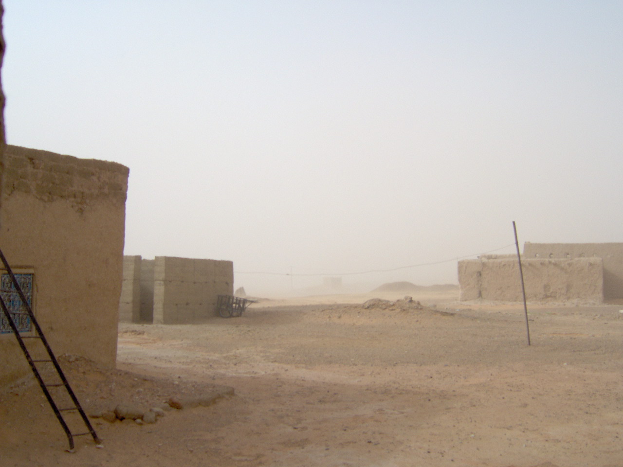
Tanamoust is located at the bottom of Erg Chebbi, a Saharan erg in southeast Morocco near the Algerian border. It most famous well known nearby village is Merzouga. Other villages around the dunes are Hassilabied, Takoujt, Khamlia Khamlia is a small village located on the edge of sand dunes of Erg Chebbi in southeast Morocco near the Algerian border. The village is also called the southern gateway to the Sahara, which begins in Algeria. There is a larger village named Mer ... and Tisserdmine. {{Coord, 31.0678, N, 4.0173, W, display=title Populated places in Errachidia Province Oases of Morocco ... [...More Info...] [...Related Items...] OR: [Wikipedia] [Google] [Baidu] |
Takoujt
Takoujt village is located on the bottom of Erg Chebbi, a Saharan erg in southeast Morocco near the Algerian border. Its most well known nearby village is Merzouga. Other villages around the dunes are Hassilabied, Tanamoust, Khamlia Khamlia is a small village located on the edge of sand dunes of Erg Chebbi in southeast Morocco near the Algerian border. The village is also called the southern gateway to the Sahara, which begins in Algeria. There is a larger village named Mer ... and Tisserdmine. {{DrâaTafilalet-geo-stub Populated places in Errachidia Province Oases of Morocco ... [...More Info...] [...Related Items...] OR: [Wikipedia] [Google] [Baidu] |
Merzouga
Merzouga is a small village in southeastern Morocco, about southeast of Rissani, about from Erfoud and about from the Algerian border. The village is known for its proximity to Erg Chebbi and is a popular destination for tourists. It has been described as "a desert theme park" and the Erg Chebbi as "a wonderland of sand". Merzouga has the largest natural underground body of water in Morocco. In 2006, Merzouga experienced devastating flash floods, displacing 1,200 and resulting in some deaths. Near the dunes of Erg Chebbi there are other known villages: Hassilabied away, Tanamoust away, Takoujt away, Khamlia away and Tisserdmine away. History Legend states that Merzouga once flourished as a tropical jungle until it was turned into a desert environment by God who punished families for refused offerings to a poor woman and buried them in the sand dunes of Erg Chebbi. Merzouga was uninhabited but later became a transit point for merchants heading to Timbuktu. It later be ... [...More Info...] [...Related Items...] OR: [Wikipedia] [Google] [Baidu] |
Tisserdmine
The village is located on the bottom of Erg Chebbi, a Saharan erg in southeast Morocco near the Algerian border. The most well-known nearby village is Merzouga. Other villages around the dunes are Hassilabied, Tanamoust, Takoujt and Khamlia Khamlia is a small village located on the edge of sand dunes of Erg Chebbi in southeast Morocco near the Algerian border. The village is also called the southern gateway to the Sahara, which begins in Algeria. There is a larger village named Mer .... Populated places in Errachidia Province Oases of Morocco {{DrâaTafilalet-geo-stub ... [...More Info...] [...Related Items...] OR: [Wikipedia] [Google] [Baidu] |
Erg Chebbi
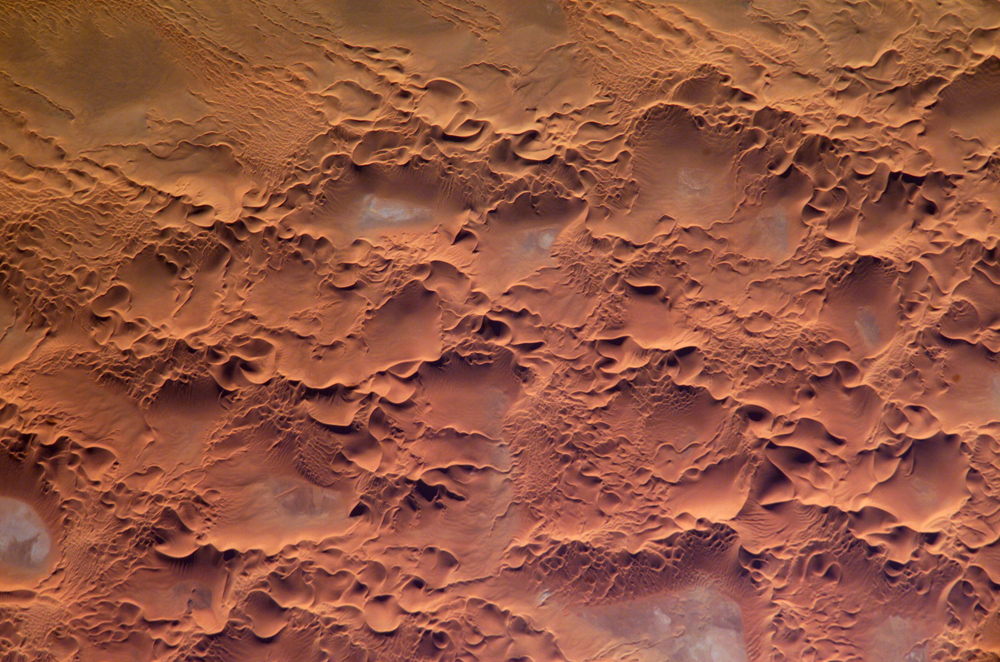
Erg Chebbi ( Berber: ⴻⵔⴳ ⵛⴱⵉ, ar, عرق الشبي) is one of Morocco's several ergs – large seas of dunes formed by wind-blown sand. There are several other ergs such as Erg Chigaga near M'hamid. Technically all these ergs are within an area of semi-arid Pre-Saharan Steppes and not part of the Sahara desert which lies some distance to the south. Description In places, the dunes of Erg Chebbi rise up to 150 meters from the surrounding hamada (rocky desert) and altogether it spans an area of 28 kilometers from north to south and up to 5–7 kilometers from east to west lining the Algerian border. The nearest sizable town is Erfoud, about 60 kilometers further north. One other city is Rissani, around 40 kilometers from Merzouga. Rissani was the site of a kingdom known as Sijilmassa, which became prosperous from the 8th to the 14th century due to its control of the caravan routes. Although rainfall is not very common, in 2006 flooding adjacent to the dunes destroy ... [...More Info...] [...Related Items...] OR: [Wikipedia] [Google] [Baidu] |
Sahara
, photo = Sahara real color.jpg , photo_caption = The Sahara taken by Apollo 17 astronauts, 1972 , map = , map_image = , location = , country = , country1 = , country2 = , country3 = , country4 = , country5 = , country6 = , country7 = , country8 = , country9 = , country10 = ( disputed) , region = , state = , district = , city = , relief = , label = , label_position = , coordinates = , coordinates_ref = , elevation = , elevation_m = , elevation_ft = , elevation_ref = , length = , length_mi = , length_km = 4,800 , length_orientation = , length_note = , width = , width_mi = , width ... [...More Info...] [...Related Items...] OR: [Wikipedia] [Google] [Baidu] |
Erg (landform)
An erg (also sand sea or dune sea, or sand sheet if it lacks dunes) is a broad, flat area of desert covered with wind-swept sand with little or no vegetative cover. The word is derived from the Arabic word ''ʿarq'' (), meaning "dune field". Strictly speaking, an erg is defined as a desert area that contains more than of aeolian or wind-blown sand and where sand covers more than 20% of the surface. Smaller areas are known as "dune fields". The largest hot desert in the world, the Sahara, covers and contains several ergs, such as the Chech Erg and the Issaouane Erg in Algeria. Approximately 85% of all the Earth's mobile sand is found in ergs that are greater than . Ergs are also found on other celestial bodies, such as Venus, Mars, and Saturn's moon Titan. Description Ergs are concentrated in two broad belts between 20° to 40°N and 20° to 40°S latitudes, which include regions crossed by the dry, subsiding air of the trade winds. Active ergs are limited to regions ... [...More Info...] [...Related Items...] OR: [Wikipedia] [Google] [Baidu] |
Morocco
Morocco (),, ) officially the Kingdom of Morocco, is the westernmost country in the Maghreb region of North Africa. It overlooks the Mediterranean Sea to the north and the Atlantic Ocean to the west, and has land borders with Algeria to the east, and the disputed territory of Western Sahara to the south. Mauritania lies to the south of Western Sahara. Morocco also claims the Spanish exclaves of Ceuta, Melilla and Peñón de Vélez de la Gomera, and several small Spanish-controlled islands off its coast. It spans an area of or , with a population of roughly 37 million. Its official and predominant religion is Islam, and the official languages are Arabic and Berber; the Moroccan dialect of Arabic and French are also widely spoken. Moroccan identity and culture is a mix of Arab, Berber, and European cultures. Its capital is Rabat, while its largest city is Casablanca. In a region inhabited since the Paleolithic Era over 300,000 years ago, the first Moroccan s ... [...More Info...] [...Related Items...] OR: [Wikipedia] [Google] [Baidu] |
Hassilabied
Hassilabied is a village in the Sahara Desert in Morocco, 5 km north of Merzouga. Most people are here to take a camel safari into the dunes of Erg Chebbi Erg Chebbi ( Berber: ⴻⵔⴳ ⵛⴱⵉ, ar, عرق الشبي) is one of Morocco's several ergs – large seas of dunes formed by wind-blown sand. There are several other ergs such as Erg Chigaga near M'hamid. Technically all these ergs are w ..., and to get a taste of remote (tourism-influenced) Berber life. Winter months (November to February) are cool, with daily high temperatures only slightly over 10 °C, and cold nights. Spring until April is pleasant, with temperatures from 25 °C up to 30 °C in the afternoons, and with cool nights. Summer months are hot. In winter and spring there is occasional short rain or drizzle (a couple of days per month, on average), but heavy rain is unusual. {{Coord, 31.1344, N, 4.0261, W, display=title Populated places in Errachidia Province Oases of Morocco ... [...More Info...] [...Related Items...] OR: [Wikipedia] [Google] [Baidu] |
Khamlia
Khamlia is a small village located on the edge of sand dunes of Erg Chebbi in southeast Morocco near the Algerian border. The village is also called the southern gateway to the Sahara, which begins in Algeria. There is a larger village named Merzouga in about 7 km away from Khamilia. From here you can get to Taouzient, Taouz, Zagora and a mineral mines. There are some shops, a primary school, a small guesthouse, a cafe and a restaurant Nora in Khamilia. There is also electricity and water. The number of houses is about 60-80 with around 250-300 people living there. Khamlia is an excellent base for desert exploration and bird watchers. The village is also known for the music band Gnawa known throughout Morocco. They are descendants of Sudanese slaves and their musical style is completely different from the Arabic style. It is a spiritual music that touches the soul, thus causing a desire to dance and participate as well. There is a festival in Essaouira in summer, and finally ... [...More Info...] [...Related Items...] OR: [Wikipedia] [Google] [Baidu] |
Populated Places In Errachidia Province
Population typically refers to the number of people in a single area, whether it be a city or town, region, country, continent, or the world. Governments typically quantify the size of the resident population within their jurisdiction using a census, a process of collecting, analysing, compiling, and publishing data regarding a population. Perspectives of various disciplines Social sciences In sociology and population geography, population refers to a group of human beings with some predefined criterion in common, such as location, race, ethnicity, nationality, or religion. Demography is a social science which entails the statistical study of populations. Ecology In ecology, a population is a group of organisms of the same species who inhabit the same particular geographical area and are capable of interbreeding. The area of a sexual population is the area where inter-breeding is possible between any pair within the area and more probable than cross-breeding with ind ... [...More Info...] [...Related Items...] OR: [Wikipedia] [Google] [Baidu] |


