|
Sülüktü
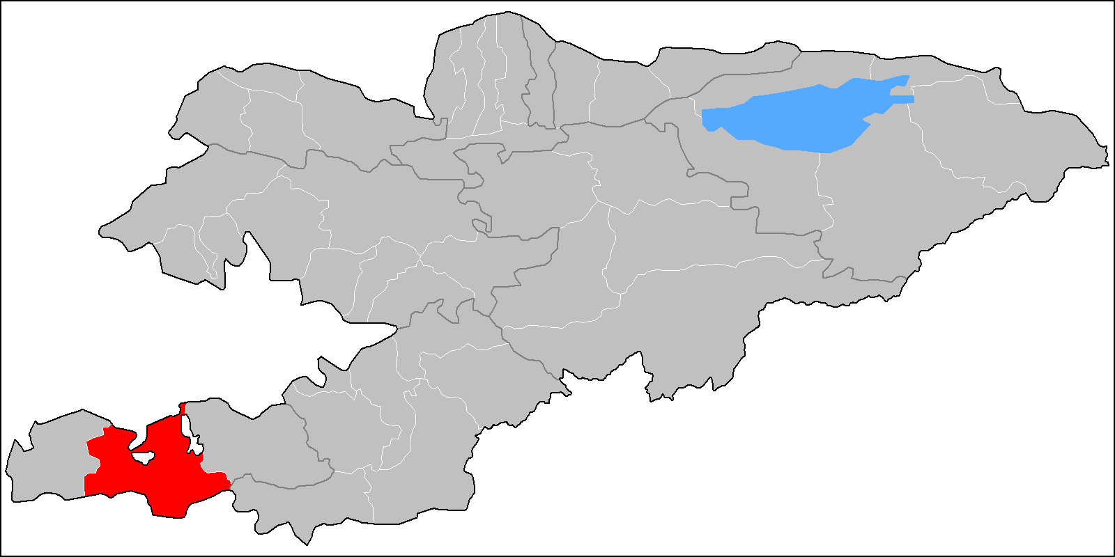
Sülüktü, also spelled Sulukta or Suliukta ( ky, Сүлүктү; uz, Sulukta / Сулукта; russian: Сулюкта, Sulyukta) is a town located at the extreme western end of Batken Region in southern Kyrgyzstan. Sülüktü is situated at the southern fringe of the Fergana Valley in a region surrounded on three sides by Tajikistan. The word "sülüktü" is believed to have come from the Turkic word "suluk" or "zuluk" which means a " leech". According to this view, the waters of present-day Sülüktü had leeches and therefore people called the place "suluktu" which literally means "containing leeches." Sülüktü is one of Central Asia's oldest coal extraction sites. The first industrial coal mine of Sülüktü was opened in 1868. Sülüktü was made into a town in 1940. Sülüktü is the first town in Kyrgyzstan where Soviet rule was established. Sülüktü is directly subordinated to Batken Region. In other words, it is not part of any district. The urban-type settlement ... [...More Info...] [...Related Items...] OR: [Wikipedia] [Google] [Baidu] |
Batken Region
Batken Region ( ky, Баткен облусу, Batken oblusu; russian: Баткенская область, Batkenskaya oblast) is a region ('' oblus'') of Kyrgyzstan. Its capital is Batken. It is bounded on the east by Osh Region, on the south, west and north by Tajikistan, and on the northeast by Uzbekistan. The northern part of the region is part of the flat, agricultural Ferghana Valley. The land rises southward to the mountains on the southern border: the Alay Mountains in the east, and the Turkestan Range in the west. Its total area is . The resident population of the region was 548,247 as of January 2021. The region has sizeable Uzbek (14.7% in 2009) and Tajik (6.9% in 2009) minorities. History Batken Region was created on 15 October 1999 from the westernmost section of Osh Region. This was partly in response to the activities of the Islamic Movement for Uzbekistan (IMU), with bases in Tajikistan. In 1999 they kidnapped a group of Japanese geologists and in 2000 some Amer ... [...More Info...] [...Related Items...] OR: [Wikipedia] [Google] [Baidu] |
Vostochny, Kyrgyzstan
Vostochny ( ky, Восточный) is an urban-type settlement in Batken Region of Kyrgyzstan Kyrgyzstan,, pronounced or the Kyrgyz Republic, is a landlocked country in Central Asia. Kyrgyzstan is bordered by Kazakhstan to the north, Uzbekistan to the west, Tajikistan to the south, and the People's Republic of China to the ea .... The settlement is governed by the town council of Sülüktü. Its population was 8,611 in 2021. Population References External links Gorod 36-53 (Informal site of the town Sulyukta)Satellite map at Maplandia.com Populated places in Batken Region {{Batken-geo-stub ... [...More Info...] [...Related Items...] OR: [Wikipedia] [Google] [Baidu] |
Countries Of The World
The following is a list providing an overview of sovereign states around the world with information on their status and recognition of their sovereignty. The 206 listed states can be divided into three categories based on membership within the United Nations System: 193 member states of the United Nations, UN member states, 2 United Nations General Assembly observers#Present non-member observers, UN General Assembly non-member observer states, and 11 other states. The ''sovereignty dispute'' column indicates states having undisputed sovereignty (188 states, of which there are 187 UN member states and 1 UN General Assembly non-member observer state), states having disputed sovereignty (16 states, of which there are 6 UN member states, 1 UN General Assembly non-member observer state, and 9 de facto states), and states having a political status of the Cook Islands and Niue, special political status (2 states, both in associated state, free association with New Zealand). Compi ... [...More Info...] [...Related Items...] OR: [Wikipedia] [Google] [Baidu] |
Gypsum
Gypsum is a soft sulfate mineral composed of calcium sulfate dihydrate, with the chemical formula . It is widely mined and is used as a fertilizer and as the main constituent in many forms of plaster, blackboard or sidewalk chalk, and drywall. Alabaster, a fine-grained white or lightly tinted variety of gypsum, has been used for sculpture by many cultures including Ancient Egypt, Mesopotamia, Ancient Rome, the Byzantine Empire, and the Nottingham alabasters of Medieval England. Gypsum also crystallizes as translucent crystals of selenite. It forms as an evaporite mineral and as a hydration product of anhydrite. The Mohs scale of mineral hardness defines gypsum as hardness value 2 based on scratch hardness comparison. Etymology and history The word ''gypsum'' is derived from the Greek word (), "plaster". Because the quarries of the Montmartre district of Paris have long furnished burnt gypsum (calcined gypsum) used for various purposes, this dehydrated gypsum became known ... [...More Info...] [...Related Items...] OR: [Wikipedia] [Google] [Baidu] |
Hill
A hill is a landform that extends above the surrounding terrain. It often has a distinct Summit (topography), summit. Terminology The distinction between a hill and a mountain is unclear and largely subjective, but a hill is universally considered to be not as tall, or as Grade (slope), steep as a mountain. Geographers historically regarded mountains as hills greater than above sea level, which formed the basis of the plot of the 1995 film ''The Englishman who Went up a Hill but Came down a Mountain''. In contrast, hillwalkers have tended to regard mountains as peaks above sea level. The ''Oxford English Dictionary'' also suggests a limit of and Whittow states "Some authorities regard eminences above as mountains, those below being referred to as hills." Today, a mountain is usually defined in the UK and Ireland as any summit at least high, while the official UK government's definition of a mountain is a summit of or higher. Some definitions include a topographical pro ... [...More Info...] [...Related Items...] OR: [Wikipedia] [Google] [Baidu] |
Turkestan Range
One of the northern extensions of the Pamir-Alay system, the Turkestan Range (russian: Туркестанский хребет; ky, Түркстан кырка тоосу; uz, Туркистон тизмаси, Turkiston tizmasi; tg, Қаторкӯҳи Туркистон) stretches for a total length of 340 km from the Alay Mountains on the border of Kyrgyzstan with Tajikistan to the Samarkand oasis in Uzbekistan. It runs in the east–west direction, north of the Zeravshan Range, forming the southern boundary of the Ferghana Valley in Tajikistan and Golodnaya Steppe in Uzbekistan. The highest elevations are in the east, near the border with Kyrgyzstan. The maximum elevation is the Pik Skalisty at . Glaciation occurs especially in the east. The southern slopes are bare cliffs and mountain steppe; the northern slopes are covered with forests. A highway through the Shakhristan Pass at connects the capital Dushanbe with Khujand in Northern Tajikistan (Sughd Province). See ... [...More Info...] [...Related Items...] OR: [Wikipedia] [Google] [Baidu] |
Sea Level
Mean sea level (MSL, often shortened to sea level) is an average surface level of one or more among Earth's coastal bodies of water from which heights such as elevation may be measured. The global MSL is a type of vertical datuma standardised geodetic datumthat is used, for example, as a chart datum in cartography and marine navigation, or, in aviation, as the standard sea level at which atmospheric pressure is measured to calibrate altitude and, consequently, aircraft flight levels. A common and relatively straightforward mean sea-level standard is instead the midpoint between a mean low and mean high tide at a particular location. Sea levels can be affected by many factors and are known to have varied greatly over geological time scales. Current sea level rise is mainly caused by human-induced climate change. When temperatures rise, Glacier, mountain glaciers and the Ice sheet, polar ice caps melt, increasing the amount of water in water bodies. Because most of human settlem ... [...More Info...] [...Related Items...] OR: [Wikipedia] [Google] [Baidu] |
Tatars
The Tatars ()Tatar in the Collins English Dictionary is an umbrella term for different Turkic ethnic groups bearing the name "Tatar". Initially, the ethnonym ''Tatar'' possibly referred to the . That confederation was eventually incorporated into the when unified the various steppe tr ... [...More Info...] [...Related Items...] OR: [Wikipedia] [Google] [Baidu] |
Russians
, native_name_lang = ru , image = , caption = , population = , popplace = 118 million Russians in the Russian Federation (2002 ''Winkler Prins'' estimate) , region1 = , pop1 = approx. 7,500,000 (including Russian Jews and Russian Germans) , ref1 = , region2 = , pop2 = 7,170,000 (2018) ''including Crimea'' , ref2 = , region3 = , pop3 = 3,512,925 (2020) , ref3 = , region4 = , pop4 = 3,072,756 (2009)(including Russian Jews and Russian Germans) , ref4 = , region5 = , pop5 = 1,800,000 (2010)(Russian ancestry and Russian Germans and Jews) , ref5 = 35,000 (2018)(born in Russia) , region6 = , pop6 = 938,500 (2011)(including Russian Jews) , ref6 = , region7 = , pop7 = 809,530 (2019) , ref7 ... [...More Info...] [...Related Items...] OR: [Wikipedia] [Google] [Baidu] |
Clothing
Clothing (also known as clothes, apparel, and attire) are items worn on the body. Typically, clothing is made of fabrics or textiles, but over time it has included garments made from animal skin and other thin sheets of materials and natural products found in the environment, put together. The wearing of clothing is mostly restricted to human beings and is a feature of all human societies. The amount and type of clothing worn depends on gender, body type, social factors, and geographic considerations. Garments cover the body, footwear covers the feet, gloves cover the hands, while hats and headgear cover the head. Eyewear and jewelry are not generally considered items of clothing, but play an important role in fashion and clothing as costume. Clothing serves many purposes: it can serve as protection from the elements, rough surfaces, sharp stones, rash-causing plants, insect bites, by providing a barrier between the skin and the environment. Clothing can insulate against ... [...More Info...] [...Related Items...] OR: [Wikipedia] [Google] [Baidu] |
Brick
A brick is a type of block used to build walls, pavements and other elements in masonry construction. Properly, the term ''brick'' denotes a block composed of dried clay, but is now also used informally to denote other chemically cured construction blocks. Bricks can be joined using mortar, adhesives or by interlocking them. Bricks are usually produced at brickworks in numerous classes, types, materials, and sizes which vary with region and time period, and are produced in bulk quantities. ''Block'' is a similar term referring to a rectangular building unit composed of similar materials, but is usually larger than a brick. Lightweight bricks (also called lightweight blocks) are made from expanded clay aggregate. Fired bricks are one of the longest-lasting and strongest building materials, sometimes referred to as artificial stone, and have been used since circa 4000 BC. Air-dried bricks, also known as mud-bricks, have a history older than fired bricks, and have an additi ... [...More Info...] [...Related Items...] OR: [Wikipedia] [Google] [Baidu] |


