|
Sunnyside, Calgary
Sunnyside is an innercity community in Calgary, Alberta located on the north side of the Bow River immediately adjacent to Calgary's downtown. The community partners with the neighbouring community of Hillhurst to form the Hillhurst-Sunnyside Community Association. The combined communities have an area redevelopment plan in place, revised in 2009. Kensington is a Business Revitalization Zone adjacent to the communities of Hillhurst and Sunnyside. It is an active family-friendly commercial area, abundant with amenities. History Sunnyside is one of Calgary's oldest communities. Originally settled by homesteaders in the 1880s, the land was purchased by the City of Calgary and incorporated into the city proper in 1904.Hillhurst Sunnyside Community Association - History < ... [...More Info...] [...Related Items...] OR: [Wikipedia] [Google] [Baidu] |
Calgary
Calgary ( ) is the largest city in the western Canadian province of Alberta and the largest metro area of the three Prairie Provinces. As of 2021, the city proper had a population of 1,306,784 and a metropolitan population of 1,481,806, making it the third-largest city and fifth-largest metropolitan area in Canada. Calgary is situated at the confluence of the Bow River and the Elbow River in the south of the province, in the transitional area between the Rocky Mountain Foothills and the Canadian Prairies, about east of the front ranges of the Canadian Rockies, roughly south of the provincial capital of Edmonton and approximately north of the Canada–United States border. The city anchors the south end of the Statistics Canada-defined urban area, the Calgary–Edmonton Corridor. Calgary's economy includes activity in the energy, financial services, film and television, transportation and logistics, technology, manufacturing, aerospace, health and wellness, retail, and ... [...More Info...] [...Related Items...] OR: [Wikipedia] [Google] [Baidu] |
Calgary Curling Club
The Calgary Curling Club is a curling club located in Calgary, Alberta. History The Calgary Curling Club was founded in 1888 and opened its first rink in 1892. It then moved venues to Victoria Park in 1909, and moved from there to its current location in 1953. The club won the 2018 Travelers Curling Club Championship. Notable members *Cheryl Bernard *Crystal Webster Curlers Corner The Curlers Corner equipment shop is located inside of the Calgary Curling Club. The club hosts the Curlers Corner Autumn Gold Curling Classic, a former women's Grand Slam event on the World Curling Tour sponsored by the Curlers Corner equipment shop, every year. Provincial champions The club has won a number of provincial curling titles over the years: Women's The club has won the women's provincial championships once: *1981 Susan Seitz, Judy Erickson, Myrna McKay, Betty McCracken (1981 Canadian Ladies Curling Association Championship winners, 1981 Royal Bank of Scotland World Women's Curling ... [...More Info...] [...Related Items...] OR: [Wikipedia] [Google] [Baidu] |
Residential Area
A residential area is a land used in which housing predominates, as opposed to industrial and commercial areas. Housing may vary significantly between, and through, residential areas. These include single-family housing, multi-family residential, or mobile homes. Zoning for residential use may permit some services or work opportunities or may totally exclude business and industry. It may permit high density land use or only permit low density uses. Residential zoning usually includes a smaller FAR (floor area ratio) than business, commercial or industrial/manufacturing zoning. The area may be large or small. Overview In certain residential areas, especially rural, large tracts of land may have no services whatever, such that residents seeking services must use a motor vehicle or other transportation, so the need for transportation has resulted in land development following existing or planned transport infrastructure such as rail and road. Development patterns may be reg ... [...More Info...] [...Related Items...] OR: [Wikipedia] [Google] [Baidu] |
Shapefile
The shapefile format is a geospatial vector data format for geographic information system (GIS) software. It is developed and regulated by Esri as a mostly open specification for data interoperability among Esri and other GIS software products. The shapefile format can spatially describe vector features: points, lines, and polygons, representing, for example, water wells, rivers, and lakes. Each item usually has attributes that describe it, such as ''name'' or ''temperature''. Overview The shapefile format is a digital vector storage format for storing geographic location and associated attribute information. This format lacks the capacity to store topological information. The shapefile format was introduced with ArcView GIS version 2 in the early 1990s. It is now possible to read and write geographical datasets using the shapefile format with a wide variety of software. The shapefile format stores the geometry as primitive geometric shapes like points, lines, and polygo ... [...More Info...] [...Related Items...] OR: [Wikipedia] [Google] [Baidu] |
Esri
Esri (; Environmental Systems Research Institute) is an American multinational geographic information system (GIS) software company. It is best known for its ArcGIS products. With a 43% market share, Esri is the world's leading supplier of GIS software, web GIS and geodatabase management applications. The company is headquartered in Redlands, California. Founded as the Environmental Systems Research Institute in 1969 as a land-use consulting firm, Esri currently has 49 offices worldwide including 11 research and development centers in the United States, Europe, the Middle East and Africa and Asia Pacific. There are 10 regional U.S. offices and over 3,000 partners globally, with users in every country and a total of over a million active users in 350,000 organizations. These include Fortune 500 companies, most national governments, 20,000 cities, all 50 US States and 7,000+ universities. The firm has 4,000 total employees, and is privately held by its founders. In a 2016 Invest ... [...More Info...] [...Related Items...] OR: [Wikipedia] [Google] [Baidu] |
Storm Sewer Outfall
A storm is any disturbed state of the natural environment or the atmosphere of an astronomical body. It may be marked by significant disruptions to normal conditions such as strong wind, tornadoes, hail, thunder and lightning (a thunderstorm), heavy precipitation (snowstorm, rainstorm), heavy freezing rain (ice storm), strong winds (tropical cyclone, windstorm), wind transporting some substance through the atmosphere such as in a dust storm, among other forms of severe weather. Storms have the potential to harm lives and property via storm surge, heavy rain or snow causing flooding or road impassibility, lightning, wildfires, and vertical and horizontal wind shear. Systems with significant rainfall and duration help alleviate drought in places they move through. Heavy snowfall can allow special recreational activities to take place which would not be possible otherwise, such as skiing and snowmobiling. The English word comes from Proto-Germanic ''*sturmaz'' meaning "noise, tumu ... [...More Info...] [...Related Items...] OR: [Wikipedia] [Google] [Baidu] |
Outfall
An outfall is the discharge point of a waste stream into a body of water; alternatively it may be the outlet of a river, drain or a sewer where it discharges into the sea, a lake or ocean. In the United States, industrial facilities that discharge storm water which was exposed to industrial activities at the site are required to have a multi-sector general permit.40 CFR Section 122.26 Issuing permits for storm water is delegated to the individual states that are authorized by the EPA. Facilities that apply for a permit must specify the number of outfalls at the site. According to the EPA'2008 MSGP (final version) outfalls are locations where the stormwater exits the facility, including pipes, ditches, swales, and other structures that transport stormwater. If there is more than one outfall present, measure at the primary outfall (i.e., the outfall with the largest volume of stormwater discharge associated with industrial activity). Outfalls from sewage plants can be up to 20 fee ... [...More Info...] [...Related Items...] OR: [Wikipedia] [Google] [Baidu] |
Berm
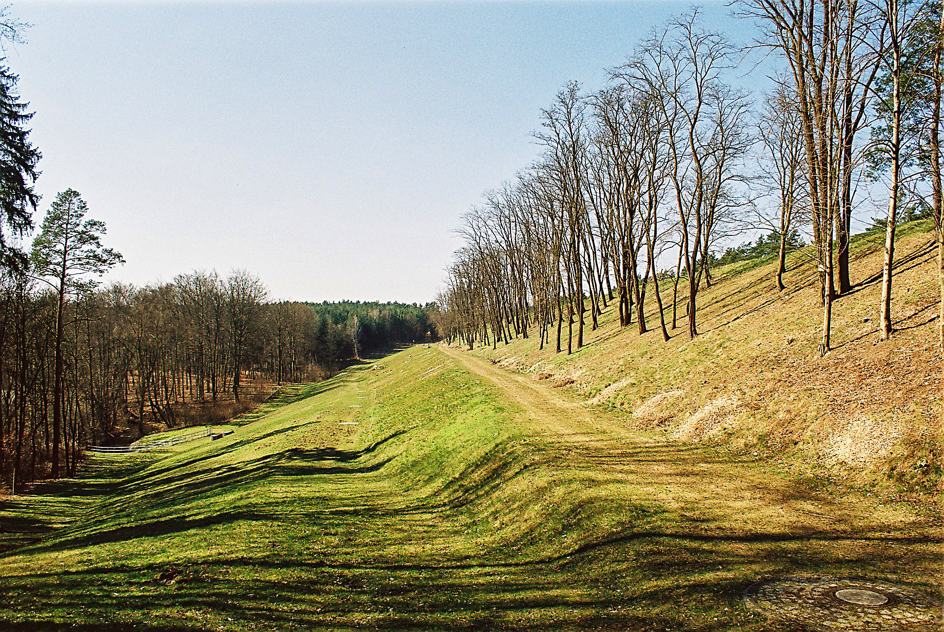
A berm is a level space, shelf, or raised barrier (usually made of compacted soil) separating areas in a vertical way, especially partway up a long slope. It can serve as a terrace road, track, path, a fortification line, a border/ separation barrier for navigation, good drainage, industry, or other purposes. Etymology The word is one of Middle Dutch and came into usage in English via French. Military use History In medieval military engineering, a berm (or berme) was a level space between a parapet or defensive wall and an adjacent steep-walled ditch or moat. It was intended to reduce soil pressure on the walls of the excavated part to prevent its collapse. It also meant that debris dislodged from fortifications would not fall into (and fill) a ditch or moat. In the trench warfare of World War I, the name was applied to a similar feature at the lip of a trench, which served mainly as an elbow-rest for riflemen. Modern usage In modern military engineering, a berm is ... [...More Info...] [...Related Items...] OR: [Wikipedia] [Google] [Baidu] |
Inglewood, Calgary
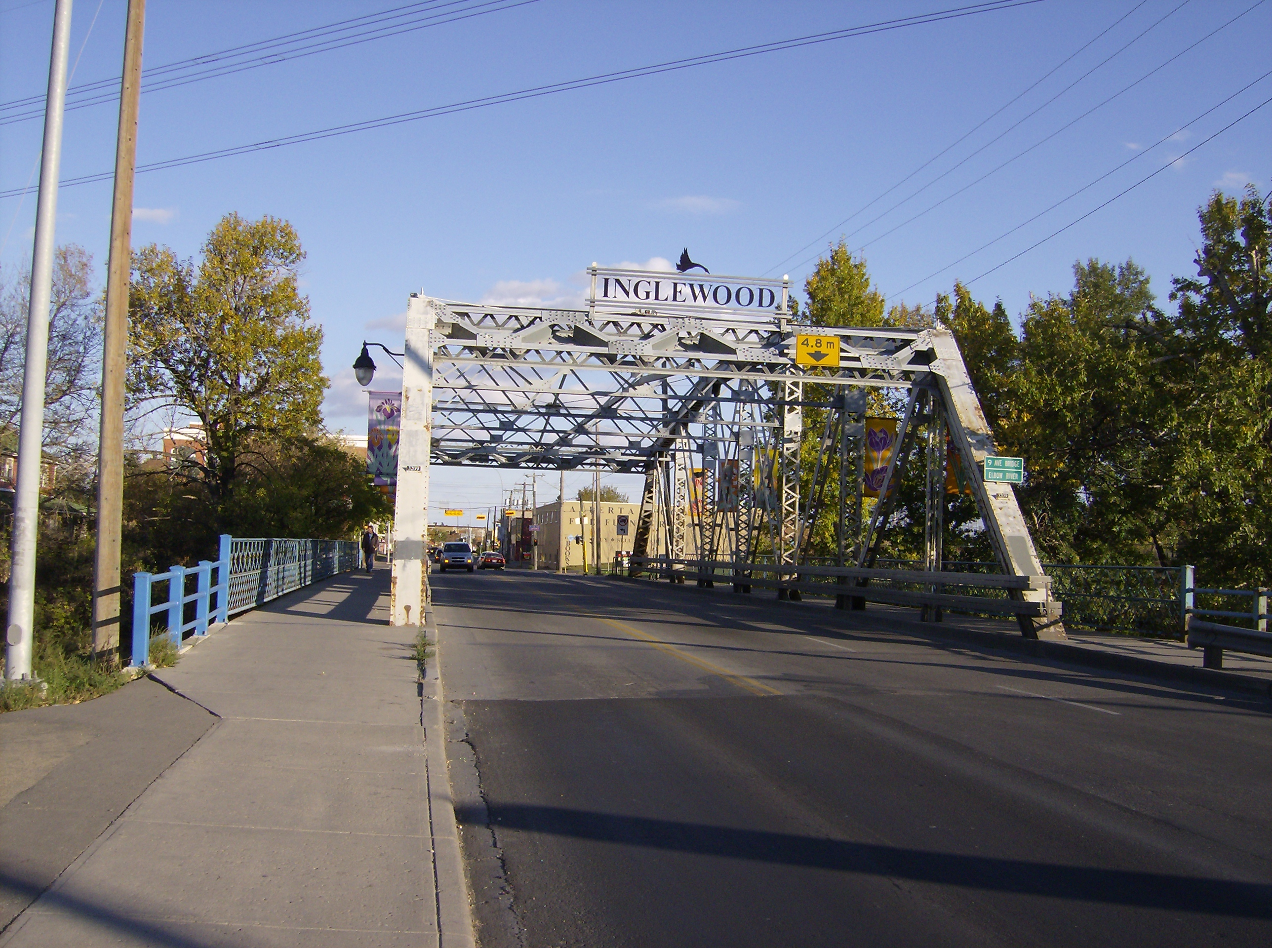
Inglewood is an urban neighbourhood in central Calgary, Alberta, Canada, centred on 9th Avenue SE for several blocks east of the Elbow River and downtown. It also contains the Business Revitalization Zone of Inglewood. It is represented in the Calgary City Council by the Ward 9 councillor, Gian-Carlo Carra. The postal code in this area is T2G. History Inglewood has the distinction of being Calgary's oldest neighbourhood and it is immediately across the Elbow river from Fort Calgary. The community was established in 1875 after the fort was built. It was developed by a group headed by Acheson Irvine, Major John Stewart and James Macleod. Ninth Avenue (formerly Atlantic Avenue) was probably the first "main street" in the city. Today, the neighbourhood is a shopping and arts district. It is also home to the Inglewood Bird Sanctuary, an urban wildlife refuge. Originally known as East Calgary or Brewery Flats, the community was not officially given the name Inglewood until 1911, w ... [...More Info...] [...Related Items...] OR: [Wikipedia] [Google] [Baidu] |
Downtown East Village, Calgary
Downtown East Village more commonly known as simply East Village, is a mixed-use neighbourhood within the eastern portions of downtown Calgary, Alberta, Canada. It is contained within the city's Rivers District. Containing the earliest-settled land in the Calgary area - Fort Calgary - East Village was for years a mixture of high-rise residential, commercial, and industrial development. Much of the parkland currently surrounding Fort Calgary was industrial as recently as the 1960s. Construction of the city's light rail transit Blue Line, coupled with the closure of 8th Avenue at Macleod Trail in the early 1980s by construction of the massive Calgary Municipal Building, resulted in East Village being "cut off," figuratively speaking, from the rest of downtown. As a result, it became home to many rundown properties and vacant lots over the years, and a severe crime problem. Plans to reshape this neighbourhood were approved by Calgary City Council in March, 2005 (''East Village Area ... [...More Info...] [...Related Items...] OR: [Wikipedia] [Google] [Baidu] |
Chinatown, Calgary
Calgary's Chinatown is a district of Calgary located along Centre Street in the southeast area of Downtown Calgary immediately west of the Downtown East Village. Calgary's Chinese Cultural Centre with its traditional architecture and decor (styled after the Temple of Heaven in Beijing) is the largest facility of its kind in North America. The Dragon City Mall is also located in this district. The area along Centre Street north of downtown and continuing for several blocks is also very Asian-influenced and is often thought of as the city's second Chinatown. International Avenue is also a major multi-ethnic centre in the city's southeast with considerable Asian influence. The community has an area redevelopment plan in place. History Chinatown Calgary Celebrates 100 Years In 2010, Calgary's Chinatown community celebrated 100 years of challenge, growth and prosperity on its way to becoming Canada's third largest Chinese community by population and its largest in area. But 100 yea ... [...More Info...] [...Related Items...] OR: [Wikipedia] [Google] [Baidu] |
Eau Claire, Calgary
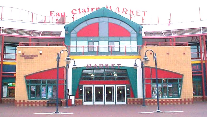
The neighbourhood of Eau Claire in Calgary, Alberta, Canada is located immediately north of Downtown, and south of the Bow River and north of 4th Avenue. A mix of riverside condominiums, shopping, restaurants, hotels, a large public plaza and urban parkland make Eau Claire one of Calgary's most popular areas. Contained within Eau Claire is the city's Festival District. The area, which was developed from reclaimed industrial land, fronts the Bow River and sits immediately north of 3rd Avenue South. North of Eau Claire is Prince's Island Park, a large urban park on an island in the Bow River and the site of many summer festivals, including the Calgary Folk Music Festival, Carifest, Shakespeare in the Park and various busking happenings. Within Eau Claire is Eau Claire Market and a variety of pubs and restaurants. It is also located on the city's large network of pedestrian pathways and trails, along the Bow River pathway. History The name Eau Claire derives from one of Calgary's o ... [...More Info...] [...Related Items...] OR: [Wikipedia] [Google] [Baidu] |


