|
Subboreal
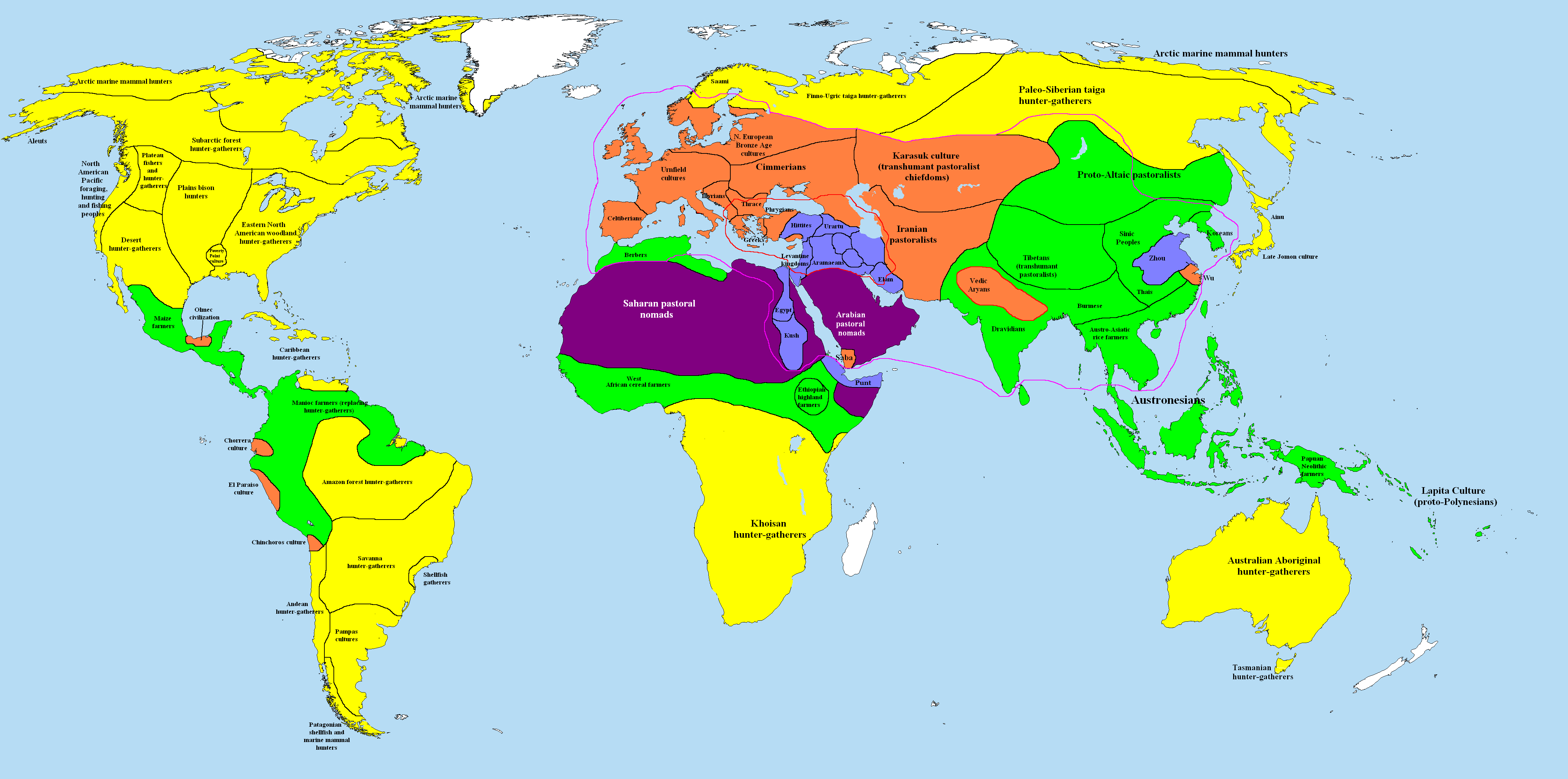
The Subboreal is a climatic period, immediately before the present one, of the Holocene. It lasted from 3710 to 450 BCE. Etymology The composite scientific term ''Subboreal'', meaning "below the Boreal," is derived from the Latin ''sub'' (below, under) and the Greek ''Βορέας'', from Boreas, the god of the North Wind. The word was first introduced in 1889 by Rutger Sernander to distinguish it from Axel Blytt's Boreal, which had been established in 1876. History The Subboreal followed the Atlantic and was followed by the Subatlantic. The Subboreal is equivalent to W. H. Zagwijn's pollen zones IVa and IVb and T. Litt's pollen zone VIII. In the pollen scheme of Fritz Theodor Overbeck, it occupies pollen zone X. In paleoclimatology, it is divided into an Older Subboreal and a Younger Subboreal. Historically, the Subboreal is equivalent to most of the Neolithic and the entire Bronze Age, which started 4200 to 3800 years ago. Dating The Subboreal is usually defined as 5 ... [...More Info...] [...Related Items...] OR: [Wikipedia] [Google] [Baidu] |
Holocene Temperature Variations
The Holocene ( ) is the current geological epoch. It began approximately 11,650 cal years Before Present (), after the Last Glacial Period, which concluded with the Holocene glacial retreat. The Holocene and the preceding Pleistocene together form the Quaternary period. The Holocene has been identified with the current warm period, known as MIS 1. It is considered by some to be an interglacial period within the Pleistocene Epoch, called the Flandrian interglacial.Oxford University Press – Why Geography Matters: More Than Ever (book) – "Holocene Humanity" section https://books.google.com/books?id=7P0_sWIcBNsC The Holocene corresponds with the rapid proliferation, growth and impacts of the human species worldwide, including all of its written history, technological revolutions, development of major civilizations, and overall significant transition towards urban living in the present. The human impact on modern-era Earth and its ecosystems may be considered of global sig ... [...More Info...] [...Related Items...] OR: [Wikipedia] [Google] [Baidu] |
Atlantic (period)
The Atlantic in palaeoclimatology was the warmest and moistest Blytt–Sernander period, pollen zone and chronozone of Holocene northern Europe. The climate was generally warmer than today. It was preceded by the Boreal, with a climate similar to today's, and was followed by the Subboreal, a transition to the modern. Because it was the warmest period of the Holocene, the Atlantic is often referenced more directly as the Holocene climatic optimum, or just climatic optimum. Subdividing the Atlantic The Atlantic is equivalent to pollen zone VII. Sometimes a Pre-atlantic or early Atlantic is distinguished, on the basis of an early dividing cold snap. Other scientists place the Atlantic entirely after the cold snap, assigning the latter to the Boreal. The period is still in the process of definition. Dating Beginning of the Atlantic period It is a question of definition and the criteria: Beginning with the temperatures, as derivable from Greenland ice core data, it is possible to ... [...More Info...] [...Related Items...] OR: [Wikipedia] [Google] [Baidu] |
Holocene
The Holocene ( ) is the current geological epoch. It began approximately 11,650 cal years Before Present (), after the Last Glacial Period, which concluded with the Holocene glacial retreat. The Holocene and the preceding Pleistocene together form the Quaternary period. The Holocene has been identified with the current warm period, known as MIS 1. It is considered by some to be an interglacial period within the Pleistocene Epoch, called the Flandrian interglacial.Oxford University Press – Why Geography Matters: More Than Ever (book) – "Holocene Humanity" section https://books.google.com/books?id=7P0_sWIcBNsC The Holocene corresponds with the rapid proliferation, growth and impacts of the human species worldwide, including all of its written history, technological revolutions, development of major civilizations, and overall significant transition towards urban living in the present. The human impact on modern-era Earth and its ecosystems may be considered of global si ... [...More Info...] [...Related Items...] OR: [Wikipedia] [Google] [Baidu] |
Subatlantic
The Subatlantic is the current climatic age of the Holocene epoch. It started about 2,500 years BP and is still ongoing. Its average temperatures are slightly lower than during the preceding Subboreal and Atlantic. During its course, the temperature underwent several oscillations, which had a strong influence on fauna and flora and thus indirectly on the evolution of human civilizations. With intensifying industrialisation, human society started to stress the natural climatic cycles with increased greenhouse gas emissions. History and stratigraphy The term ''subatlantic'' was first introduced in 1889 by Rutger Sernander to differentiate it from Axel Blytt's ''atlantic''. It follows upon the previous ''subboreal''. According to Franz Firbas (1949) and Litt ''et al.'' (2001) the subatlantic consists of the pollen zones IX and X. This corresponds in the scheme of Fritz Theodor Overbeck to the pollen zones XI and XII. In climate stratigraphy the subatlantic is usually subdivide ... [...More Info...] [...Related Items...] OR: [Wikipedia] [Google] [Baidu] |
Aegean Region
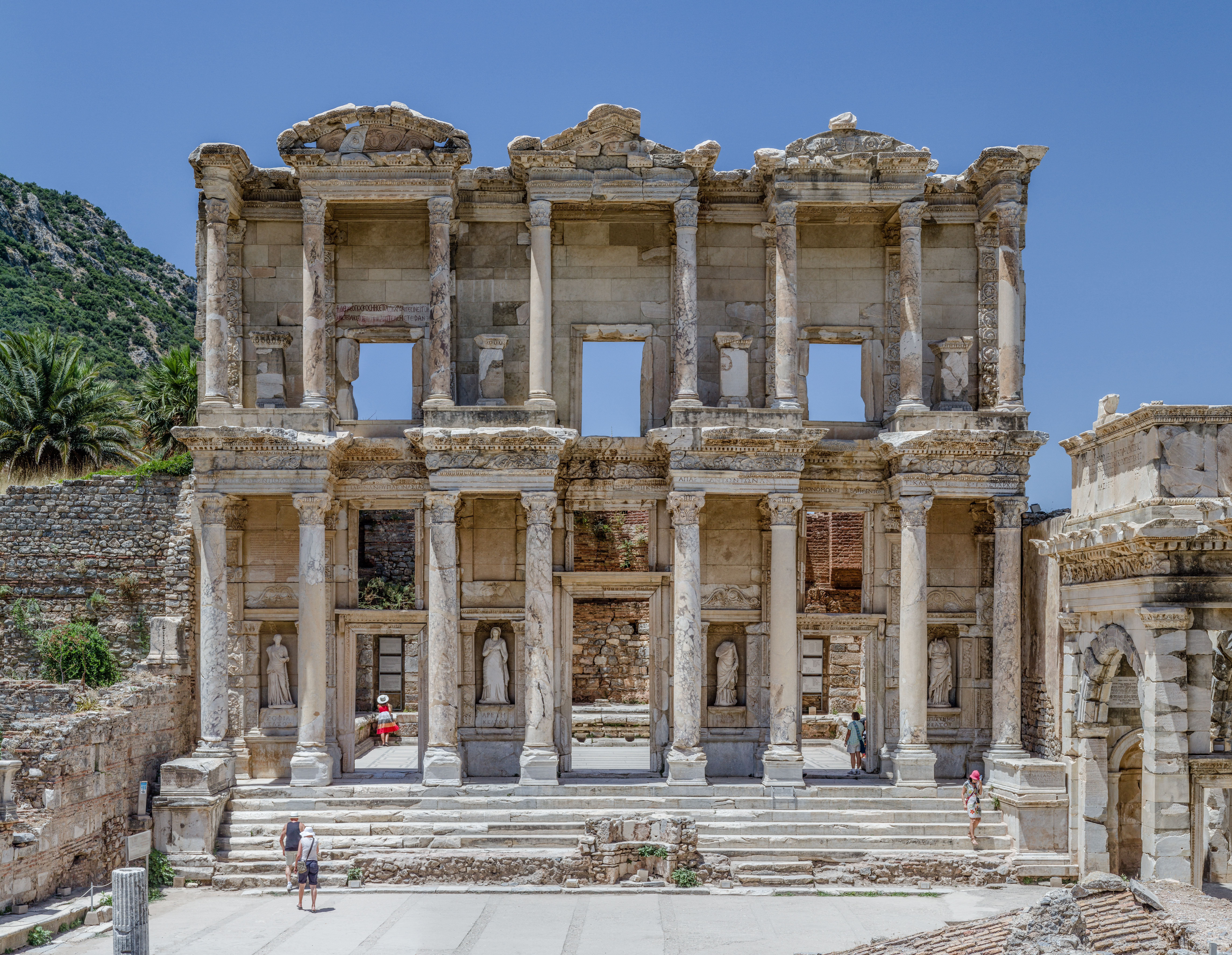
The Aegean Region () is one of the 7 Geographical regions of Turkey, geographical regions of Turkey. The largest city in the region is İzmir. Other big cities are Manisa, Aydın, Denizli, Muğla, Afyonkarahisar and Kütahya. Located in western Turkey, it is bordered by the Aegean Sea to the west, the Marmara Region to the north, the Central Anatolia Region to the east, and the Mediterranean Region, Turkey, Mediterranean Region to the south. Among the four coastal regions, the Aegean Region has the longest coastline. Subdivision *Aegean Section ( tr, Ege Bölümü) **Edremit Area ( tr, Edremit Yöresi) **Bakırçay Area ( tr, Bakırçay Yöresi) **Gediz Area ( tr, Gediz Yöresi) **İzmir Area ( tr, İzmir Yöresi) **Küçük Menderes Area ( tr, Küçük Menderes Yöresi) **Büyük Menderes Area ( tr, Büyük Menderes Yöresi) **Menteşe Area ( tr, Menteşe Yöresi) * Inner Western Anatolia Section ( tr, İç Batı Anadolu Bölümü) Ecoregions The ecoregions of this ... [...More Info...] [...Related Items...] OR: [Wikipedia] [Google] [Baidu] |
Drought
A drought is defined as drier than normal conditions.Douville, H., K. Raghavan, J. Renwick, R.P. Allan, P.A. Arias, M. Barlow, R. Cerezo-Mota, A. Cherchi, T.Y. Gan, J. Gergis, D. Jiang, A. Khan, W. Pokam Mba, D. Rosenfeld, J. Tierney, and O. Zolina, 2021Water Cycle Changes In Climate Change 2021: The Physical Science Basis. Contribution of Working Group I to the Sixth Assessment Report of the Intergovernmental Panel on Climate Change [Masson-Delmotte, V., P. Zhai, A. Pirani, S.L. Connors, C. Péan, S. Berger, N. Caud, Y. Chen, L. Goldfarb, M.I. Gomis, M. Huang, K. Leitzell, E. Lonnoy, J.B.R. Matthews, T.K. Maycock, T. Waterfield, O. Yelekçi, R. Yu, and B. Zhou (eds.)]. Cambridge University Press, Cambridge, United Kingdom and New York, NY, USA, pp. 1055–1210, doi:10.1017/9781009157896.010. This means that a drought is "a moisture deficit relative to the average water availability at a given location and season". A drought can last for days, months or years. Drought ... [...More Info...] [...Related Items...] OR: [Wikipedia] [Google] [Baidu] |
African Humid Period
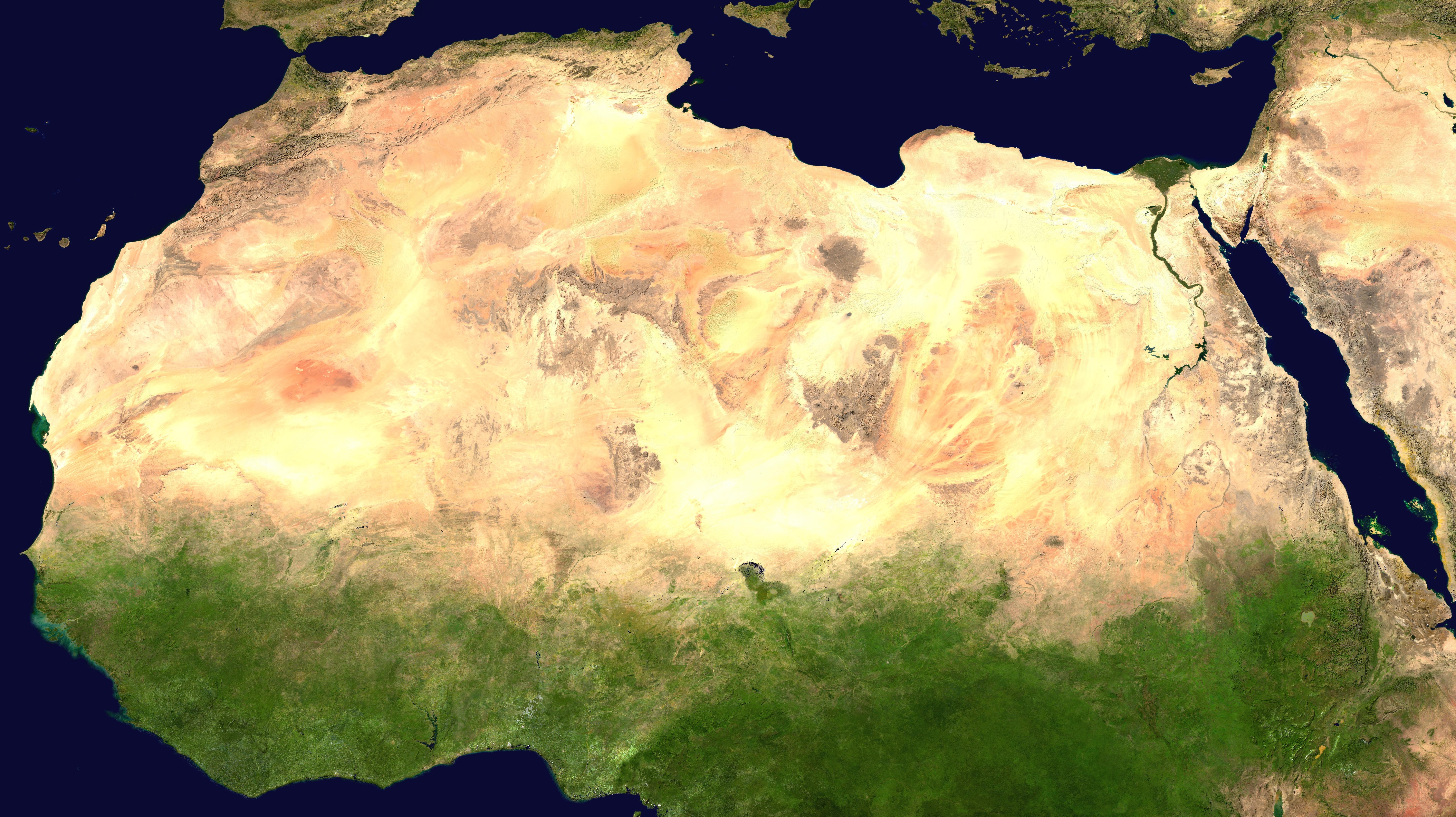
The African humid period (AHP) (also known by other names) is a climate period in Africa during the late Pleistocene and Holocene geologic epochs, when northern Africa was wetter than today. The covering of much of the Sahara desert by grasses, trees and lakes was caused by changes in Earth's orbit around the Sun; changes in vegetation and dust in the Sahara which strengthened the African monsoon; and increased greenhouse gases. During the preceding Last Glacial Maximum, the Sahara contained extensive dune fields and was mostly uninhabited. It was much larger than today, but its lakes and rivers such as Lake Victoria and the White Nile were either dry or at low levels. The humid period began about 14,600–14,500 years ago at the end of Heinrich event 1, simultaneously to the Bølling–Allerød warming. Rivers and lakes such as Lake Chad formed or expanded, glaciers grew on Mount Kilimanjaro and the Sahara retreated. Two major dry fluctuations occurred; during the Youn ... [...More Info...] [...Related Items...] OR: [Wikipedia] [Google] [Baidu] |
Lake
A lake is an area filled with water, localized in a basin, surrounded by land, and distinct from any river or other outlet that serves to feed or drain the lake. Lakes lie on land and are not part of the ocean, although, like the much larger oceans, they do form part of the Earth's water cycle. Lakes are distinct from lagoons, which are generally coastal parts of the ocean. Lakes are typically larger and deeper than ponds, which also lie on land, though there are no official or scientific definitions. Lakes can be contrasted with rivers or streams, which usually flow in a channel on land. Most lakes are fed and drained by rivers and streams. Natural lakes are generally found in mountainous areas, rift zones, and areas with ongoing glaciation. Other lakes are found in endorheic basins or along the courses of mature rivers, where a river channel has widened into a basin. Some parts of the world have many lakes formed by the chaotic drainage patterns left over from the la ... [...More Info...] [...Related Items...] OR: [Wikipedia] [Google] [Baidu] |
Žernov 2
Žernov may refer to places in the Czech Republic: * Žernov (Náchod District), a market town in the Hradec Králové Region * Žernov (Semily District), a municipality and village in the Liberec Region See also * Zernov (surname) {{geodis ... [...More Info...] [...Related Items...] OR: [Wikipedia] [Google] [Baidu] |
Africa
Africa is the world's second-largest and second-most populous continent, after Asia in both cases. At about 30.3 million km2 (11.7 million square miles) including adjacent islands, it covers 6% of Earth's total surface area and 20% of its land area.Sayre, April Pulley (1999), ''Africa'', Twenty-First Century Books. . With billion people as of , it accounts for about of the world's human population. Africa's population is the youngest amongst all the continents; the median age in 2012 was 19.7, when the worldwide median age was 30.4. Despite a wide range of natural resources, Africa is the least wealthy continent per capita and second-least wealthy by total wealth, behind Oceania. Scholars have attributed this to different factors including geography, climate, tribalism, colonialism, the Cold War, neocolonialism, lack of democracy, and corruption. Despite this low concentration of wealth, recent economic expansion and the large and young population make Afr ... [...More Info...] [...Related Items...] OR: [Wikipedia] [Google] [Baidu] |
Varve
A varve is an annual layer of sediment or sedimentary rock. The word 'varve' derives from the Swedish word ''varv'' whose meanings and connotations include 'revolution', 'in layers', and 'circle'. The term first appeared as ''Hvarfig lera'' (varved clay) on the first map produced by the Geological Survey of Sweden in 1862. Initially, "varve" referred to each of the separate components comprising a single annual layer in glacial lake sediments, but at the 1910 Geological Congress, the Swedish geologist Gerard De Geer (1858–1943) proposed a new formal definition, where varve means the whole of any annual sedimentary layer. More recently introduced terms such as 'annually laminated' are synonymous with varve. Of the many rhythmites in the geological record, varves are one of the most important and illuminating in studies of past climate change. Varves are amongst the smallest-scale events recognised in stratigraphy. An annual layer can be highly visible because the particles wash ... [...More Info...] [...Related Items...] OR: [Wikipedia] [Google] [Baidu] |
Mesopotamia
Mesopotamia ''Mesopotamíā''; ar, بِلَاد ٱلرَّافِدَيْن or ; syc, ܐܪܡ ܢܗܪ̈ܝܢ, or , ) is a historical region of Western Asia situated within the Tigris–Euphrates river system, in the northern part of the Fertile Crescent. Today, Mesopotamia occupies modern Iraq. In the broader sense, the historical region included present-day Iraq and Kuwait and parts of present-day Iran, Syria and Turkey. The Sumerians and Akkadians (including Assyrians and Babylonians) originating from different areas in present-day Iraq, dominated Mesopotamia from the beginning of written history () to the fall of Babylon in 539 BC, when it was conquered by the Achaemenid Empire. It fell to Alexander the Great in 332 BC, and after his death, it became part of the Greek Seleucid Empire. Later the Arameans dominated major parts of Mesopotamia (). Mesopotamia is the site of the earliest developments of the Neolithic Revolution from around 10,000 BC. It has been identi ... [...More Info...] [...Related Items...] OR: [Wikipedia] [Google] [Baidu] |


