|
Streaked Reed-warbler
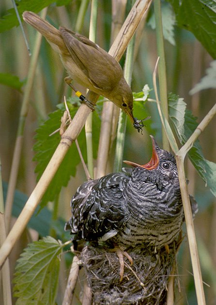
The speckled reed warbler or streaked reed warbler (''Acrocephalus sorghophilus'') is an Old World warbler in the family Acrocephalidae. The species was first described by Robert Swinhoe in 1863. It is found in China and the Philippines. Its natural habitats are swamps and arable land. It is threatened by habitat loss, particularly wetland loss in its wintering area of Candaba Swamp. Description EBird describes the bird as "A mysterious and secretive reed warbler; formerly fairly common but now increasingly rare and possibly near extinction. The only Asian reed warbler with a streaked crown and back. Adults bear a passing resemblance to the much more common Black-browed Reed Warbler but have prominent striping all along the back and crown, a less contrasting brow pattern, and are noticeably paler in color. Recorded in marshes and wet fields on passage and during the winter, but breeding grounds remain unknown. Gives a rattling, grating song akin to an Oriental Reed Warbler, b ... [...More Info...] [...Related Items...] OR: [Wikipedia] [Google] [Baidu] |
Robert Swinhoe
Robert Swinhoe FRS (1 September 1836 – 28 October 1877) was an English diplomat and naturalist who worked as a Consul in Formosa. He catalogued many Southeast Asian birds, and several, such as Swinhoe's pheasant, are named after him. Biography Swinhoe was born in Calcutta where his father, who came from a Northumberland family, was a lawyer. There is no clear record of the date of his arrival in England, but it is known he attended the University of London, and in 1854 joined the China consular corps. He was stationed to the remote port of Amoy, some 300 miles to the northeast of Hong Kong, in 1855. While at this port he not only mastered the Chinese language (both official Mandarin and the local Amoy dialect), but also initiated a detailed and authoritative understanding of the ornithology of eastern China. In March, 1856, Swinhoe made an "adventurous" visit to the camphor districts of northwestern Formosa on board a lorcha, a hybrid vessel utilizing a European hull an ... [...More Info...] [...Related Items...] OR: [Wikipedia] [Google] [Baidu] |
Habitat Loss
Habitat destruction (also termed habitat loss and habitat reduction) is the process by which a natural habitat becomes incapable of supporting its native species. The organisms that previously inhabited the site are displaced or dead, thereby reducing biodiversity and species abundance. Habitat destruction is the leading cause of biodiversity loss. Fragmentation and loss of habitat have become one of the most important topics of research in ecology as they are major threats to the survival of endangered species. Activities such as harvesting natural resources, industrial production and urbanization are human contributions to habitat destruction. Pressure from agriculture is the principal human cause. Some others include mining, logging, trawling, and urban sprawl. Habitat destruction is currently considered the primary cause of species extinction worldwide. Environmental factors can contribute to habitat destruction more indirectly. Geological processes, climate change, intro ... [...More Info...] [...Related Items...] OR: [Wikipedia] [Google] [Baidu] |
Acrocephalus (bird)
The ''Acrocephalus'' warblers are small, insectivorous passerine birds belonging to the genus ''Acrocephalus''. Formerly in the paraphyletic Old World warbler assemblage, they are now separated as the namesake of the marsh and tree warbler family Acrocephalidae. They are sometimes called marsh warblers or reed warblers, but this invites confusion with marsh warbler and reed warbler proper, especially in North America, where it is common to use lower case for bird species. These are rather drab brownish warblers usually associated with marshes or other wetlands. Some are streaked, others plain. Many species breeding in temperate regions are migratory. This genus has heavily diversified into many species throughout islands across the tropical Pacific. This in turn has led to many of the resulting insular endemic species to become endangered. Several of these species (including all but one of the species endemic to the Marianas and two endemic to French Polynesia) have alread ... [...More Info...] [...Related Items...] OR: [Wikipedia] [Google] [Baidu] |
Dalton Pass
Dalton Pass, also called Balete Pass, is a zigzag road and mountain pass that joins the provinces of Nueva Ecija and Nueva Vizcaya, in central Luzon island of the Philippines. It is part of Cagayan Valley Road segment of Pan-Philippine Highway (Maharlika Highway). Geography The summit of the mountain pass is at around in elevation,Smith, R.R., 2005, Triumph in the Philippines, Honolulu: University Press of the Pacific, located where the Caraballo Sur (mountain range) and the Sierra Madre (mountain range) meet. The headwaters of the Digdig River originate just south of the pass. Balete Ridge starts two miles to the west-northwest of the pass, with a high point at Mt. Imugan (5,580 feet), and extends nine miles to the east-southeast, where it ends at Mt. Kabuto (4,600 feet ). Dalton Pass is a gateway to the Cagayan Valley, and the Ifugao Rice Terraces. Battle of Balete Pass The Japanese strategy during the Battle of Luzon was to fight a delaying retreat from Baguio to Ba ... [...More Info...] [...Related Items...] OR: [Wikipedia] [Google] [Baidu] |
Ramsar Site
A Ramsar site is a wetland site designated to be of international importance under the Ramsar Convention,8 ha (O) *** Permanent 8 ha (P) *** Seasonal Intermittent < 8 ha(Ts) ** es on s: *** Permanent (herb dominated) (Tp) *** Permanent / Seasonal / Intermittent (shrub dominated)(W) *** Permanent / Seasonal / Intermittent (tree dominated) (Xf) *** Seasonal/intermittent (herb dominated) (Ts) ** Marshes on soils: *** Permanent (non-forested)(U) *** Permanent (forested)(Xp) ** Marshes on inorganic or peat soils: *** Marshes on inorganic or peat soils / High altitude (alpine) (Va) *** Marshes on inorganic or peat soils / Tundra (Vt) ... [...More Info...] [...Related Items...] OR: [Wikipedia] [Google] [Baidu] |
Millet
Millets () are a highly varied group of small-seeded grasses, widely grown around the world as cereal crops or grains for fodder and human food. Most species generally referred to as millets belong to the tribe Paniceae, but some millets also belong to various other taxa. Millets are important crops in the semiarid tropics of Asia and Africa (especially in India, Mali, Nigeria, and Niger), with 97% of millet production in developing countries. This crop is favored due to its productivity and short growing season under dry, high-temperature conditions. Millets are indigenous to many parts of the world. The most widely grown millets are sorghum and pearl millets, which are important crops in India and parts of Africa. Finger millet, proso millet, and foxtail millet are also important crop species. Millets may have been consumed by humans for about 7,000 years and potentially had "a pivotal role in the rise of multi-crop agriculture and settled farming societies." Desc ... [...More Info...] [...Related Items...] OR: [Wikipedia] [Google] [Baidu] |
EBird
eBird is an online database of bird observations providing scientists, researchers and amateur naturalists with real-time data about bird distribution and abundance. Originally restricted to sightings from the Western Hemisphere, the project expanded to include New Zealand in 2008, and again expanded to cover the whole world in June 2010. eBird has been described as an ambitious example of enlisting amateurs to gather data on biodiversity for use in science. eBird is an example of crowdsourcing, and has been hailed as an example of democratizing science, treating citizens as scientists, allowing the public to access and use their own data and the collective data generated by others. History and purpose Launched in 2002 by the Cornell Lab of Ornithology at Cornell University and the National Audubon Society, eBird gathers basic data on bird abundance and distribution at a variety of spatial and temporal scales. It was mainly inspired by the ÉPOQ database, created by Jac ... [...More Info...] [...Related Items...] OR: [Wikipedia] [Google] [Baidu] |
Candaba Swamp
Candaba Swamp is located in Candaba, Pampanga province, 60 km northeast of Manila in the Philippines. It encompasses about 32,000 ha, made of freshwater ponds, swamps and marshes surrounded by seasonally flooded grasslands. The entire area becomes submerged underwater during the wet season. It dries out during the months of November to April, then the swamp is converted to farmland by the locals. Watermelon and rice are usually planted, comprising the vegetation of the floodplain, together with patches of Nipa palm and some mangrove species. The Candaba swamp also acts as a natural flood retention basin during the rainy season. It holds the overflow from five smaller rivers (Maasim, San Miguel, Garlang, Bulu and Peñaranda), then drains into the larger Pampanga River The Pampanga River is the second largest river on the island of Luzon in the Philippines (next to Cagayan River) and the country's fifth longest river. It is in the Central Luzon region and traverses the pr ... [...More Info...] [...Related Items...] OR: [Wikipedia] [Google] [Baidu] |
Arable Land
Arable land (from the la, arabilis, "able to be ploughed") is any land capable of being ploughed and used to grow crops.''Oxford English Dictionary'', "arable, ''adj''. and ''n.''" Oxford University Press (Oxford), 2013. Alternatively, for the purposes of agricultural statistics, the term often has a more precise definition: A more concise definition appearing in the Eurostat glossary similarly refers to actual rather than potential uses: "land worked (ploughed or tilled) regularly, generally under a system of crop rotation". In Britain, arable land has traditionally been contrasted with pasturable land such as heaths, which could be used for sheep-rearing but not as farmland. Arable land area According to the Food and Agriculture Organization of the United Nations, in 2013, the world's arable land amounted to 1.407 billion hectares, out of a total of 4.924 billion hectares of land used for agriculture. Arable land (hectares per person) Non-arable lan ... [...More Info...] [...Related Items...] OR: [Wikipedia] [Google] [Baidu] |
Old World Warbler
Old World warblers are a large group of birds formerly grouped together in the bird family Sylviidae. The family held over 400 species in over 70 genera, and were the source of much taxonomic confusion. Two families were split out initially, the cisticolas into Cisticolidae and the kinglets into Regulidae. In the past ten years they have been the subject of much research and many species are now placed into other families, including the Acrocephalidae, Cettiidae, Phylloscopidae, and Megaluridae. In addition some species have been moved into existing families or have not yet had their placement fully resolved. A smaller family of warblers, together with some babblers formerly placed in the family Timaliidae and the parrotbills, are retained in a much smaller family Sylviidae. Characteristics Most Old World warblers are of generally undistinguished appearance, though some Asian species are boldly marked. The sexes are often identical, but may be clearly distinct, notably in the ... [...More Info...] [...Related Items...] OR: [Wikipedia] [Google] [Baidu] |
Swamp
A swamp is a forested wetland.Keddy, P.A. 2010. Wetland Ecology: Principles and Conservation (2nd edition). Cambridge University Press, Cambridge, UK. 497 p. Swamps are considered to be transition zones because both land and water play a role in creating this environment. Swamps vary in size and are located all around the world. The water of a swamp may be fresh water, brackish water, or seawater. Freshwater swamps form along large rivers or lakes where they are critically dependent upon rainwater and seasonal flooding to maintain natural water level fluctuations.Hughes, F.M.R. (ed.). 2003. The Flooded Forest: Guidance for policy makers and river managers in Europe on the restoration of floodplain forests. FLOBAR2, Department of Geography, University of Cambridge, Cambridge, UK. 96 p. Saltwater swamps are found along tropical and subtropical coastlines. Some swamps have hammocks, or dry-land protrusions, covered by aquatic vegetation, or vegetation that tolerates periodic inu ... [...More Info...] [...Related Items...] OR: [Wikipedia] [Google] [Baidu] |


