|
St Austell Bay
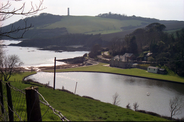
St Austell Bay ( kw, Baya Ti war Dreth) is a bay on Cornwall's south coast which is bounded to the east by Gribbin Head and to the west by Black Head. Since 1 April 2009, it has also been the name of a civil parish, one of four new parishes created on for the St Austell area. It lies southeast of the town of St AustellOrdnance Survey: Landranger map sheet 200 ''Newquay & Bodmin'' and stretches along the coast from Charlestown in the north to Black Head in the south. It includes the communities of Charlestown, Duporth, Porthpean ( Higher and Lower Porthpean Lower Porthpean is a coastal hamlet in Cornwall, England, UK. It is close to Higher Porthpean Higher Porthpean is a village south of Duporth and contiguous with Lower Porthpean in Cornwall, England. It has a small church, dedicated to St L ...) and Trenarren and is represented by seven councillors. [...More Info...] [...Related Items...] OR: [Wikipedia] [Google] [Baidu] |
Charlestown Beach St Austell Cornwall Right
Charlestown or Charles Town may refer to: Places Australia *Charlestown, New South Wales ** Electoral district of Charlestown, an electoral district in the New South Wales Legislative Assembly including the area * Charlestown, Queensland Ireland *Charlestown, County Mayo **Charlestown Shopping Centre, Dublin South Africa *Charlestown, KwaZulu-Natal United Kingdom England *Charlestown, Cornwall * Charlestown, Derbyshire *Charlestown, Dorset *Charlestown, Manchester, Greater Manchester * Charlestown, Salford, Greater Manchester, a location * Charlestown, Bradford, West Yorkshire, a location * Charlestown, Calderdale, West Yorkshire, a location Northern Ireland * Bannfoot, County Armagh (also known as Charlestown) Scotland * Charlestown, Aberdeen, a location * Charlestown, Aberdeenshire, a location *Charlestown, Fife (also known as Charlestown-on-Forth) * Charlestown, Black Isle, in the Highland council area * Charlestown, Wester Ross, part of Gairloch, in the Highland cou ... [...More Info...] [...Related Items...] OR: [Wikipedia] [Google] [Baidu] |
Cornish Language Partnership
The Cornish Language Partnership ( kw, Keskowethyans an Taves Kernewek , ) is a representative body that was set up in Cornwall, England, UK in 2005 to promote and develop the use of the Cornish language. It is a public and voluntary sector partnership and consists of representatives from various Cornish language societies, Cornish cultural and economic organisations and local government in Cornwall. The organisation is part-funded by the European Union's Objective One programme, the United Kingdom government's Department for Communities and Local Government and Cornwall Council. The Partnership is the chief regulator of the Standard Written Form of Cornish, an orthography that was published in 2008 with the intention of uniting the previous conflicting orthographies, and for use on road signs, in official documents, and in school examinations. Organisations represented * Agan Tavas * Cussel an Tavas Kernuak * Kesva an Taves Kernewek * Kowethas an Yeth Kernewek See also * ' ... [...More Info...] [...Related Items...] OR: [Wikipedia] [Google] [Baidu] |
Cornwall
Cornwall (; kw, Kernow ) is a historic county and ceremonial county in South West England. It is recognised as one of the Celtic nations, and is the homeland of the Cornish people. Cornwall is bordered to the north and west by the Atlantic Ocean, to the south by the English Channel, and to the east by the county of Devon, with the River Tamar forming the border between them. Cornwall forms the westernmost part of the South West Peninsula of the island of Great Britain. The southwesternmost point is Land's End and the southernmost Lizard Point. Cornwall has a population of and an area of . The county has been administered since 2009 by the unitary authority, Cornwall Council. The ceremonial county of Cornwall also includes the Isles of Scilly, which are administered separately. The administrative centre of Cornwall is Truro, its only city. Cornwall was formerly a Brythonic kingdom and subsequently a royal duchy. It is the cultural and ethnic origin of the Cornish dias ... [...More Info...] [...Related Items...] OR: [Wikipedia] [Google] [Baidu] |
Gribbin Head
Gribbin Head ( kw, an Gribyn) is a promontory on the south coast of Cornwall, England, UK, owned and managed by the National Trust. It separates St Austell Bay from the estuary of the River Fowey and is marked by a large tower used to aid navigation of ships approaching the local harbours. The nearest town is Fowey. The western point of the headland is called Little Gribbin. Gribbin Head is the most southerly part of the parish of Fowey. To the north, and facing west across St Austell Bay is the small village of Polkerris, beyond which is the harbour at Par. To the east is Polridmouth cove and the Fowey estuary, where the town of Fowey itself is situated. Inland, to the north, is the Menabilly estate,Ordnance Survey 1:25000 Explorer Map 107 built for the Rashleigh family but later home to author Daphne du Maurier. The high promontory forms a part of the South Coast (eastern) section of the Cornwall Area of Outstanding Natural Beauty. The South West Coast Path passes aroun ... [...More Info...] [...Related Items...] OR: [Wikipedia] [Google] [Baidu] |
Black Head (St Austell), Cornwall
Black Head is a headland at the western end of St Austell Bay, in Cornwall, England. It is owned by the National Trust. Description It is the site of an Iron Age promontory fort. There are two parallel ramparts, up to high, with ditches of depth ; slight remains are visible of a further rampart beyond. The fort is a scheduled monument. There are also the remains of a rifle range, built in the 1880s and modified in later years. A memorial stone for the Cornish writer A. L. Rowse is situated on Black Head. In retirement he lived in the nearby hamlet of Trenarren. The stone includes the inscription "This was the land of my content". '' South West Coast Path
[...More Info...] [...Related Items...] OR: [Wikipedia] [Google] [Baidu] |
Civil Parishes In England
In England, a civil parish is a type of Parish (administrative division), administrative parish used for Local government in England, local government. It is a territorial designation which is the lowest tier of local government below districts of England, districts and metropolitan and non-metropolitan counties of England, counties, or their combined form, the Unitary authorities of England, unitary authority. Civil parishes can trace their origin to the ancient system of Parish (Church of England), ecclesiastical parishes, which historically played a role in both secular and religious administration. Civil and religious parishes were formally differentiated in the 19th century and are now entirely separate. Civil parishes in their modern form came into being through the Local Government Act 1894, which established elected Parish councils in England, parish councils to take on the secular functions of the vestry, parish vestry. A civil parish can range in size from a sparsely ... [...More Info...] [...Related Items...] OR: [Wikipedia] [Google] [Baidu] |
St Austell Parishes
Four new parishes were created in Cornwall, England, United Kingdom for the St Austell area on 1 April 2009. The parishes are: * St Austell Town Council covering Bethel, Gover, Mount Charles, Poltair and St Austell Bay (Holmbush area); represented by 20 councillors. * Carlyon :For the surname, ''see'' Carlyon (surname) Carlyon ( kw, Karleghyon, meaning ''fort of rock-slabs'') is one of four new civil parishes created on 1 April 2009 for the St Austell area of south Cornwall, England, United Kingdom. The new parish ... Parish Council covering Carlyon Bay and Tregrehan; represented by 9 councillors. * St Austell Bay Parish Council covering Charlestown, Duporth, Porthpean and Trenarren; represented by 7 councillors. * Pentewan Valley Parish Council covering Tregorrick, Trewhiddle, London Apprentice and Pentewan; represented by 9 councillors. References Cornwall Council websiteGeneral Information on Parish and Town Councils. retrieved May 2010 Civil parishes in Cornw ... [...More Info...] [...Related Items...] OR: [Wikipedia] [Google] [Baidu] |
St Austell
St Austell (; kw, Sans Austel) is a town in Cornwall, England, south of Bodmin and west of the border with Devon. St Austell is one of the largest towns in Cornwall; at the 2011 census it had a population of 19,958. History St Austell was a village centred around the parish church, until the arrival of significant tin mining in the 18th century turned it into a town. St Austell is named after the 6th century Cornish saint, St Austol, a disciple of St Mewan. In a Vatican manuscript there is a 10th-century list of Cornish parish saints. This includes Austoll, which means that the church and village existed at that time, shortly after 900. St Austell is not mentioned in Domesday Book (1086). However A. L. Rowse, in his book ''St. Austell: Church, Town, and Parish'', cites records which show a church was dedicated on 9 October 1262 by Bishop Bronescombe, and other records show a church there in 1169, dedicated to "Sanctus Austolus". The current church dates from the 13t ... [...More Info...] [...Related Items...] OR: [Wikipedia] [Google] [Baidu] |
Charlestown, Cornwall
Charlestown ( kw, Porth Meur, meaning ''great cove'') is a village and port on the south coast of Cornwall, United Kingdom, and in the civil parish of St Austell Bay. It is situated approximately south east of St Austell town centre. The port at Charlestown developed in the late 18th century from the fishing village of West Polmear. Whereas other areas of St Austell have seen much development during the 20th century, Charlestown has remained relatively unchanged. History Charlestown grew out of the small fishing village of West Polmear (or West Porthmear), which consisted of a few cottages and three cellars, in which the catch of pilchards were processed. The population amounted to nine fishermen and their families in 1790. Before the harbour was built, trading vessels landed and loaded on the beach. Charles Rashleigh, who moved to Duporth Manor, just outside the village, used plans prepared by John Smeaton to begin the construction of a harbour and dock in 1791. After bu ... [...More Info...] [...Related Items...] OR: [Wikipedia] [Google] [Baidu] |
Duporth
Duporth ( Cornish: ''Dewborth''; also Duporth Holiday Village) was situated on Porthpean Road, just outside St Austell in south Cornwall, England, UK. For over 50 years, it was a holiday resort, until its closure in 2006. The site has now been sold to private developers and now contains new houses in the traditional Cornish cottage style. History Duporth Holiday Village was built on the site of the old Duporth estate and manor which was owned by Charles Rashleigh, who developed Charlestown. The site was sold in 1933 to Seaside Holiday Camps Ltd and the camp opened by the Whitsun of 1934. During the second world war the camp was requisitioned by the War Office and the Indian Army and American Army were stationed there. After the war it returned to being a holiday camp. Butlins bought the camp in 1972 and it opened as one of their Smaller ''Freshfields'' sites. In 1985, The Rank Group owner of Butlins at that time, also bought Haven Holidays and certain sites including Duporth ... [...More Info...] [...Related Items...] OR: [Wikipedia] [Google] [Baidu] |
Higher Porthpean
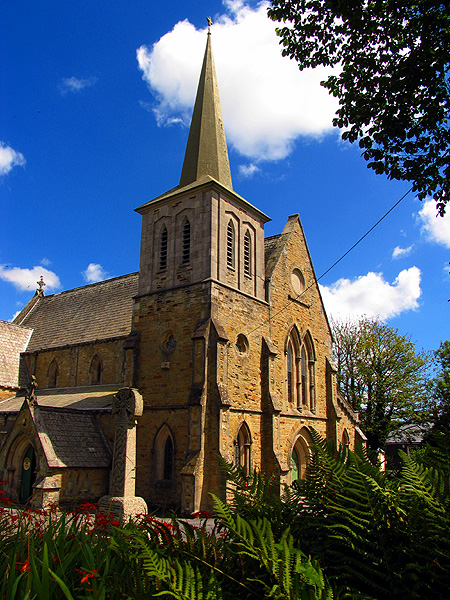
Higher Porthpean is a village south of Duporth and contiguous with Lower Porthpean in Cornwall, England. It has a small church, dedicated to St Levan that is a Grade II building, and that seats 48 people. The church is a Chapel of ease A chapel of ease (or chapel-of-ease) is a church architecture, church building other than the parish church, built within the bounds of a parish for the attendance of those who cannot reach the parish church conveniently. Often a chapel of ea ... to St Austell Parish Church. References External links St Levan's Church, Porthpean Hamlets in Cornwall {{Penwith-geo-stub ... [...More Info...] [...Related Items...] OR: [Wikipedia] [Google] [Baidu] |


