|
South Moor
South Moor is a village in County Durham, in England. It is located to the south-west of Stanley on the northern slope of the Craghead valley. It is a well-developed village, yet still semi-rural, containing a main street (Park Road) of around twelve shops which survive despite their proximity to the front street of Stanley and its Asda supermarket. There was a branch of Stanley Co-op at the bottom of Park Rd and a glove factory above it. On the opposite side in a walled garden stood the Colliery Offices for the district. A local meeting place for teenagers in the 1950s and 1960s was Boves café which had a jukebox and sold coffee and snacks. The proprietor also had an icecream factory around the back of the shop and vans travel about to this day selling to the public. The café is now home to an award-winning Indian restaurant The Monju Tandoori, which has been established since 1987. There is a local church, St. Georges at the bottom of South Moor and "The Woodland Tavern" once ... [...More Info...] [...Related Items...] OR: [Wikipedia] [Google] [Baidu] |
County Durham
County Durham ( ), officially simply Durham,UK General Acts 1997 c. 23Lieutenancies Act 1997 Schedule 1(3). From legislation.gov.uk, retrieved 6 April 2022. is a ceremonial county in North East England.North East Assembly �About North East England. Retrieved 30 November 2007. The ceremonial county spawned from the historic County Palatine of Durham in 1853. In 1996, the county gained part of the abolished ceremonial county of Cleveland.Lieutenancies Act 1997 . Retrieved 27 October 2014. The county town is the of |
Oxhill, Durham
Oxhill is a small village in County Durham, in England. It is located to the west of Stanley, on the bottom of the hill which leads up to New Kyo and Annfield Plain to it's east. Down the hill to the north are the C2C cycle path, East Kyo and Harperley. Oxhill contains very little: a few households, a pub called The Ox (frequented by locals and occasional cyclists from the neaby C2C cycle path taking lunch - the pub used to be known for weekend live music as well as food) and the main nursery school for the Stanley area. Opposite the ''Ox Inn'' to the south west is the former ''Oxhill Chapel''. This has now been converted to a private house. Oxhill used to be the site of a major level crossing, allowing access from the former nearby Stanhope and Tyne Railway line (this is now the basis of the eastern section of the ''C2C'' cycle path) to a shunting yard adjacent to nearby South Moor, where coal was loaded for transport to the River Tyne for export. A small pond calle ... [...More Info...] [...Related Items...] OR: [Wikipedia] [Google] [Baidu] |
Bandstand
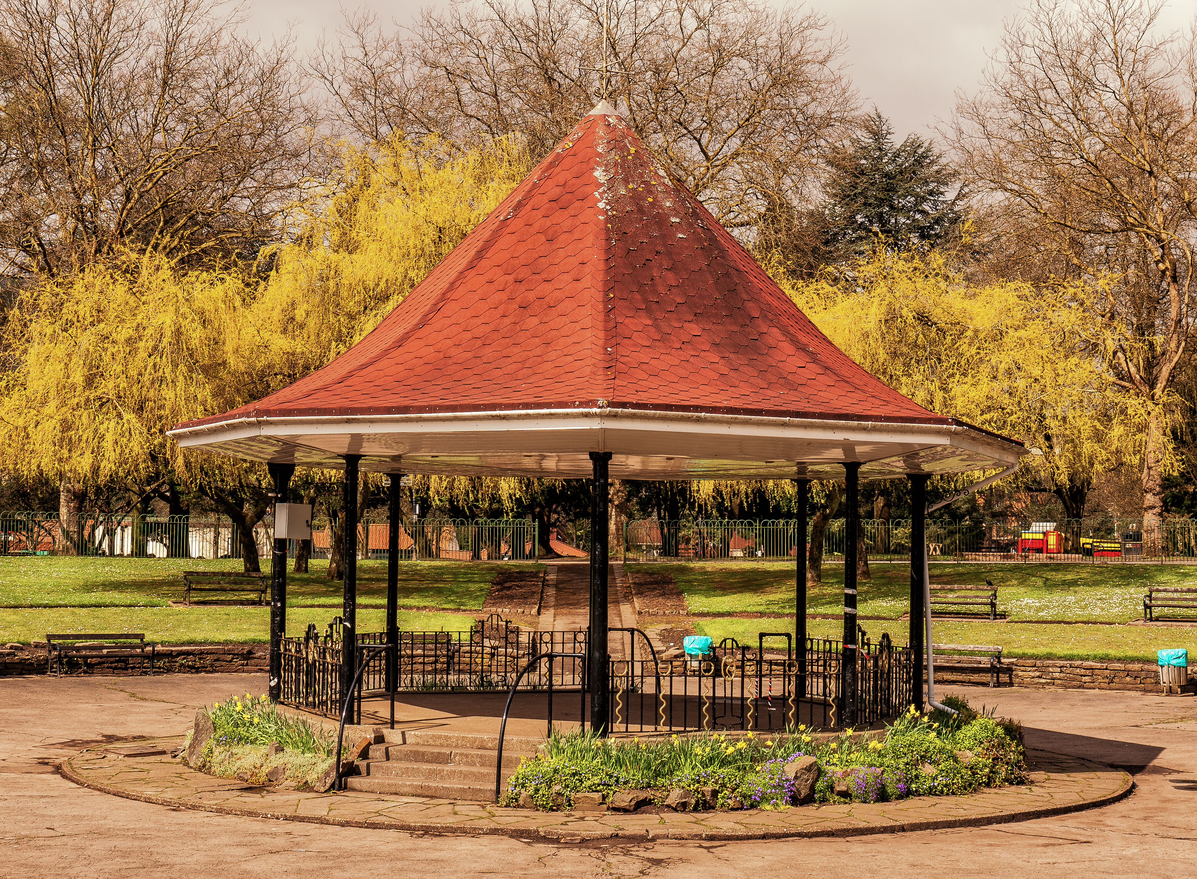
A bandstand (sometimes music kiosk) is a circular, semicircular or polygonal structure set in a park, garden, pier, or indoor space, designed to accommodate musical bands performing concerts. A simple construction, it both creates an ornamental focal point and also serves acoustic requirements while providing shelter for the changeable weather, if outdoors. In form bandstands resemble ornamental European garden gazebos modeled on outdoor open-sided pavilions found in Asian countries from early times. Origins During the 18th and 19th centuries this type of performance building was found in the fashionable pleasure gardens of London and Paris where musicians played for guests dining and dancing. They were later built in public spaces in many countries as practical amenities for outdoor entertainment. Many bandstands in the United Kingdom originated in the Victorian era as the British brass band movement gained popularity. Smaller bandstands are often not much more than gaze ... [...More Info...] [...Related Items...] OR: [Wikipedia] [Google] [Baidu] |
Park
A park is an area of natural, semi-natural or planted space set aside for human enjoyment and recreation or for the protection of wildlife or natural habitats. Urban parks are urban green space, green spaces set aside for recreation inside towns and cities. National parks and country parks are green spaces used for recreation in the countryside. State parks and provincial parks are administered by sub-national government states and agencies. Parks may consist of grassy areas, rocks, soil and trees, but may also contain buildings and other artifacts such as monuments, fountains or playground structures. Many parks have fields for playing sports such as baseball and football, and paved areas for games such as basketball. Many parks have trails for walking, biking and other activities. Some parks are built adjacent to bodies of water or watercourses and may comprise a beach or boat dock area. Urban parks often have benches for sitting and may contain picnic tables and barbecue gr ... [...More Info...] [...Related Items...] OR: [Wikipedia] [Google] [Baidu] |
Tennis Court
A tennis court is the venue where the sport of tennis is played. It is a firm rectangular surface with a low net stretched across the centre. The same surface can be used to play both doubles and singles matches. A variety of surfaces can be used to create a tennis court, each with its own characteristics which affect the playing style of the game. Dimensions The dimensions of a tennis court are defined and regulated by the International Tennis Federation (ITF) governing body and are written down in the annual 'Rules of Tennis' document. The court is long. Its width is for singles matches and for doubles matches. The service line is from the net. Additional clear space around the court is needed in order for players to reach overrun balls for a total of wide and long. A net is stretched across the full width of the court, parallel with the baselines, dividing it into two equal ends. The net is high at the posts, and high in the center. The net posts are outside the d ... [...More Info...] [...Related Items...] OR: [Wikipedia] [Google] [Baidu] |
Bowling Green
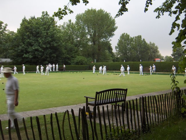
A bowling green is a finely laid, close-mown and rolled stretch of turf for playing the game of bowls. Before 1830, when Edwin Beard Budding of Thrupp, near Stroud, UK, invented the lawnmower, lawns were often kept cropped by grazing sheep on them. The world's oldest surviving bowling green is the Southampton Old Bowling Green, which was first used in 1299. When the French adopted "boulingrin" in the 17th century, it was understood to mean a sunk geometrically shaped piece of perfect grass, framed in gravel walks, which often formed the centre of a regularly planted wood called a ''bosquet,'' somewhat like a highly formalized glade; it might have a central pool or fountain. The diarist Samuel Pepys relates a conversation he had with the architect Hugh May: Dimensions and other specifications Bowling green specifications for the lawn bowls variation of the sport are stipulated in World Bowls' Laws of the Sport of Bowls. For the variant known as crown green bowls Crown gre ... [...More Info...] [...Related Items...] OR: [Wikipedia] [Google] [Baidu] |
South Moor Park, Co
South is one of the cardinal directions or compass points. The direction is the opposite of north and is perpendicular to both east and west. Etymology The word ''south'' comes from Old English ''sūþ'', from earlier Proto-Germanic ''*sunþaz'' ("south"), possibly related to the same Proto-Indo-European root that the word ''sun'' derived from. Some languages describe south in the same way, from the fact that it is the direction of the sun at noon (in the Northern Hemisphere), like Latin meridies 'noon, south' (from medius 'middle' + dies 'day', cf English meridional), while others describe south as the right-hand side of the rising sun, like Biblical Hebrew תֵּימָן teiman 'south' from יָמִין yamin 'right', Aramaic תַּימנַא taymna from יָמִין yamin 'right' and Syriac ܬܰܝܡܢܳܐ taymna from ܝܰܡܝܺܢܳܐ yamina (hence the name of Yemen, the land to the south/right of the Levant). Navigation By convention, the ''bottom or down-facing side'' of a ... [...More Info...] [...Related Items...] OR: [Wikipedia] [Google] [Baidu] |
World War I
World War I (28 July 1914 11 November 1918), often abbreviated as WWI, was one of the deadliest global conflicts in history. Belligerents included much of Europe, the Russian Empire, the United States, and the Ottoman Empire, with fighting occurring throughout Europe, the Middle East, Africa, the Pacific, and parts of Asia. An estimated 9 million soldiers were killed in combat, plus another 23 million wounded, while 5 million civilians died as a result of military action, hunger, and disease. Millions more died in genocides within the Ottoman Empire and in the 1918 influenza pandemic, which was exacerbated by the movement of combatants during the war. Prior to 1914, the European great powers were divided between the Triple Entente (comprising France, Russia, and Britain) and the Triple Alliance (containing Germany, Austria-Hungary, and Italy). Tensions in the Balkans came to a head on 28 June 1914, following the assassination of Archduke Franz Ferdin ... [...More Info...] [...Related Items...] OR: [Wikipedia] [Google] [Baidu] |
Quaking Houses
Quaking Houses is a small village near to the town of Stanley in County Durham, in England. It may have been originally settled by Quakers, but during the Industrial Revolution it developed into a mining village with traditional terraced houses. The Quaker origin is supported by the 1873 name for a mine with two shafts at the village called Quaker House Pit. However, an alternative origin is suggested by the following; the 1865 OS Map shows a farm called Quaking House to the north at Anniefield Plain and a colliery railway line ran past this farm branching to the village mine. This colliery railway line was called the Quaking House Branch Line. A colloquial name for the village was "banana goat island" perhaps reflecting the livestock kept in the extensive allotments and grazing area around the village. Accessible by road only from the main South Moor Road, the village is dominated by one large road, with large strips of terraced housing on either side, both facing outwards. ... [...More Info...] [...Related Items...] OR: [Wikipedia] [Google] [Baidu] |
Icecream
Ice cream is a sweetened frozen food typically eaten as a snack or dessert. It may be made from milk or cream and is flavoured with a sweetener, either sugar or an alternative, and a spice, such as cocoa or vanilla, or with fruit such as strawberries or peaches. It can also be made by whisking a flavored cream base and liquid nitrogen together. Food coloring is sometimes added, in addition to stabilizers. The mixture is cooled below the freezing point of water and stirred to incorporate air spaces and to prevent detectable ice crystals from forming. The result is a smooth, semi-solid foam that is solid at very low temperatures (below ). It becomes more malleable as its temperature increases. The meaning of the name "ice cream" varies from one country to another. In some countries, such as the United States, "ice cream" applies only to a specific variety, and most governments regulate the commercial use of the various terms according to the relative quantities of the main in ... [...More Info...] [...Related Items...] OR: [Wikipedia] [Google] [Baidu] |
North Durham (UK Parliament Constituency)
North Durham is a constituency represented in the House of Commons of the UK Parliament since 2001 by Kevan Jones of the Labour Party. History A constituency formally named the Northern Division of Durham was created by the Great Reform Act for the 1832 general election, when the former Durham constituency was split into the northern and southern divisions, each electing two members using the bloc vote system. This seat was abolished by the Redistribution of Seats Act 1885 when the two divisions were replaced by eight single-member divisions.These were Barnard Castle, Bishop Auckland, Chester-le-Street, Houghton-le-Spring, Jarrow, Mid Durham, North West Durham and South East Durham. In addition there were seven County Durham borough constituencies. The seat was re-created as a single-seat constituency for the 1983 general election as a result of the redistribution following the changes to local authority boundaries under the Local Government Act 1972. The new consti ... [...More Info...] [...Related Items...] OR: [Wikipedia] [Google] [Baidu] |
Coffee
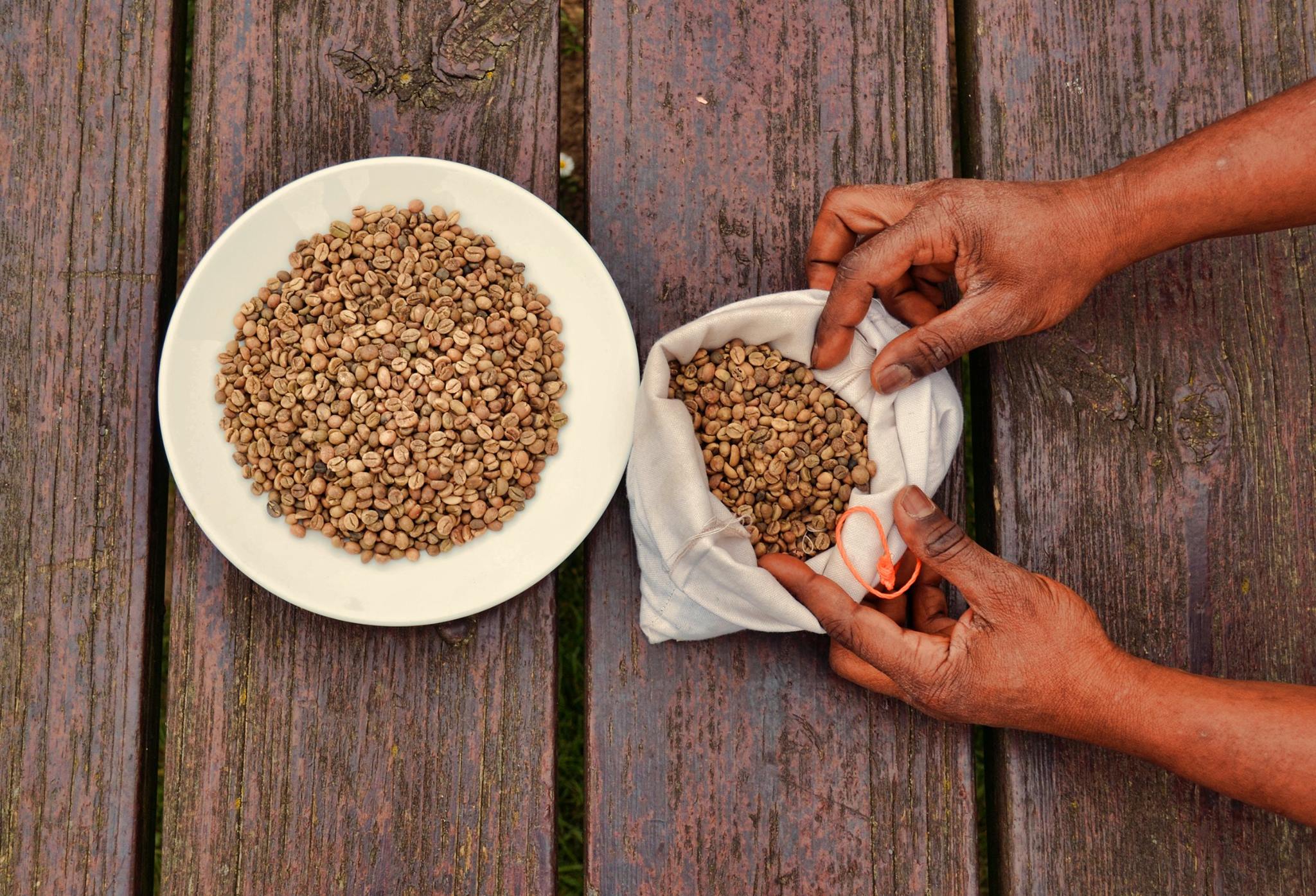
Coffee is a drink prepared from roasted coffee beans. Darkly colored, bitter, and slightly acidic, coffee has a stimulant, stimulating effect on humans, primarily due to its caffeine content. It is the most popular hot drink in the world. Seeds of the ''Coffea'' plant's fruits are separated to produce unroasted green coffee beans. The beans are Coffee roasting, roasted and then ground into fine particles that are typically steeped in hot water before being filtered out, producing a cup of coffee. It is usually served hot, although chilled or iced coffee is common. Coffee can be prepared and presented in a variety of ways (e.g., espresso, French press, caffè latte, or already-brewed canned coffee). Sugar, sugar substitutes, milk, and cream are often used to mask the bitter taste or enhance the flavor. Though coffee is now a global commodity, it has a History of coffee, long history tied closely to food traditions around the Red Sea. The earliest credible evidence of coffee d ... [...More Info...] [...Related Items...] OR: [Wikipedia] [Google] [Baidu] |


