|
Shintotsukawa, Hokkaido
is a List of towns in Japan, town located in Sorachi Subprefecture, Hokkaido, Japan. As of September 2016, the town has an estimated population of 6,787, and a population density of 14 persons per km2. The total area is 495.62 km2. In 1890, the people from Totsukawa, Nara, Totsukawa in Nara Prefecture reclaimed land. Culture Mascot Shintotsukawa's mascot is . His name is . He is a rice ghost that likes rice and sake. Notable people from Shintotsukawa *Yoshio Hachiro, politician References External links *Official Website Towns in Hokkaido {{Hokkaido-geo-stub ... [...More Info...] [...Related Items...] OR: [Wikipedia] [Google] [Baidu] |
Hokkaido
is Japan's second largest island and comprises the largest and northernmost prefecture, making up its own region. The Tsugaru Strait separates Hokkaidō from Honshu; the two islands are connected by the undersea railway Seikan Tunnel. The largest city on Hokkaidō is its capital, Sapporo, which is also its only ordinance-designated city. Sakhalin lies about 43 kilometers (26 mi) to the north of Hokkaidō, and to the east and northeast are the Kuril Islands, which are administered by Russia, though the four most southerly are claimed by Japan. Hokkaidō was formerly known as ''Ezo'', ''Yezo'', ''Yeso'', or ''Yesso''. Nussbaum, Louis-Frédéric. (2005). "Hokkaidō" in Although there were Japanese settlers who ruled the southern tip of the island since the 16th century, Hokkaido was considered foreign territory that was inhabited by the indigenous people of the island, known as the Ainu people. While geographers such as Mogami Tokunai and Mamiya Rinzō explored the isla ... [...More Info...] [...Related Items...] OR: [Wikipedia] [Google] [Baidu] |
List Of Towns In Japan
A town (町; ''chō'' or ''machi'') is a local administrative unit in Japan. It is a local public body along with prefecture (''ken'' or other equivalents), city (''shi''), and village (''mura''). Geographically, a town is contained within a district. Note that the same word (町; ''machi'' or ''chō'') is also used in names of smaller regions, usually a part of a ward in a city. This is a legacy of when smaller towns were formed on the outskirts of a city, only to eventually merge into it. Towns See also * Municipalities of Japan * Japanese addressing system The Japanese addressing system is used to identify a specific location in Japan. When written in Japanese characters, addresses start with the largest geographical entity and proceed to the most specific one. When written in Latin characters, ad ... References {{reflist External links "Large_City_System_of_Japan";_graphic_shows_towns_compared_with_other_Japanese_city_types_at_p._1_[PDF_7_of_40/nowiki>">DF_7_of_4 ... [...More Info...] [...Related Items...] OR: [Wikipedia] [Google] [Baidu] |
Nara Prefecture
is a prefecture of Japan located in the Kansai region of Honshu. Nara Prefecture has a population of 1,321,805 and has a geographic area of . Nara Prefecture borders Kyoto Prefecture to the north, Osaka Prefecture to the northwest, Wakayama Prefecture to the southwest, and Mie Prefecture to the east. Nara is the capital and largest city of Nara Prefecture, with other major cities including Kashihara, Ikoma, and Yamatokōriyama. Nara Prefecture is located in the center of the Kii Peninsula on Japan's Pacific Ocean coast, and is one of only eight landlocked prefectures. Nara Prefecture has the distinction of having more UNESCO World Heritage listings than any other prefecture in Japan. History Nara Prefecture region is considered one of the oldest regions in Japan, having been in existence for thousands of years, and is widely viewed as the Japanese cradle of civilization. Like Kyoto, Nara was one of Imperial Japan's earliest capital cities. The current form of Nara Prefec ... [...More Info...] [...Related Items...] OR: [Wikipedia] [Google] [Baidu] |
Totsukawa, Nara
is a village located in Yoshino District, Nara Prefecture, Japan. It is the largest village in Japan in terms of area. As of January 2017, the village has an estimated population of 3,488 and a density of 5.2 persons per km2. The total area is 672.35 km2. History In 1889, a major flood happened in Totsukawa, causing widespread destruction. In result, many citizens moved to Hokkaido and developed a new village there. It was named “ Shintotsukawa”, meaning “New Totsukawa" . Geography Climate Totsukawa has a humid subtropical climate (Köppen climate classification ''Cfa''), which is hot and humid in the summer (above ) and is somewhat cold in the winter with temperatures dropping to around freezing () Demographics Per Japanese census data, the population of Totsukawa in 2020 is 3,061 people. Totsukawa has been conducting censuses since 1920. Landmarks * Tanize Suspension Bridge (谷瀬の吊り橋): a suspension bridge known for the ''Yuredaiko'', an annual drum ... [...More Info...] [...Related Items...] OR: [Wikipedia] [Google] [Baidu] |
Population Density
Population density (in agriculture: standing stock or plant density) is a measurement of population per unit land area. It is mostly applied to humans, but sometimes to other living organisms too. It is a key geographical term.Matt RosenberPopulation Density Geography.about.com. March 2, 2011. Retrieved on December 10, 2011. In simple terms, population density refers to the number of people living in an area per square kilometre, or other unit of land area. Biological population densities Population density is population divided by total land area, sometimes including seas and oceans, as appropriate. Low densities may cause an extinction vortex and further reduce fertility. This is called the Allee effect after the scientist who identified it. Examples of the causes of reduced fertility in low population densities are * Increased problems with locating sexual mates * Increased inbreeding Human densities Population density is the number of people per unit of area, usuall ... [...More Info...] [...Related Items...] OR: [Wikipedia] [Google] [Baidu] |
Population
Population typically refers to the number of people in a single area, whether it be a city or town, region, country, continent, or the world. Governments typically quantify the size of the resident population within their jurisdiction using a census, a process of collecting, analysing, compiling, and publishing data regarding a population. Perspectives of various disciplines Social sciences In sociology and population geography, population refers to a group of human beings with some predefined criterion in common, such as location, race, ethnicity, nationality, or religion. Demography is a social science which entails the statistical study of populations. Ecology In ecology, a population is a group of organisms of the same species who inhabit the same particular geographical area and are capable of interbreeding. The area of a sexual population is the area where inter-breeding is possible between any pair within the area and more probable than cross-breeding with in ... [...More Info...] [...Related Items...] OR: [Wikipedia] [Google] [Baidu] |
Japan
Japan ( ja, 日本, or , and formally , ''Nihonkoku'') is an island country in East Asia. It is situated in the northwest Pacific Ocean, and is bordered on the west by the Sea of Japan, while extending from the Sea of Okhotsk in the north toward the East China Sea, Philippine Sea, and Taiwan in the south. Japan is a part of the Ring of Fire, and spans Japanese archipelago, an archipelago of List of islands of Japan, 6852 islands covering ; the five main islands are Hokkaido, Honshu (the "mainland"), Shikoku, Kyushu, and Okinawa Island, Okinawa. Tokyo is the Capital of Japan, nation's capital and largest city, followed by Yokohama, Osaka, Nagoya, Sapporo, Fukuoka, Kobe, and Kyoto. Japan is the List of countries and dependencies by population, eleventh most populous country in the world, as well as one of the List of countries and dependencies by population density, most densely populated and Urbanization by country, urbanized. About three-fourths of Geography of Japan, the c ... [...More Info...] [...Related Items...] OR: [Wikipedia] [Google] [Baidu] |
Azalea
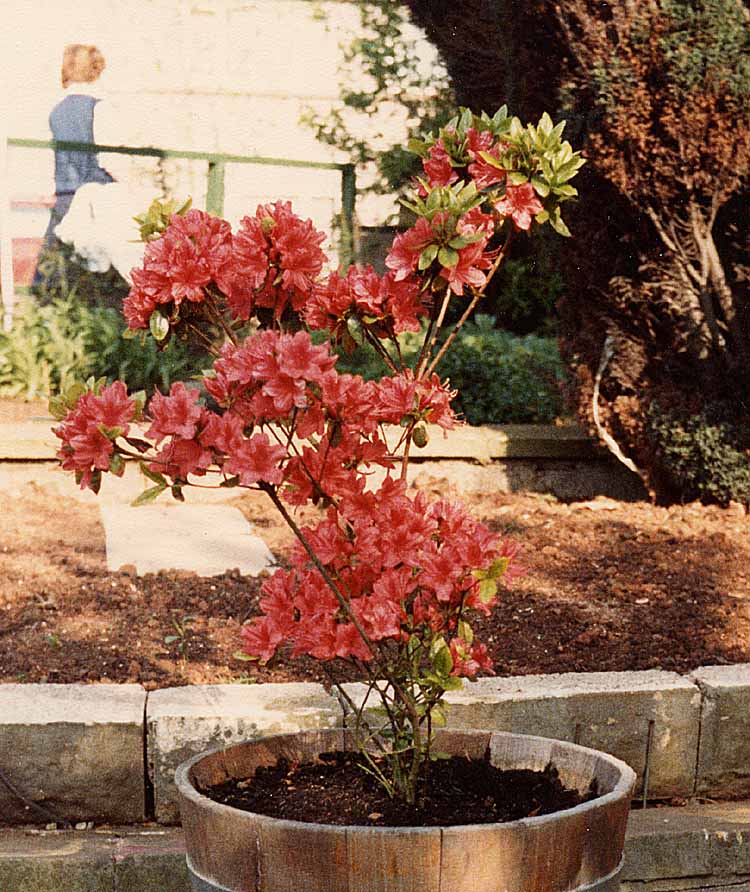
Azaleas are flowering shrubs in the genus ''Rhododendron'', particularly the former sections ''Tsutsusi'' (evergreen) and '' Pentanthera'' (deciduous). Azaleas bloom in the spring (April and May in the temperate Northern Hemisphere, and October and November in the Southern Hemisphere), their flowers often lasting several weeks. Shade tolerant, they prefer living near or under trees. They are part of the family Ericaceae. Cultivation Plant enthusiasts have selectively bred azaleas for hundreds of years. This human selection has produced over 10,000 different cultivars which are propagated by cuttings. Azalea seeds can also be collected and germinated. Azaleas are generally slow-growing and do best in well-drained acidic soil (4.5–6.0 pH). Fertilizer needs are low. Some species need regular pruning. Azaleas are native to several continents including Asia, Europe and North America. They are planted abundantly as ornamentals in the southeastern US, southern Asia, and parts o ... [...More Info...] [...Related Items...] OR: [Wikipedia] [Google] [Baidu] |
Sorachi Subprefecture
is a subprefecture of Hokkaido Prefecture, Japan. As of 2004, its estimated population is 373,736 and its area is 6,558.26 km2. Geography Cities 10 cities are located in Sorachi Subprefecture: Towns and villages by district These are the towns and villages in each district: Mergers History *1897: Sorachi Subprefecture established. *1899: Furano Village (now Kamifurano Town, Nakafurano Town, Furano City, and Minamifurano Town) transferred to Kamikawa Subprefecture is a subprefecture of Hokkaido Prefecture, Japan. The name is derived from Kamikawa no hitobito no Shūraku (Village of the Upstream People), a translation of the Ainu Peni Unguri Kotan. Settlement began in 1867. The sub-prefecture was establi .... *2010: Horokanai town from Uryū District transferred to Kamikawa Subprefecture. External linksOfficial website Subprefectures in Hokkaido {{Hokkaido-geo-stub ... [...More Info...] [...Related Items...] OR: [Wikipedia] [Google] [Baidu] |
Taxus Cuspidata
''Taxus cuspidata'', the Japanese yew or spreading yew, is a member of the genus ''Taxus'', native to Japan, Korea, northeast China and the extreme southeast of Russia. It is an evergreen tree or large shrub growing to 10–18 m tall, with a trunk up to 60 cm diameter. The leaves are lanceolate, flat, dark green, 1–3 cm long and 2–3 mm broad, arranged spirally on the stem, but with the leaf bases twisted to align the leaves in two flattish rows either side of the stem except on erect leading shoots where the spiral arrangement is more obvious. The seed cones are highly modified, each cone containing a single seed 4–8 mm long partly surrounded by a modified scale which develops into a soft, bright red berry-like structure called an aril, 8–12 mm long and wide and open at the end. The arils are mature 6–9 months after pollination. Individual trees from Sikhote-Alin are known to have been 1,000 years old. Uses It is widely grown in eastern Asi ... [...More Info...] [...Related Items...] OR: [Wikipedia] [Google] [Baidu] |
Japan Standard Time
, or , is the standard time zone in Japan, 9 hours ahead of UTC ( UTC+09:00). Japan does not observe daylight saving time, though its introduction has been debated on several occasions. During World War II, the time zone was often referred to as Tokyo Standard Time. Japan Standard Time is equivalent to Korean Standard Time, Pyongyang Time (North Korea), Eastern Indonesia Standard Time, East-Timorese Standard Time and Yakutsk Time (Russia). History Before the Meiji era (1868–1912), each local region had its own time zone in which noon was when the sun was exactly at its culmination. As modern transportation methods, such as trains, were adopted, this practice became a source of confusion. For example, there is a difference of about 5 degrees longitude between Tokyo and Osaka and because of this, a train that departed from Tokyo would arrive at Osaka 20 minutes behind the time in Tokyo. In 1886, Ordinance 51 was issued in response to this problem, which stated: Accordi ... [...More Info...] [...Related Items...] OR: [Wikipedia] [Google] [Baidu] |


.png)