|
Shimen Mountain
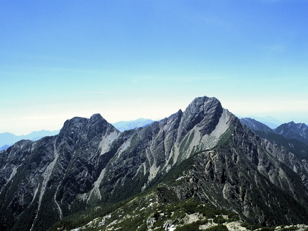
The Mount Shimen () is a mountain in Ren'ai Township, Nantou County and Xiulin Township, Hualien County of Taiwan. Geology The peak of the mountain stands at an elevation of 3,237 meters above sea level. See also * List of mountains in Taiwan The island of Taiwan has the largest number and density of high mountains in the world. This article summarizes the list of mountains that is under the Republic of China's territorial jurisdiction. There are 268 mountain peaks over above sea ... References Landforms of Hualien County Landforms of Nantou County Shimen {{Taiwan-geo-stub ... [...More Info...] [...Related Items...] OR: [Wikipedia] [Google] [Baidu] |
Ren'ai, Nantou
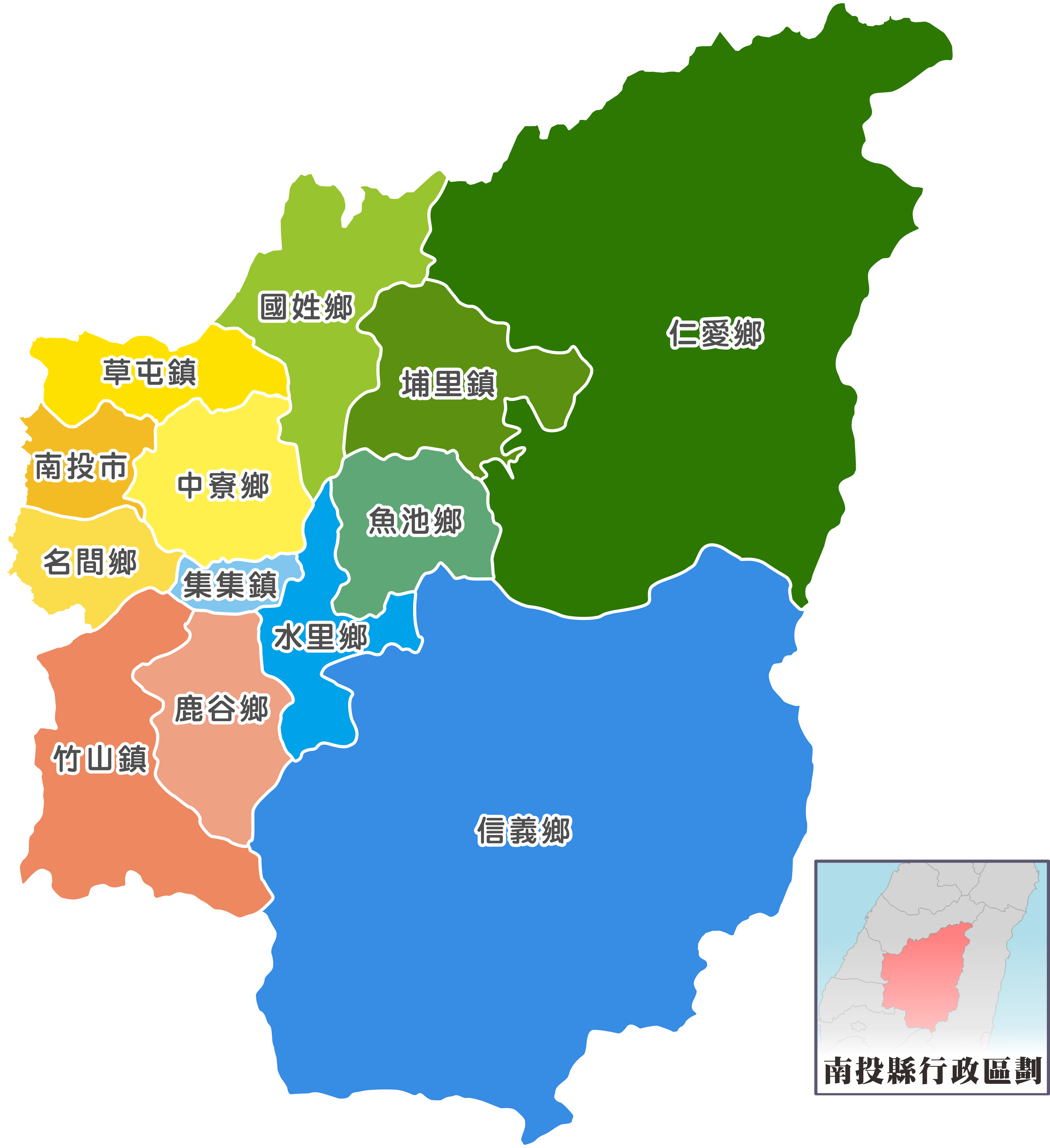
Ren'ai Township () is a mountain indigenous township in Nantou County, Taiwan. It has a population total of 15,850 and an area of 1,273.5312 km2, making it the second largest township by area in the county after Xinyi Township. The populations is mainly of the indigenous Seediq, Atayal and Bunun peoples. Administrative divisions *1 Rongxing Village *2 Cuihua Village *3 Lixing Village *4 Faxiang Village *5 Datong Village *6 Hezuo Village *7 Douda Village *8 Jingying Village *9 Chunyang Village *10 Qinai Village *11 Fazhi Village *12 Zhongzheng Village *13 Wanfeng Village *14 Nanfeng Village *15 Xinsheng Village *16 Huzhu Village Tourist attractions * Aowanda National Forest Recreation Area * Atayal Resort * Chuping Archaeological Site * Huisun Forest Recreation Area * Mount Hehuan * Qingjing Farm * Shimen Mountain * Small Swiss Garden * Wujie D ... [...More Info...] [...Related Items...] OR: [Wikipedia] [Google] [Baidu] |
Nantou County
Nantou County (; Hokkien POJ: ''Lâm-tâu-koān''; Hakka PFS: ''Nàm-thèu-yen'') is the second largest county of Taiwan by area, located in the central part of the country. It is also the only non-coastal county in Taiwan. Its name derives from the Hoanya Taiwanese aboriginal word ''Ramtau''. Its mountainous area makes it a tourist destination; Sun Moon Lake is located in this county. Other well-known sightseeing of the county including Aowanda, Formosan Aboriginal Culture Village, Hehuanshan, Paper Dome, Qingjing Farm, Shanlinxi, Shuiyuan Suspension Bridge and Xitou. Notable cities in Nantou are Nantou City and Puli Town. The official butterfly of Nantou County is the broad-tailed swallowtail butterfly (''Agehana maraho''). Nantou's tung-ting tea is one of the most famous and high-quality oolong teas grown in Taiwan. History Early history Before the arrival of Han Chinese to Nantou, the Atayal, Bunun and Tsou tribes were distributed throughout the northern and ce ... [...More Info...] [...Related Items...] OR: [Wikipedia] [Google] [Baidu] |
Xiulin, Hualien
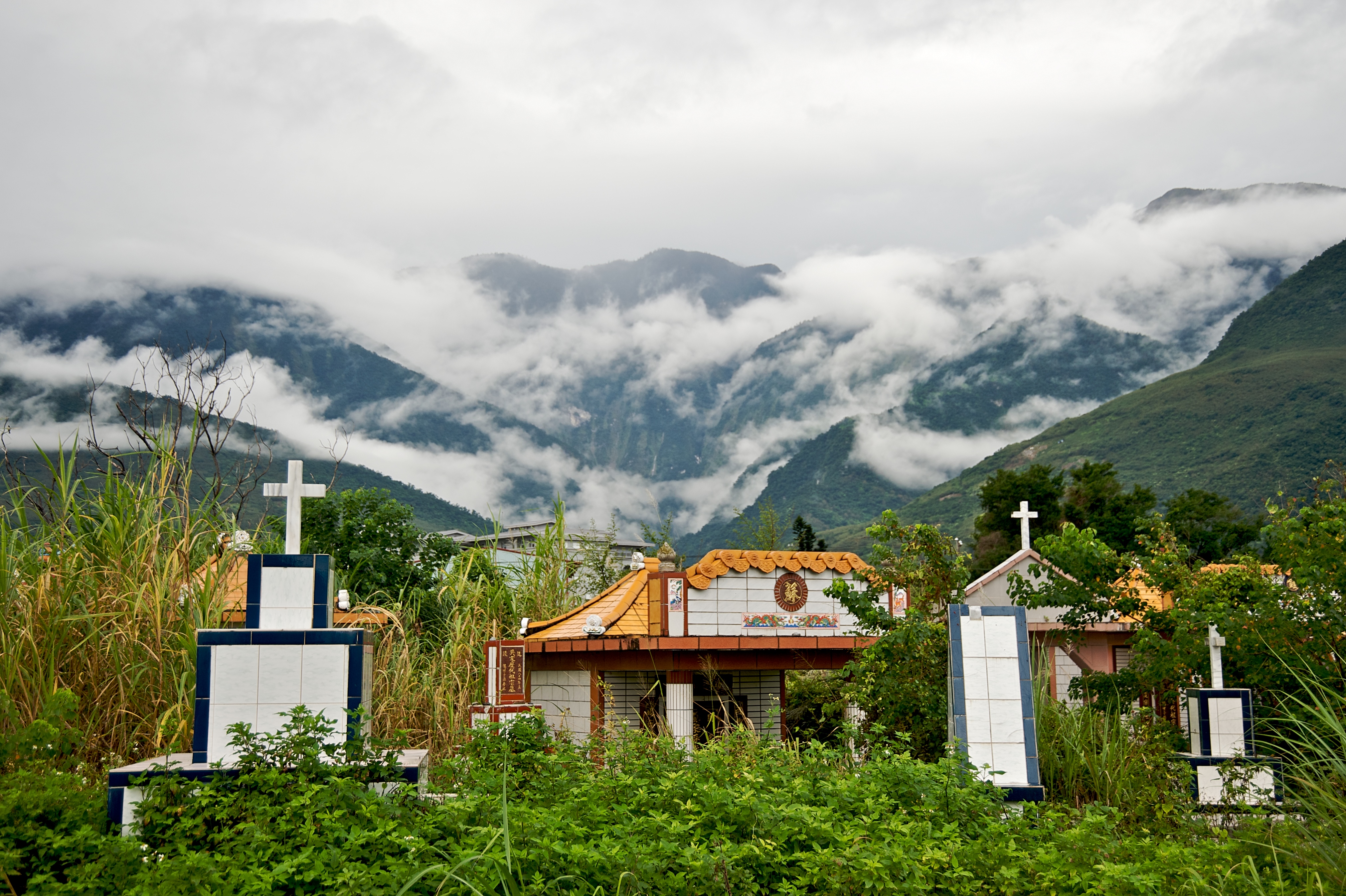
Xiulin Township / Sioulin Township () is a mountain indigenous township of Hualien County, Taiwan. It is located northwest of Hualien City, and is the largest township in Taiwan by area (1,641.86 km²) with 9 villages. It has a population of 15,494, most of which are the indigenous Taroko people. Because of its location beside the Central Mountain Range, the climate changes by altitude. Taroko National Park is located in Xiulin Township. In recent years, people in Xiulin have lobbied to change its name to "Taroko Township" (太魯閣鄉). The Hualien train derailment, the second deadliest train disaster in Taiwan's history, happened here in 2021. Administrative divisions The township comprises nine villages: Chongde, Fushi, Heping, Jiamin, Jingmei, Shuiyuan, Tongmen, Wenlan and Xiulin. Tourist attractions * Taroko National Park * Qingshui Cliff * Sanchan Creek Scenic Area * Mukumugi ecological Trail and preserve area * Kilai Mountain (3607 m) * Dayu Mountain ( ... [...More Info...] [...Related Items...] OR: [Wikipedia] [Google] [Baidu] |
Hualien County
Hualien County (Mandarin Wade–Giles: Hua¹-lien² Hsien⁴; Pīnyīn: ''Huālián Xiàn''; Hokkien POJ: ''Hoa-lian-koān'' or ''Hoa-liân-koān''; Hakka PFS: ''Fâ-lièn-yen''; Amis: ''Kalingko'') is a county on the east coast of Taiwan. It is the largest county by area, yet due to its mountainous terrain, has one of the lowest populations in the country. The county seat and largest city is Hualien City. Most of the population resides in the Huadong Valley, which runs north to south, sandwiched between the Central and Hai'an mountain ranges. Due to the rural nature of the county, Hualien attracts many visitors for its natural environment, which includes Taroko Gorge, Qingshui Cliff and Qixingtan Beach. History Early history Modern-day Hualien City was originally called ''Kilai'' (), after the Sakiraya Taiwanese aborigines and their settlement. Spanish settlers arrived in 1622 to pan for gold. Picking up the sounds of native words, these settlers called the area ''Turumoa ... [...More Info...] [...Related Items...] OR: [Wikipedia] [Google] [Baidu] |
Taiwan
Taiwan, officially the Republic of China (ROC), is a country in East Asia, at the junction of the East and South China Seas in the northwestern Pacific Ocean, with the People's Republic of China (PRC) to the northwest, Japan to the northeast, and the Philippines to the south. The territories controlled by the ROC consist of 168 islands, with a combined area of . The main island of Taiwan, also known as ''Formosa'', has an area of , with mountain ranges dominating the eastern two-thirds and plains in the western third, where its highly urbanised population is concentrated. The capital, Taipei, forms along with New Taipei City and Keelung the largest metropolitan area of Taiwan. Other major cities include Taoyuan, Taichung, Tainan, and Kaohsiung. With around 23.9 million inhabitants, Taiwan is among the most densely populated countries in the world. Taiwan has been settled for at least 25,000 years. Ancestors of Taiwanese indigenous peoples settled the isla ... [...More Info...] [...Related Items...] OR: [Wikipedia] [Google] [Baidu] |
Central Mountain Range
The Central Mountain Range is the principal mountain range on the island of Taiwan. It runs from the north of the island to the south. Due to this separation, connecting between the west and east is not very convenient. The tallest peak of the range is Xiuguluan Mountain, . Names "Central Range" or "Central Mountain Range" is a calque of the range's Chinese name, the ''Zhōngyāng Shānmài'' or ''Shānmò''. It is also sometimes simply called the Zhongyang or in English. During the Qing Dynasty, the range was known as the , from the Wade-Giles romanization of the Chinese name ''Dàshān'', meaning "Big Mountains". Geography In a broad sense, Central Mountain Range includes its conjoint ranges such as Xueshan Range and Yushan Range; thus the tallest peak of Central Mountain Range in this sense is Yushan (Jade Mountain/Mount Morrison), , and the second tallest peak is Xueshan (Snow Mountain), . Ecology The Central Range lies within the Taiwan subtropical evergreen for ... [...More Info...] [...Related Items...] OR: [Wikipedia] [Google] [Baidu] |
Mountain
A mountain is an elevated portion of the Earth's crust, generally with steep sides that show significant exposed bedrock. Although definitions vary, a mountain may differ from a plateau in having a limited Summit (topography), summit area, and is usually higher than a hill, typically rising at least 300 metres (1,000 feet) above the surrounding land. A few mountains are Monadnock, isolated summits, but most occur in mountain ranges. Mountain formation, Mountains are formed through Tectonic plate, tectonic forces, erosion, or volcanism, which act on time scales of up to tens of millions of years. Once mountain building ceases, mountains are slowly leveled through the action of weathering, through Slump (geology), slumping and other forms of mass wasting, as well as through erosion by rivers and glaciers. High elevations on mountains produce Alpine climate, colder climates than at sea level at similar latitude. These colder climates strongly affect the Montane ecosystems, ecosys ... [...More Info...] [...Related Items...] OR: [Wikipedia] [Google] [Baidu] |
List Of Mountains In Taiwan
The island of Taiwan has the largest number and density of high mountains in the world. This article summarizes the list of mountains that is under the Republic of China's territorial jurisdiction. There are 268 mountain peaks over above sea level on the island, with Yushan (Jade Mountain – in Chinese) being the tallest mountain in both Taiwan and East Asia. Mountaineering is one of the most popular activities for many Taiwanese. A list of 100 Peaks of Taiwan was created in 1971, which lists the selected one hundred mountain peaks over 3,000 m for mountaineering on the island. Climbing all of the one hundred mountain peaks listed is considered a great challenge for Taiwanese climbers. Mountain ranges There are five mountain ranges in the main island of Taiwan List of high mountains Over 3,000 m Notes: *The rank and locations is the one of the highest peak of each mountain. *In total, there are 165 mountains over 3,000 m above sea level, with a total of 275 peaks. *Of ... [...More Info...] [...Related Items...] OR: [Wikipedia] [Google] [Baidu] |
Landforms Of Hualien County
A landform is a natural or anthropogenic land feature on the solid surface of the Earth or other planetary body. Landforms together make up a given terrain, and their arrangement in the landscape is known as topography. Landforms include hills, mountains, canyons, and valleys, as well as shoreline features such as bays, peninsulas, and seas, including submerged features such as mid-ocean ridges, volcanoes, and the great ocean basins. Physical characteristics Landforms are categorized by characteristic physical attributes such as elevation, slope, orientation, stratification, rock exposure and soil type. Gross physical features or landforms include intuitive elements such as berms, mounds, hills, ridges, cliffs, valleys, rivers, peninsulas, volcanoes, and numerous other structural and size-scaled (e.g. ponds vs. lakes, hills vs. mountains) elements including various kinds of inland and oceanic waterbodies and sub-surface features. Mountains, hills, plateaux, and plains are the fou ... [...More Info...] [...Related Items...] OR: [Wikipedia] [Google] [Baidu] |
Landforms Of Nantou County
A landform is a natural or anthropogenic land feature on the solid surface of the Earth or other planetary body. Landforms together make up a given terrain, and their arrangement in the landscape is known as topography. Landforms include hills, mountains, canyons, and valleys, as well as shoreline features such as bays, peninsulas, and seas, including submerged features such as mid-ocean ridges, volcanoes, and the great ocean basins. Physical characteristics Landforms are categorized by characteristic physical attributes such as elevation, slope, orientation, Stratum, stratification, rock exposure and soil type. Gross physical features or landforms include intuitive elements such as berms, mounds, hills, ridges, cliffs, valleys, rivers, peninsulas, volcanoes, and numerous other structural and size-scaled (e.g. ponds vs. lakes, hills vs. mountains) elements including various kinds of inland and oceanic Waterbody, waterbodies and sub-surface features. Mountains, hills, Plateau, plat ... [...More Info...] [...Related Items...] OR: [Wikipedia] [Google] [Baidu] |


.jpg)