|
Sharp Airlines
Sharp Airlines is a regional airline founded in Hamilton, Victoria, Australia in 1990. Sharp operates scheduled airline services in the southern states of Australia. Its main bases are Essendon Airport, Adelaide Airport and Launceston Airport. The airline also provides charter operations to regional Victoria and South Australia. The parent company, Sharp Aviation, has its main maintenance base at Launceston Airport. Sharp Airlines has no registered ICAO code. History Commencing operations using the Piper PA-31-350 Chieftain, the airline has continued to grow, acquiring Fairchild Metro aircraft to replace the Chieftains, and adding Essendon Airport to the route network. In April 2008, it commenced services to Port Augusta from a new Adelaide Airport base of operations. Services from Adelaide to Port August were terminated in May 2017. In October 2009, Sharp Airlines commenced a trial service connecting Adelaide with Portland and Avalon Airport. In January 2010, it became a p ... [...More Info...] [...Related Items...] OR: [Wikipedia] [Google] [Baidu] |
Hamilton, Victoria
Hamilton is a large town in south-western Victoria, Australia, at the intersection of the Glenelg Highway and the Henty Highway. The Hamilton Highway connects it to Geelong. Hamilton is in the federal Division of Wannon, and is in the Southern Grampians local government area. Hamilton claims to be the ''"Wool Capital of the World"'', based on its strong historical links to sheep grazing which continue today. The town uses the tagline "Greater Hamilton: one place, many possibilities". History Early history Hamilton was built near the border of three traditional indigenous tribal territories: the Gunditjmara land that stretches south to the coast, the Tjapwurong land to the north east and the Bunganditj territory to the west. People who lived in these areas tended to be settled rather than nomadic. The region is fertile and well-watered, leading to an abundance of wildlife, and no need to travel far for food. Physical remains such as the weirs and fish traps found in Lake Cond ... [...More Info...] [...Related Items...] OR: [Wikipedia] [Google] [Baidu] |
Airlines Of Tasmania
Airlines of Tasmania, commercially known by the name Par Avion is a regional airline based in Hobart, Tasmania, Australia. It operates scheduled services across a number of locations in Tasmania. Par Avion also operates a wide variety of charter services ranging from business, scenic flights into Tasmania's South West, group charter and leisure. Par Avion owns and operates Cambridge Aerodrome, a flying training school which is affiliated with the University of Tasmania and a tourism business into the Southwest National Park of Tasmania, including day and overnight trips in Bathurst Harbour. History Airlines of Tasmania was established as a regular public transport operator (previously it had been an airwork operator) in 1977, along with Par-Avion, a different branding used for chartered and sightseeing flights. During its early years, the company had regular services to the West Coast from Queenstown and Strahan. In the 2004–2005 year there was a service between Hobart ... [...More Info...] [...Related Items...] OR: [Wikipedia] [Google] [Baidu] |
Regional Aviation Association Of Australia
The Regional Aviation Association of Australia (RAAA) is a non-profit organisation representing the interests of regional aviation in Australia. RAAA has approximately 100 members and 2500 employees. They Provide air transportation in Australia for more than 2 million passengers and 23 million kilograms cargo per year. It was formed in 1980 as the Regional Airline Association of Australia and amended its name in 2001 when its charter was widened to include "aerial work operators" as well as regional airlines and air charter companies "and the businesses that support them". The members of Regional Aviation Association of Australia include "airlines, airports, engineering and flight training companies, finance and insurance companies and government entities".Quotes from thRAAA homepage/ref> Thomas Global System's CEO Angus Hutchinson stated "The RAAA plays a fundamental role in supporting the Australian aviation industry and linking regional communities and remote areas across Aus ... [...More Info...] [...Related Items...] OR: [Wikipedia] [Google] [Baidu] |
List Of Airlines Of Australia
The airline industry in Australia began in the early 1920s with Western Australian Airways on the west coast, and Australian Aircraft and Engineering Company on the east coast. In 1921, Queensland and Northern Territory Aerial Services (QANTAS) was formed, and continues to operate. This is a list of airlines that have a current air operator's certificate issued by the Civil Aviation Safety Authority. Scheduled airlines Charter airlines Cargo airlines See also *List of defunct airlines of Australia *List of airlines References External linksInternational airlines in Australia {{List of airlines [...More Info...] [...Related Items...] OR: [Wikipedia] [Google] [Baidu] |
Burnie Airport
Burnie Airport , also called Burnie Wynyard Airport or Wynyard Airport, is a regional airport located adjacent to the town of Wynyard, about west from Burnie, Tasmania, Australia. Formally named the Wynyard Aerodrome, the first official opening occurred on 26 February 1934. The Burnie Airport is majority owned by the Burnie City Council. Airlines and destinations Rex Airlines operates services to and from Melbourne about 4 times per day using Saab 340 turboprop aircraft. Sharp Airlines offers flights to King Island and Launceston twice per day using a 19-seat Metro 23 (SA-227) turboprop aircraft. From 17 September 2021, QantasLink will launch direct seven weekly flights to Melbourne for the first time in 15 years with its 50-seat Q300 turboprop aircraft. History of Burnie Airport The first aerodrome at Wynyard was built by volunteers on an old racecourse. However, within a year of completion in 1932, the aerodrome was found to be too small for larger passenger and mai ... [...More Info...] [...Related Items...] OR: [Wikipedia] [Google] [Baidu] |
King Island, Tasmania
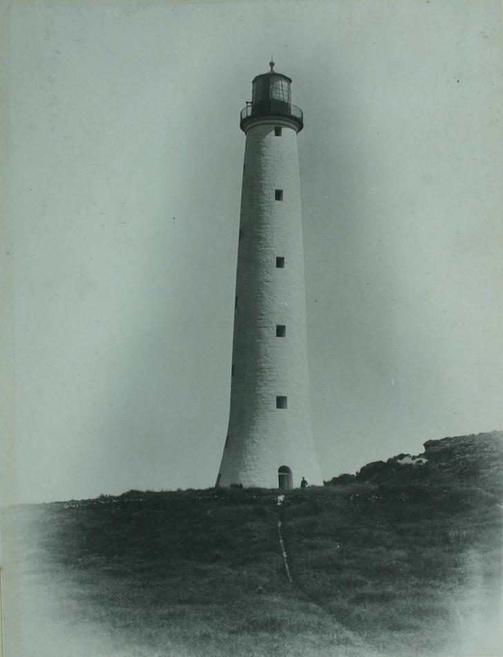
King Island is an island in the Bass Strait, belonging to the Australian state of Tasmania. It is the largest of three islands known as the New Year Group, and the second-largest island in Bass Strait (after Flinders Island). The island's population at the was 1,585 people, up from 1,566 in 2011. The local government area of the island is the King Island Council. The island forms part of the official land divide between the Great Australian Bight and Bass Strait, off the north-western tip of Tasmania and about halfway to the mainland state of Victoria. The southernmost point is Stokes Point and the northernmost point is Cape Wickham. There are three small islands immediately offshore: New Year Island and Christmas Island situated to the northwest, and a smaller island Councillor Island to the east, opposite Sea Elephant Beach. King Island was first visited by Europeans in the late 18th century. It was named after Philip Gidley King, Colonial Governor of New South Wales, who ... [...More Info...] [...Related Items...] OR: [Wikipedia] [Google] [Baidu] |
Hobart Airport
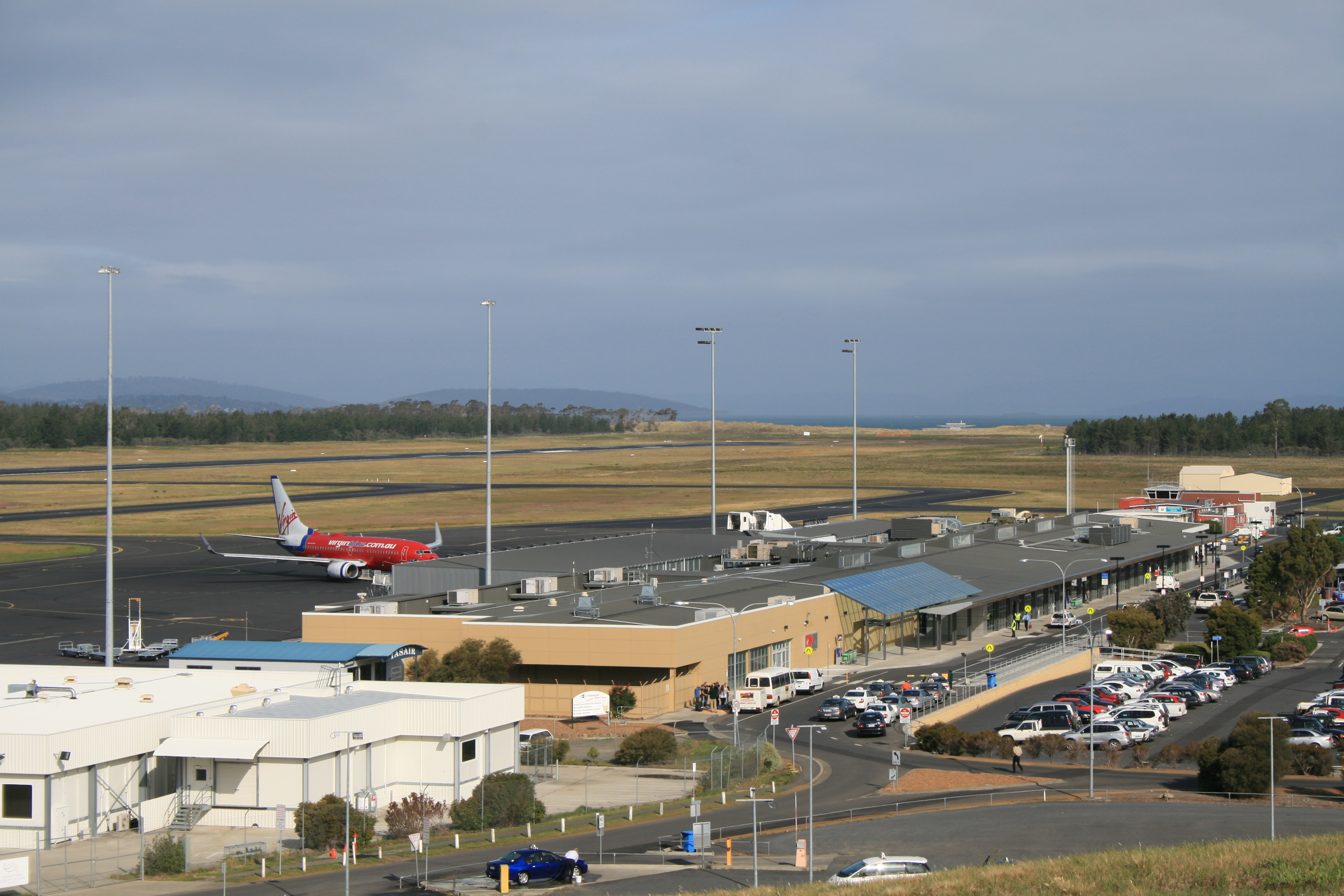
Hobart Airport is an international airport located in Cambridge, north-east of Hobart. It is the major and fastest growing passenger airport in Tasmania. The Federal government owned airport is operated by the Tasmanian Gateway Consortium under a 99-year lease. The airport maintains a conjoined international and domestic terminal. The major airlines servicing the airport are Qantas, Jetstar and Virgin Australia operating domestic flights predominantly to Melbourne, Sydney and Brisbane. International flights to Auckland (New Zealand) operate twice to three times weekly with Air New Zealand. Due to the airport's southern location, Skytraders operates regular flights to Antarctica on behalf of the Australian Antarctic Division using an Airbus A319. Hobart International Airport was opened in 1956 and privatised in 1988. Occupying approximately of land, the airport is situated on a narrow peninsula. Take-offs and landings are inevitably directed over bodies of water rega ... [...More Info...] [...Related Items...] OR: [Wikipedia] [Google] [Baidu] |
Hobart, Tasmania
Hobart ( ; Nuennonne/Palawa kani: ''nipaluna'') is the capital and most populous city of the Australian island state of Tasmania. Home to almost half of all Tasmanians, it is the least-populated Australian state capital city, and second-smallest if territories are taken into account, before Darwin, Northern Territory. Hobart is located in Tasmania's south-east on the estuary of the River Derwent, making it the most southern of Australia's capital cities. Its skyline is dominated by the kunanyi/Mount Wellington, and its harbour forms the second-deepest natural port in the world, with much of the city's waterfront consisting of reclaimed land. The metropolitan area is often referred to as Greater Hobart, to differentiate it from the City of Hobart, one of the five local government areas that cover the city. It has a mild maritime climate. The city lies on country which was known by the local Mouheneener people as nipaluna, a name which includes surrounding features such as ku ... [...More Info...] [...Related Items...] OR: [Wikipedia] [Google] [Baidu] |
Flinders Island Airport
Flinders Island Airport is a small regional airport located northwest of Whitemark on Flinders Island off the north-east coast of Tasmania, Australia. The airport is owned and operated by the Flinders Council. The airport site has a total area of approximately 134 hectares. Access to the airport is off Palana Road. The primary aviation facilities at Flinders Island Airport consist of two sealed runways, a sealed taxiway, a sealed apron, a grassed apron and a fuel storage facility. Adjacent to the sealed apron is a passenger terminal building with an associated car parking area. There is only one small hangar on the site at present. The primary use of Flinders Island Airport is for Regular Public Transport (RPT) services operated by Sharp Airlines which offers services to and from Melbourne and Launceston. The airport is also used for charter and freight services, emergency services and private/recreational flying. Airlines and destinations This flight operates via Cape Ba ... [...More Info...] [...Related Items...] OR: [Wikipedia] [Google] [Baidu] |
Flinders Island, Tasmania
Flinders Island, the largest island in the Furneaux Group, is a island in the Bass Strait, northeast of the island of Tasmania. Flinders Island was the place where the last remnants of aboriginal Tasmanian population were exiled by the colonial British government. Today Flinders Island is part of the state of Tasmania, Australia. It is from Cape Portland and is located on 40° south, a zone known as the Roaring Forties. History Prehistory Flinders Island was first inhabited at least 35,000 years ago, when people made their way from Australia across the then land-bridge which is now Bass Strait. A population remained until about 4,500 years ago, succumbing to thirst and hunger following an acute El Niño climate shift. European discovery Some of the south-eastern islands of the Furneaux Group were first recorded in 1773 by British navigator Tobias Furneaux, commander of , the support vessel with James Cook on Cook's second voyage. In February 1798, British navigator Matthew ... [...More Info...] [...Related Items...] OR: [Wikipedia] [Google] [Baidu] |
Sharp Airlines (VH-SEZ) Swearingen SA227-AC Metro III At Essendon Airport
Sharp Airlines is a regional airline founded in Hamilton, Victoria, Australia in 1990. Sharp operates scheduled airline services in the southern states of Australia. Its main bases are Essendon Airport, Adelaide Airport and Launceston Airport. The airline also provides charter operations to regional Victoria and South Australia. The parent company, Sharp Aviation, has its main maintenance base at Launceston Airport. Sharp Airlines has no registered ICAO code. History Commencing operations using the Piper PA-31-350 Chieftain, the airline has continued to grow, acquiring Fairchild Metro aircraft to replace the Chieftains, and adding Essendon Airport to the route network. In April 2008, it commenced services to Port Augusta from a new Adelaide Airport base of operations. Services from Adelaide to Port August were terminated in May 2017. In October 2009, Sharp Airlines commenced a trial service connecting Adelaide with Portland and Avalon Airport. In January 2010, it became a ... [...More Info...] [...Related Items...] OR: [Wikipedia] [Google] [Baidu] |
Griffith, New South Wales
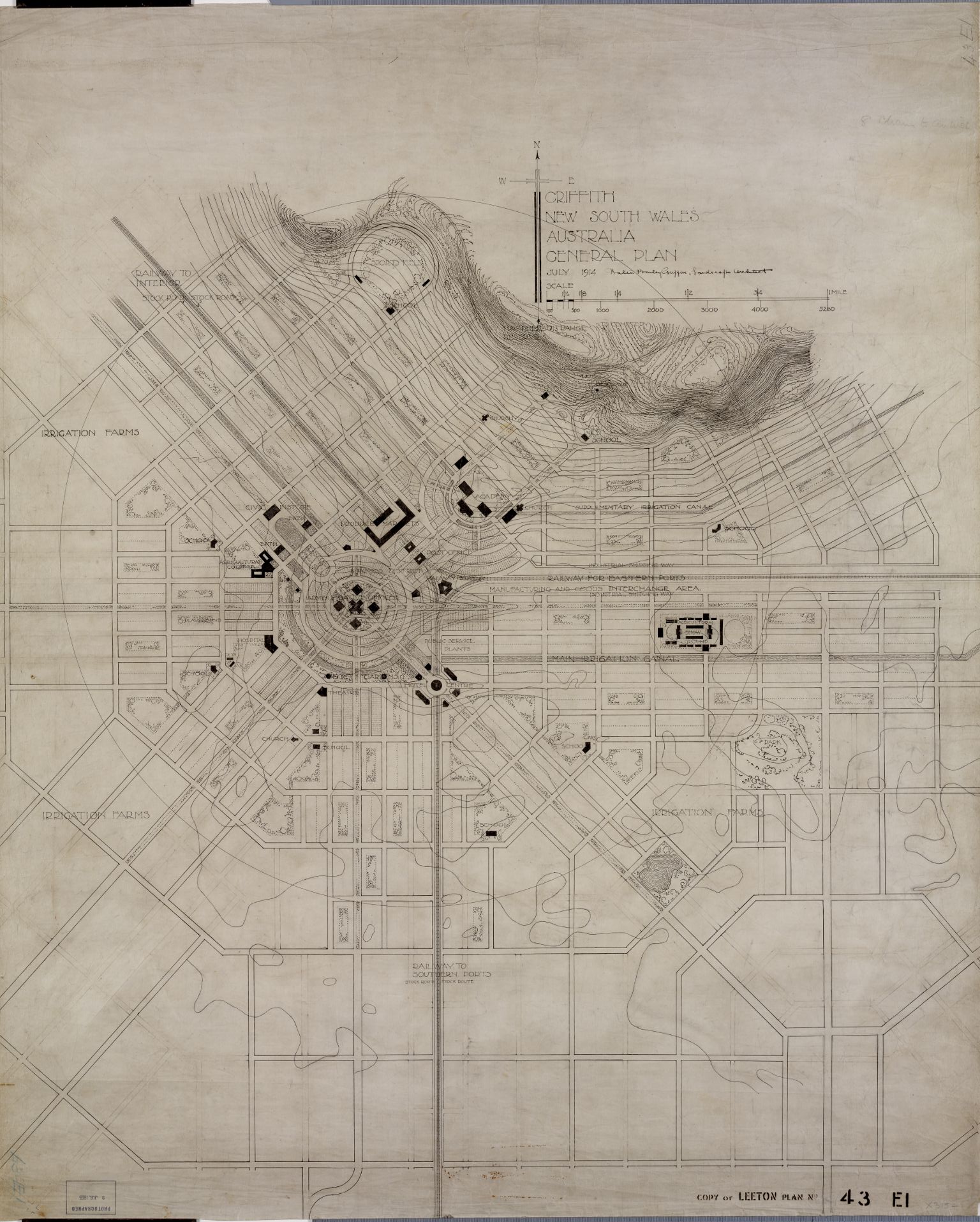
Griffith is a major regional city in the Murrumbidgee Irrigation Area that is located in the north-western part of the Riverina region of New South Wales, known commonly as the food bowl of Australia. It is also the seat of the City of Griffith local government area. Like the Australian capital, Canberra, and extensions to the nearby town of Leeton, Griffith was designed by Walter Burley Griffin and Marion Mahony Griffin. Griffith was named after Arthur Hill Griffith, the then New South Wales Secretary for Public Works. Griffith was proclaimed a city in 1987, and had a population of 20,251 Estimated resident population, 30 June 2018. in June 2018. It can be accessed by road from Sydney and Canberra via the Hume Highway and the Burley Griffin Way and from Melbourne, via the Newell Highway and either by using the Kidman Way or the Irrigation Way. Griffith can be accessed from other places like Adelaide, Orange, and Bathurst through the Mid-Western Highway and the Rankins Spri ... [...More Info...] [...Related Items...] OR: [Wikipedia] [Google] [Baidu] |


