|
Flinders Island Airport
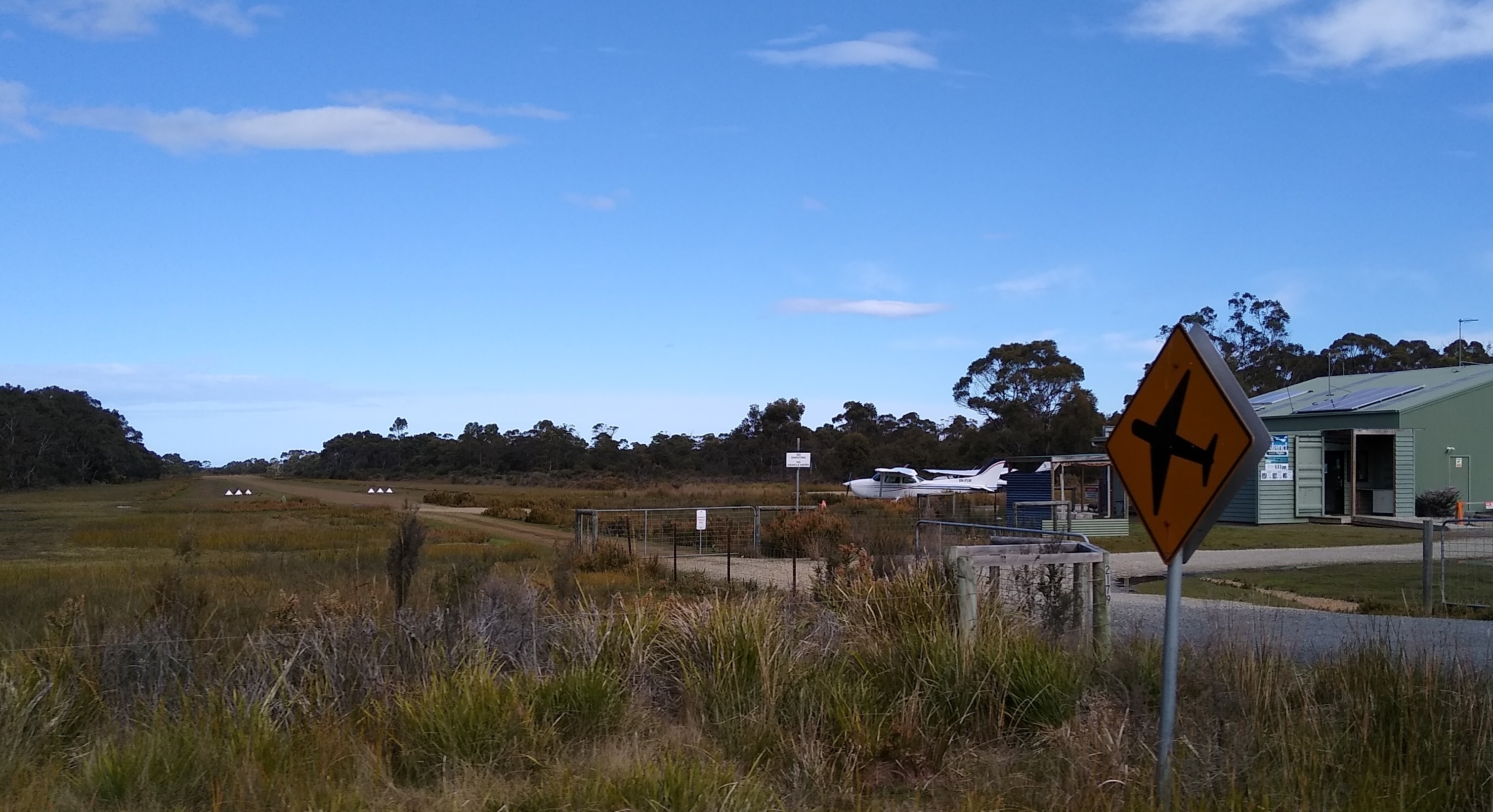
Flinders Island Airport is a small regional airport located northwest of Whitemark on Flinders Island off the north-east coast of Tasmania, Australia. The airport is owned and operated by the Flinders Council. The airport site has a total area of approximately 134 hectares. Access to the airport is off Palana Road. The primary aviation facilities at Flinders Island Airport consist of two sealed runways, a sealed taxiway, a sealed apron, a grassed apron and a fuel storage facility. Adjacent to the sealed apron is a passenger terminal building with an associated car parking area. There is only one small hangar on the site at present. The primary use of Flinders Island Airport is for Regular Public Transport (RPT) services operated by Sharp Airlines which offers services to and from Melbourne and Launceston. The airport is also used for charter and freight services, emergency services and private/recreational flying. Airlines and destinations This flight operates via Cape Ba ... [...More Info...] [...Related Items...] OR: [Wikipedia] [Google] [Baidu] |
Flinders Council
Flinders Council is a local government body in Tasmania, encompassing the Furneaux Group and nearby islands of Bass Strait, in the north-east of the state. Flinders is classified as a rural local government area and has a population of 987, with Whitemark the main town located on Flinders Island. History and attributes The municipality was established on 1 January 1907. Flinders is classified as rural, agricultural and small under the Australian Classification of Local Governments. Geography Flinders covers more than 60 islands off the north-eastern tip of Tasmania at the eastern end of Bass Strait. Of these 60, 12 have permanent populations. The bigger ones are Clarke Island, Cape Barren Island, and the largest and most populous, Flinders Island. The Flinders Council includes the Furneaux Group together with the groups of islands to the north west including Kent Group, Hogan Island Group, Curtis Group, and the Wilsons Promontory Tasmanian Islands ( Rodondo, West Moncoeur ... [...More Info...] [...Related Items...] OR: [Wikipedia] [Google] [Baidu] |
Essendon Airport
Essendon Fields Airport , colloquially known by its former name Essendon Airport, is a public airport serving scheduled commercial, corporate-jet, charter and general aviation flights. It is located next to the intersection of the Tullamarine and Calder Freeways, in the north western suburb of Essendon Fields of Melbourne, Victoria, Australia. The airport is the closest to Melbourne's City Centre, approximately an drive north-west from it and south-east from Melbourne–Tullamarine Airport. In 1970, Tullamarine Airport replaced Essendon as Melbourne's main airport. History The area of the airport was originally known as St Johns, after an early landowner. The airport was proclaimed as Essendon Aerodrome by the Commonwealth Government in 1921. For some time prior to proclamation, the aerodrome had been used by the Victorian Chapter of the Australian Aero Club (renamed the Royal Victorian Aero Club), having initially been based at Point Cook. The Aero Club remained at Essend ... [...More Info...] [...Related Items...] OR: [Wikipedia] [Google] [Baidu] |
List Of Airports In Tasmania
This is a list of current registered airports in the Australian state of Tasmania. __TOC__ List of airports The list is sorted by the name of the community served, click the sort buttons in the table header to switch listing order. Airports named in bold are Designated International Airports, even if they have limited or no scheduled international services. Note that some unregistered landing grounds in Tasmania, such as Queenstown Airport, are still listed in international coding systems, usually as private aerodromes. Notes {{reflist See also *List of airports in Australia Tasmania ) , nickname = , image_map = Tasmania in Australia.svg , map_caption = Location of Tasmania in AustraliaCoordinates: , subdivision_type = Country , subdi ... Airports ... [...More Info...] [...Related Items...] OR: [Wikipedia] [Google] [Baidu] |
Moorabbin Airport
Moorabbin (Harry Hawker) Airport is a mostly general aviation airport for light aircraft located in between the southern Melbourne suburbs of Heatherton, Cheltenham, Dingley Village and Mentone. It also receives commercial airline service. The airport grounds are treated as their own suburb, and share the postcode ''3194'' with the neighboring suburb of Mentone. With a total of 274,082 aircraft movements, Moorabbin Airport was the second busiest airport in Australia for the calendar year 2011. History The airport opened in December 1949. Originally the intent was to name the airport "Mentone" but this was abandoned after a potential clash with the then French airport in Menton. Similarly, Cheltenham was discarded due to similarities to the Gloucestershire Airport near Cheltenham in South West England. The name comes from the nearby (but not neighboring) suburb of Moorabbin. The airport was renamed tMoorabbin (Harry Hawker) Airporton 22 January 1989, after pioneering Aust ... [...More Info...] [...Related Items...] OR: [Wikipedia] [Google] [Baidu] |
Cape Barren Island
Cape Barren Island, officially truwana / Cape Barren Island, is a island in the Bass Strait, off the north east coast of Tasmania, Australia. It is the second largest island of the Furneaux Group; Flinders Island lies to the north, with the smaller Clarke Island to the south. The highest point on the island is Mount Munro at . Mount Munro is probably named after James Munro (c. 1779-1845), a former convict and then sealer, who lived from the 1820s for more than 20 years with several women on nearby Preservation Island. The south-eastern point of the island was named ''Cape Barren'' by Tobias Furneaux in in March 1773. The island was gazetted as a locality of the Flinders Council in 1968. The population of the island numbered 66 in 2016, most of them in the settlement Cape Barren Island, also called ''The Corner'', on the northwest coast. Australia's only native goose, the Cape Barren goose, was first documented by European explorers on this island. History Sealing is ... [...More Info...] [...Related Items...] OR: [Wikipedia] [Google] [Baidu] |
Hobart Airport
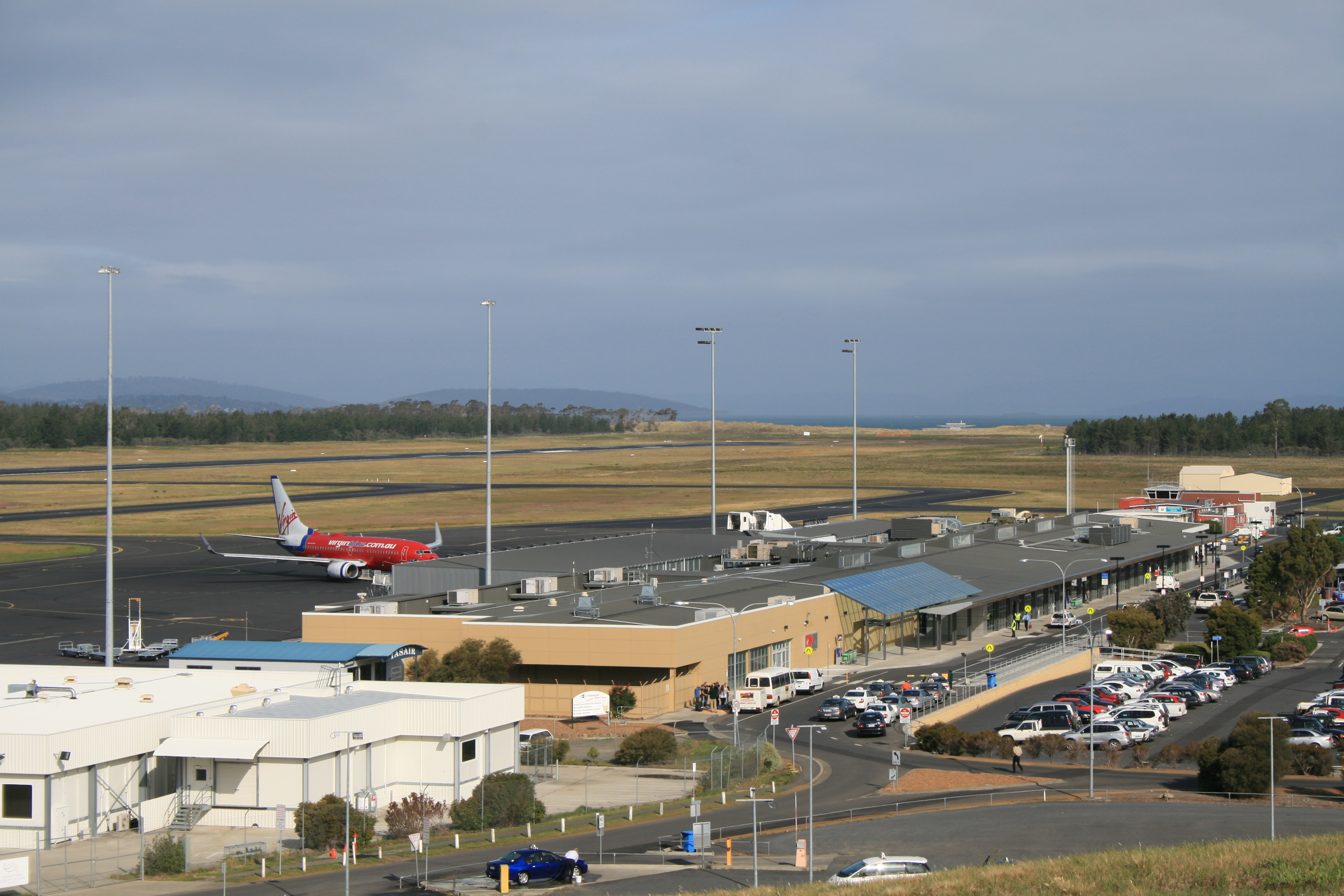
Hobart Airport is an international airport located in Cambridge, north-east of Hobart. It is the major and fastest growing passenger airport in Tasmania. The Federal government owned airport is operated by the Tasmanian Gateway Consortium under a 99-year lease. The airport maintains a conjoined international and domestic terminal. The major airlines servicing the airport are Qantas, Jetstar and Virgin Australia operating domestic flights predominantly to Melbourne, Sydney and Brisbane. International flights to Auckland (New Zealand) operate twice to three times weekly with Air New Zealand. Due to the airport's southern location, Skytraders operates regular flights to Antarctica on behalf of the Australian Antarctic Division using an Airbus A319. Hobart International Airport was opened in 1956 and privatised in 1988. Occupying approximately of land, the airport is situated on a narrow peninsula. Take-offs and landings are inevitably directed over bodies of water rega ... [...More Info...] [...Related Items...] OR: [Wikipedia] [Google] [Baidu] |
Airlines Of Tasmania
Airlines of Tasmania, commercially known by the name Par Avion is a regional airline based in Hobart, Tasmania, Australia. It operates scheduled services across a number of locations in Tasmania. Par Avion also operates a wide variety of charter services ranging from business, scenic flights into Tasmania's South West, group charter and leisure. Par Avion owns and operates Cambridge Aerodrome, a flying training school which is affiliated with the University of Tasmania and a tourism business into the Southwest National Park of Tasmania, including day and overnight trips in Bathurst Harbour. History Airlines of Tasmania was established as a regular public transport operator (previously it had been an airwork operator) in 1977, along with Par-Avion, a different branding used for chartered and sightseeing flights. During its early years, the company had regular services to the West Coast from Queenstown and Strahan. In the 2004–2005 year there was a service between Hobart ... [...More Info...] [...Related Items...] OR: [Wikipedia] [Google] [Baidu] |
Launceston Airport
Launceston Airport is a regional airport on the outskirts of Launceston, Tasmania. The airport is located in the industrial area of Western Junction from Launceston city centre. It is Tasmania's second busiest after Hobart Airport; it can also run as a curfew free airport. In the 2007/2008 financial year, the airport had a record 1.1 million passengers, up 10% on the previous year; 255,000 passengers passed through the airport in the three months to 30 September, up 7% on the previous year. 309,000 passengers passed through in January – March 2008, the highest ever number in a calendar quarter, up 11% on the previous year. It is currently Australia's 13th busiest airport, handling 1,126,572 passengers in the 2008–09 financial and 1,124,000 passengers in the 2009–10 financial year. The total number of passenger movements through Launceston Airport is projected to increase annually by 2.7 per cent during the forecast period to 2,000,000 in 2030–31. The expected growth r ... [...More Info...] [...Related Items...] OR: [Wikipedia] [Google] [Baidu] |
Sharp Airlines
Sharp Airlines is a regional airline founded in Hamilton, Victoria, Australia in 1990. Sharp operates scheduled airline services in the southern states of Australia. Its main bases are Essendon Airport, Adelaide Airport and Launceston Airport. The airline also provides charter operations to regional Victoria and South Australia. The parent company, Sharp Aviation, has its main maintenance base at Launceston Airport. Sharp Airlines has no registered ICAO code. History Commencing operations using the Piper PA-31-350 Chieftain, the airline has continued to grow, acquiring Fairchild Metro aircraft to replace the Chieftains, and adding Essendon Airport to the route network. In April 2008, it commenced services to Port Augusta from a new Adelaide Airport base of operations. Services from Adelaide to Port August were terminated in May 2017. In October 2009, Sharp Airlines commenced a trial service connecting Adelaide with Portland and Avalon Airport. In January 2010, it became a p ... [...More Info...] [...Related Items...] OR: [Wikipedia] [Google] [Baidu] |
Flinders Island
Flinders Island, the largest island in the Furneaux Group, is a island in the Bass Strait, northeast of the island of Tasmania. Flinders Island was the place where the last remnants of aboriginal Tasmanian population were exiled by the colonial British government. Today Flinders Island is part of the state of Tasmania, Australia. It is from Cape Portland and is located on 40° south, a zone known as the Roaring Forties. History Prehistory Flinders Island was first inhabited at least 35,000 years ago, when people made their way from Australia across the then land-bridge which is now Bass Strait. A population remained until about 4,500 years ago, succumbing to thirst and hunger following an acute El Niño climate shift. European discovery Some of the south-eastern islands of the Furneaux Group were first recorded in 1773 by British navigator Tobias Furneaux, commander of , the support vessel with James Cook on Cook's second voyage. In February 1798, British navigator Ma ... [...More Info...] [...Related Items...] OR: [Wikipedia] [Google] [Baidu] |
Australia
Australia, officially the Commonwealth of Australia, is a Sovereign state, sovereign country comprising the mainland of the Australia (continent), Australian continent, the island of Tasmania, and numerous List of islands of Australia, smaller islands. With an area of , Australia is the largest country by area in Oceania and the world's List of countries and dependencies by area, sixth-largest country. Australia is the oldest, flattest, and driest inhabited continent, with the least fertile soils. It is a Megadiverse countries, megadiverse country, and its size gives it a wide variety of landscapes and climates, with Deserts of Australia, deserts in the centre, tropical Forests of Australia, rainforests in the north-east, and List of mountains in Australia, mountain ranges in the south-east. The ancestors of Aboriginal Australians began arriving from south east Asia approximately Early human migrations#Nearby Oceania, 65,000 years ago, during the Last Glacial Period, last i ... [...More Info...] [...Related Items...] OR: [Wikipedia] [Google] [Baidu] |
Tasmania
) , nickname = , image_map = Tasmania in Australia.svg , map_caption = Location of Tasmania in AustraliaCoordinates: , subdivision_type = Country , subdivision_name = Australia , established_title = Before federation , established_date = Colony of Tasmania , established_title2 = Federation , established_date2 = 1 January 1901 , named_for = Abel Tasman , demonym = , capital = Hobart , largest_city = capital , coordinates = , admin_center = 29 local government areas , admin_center_type = Administration , leader_title1 = Monarch , leader_name1 = Charles III , leader_title2 = Governor , leader_name2 ... [...More Info...] [...Related Items...] OR: [Wikipedia] [Google] [Baidu] |


