|
Seven Star Mountain
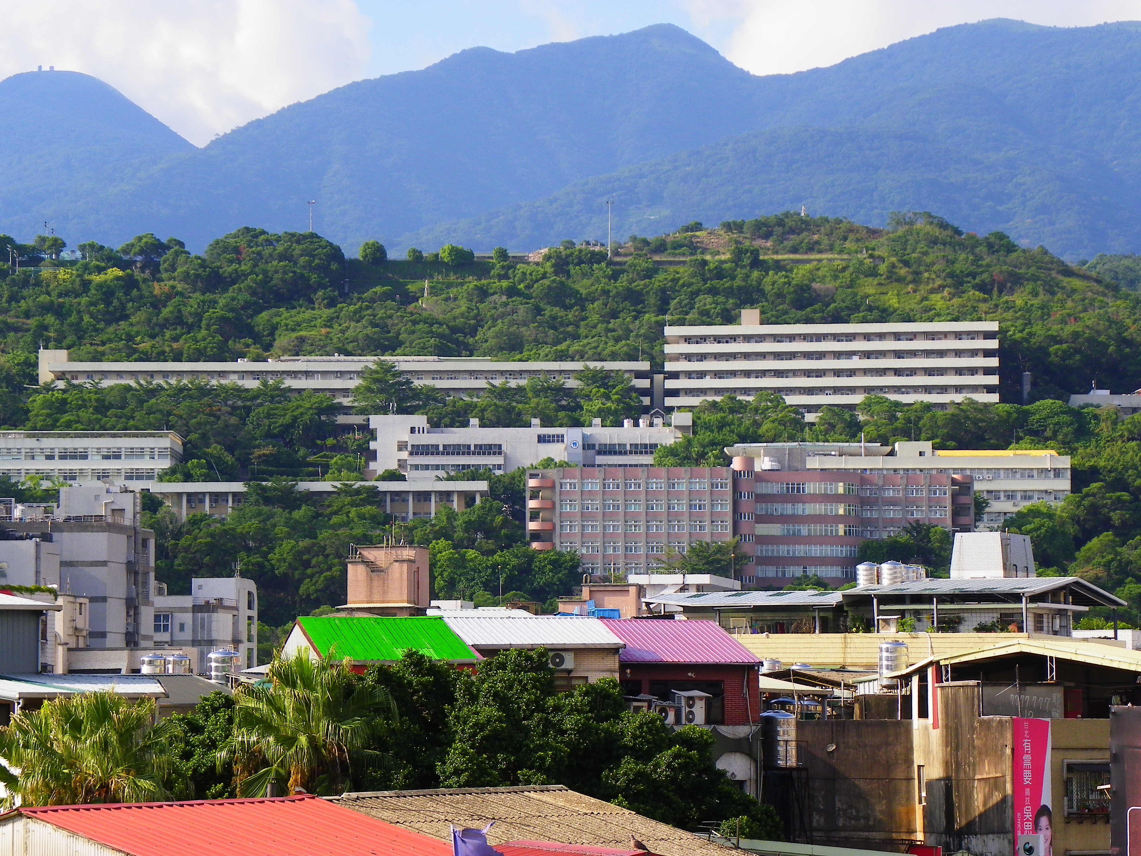
Qixing Mountain, also spelled Cising Mountain or Chihsing Mountain, () is a mountain in Beitou District, Taipei, Taiwan. It is located on the Datun Volcano Group and is the highest mountain in the city, at the rim of Taipei Basin. It is also the highest (dormant) volcano in Taiwan. It is located in the center of Yangmingshan National Park; its main peak is above sea level. It began erupting about 700,000 years ago. There was a crater at the peak but it became seven small peaks due to post-eruption erosion. The mountain has Fault (geology), faults running across the southeast and northwest contours, and has volcanic landforms such as hot springs and fumaroles. Shamao Mountain is a round volcanic dome that looks like a black gauze cap. As the lava was more viscous when the mountain was formed, it gradually became a tholoid, also known as a Lava dome, cumulo-dome volcano, it is above sea level. Shamaoshan and Cigushan (七股山, ) are parasitic volcanoes of Qixingshan. This mou ... [...More Info...] [...Related Items...] OR: [Wikipedia] [Google] [Baidu] |
Beitou District
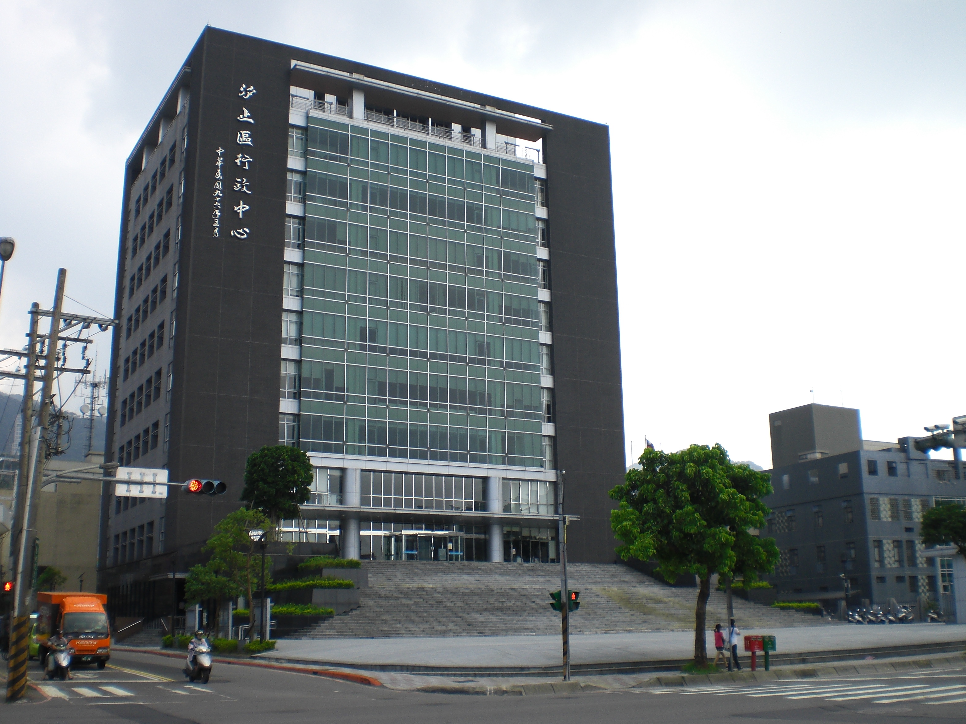
Beitou District is the northernmost of the twelve districts of Taipei City, Taiwan. The historical spelling of the district is Peitou. The name originates from the Ketagalan word ''Kipatauw'', meaning witch. Beitou is the most mountainous and highest of Taipei's districts, encompassing a meadow with rivers running through the valley which have abundant steam rising from them; the result of geothermal warming. The valley is often surrounded by mist shrouding the trees and grass. Beitou is famous for its hot springs. In March 2012, it was named one of the ''Top 10 Small Tourist Towns'' by the Tourism Bureau of Taiwan. History The area's hot springs had long been enjoyed by the aboriginal people of Taiwan. Shortly before the Japanese period a German sulfur merchant established the first hot spring club in Beitou. During early Japanese rule, ''Hokutō'' () was a village at the entrance of the well-known North Formosa sulfur district. Three Japanese extracting plants in this d ... [...More Info...] [...Related Items...] OR: [Wikipedia] [Google] [Baidu] |
Taihoku Prefecture
Taihoku Prefecture (台北州; ''Taihoku-shū'') was an administrative division of Taiwan created in 1920, during Japanese rule. The prefecture consisted of modern-day Keelung, New Taipei City, Taipei and Yilan County. Its government office, which is now occupied by the Control Yuan of Taiwan, was in Taihoku City (modern-day Taipei). Population Population statistics of permanent residents in Taihoku Prefecture in 1941: Administrative divisions Cities and districts There were 3 cities and 9 districts under Taihoku Prefecture. All of the cities (市 ''shi'') name in Chinese characters is carried from Japanese to Chinese. Towns and villages Buildings and establishments Hospitals *Taihoku Imperial University Hospital (台北帝国大学医学部附属病院) *Japanese Red Cross Society Taiwan Branch Hospital (赤十字社台湾支部病院) *Government-General of Taiwan Monopoly Bureau Mutual Aid Association Hospital (台湾総督府専売局共済組合病院) *Go ... [...More Info...] [...Related Items...] OR: [Wikipedia] [Google] [Baidu] |
Pleistocene Lava Domes
The Pleistocene ( , often referred to as the ''Ice age'') is the geological epoch that lasted from about 2,580,000 to 11,700 years ago, spanning the Earth's most recent period of repeated glaciations. Before a change was finally confirmed in 2009 by the International Union of Geological Sciences, the cutoff of the Pleistocene and the preceding Pliocene was regarded as being 1.806 million years Before Present (BP). Publications from earlier years may use either definition of the period. The end of the Pleistocene corresponds with the end of the last glacial period and also with the end of the Paleolithic age used in archaeology. The name is a combination of Ancient Greek grc, label=none, πλεῖστος, pleīstos, most and grc, label=none, καινός, kainós (latinized as ), 'new'. At the end of the preceding Pliocene, the previously isolated North and South American continents were joined by the Isthmus of Panama, causing a faunal interchange between the two ... [...More Info...] [...Related Items...] OR: [Wikipedia] [Google] [Baidu] |
Volcanoes Of Taiwan
A volcano is a rupture in the crust of a planetary-mass object, such as Earth, that allows hot lava, volcanic ash, and gases to escape from a magma chamber below the surface. On Earth, volcanoes are most often found where tectonic plates are diverging or converging, and most are found underwater. For example, a mid-ocean ridge, such as the Mid-Atlantic Ridge, has volcanoes caused by divergent tectonic plates whereas the Pacific Ring of Fire has volcanoes caused by convergent tectonic plates. Volcanoes can also form where there is stretching and thinning of the crust's plates, such as in the East African Rift and the Wells Gray-Clearwater volcanic field and Rio Grande rift in North America. Volcanism away from plate boundaries has been postulated to arise from upwelling diapirs from the core–mantle boundary, deep in the Earth. This results in hotspot volcanism, of which the Hawaiian hotspot is an example. Volcanoes are usually not created where two tectonic plates slide ... [...More Info...] [...Related Items...] OR: [Wikipedia] [Google] [Baidu] |
List Of Mountains In Taiwan
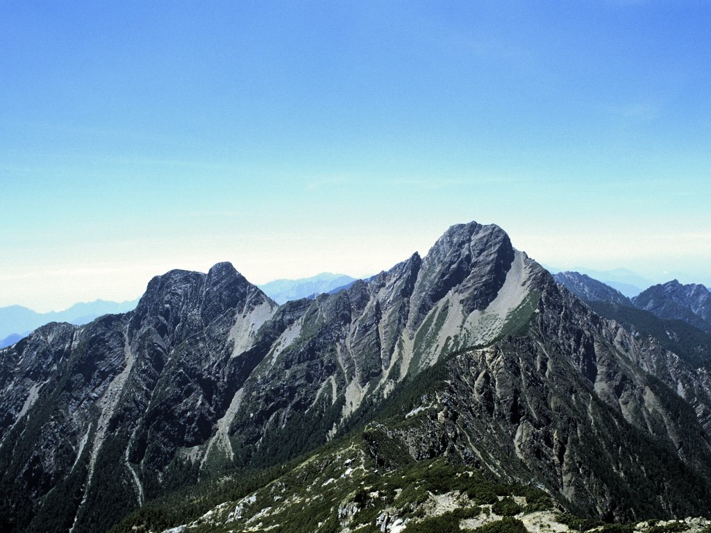
The island of Taiwan has the largest number and density of high mountains in the world. This article summarizes the list of mountains that is under the Republic of China's territorial jurisdiction. There are 268 mountain peaks over above sea level on the island, with Yushan (Jade Mountain – in Chinese) being the tallest mountain in both Taiwan and East Asia. Mountaineering is one of the most popular activities for many Taiwanese. A list of 100 Peaks of Taiwan was created in 1971, which lists the selected one hundred mountain peaks over 3,000 m for mountaineering on the island. Climbing all of the one hundred mountain peaks listed is considered a great challenge for Taiwanese climbers. Mountain ranges There are five mountain ranges in the main island of Taiwan List of high mountains Over 3,000 m Notes: *The rank and locations is the one of the highest peak of each mountain. *In total, there are 165 mountains over 3,000 m above sea level, with a total of 275 peaks. *Of ... [...More Info...] [...Related Items...] OR: [Wikipedia] [Google] [Baidu] |
Xinyi District, Taipei
Xinyi District or Sinyi District is the seat of the Taipei City Government and Taipei City Council. The district includes Taipei 101, Taipei International Convention Center, Taipei World Trade Center, Sun Yat-sen Memorial Hall (Taipei), National Sun Yat-sen Memorial Hall and various shopping malls and entertainment venues, making it the most cosmopolitan district of Taipei. Xinyi District is also considered the financial district of Taipei. The district is a prime shopping area in Taipei, anchored by a number of department stores and malls. In addition, numerous high-end restaurants are located in the area. History and geography During Taiwan under Japanese rule, Japanese rule (1895–1945), covered modern day Xinyi and Songshan District, Taipei, Songshan districts. The village was named after Matsuyama, Ehime, Matsuyama City in Japan and formed part of Shichisei District, Taihoku Prefecture. Matsuyama Village was incorporated into Taihoku City (modern-day Taipei) in 193 ... [...More Info...] [...Related Items...] OR: [Wikipedia] [Google] [Baidu] |
Songshan District, Taipei
Songshan District is a district of Taipei, Taiwan. The Songshan Airport and the Taipei Arena are located here. History Songshan was originally named Malysyakkaw, a lowland Ketagalan word meaning "Where the river twists". Its written form () was abbreviated () in 1815 during Qing rule. During Japanese rule (1895-1945), the area served as a prime tea-growing area in northern Taiwan. In 1920, the area's settlements were established as , Shichisei District, Taihoku Prefecture. The village, named after Matsuyama City in Japan, was incorporated into Taihoku City (modern-day Taipei) in 1938. At the outset of one-party rule by the Kuomintang (1945-1990), the Mandarin Chinese reading of the kanji characters (i.e. Sung-shan) was adopted as the name of the district, which in 1946 officially comprised 26 municipal villages (). In 1949, the area's tea estates gave way to military housing for lower-income Kuomintang refugee families. The bodies of many residents and political victims ... [...More Info...] [...Related Items...] OR: [Wikipedia] [Google] [Baidu] |
Neihu District
Neihu District is a district of Taipei City, Taiwan. Neihu means "inner lake." The older name originates from the Ketagalan word ''Tayour'' (transliterated by the Dutch as ''Cattajo''), meaning woman's head ornament. Many mountainous roads and paths, which are ideal for hiking, connect Neihu with the neighboring Shilin District and Yangmingshan National Park. The Tri-Service General Hospital, which is a teaching hospital of the National Defense Medical Center, is also in Neihu. The Wuchih Mountain Military Cemetery borders Neihu. History During Japanese rule, Naiko Village () covered modern day Neihu in addition to Nangang. The village was under Shichisei District, Taihoku Prefecture. Economy Although it was a flood-prone region, Neihu has experienced huge growth with the construction of the Neihu Technology Park in 1995 and hypermarkets such as Costco, RT Mart, Carrefour, B&Q. The extension of the Taipei Metro to Neihu in the 1990s and early 2000s has also boosted residen ... [...More Info...] [...Related Items...] OR: [Wikipedia] [Google] [Baidu] |
Nangang District, Taipei
Nangang, United States National Geospatial-Intelligence Agency District (), also Nankang, is a southeastern district of Taipei, Taiwan. It is the seat of the Academia Sinica, Taipei World Trade Center Nangang Exhibition Hall, and Nankang Software Park (NKSP). History Nangang was settled in 1735 by Fujianese, especially in the present villages of Nangang, Sanchong, and Dongxin. The placename was ' (), Nangang-Sanchong Port (). The Qing era name of Lamkang'a (), refers to its position on Keelung River. In 1920, during the Japanese era, Nangang was part of , , Taihoku Prefecture. In December 1945, after the handover of Taiwan to the Kuomintang, the administrative levels were changed to Neihu Township (), Qixing District (), Taipei County. July 6 the following year, as proposed by Mayor Que Shankeng (), Nangang was separated into its own township (). In 1968, it became a district of Taipei. Administration Government institutions * Food and Drug Administration * Institu ... [...More Info...] [...Related Items...] OR: [Wikipedia] [Google] [Baidu] |
Shilin District
Shilin District (also spelled Shihlin District, zh, t=士林區, p=Shìlínqū, poj=Sū-lîm-khu) is a district of Taipei. The central command center of the Republic of China Navy (ROCN) is located in Shilin. History The name ''Shilin'' was derived from ''Pattsiran'', the indigenous Ketagalan word for "hot springs". It was then transliterated into Chinese as "" (), which has been written as ''Pat-chi-na'' or ''Pachina''. Prior to Han Chinese settlement, the area was home to the ''Kimassauw'' community () of the Taiwanese indigenous peoples. During the Qing era, a fort was set up, later called Zhilan Yi Bao (first fort/settlement of Pattsiran, ). By the late Qing dynasty, "many literary talents from Shilin had passed the imperial examination", prompting the local gentry to rename it ''Shilin'' (), meaning "congregation of scholars and talents".alternately, "scholars enter the forest" (). In the 1920s under Japanese colonial rule, the area was organized as and in 1933 ... [...More Info...] [...Related Items...] OR: [Wikipedia] [Google] [Baidu] |
Xizhi District
Xizhi () is an inner city district in eastern New Taipei City in northern Taiwan, and is located between Taipei City and Keelung City. Compared to most districts in eastern New Taipei, which are very sparsely populated, Xizhi is one of the more populated districts in New Taipei, with a population of 204,691 people as of August 2022. Xizhi grew quickly during the 1980s and 1990s, and is home to many of Taiwan's major electronics companies, such as Acer, Garmin (Asia), Coiler, Lanner Electronics and DFI. Name origin The district's old name ''Tsui-tng-ka'' () refers to the fact that the tide from the Keelung River stops at Xizhi and goes back to the sea. During Japanese rule, the place name was changed to and was under Shichisei District, Taihoku Prefecture. This is the source of the current name. History The area was originally called Kypanas ( Basay: ''Kippanas'') () by the indigenous Ketagalan people. In 1758, Han immigrants built a settlement () near the area. In ... [...More Info...] [...Related Items...] OR: [Wikipedia] [Google] [Baidu] |
Taiwan Under Japanese Rule
The island of Taiwan, together with the Penghu Islands, became a dependency of Japan in 1895, when the Qing dynasty ceded Fujian-Taiwan Province in the Treaty of Shimonoseki after the Japanese victory in the First Sino-Japanese War. The short-lived Republic of Formosa resistance movement was suppressed by Japanese troops and quickly defeated in the Capitulation of Tainan, ending organized resistance to Japanese occupation and inaugurating five decades of Japanese rule over Taiwan. Its administrative capital was in Taihoku (Taipei) led by the Governor-General of Taiwan. Taiwan was Japan's first colony and can be viewed as the first step in implementing their " Southern Expansion Doctrine" of the late 19th century. Japanese intentions were to turn Taiwan into a showpiece "model colony" with much effort made to improve the island's economy, public works, industry, cultural Japanization, and to support the necessities of Japanese military aggression in the Asia-Pacific. Th ... [...More Info...] [...Related Items...] OR: [Wikipedia] [Google] [Baidu] |


